
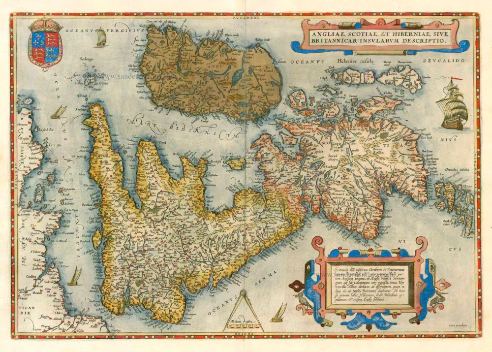
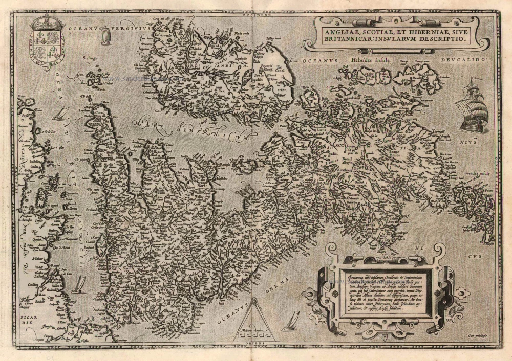
The British Isles, by J.B. Vrients. 1612
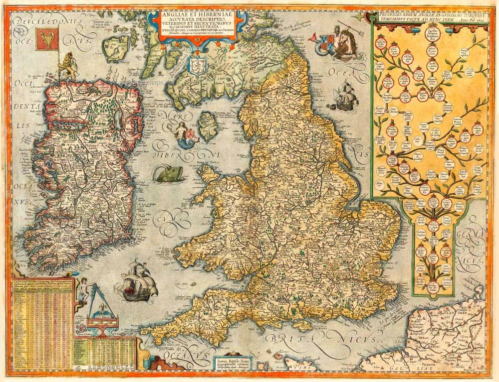


One of the most decorative maps of the British Isles, including a genealogical tree from William the Conqueror to the time of publication and James I. This rare Vrients map appeared only in the Ortelius editions 1606-1612.
Jan Baptist Vrients 1552-1612
Although Jan Baptist Vrients (Vrintius) was a map- and print-seller and an engraver, he was mainly active as a map publisher. He was enrolled in the Guild of St. Luke in Antwerpen in 1575. He published several cartographic works of great importance, i.e., Petrus Plancius's large world map of 1592. After 1600, he acquired the stock and the plates of De Jode's Speculum and Ortelius' Theatrum. He continued the editions of the Theatrum and those of the Epitome, the plates of which he had acquired from Philip Galle and Johannes Keerbergen. In 1603, Vrients published an atlas of the Netherlands compiled from the Theatrum sheets. When Vrients died in 1612, the whole stock and the copperplates were sold to the Moretus Brothers of the House Plantin, who compiled another three editions of the Theatrum.
Angliae et Hiberniae Accurata Descriptio, Veteribus et Recentioribus Nominibus Illustrata: ...
Item Number: 26563 Authenticity Guarantee
Category: Antique maps > Europe > British Isles
Old map of the British Isles, by J.B. Vrients.
Date of the first edition: 1606
Date of this map: 1612
XDate on Map: 1605
Copper engraving, printed on paper.
Size (not including margins): 44 x 56.5cm (17.2 x 22 inches)
Verso text: Latin
Condition: Original coloured, new left bottom corner with reinstatement of image (12 x 3.5 cm), close bottom and side margins (2-5mm)
Condition Rating: C
References: Van der Krogt 3, 5000:31B.2; Van den Broecke, 17.2; Shirley (BI to 1650), #290.
From: Theatrum Orbis Terrarum Abrahami Ortelii Antverp. Antwerpen, Plantin Press (J. & B. Moretus), 1612. (Van der Krogt 3, 1:055)
One of the most decorative maps of the British Isles, including a genealogical tree from William the Conqueror to the time of publication and James I. This rare Vrients map appeared only in the Ortelius editions 1606-1612.
Jan Baptist Vrients 1552-1612
Although Jan Baptist Vrients (Vrintius) was a map- and print-seller and an engraver, he was mainly active as a map publisher. He was enrolled in the Guild of St. Luke in Antwerpen in 1575. He published several cartographic works of great importance, i.e., Petrus Plancius's large world map of 1592. After 1600, he acquired the stock and the plates of De Jode's Speculum and Ortelius' Theatrum. He continued the editions of the Theatrum and those of the Epitome, the plates of which he had acquired from Philip Galle and Johannes Keerbergen. In 1603, Vrients published an atlas of the Netherlands compiled from the Theatrum sheets. When Vrients died in 1612, the whole stock and the copperplates were sold to the Moretus Brothers of the House Plantin, who compiled another three editions of the Theatrum.
Related items
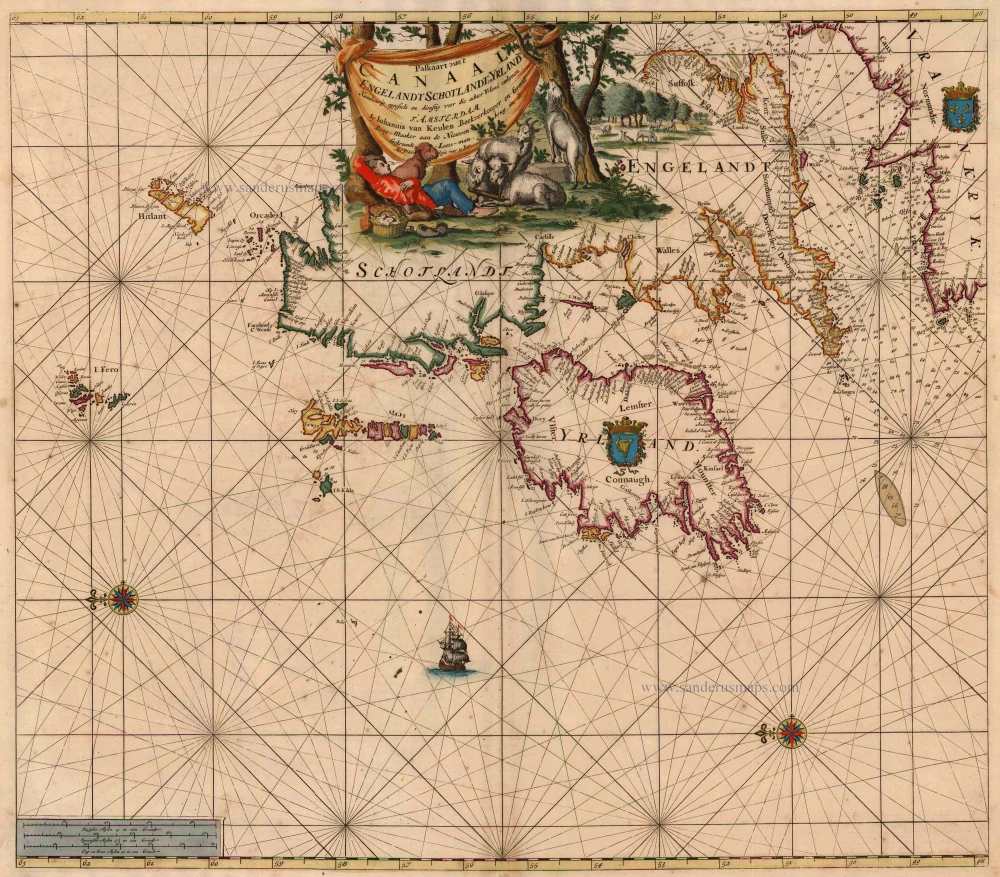
Paskaart van 't Canaal Engelandt Schotlandt en Yrland 1697-1709
British Isles, by Van Keulen Johannes.
[Item number: 5817]
Rare
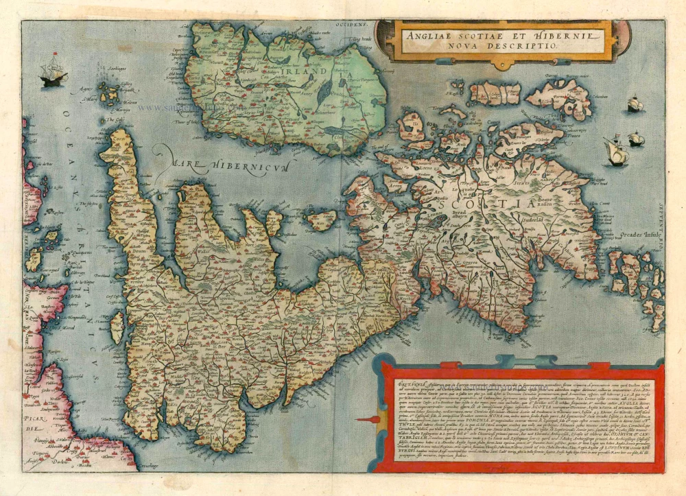
Angliae Scotiae et Hibernie Nova Descriptio 1593
British Isles, by de G. Jode.
[Item number: 11236]
Angliae, Scotiae, et Hiberniae, sive Britannicae Insularum Descriptio. 1579
The British Isles by Abraham Ortelius.
[Item number: 17897]
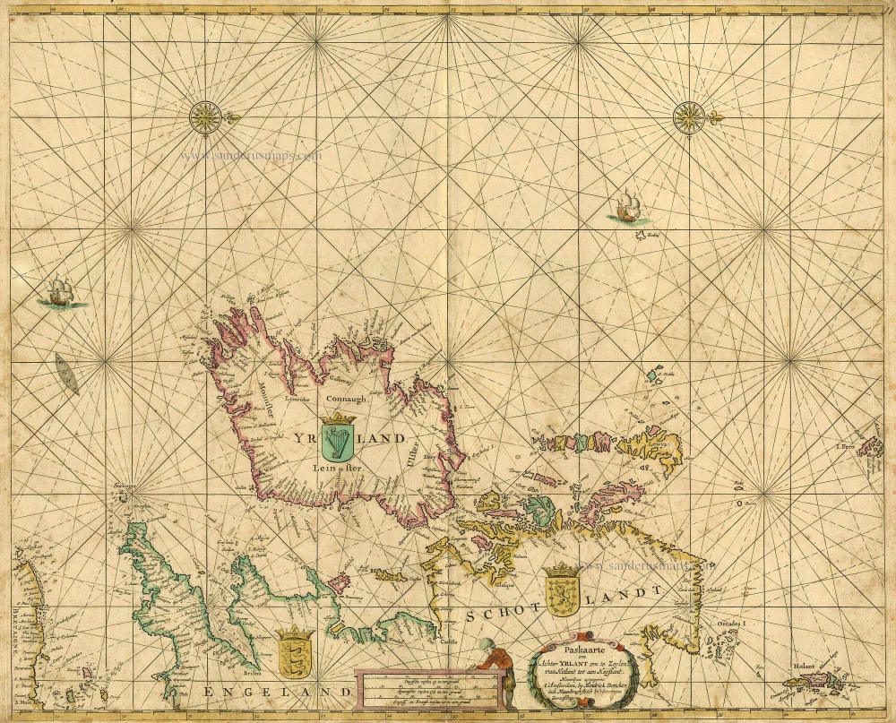
Paskaarte om achter Yrlant om te Zeylen van Hitlant tot aen Heyssant. 1665
British Isles, by Hendrik Doncker.
[Item number: 18567]
Angliae, Scotiae, et Hiberniae, sive Britannicae Insularum Descriptio. 1601
The British Isles, by Ortelius A.
[Item number: 22869]
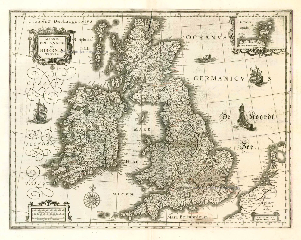
Magnae Britanniae et Hiberniae Tabula. 1662
British Isles, by W. & J. Blaeu.
[Item number: 25200]
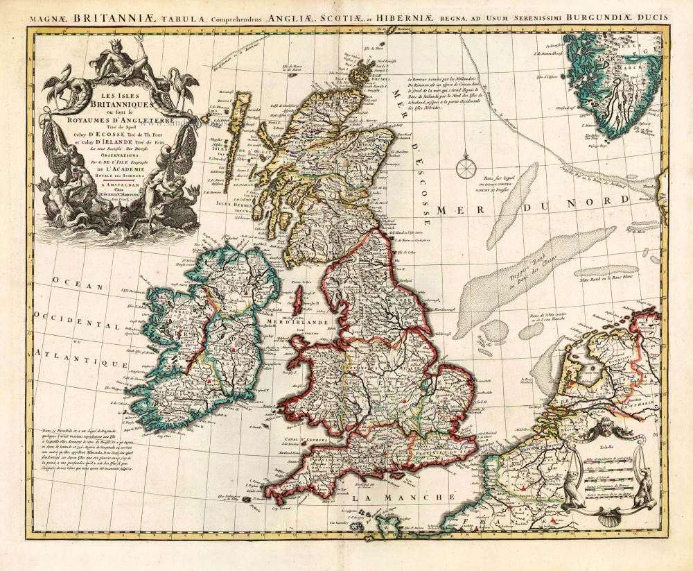
Les Isles Britanniques ou sont le Royaume D'Angleterre Tiré de Sped Celuy D'Ecosse Tiré de Th. Pont et Celuy D'Irlande Riré de Petti. 1730
British Isles by Guillaume Delisle, published by Covens & Mortier.
[Item number: 25680]
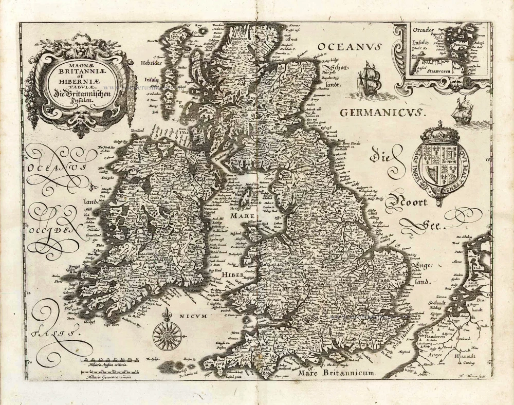
Magnae Britanniae et Hiberniae Tabulae. - Die Britannischen Insulen. 1638
The British Isles, by M. Merian.
[Item number: 25904]
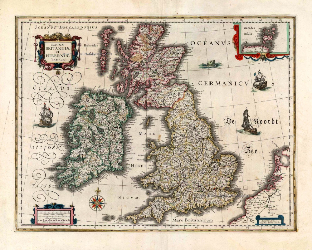
Magnae Britanniae et Hiberniae Tabula. 1645
The British Isles, by Joan and Willem Blaeu
[Item number: 26715]

Les Isles Britanniques Comprenant les Royaumes d'Angleterre, d'Ecosse et d'Iralnade, divisés en grandes provinces, ... 1776-79
British Isles, by Francesco Santini.
[Item number: 26959]