
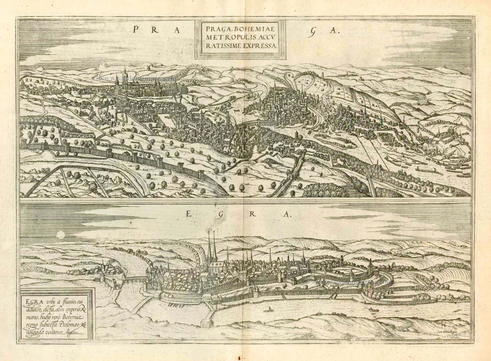
Prague, by Georg Braun and Frans Hogenberg. c. 1610
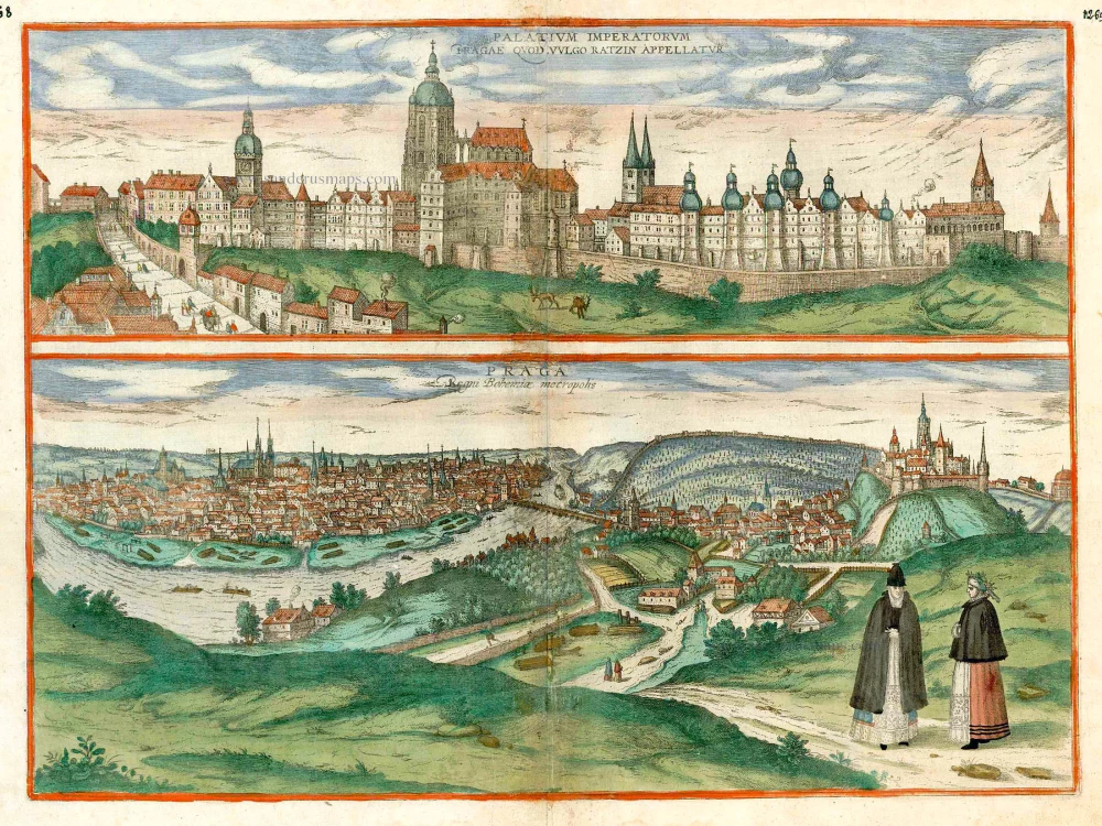


TRANSLATION CAPTION TOP: Imperial Palace in Prague, in the vernacular the Hradcany.
CAPTION BOTTOM: Prague, capital of the Kingdom of Bohemia.
COMMENTARY BY BRAUN (on verso): "In the town hall there is an extraordinary beautiful clock, the like of which is found nowhere else in the whole world in the unanimous opinion of all informed masters. The clock not only shows the entire course of the year and naturally also the number of all the months and days and the complete calendar, but also the ascent and descent of all twelve signs of the zodiac. In the part of the city that leads down to the river towards the west, the Jews have their houses; this part might be compared with a small town."
This view of the city from the north shows on the right the Hradcany castle with - rather cramped beneath it - the Lesser Quarter (Mala Strana), from where the Charles bridge leads into the Old Town. The Lesser Quarter was charted as an independent town in 1257, the old town having already received its own, separate charter in 1230. The Gothic Teyn church with its two towers can be seen on the left, directly above the bend in the Vltava River. Nearby stands the town hall, with Prague's famous astronomical clock, the Orloj. The clock was first installed in a simple form in 1410, making it the third-oldest astronomical clock in the world. The present plate offers a detailed view from the south of the all-dominating Hradcany. The wide steps that formerly led from St Matthew's gate up to the fortress complex can be seen on the left. Towering above its surroundings in the centre is St Vitus's cathedral, which was begun in 1344 and houses the tombs of Charles IV and his son Wenceslas IV. Further right lies the twin-tower Romanesque church of St George, directly attached to St George's monastery from the mid-12th century. On the far right is the Black Tower. (Taschen)
Braun G. & Hogenberg F. and the Civitates Orbis Terrarum.
The Civitates Orbis Terrarum, or the "Braun & Hogenberg", is a six-volume town atlas and the most excellent book of town views and plans ever published: 363 engravings, sometimes beautifully coloured. It was one of the best-selling works in the last quarter of the 16th century. Georg Braun wrote the text accompanying the plans and views on the verso. Many plates were engraved after the original drawings of a professional artist, a professional artist, Joris Hoefnagel (1542-1600). The first volume was published in Latin in 1572, and the sixth in 1617. Frans Hogenberg created the tables for volumes I through IV, and Simon van den Neuwel made those for volumes V and VI. Other contributors were cartographers Daniel Freese and Heinrich Rantzau. Works by Jacob van Deventer, Sebastian Münster, and Johannes Stumpf were also used. Translations appeared in German and French.
Following the original publication of Volume 1 of the Civitates in 1572, seven further editions of 1575, 1577, 1582, 1588, 1593, 1599 and 1612 can be identified. Vol.2, first issued in 1575, was followed by further editions in 1597 and 1612. The subsequent volumes appeared in 1581, 1588, 1593, 1599 and 1606. The German translation of the first volume appeared from 1574 on, and the French edition from 1575 on.
Several printers were involved: Theodor Graminaeus, Heinrich von Aich, Gottfried von Kempen, Johannis Sinniger, Bertram Buchholtz and Peter von Brachel, who all worked in Cologne.
Georg Braun (1541-1622)
Georg Braun was born in Cologne in 1541. After his studies in Cologne, he entered the Jesuit Order as a novice. 1561, he obtained his bachelor's degree, and in 1562, he received his Magister Artium. Although he left the Jesuit Order, he studied theology, gaining a licentiate in theology.
Frans Hogenberg (1535-1590)
Frans Hogenberg was a Flemish and German painter, engraver, and mapmaker. He was born in Mechelen as the son of Nicolaas Hogenberg.
By the end of the 1560s, Frans Hogenberg was employed upon Abraham Ortelius's Theatrum Orbis Terrarum, published in 1570; he is named an engraver of numerous maps. In 1568, he was banned from Antwerp by the Duke of Alva and travelled to London, where he stayed a few years before emigrating to Cologne. He immediately embarked on his two most important works, the Civitates, published in 1572 and the Geschichtsblätter, which appeared in several series from 1569 until about 1587.
Thanks to large-scale projects like the Geschichtsblätter and the Civitates, Hogenberg's social circumstances improved with each passing year. He died as a wealthy man in Cologne in 1590.
Palatium Imperatorum Pragae quod vulgo Ratzin Appellatur [on sheet with] Praga Regni Bohemiae Metropolis
Item Number: 16766 Authenticity Guarantee
Category: Antique maps > Europe > Central Europe
Old map with two bird's-eye views of Prague by Braun and Hogenberg.
Date of the first edition: 1596
Date of this map: c. 1610
Copper engraving
Size: 34 x 49cm (13.3 x 19.1 inches)
Verso text: French
Condition: Contemporary coloured, tear in lower margin reinforced, running 2 cm into the image.
Condition Rating: B
References: Taschen, Br. Hog., p.399.
From: Théâtre des Principales Villes de tout l'Univers. Tome 5. c. 1610.
TRANSLATION CAPTION TOP: Imperial Palace in Prague, in the vernacular the Hradcany.
CAPTION BOTTOM: Prague, capital of the Kingdom of Bohemia.
COMMENTARY BY BRAUN (on verso): "In the town hall there is an extraordinary beautiful clock, the like of which is found nowhere else in the whole world in the unanimous opinion of all informed masters. The clock not only shows the entire course of the year and naturally also the number of all the months and days and the complete calendar, but also the ascent and descent of all twelve signs of the zodiac. In the part of the city that leads down to the river towards the west, the Jews have their houses; this part might be compared with a small town."
This view of the city from the north shows on the right the Hradcany castle with - rather cramped beneath it - the Lesser Quarter (Mala Strana), from where the Charles bridge leads into the Old Town. The Lesser Quarter was charted as an independent town in 1257, the old town having already received its own, separate charter in 1230. The Gothic Teyn church with its two towers can be seen on the left, directly above the bend in the Vltava River. Nearby stands the town hall, with Prague's famous astronomical clock, the Orloj. The clock was first installed in a simple form in 1410, making it the third-oldest astronomical clock in the world. The present plate offers a detailed view from the south of the all-dominating Hradcany. The wide steps that formerly led from St Matthew's gate up to the fortress complex can be seen on the left. Towering above its surroundings in the centre is St Vitus's cathedral, which was begun in 1344 and houses the tombs of Charles IV and his son Wenceslas IV. Further right lies the twin-tower Romanesque church of St George, directly attached to St George's monastery from the mid-12th century. On the far right is the Black Tower. (Taschen)
Braun G. & Hogenberg F. and the Civitates Orbis Terrarum.
The Civitates Orbis Terrarum, or the "Braun & Hogenberg", is a six-volume town atlas and the most excellent book of town views and plans ever published: 363 engravings, sometimes beautifully coloured. It was one of the best-selling works in the last quarter of the 16th century. Georg Braun wrote the text accompanying the plans and views on the verso. Many plates were engraved after the original drawings of a professional artist, a professional artist, Joris Hoefnagel (1542-1600). The first volume was published in Latin in 1572, and the sixth in 1617. Frans Hogenberg created the tables for volumes I through IV, and Simon van den Neuwel made those for volumes V and VI. Other contributors were cartographers Daniel Freese and Heinrich Rantzau. Works by Jacob van Deventer, Sebastian Münster, and Johannes Stumpf were also used. Translations appeared in German and French.
Following the original publication of Volume 1 of the Civitates in 1572, seven further editions of 1575, 1577, 1582, 1588, 1593, 1599 and 1612 can be identified. Vol.2, first issued in 1575, was followed by further editions in 1597 and 1612. The subsequent volumes appeared in 1581, 1588, 1593, 1599 and 1606. The German translation of the first volume appeared from 1574 on, and the French edition from 1575 on.
Several printers were involved: Theodor Graminaeus, Heinrich von Aich, Gottfried von Kempen, Johannis Sinniger, Bertram Buchholtz and Peter von Brachel, who all worked in Cologne.
Georg Braun (1541-1622)
Georg Braun was born in Cologne in 1541. After his studies in Cologne, he entered the Jesuit Order as a novice. 1561, he obtained his bachelor's degree, and in 1562, he received his Magister Artium. Although he left the Jesuit Order, he studied theology, gaining a licentiate in theology.
Frans Hogenberg (1535-1590)
Frans Hogenberg was a Flemish and German painter, engraver, and mapmaker. He was born in Mechelen as the son of Nicolaas Hogenberg.
By the end of the 1560s, Frans Hogenberg was employed upon Abraham Ortelius's Theatrum Orbis Terrarum, published in 1570; he is named an engraver of numerous maps. In 1568, he was banned from Antwerp by the Duke of Alva and travelled to London, where he stayed a few years before emigrating to Cologne. He immediately embarked on his two most important works, the Civitates, published in 1572 and the Geschichtsblätter, which appeared in several series from 1569 until about 1587.
Thanks to large-scale projects like the Geschichtsblätter and the Civitates, Hogenberg's social circumstances improved with each passing year. He died as a wealthy man in Cologne in 1590.
Related items
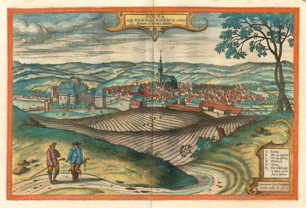
Polna vulgo Polm insign: Bohemiae civitas Regnum a Moravia dividens.. c. 1625
Polna in Bohemia, by Georg Braun and Frans Hogenberg.
[Item number: 16423]
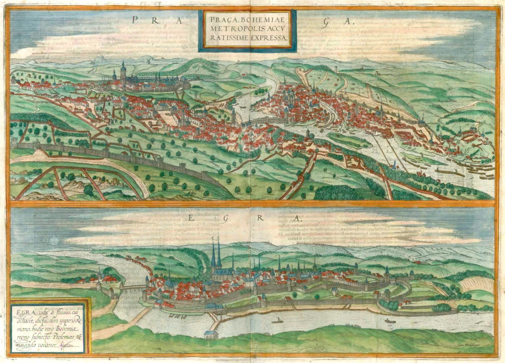
Praga, Bohemiae Metropolis Accuratissime Expressa [on sheet with] Egra, Urbs a Fluvio ... 1572-1624
Bohemia - Prague - Cheb, by Braun & Hogenberg.
[Item number: 22327]
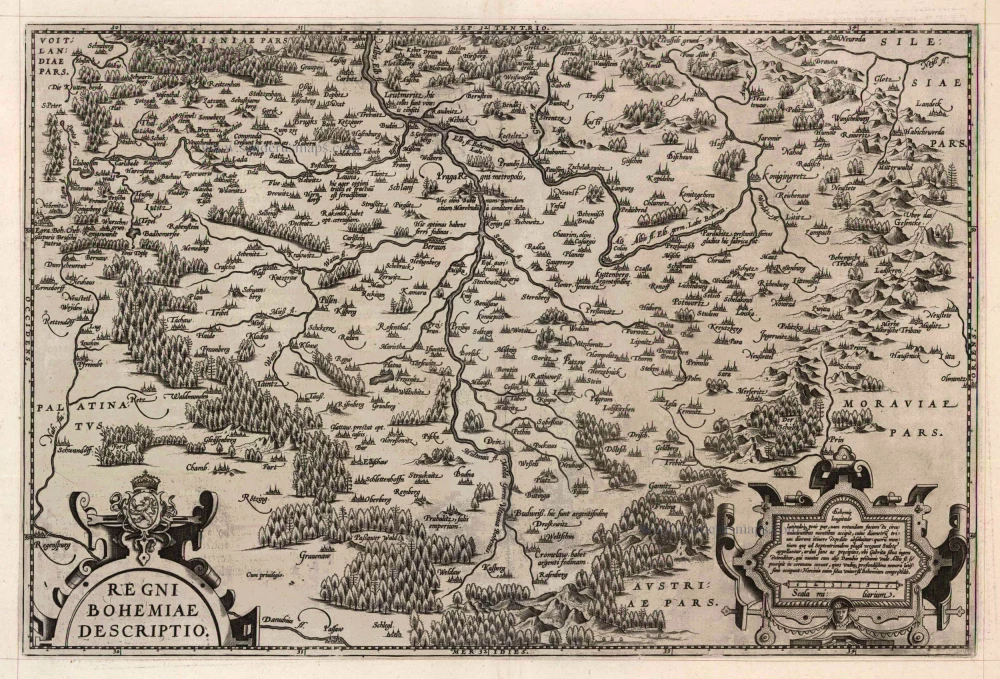
Regni Bohemiae Descriptio. 1598
Bohemia by Ortelius Abraham
[Item number: 22912]
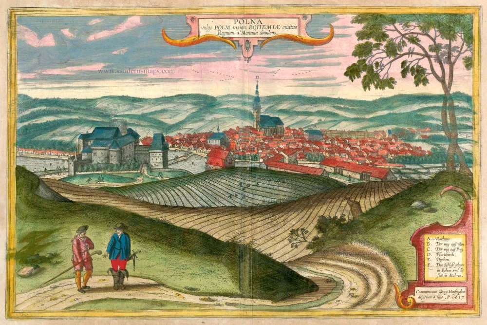
Polna vulgo Polm insign: Bohemiae civitas Regnum a Moravia dividens. 1617-18
Polna in Bohemia, by Georg Braun and Frans Hogenberg.
[Item number: 23432]
Praga, Bohemiae Metropolis Accuratissime Expressa [on sheet with] Egra, Urbs a Fluvio ... 1599
Prague (Praha) and Cheb in Bohemia, by Georg Braun and Frans Hogenberg.
[Item number: 23924]
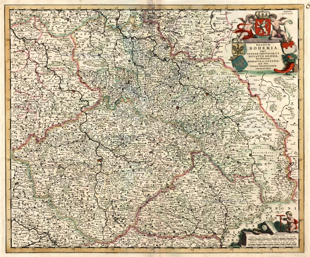
Regnum Bohemia, eique Annexae Provinciae, ut Ducatus Silesia, Marchionatus Moravia, et Lusatia ... c. 1680
Bohemia, by Frederik De Wit.
[Item number: 24430]
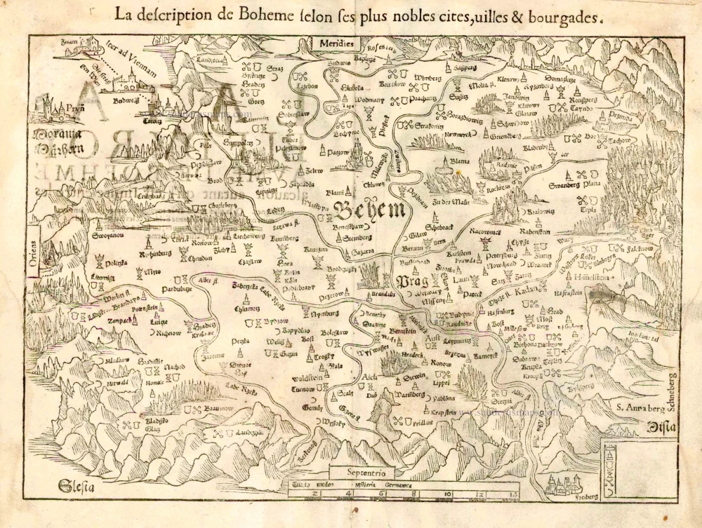
La description de Boheme selon ses plus nobles cites, villes & bourgades. 1555
Bohemia, by S. Munster.
[Item number: 25170]
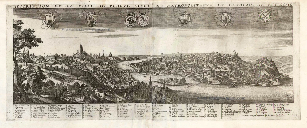
Description de la Ville de Prague Siege et Metropolitaine du Royaume de Boheme. 1648
Prague by Jean Boisseau
[Item number: 25578]
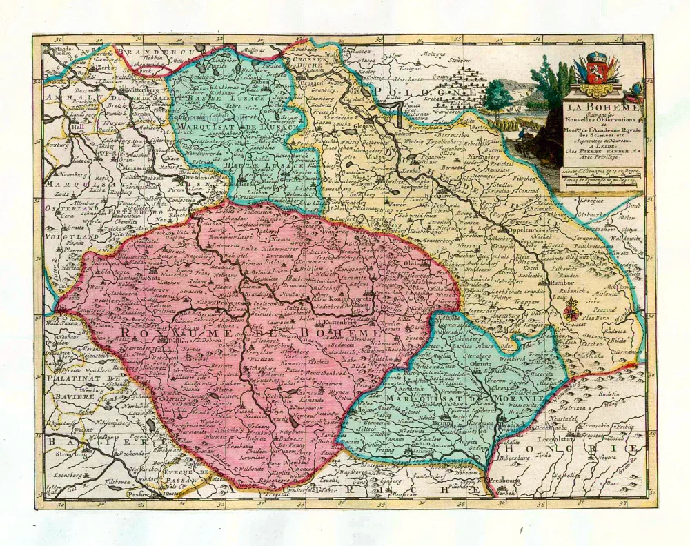
La Boheme. 1713
Bohemia, by Pieter van der Aa.
[Item number: 26179]
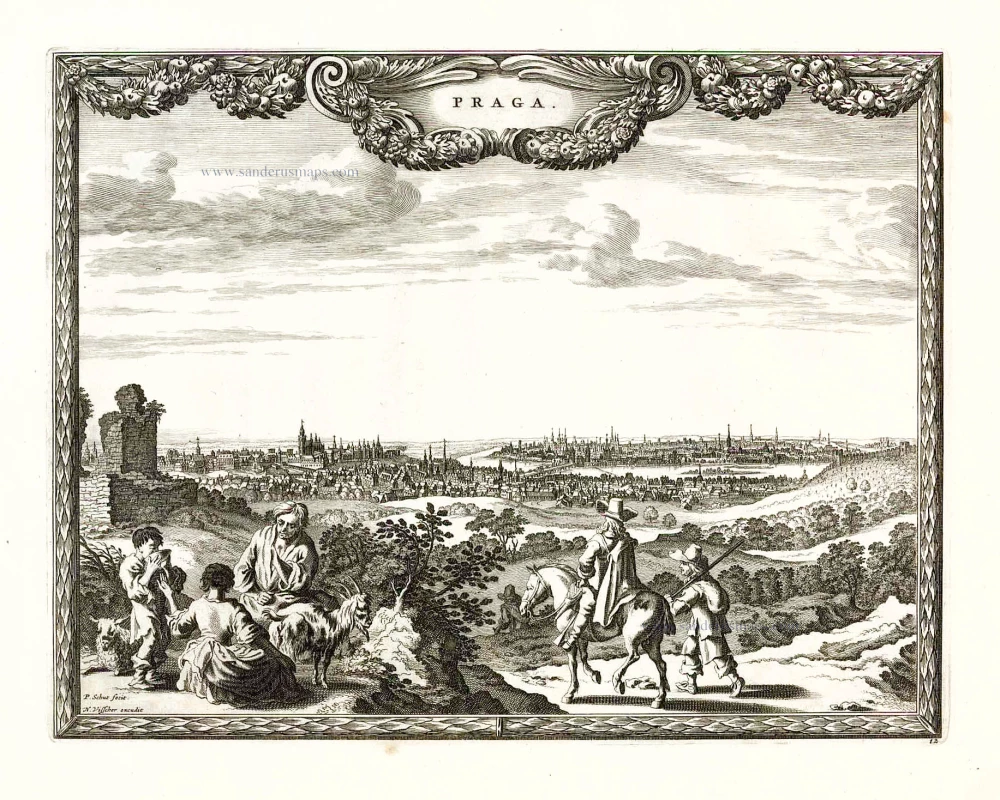
Praga. 1658/60
Prague (Praha), by N. Visscher & P.H. Schut.
[Item number: 26637]