
Old antique plan of Moravia (Czech Republic) - Znaim (Znojmo) by Braun & Hogenberg c. 1625
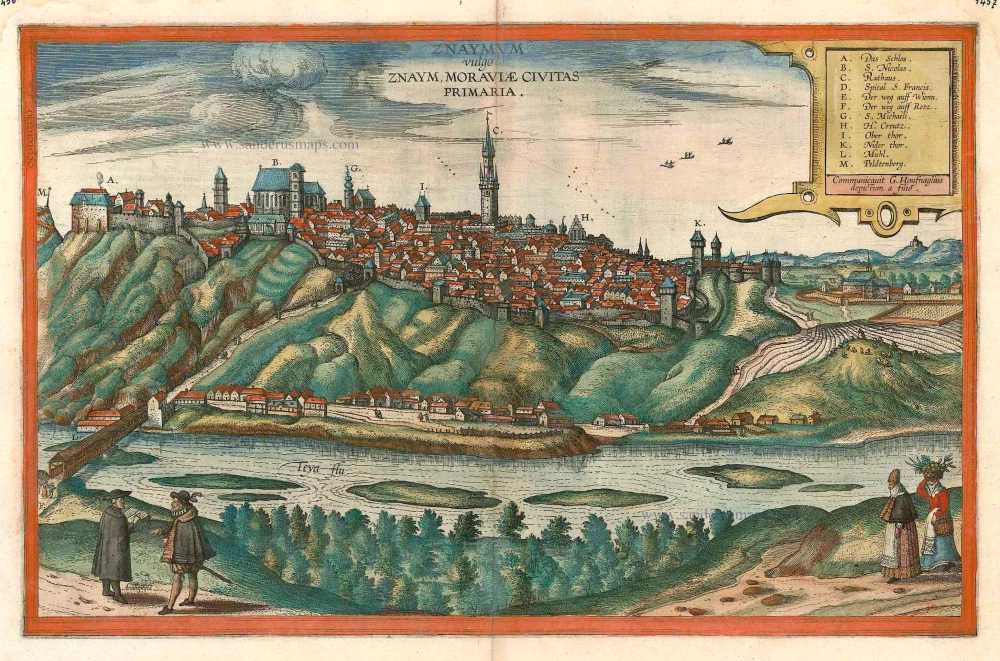


CAPTION: Znaymum, in the vernacular Znojmo, capital of Moravia.
CARTOUCHE: Procured by Georg Hoefnagel, painted by his son.
COMMENTARY BY BRAUN (on verso): "This is a beautiful and wealthy city in Moravia, situated on the border to Austria on a hill or mountain, at the foot of which lies the River Dyje. In the city there is a splendid town hall or council house with a high and skilfully built tower. The town houses are also very fine and handsome. The burghers of Znojmo are especially praised by Dubravius because they opposed the sect of the Hussites, even though today the whole of Moravia is a nest of Anabaptists."
Znojmo, which lies high above the River Dyje, is shown from the southwest with its city wall and many towers, with the Gothic hall tower (C) rising high in the middle. To the left of this is the church of St Nicholas (B) with its high nave and square tower. There was a castle in Znojmo in the 9th century during the great Moravian Empire. The town developed under the protection of the castle, built by the Margraves of Moravia in the 11th century. Of this castle the Romanesque Rotunda of St Catherine with its outstanding frescoes has been preserved. After its destruction in the 12th century, Znojmo was refounded by German settlers and was raised to the status of a royal city in 1226. The engraving shows the 13th-century Gothic castle (A); in the 17th century this was turned into a Baroque palace, which still exists. (Taschen)
Braun G. & Hogenberg F. and the Civitates Orbis Terrarum.
The Civitates Orbis Terrarum, or the "Braun & Hogenberg", is a six-volume town atlas and the most excellent book of town views and plans ever published: 363 engravings, sometimes beautifully coloured. It was one of the best-selling works in the last quarter of the 16th century. Georg Braun wrote the text accompanying the plans and views on the verso. Many plates were engraved after the original drawings of a professional artist, a professional artist, Joris Hoefnagel (1542-1600). The first volume was published in Latin in 1572, and the sixth in 1617. Frans Hogenberg created the tables for volumes I through IV, and Simon van den Neuwel made those for volumes V and VI. Other contributors were cartographers Daniel Freese and Heinrich Rantzau. Works by Jacob van Deventer, Sebastian Münster, and Johannes Stumpf were also used. Translations appeared in German and French.
Following the original publication of Volume 1 of the Civitates in 1572, seven further editions of 1575, 1577, 1582, 1588, 1593, 1599 and 1612 can be identified. Vol.2, first issued in 1575, was followed by further editions in 1597 and 1612. The subsequent volumes appeared in 1581, 1588, 1593, 1599 and 1606. The German translation of the first volume appeared from 1574 on, and the French edition from 1575 on.
Several printers were involved: Theodor Graminaeus, Heinrich von Aich, Gottfried von Kempen, Johannis Sinniger, Bertram Buchholtz and Peter von Brachel, who all worked in Cologne.
Georg Braun (1541-1622)
Georg Braun was born in Cologne in 1541. After his studies in Cologne, he entered the Jesuit Order as a novice. 1561, he obtained his bachelor's degree, and in 1562, he received his Magister Artium. Although he left the Jesuit Order, he studied theology, gaining a licentiate in theology.
Frans Hogenberg (1535-1590)
Frans Hogenberg was a Flemish and German painter, engraver, and mapmaker. He was born in Mechelen as the son of Nicolaas Hogenberg.
By the end of the 1560s, Frans Hogenberg was employed upon Abraham Ortelius's Theatrum Orbis Terrarum, published in 1570; he is named an engraver of numerous maps. In 1568, he was banned from Antwerp by the Duke of Alva and travelled to London, where he stayed a few years before emigrating to Cologne. He immediately embarked on his two most important works, the Civitates, published in 1572 and the Geschichtsblätter, which appeared in several series from 1569 until about 1587.
Thanks to large-scale projects like the Geschichtsblätter and the Civitates, Hogenberg's social circumstances improved with each passing year. He died as a wealthy man in Cologne in 1590.
Znaymum vulgo Znaym, Moraviae Civitas Primaria.
Item Number: 16435 Authenticity Guarantee
Category: Antique maps > Europe > Central Europe
Antique map - bird's-eye view of Znaim (Znojmo) in Moravia by Braun and Hogenberg after G. Hoefnagel and son, 1617.
Key to 12 locations.
Date of the first edition: 1617
Date of this map: c. 1625
Copper engraving, printed on paper.
Size (not including margins): 32.5 x 50cm (12.7 x 19.5 inches)
Verso text: French
Condition: Excellent, superb original colour.
Condition Rating: A+
References: Van der Krogt 4, 4943; Taschen, Braun and Hogenberg, p.465; Fauser, 15934.
From: Théatre des Principales Villes de tout l'Univers Vol. VI. c. 1625. (Van der Krogt 4, 41:3.6)
CAPTION: Znaymum, in the vernacular Znojmo, capital of Moravia.
CARTOUCHE: Procured by Georg Hoefnagel, painted by his son.
COMMENTARY BY BRAUN (on verso): "This is a beautiful and wealthy city in Moravia, situated on the border to Austria on a hill or mountain, at the foot of which lies the River Dyje. In the city there is a splendid town hall or council house with a high and skilfully built tower. The town houses are also very fine and handsome. The burghers of Znojmo are especially praised by Dubravius because they opposed the sect of the Hussites, even though today the whole of Moravia is a nest of Anabaptists."
Znojmo, which lies high above the River Dyje, is shown from the southwest with its city wall and many towers, with the Gothic hall tower (C) rising high in the middle. To the left of this is the church of St Nicholas (B) with its high nave and square tower. There was a castle in Znojmo in the 9th century during the great Moravian Empire. The town developed under the protection of the castle, built by the Margraves of Moravia in the 11th century. Of this castle the Romanesque Rotunda of St Catherine with its outstanding frescoes has been preserved. After its destruction in the 12th century, Znojmo was refounded by German settlers and was raised to the status of a royal city in 1226. The engraving shows the 13th-century Gothic castle (A); in the 17th century this was turned into a Baroque palace, which still exists. (Taschen)
Braun G. & Hogenberg F. and the Civitates Orbis Terrarum.
The Civitates Orbis Terrarum, or the "Braun & Hogenberg", is a six-volume town atlas and the most excellent book of town views and plans ever published: 363 engravings, sometimes beautifully coloured. It was one of the best-selling works in the last quarter of the 16th century. Georg Braun wrote the text accompanying the plans and views on the verso. Many plates were engraved after the original drawings of a professional artist, a professional artist, Joris Hoefnagel (1542-1600). The first volume was published in Latin in 1572, and the sixth in 1617. Frans Hogenberg created the tables for volumes I through IV, and Simon van den Neuwel made those for volumes V and VI. Other contributors were cartographers Daniel Freese and Heinrich Rantzau. Works by Jacob van Deventer, Sebastian Münster, and Johannes Stumpf were also used. Translations appeared in German and French.
Following the original publication of Volume 1 of the Civitates in 1572, seven further editions of 1575, 1577, 1582, 1588, 1593, 1599 and 1612 can be identified. Vol.2, first issued in 1575, was followed by further editions in 1597 and 1612. The subsequent volumes appeared in 1581, 1588, 1593, 1599 and 1606. The German translation of the first volume appeared from 1574 on, and the French edition from 1575 on.
Several printers were involved: Theodor Graminaeus, Heinrich von Aich, Gottfried von Kempen, Johannis Sinniger, Bertram Buchholtz and Peter von Brachel, who all worked in Cologne.
Georg Braun (1541-1622)
Georg Braun was born in Cologne in 1541. After his studies in Cologne, he entered the Jesuit Order as a novice. 1561, he obtained his bachelor's degree, and in 1562, he received his Magister Artium. Although he left the Jesuit Order, he studied theology, gaining a licentiate in theology.
Frans Hogenberg (1535-1590)
Frans Hogenberg was a Flemish and German painter, engraver, and mapmaker. He was born in Mechelen as the son of Nicolaas Hogenberg.
By the end of the 1560s, Frans Hogenberg was employed upon Abraham Ortelius's Theatrum Orbis Terrarum, published in 1570; he is named an engraver of numerous maps. In 1568, he was banned from Antwerp by the Duke of Alva and travelled to London, where he stayed a few years before emigrating to Cologne. He immediately embarked on his two most important works, the Civitates, published in 1572 and the Geschichtsblätter, which appeared in several series from 1569 until about 1587.
Thanks to large-scale projects like the Geschichtsblätter and the Civitates, Hogenberg's social circumstances improved with each passing year. He died as a wealthy man in Cologne in 1590.
Related items
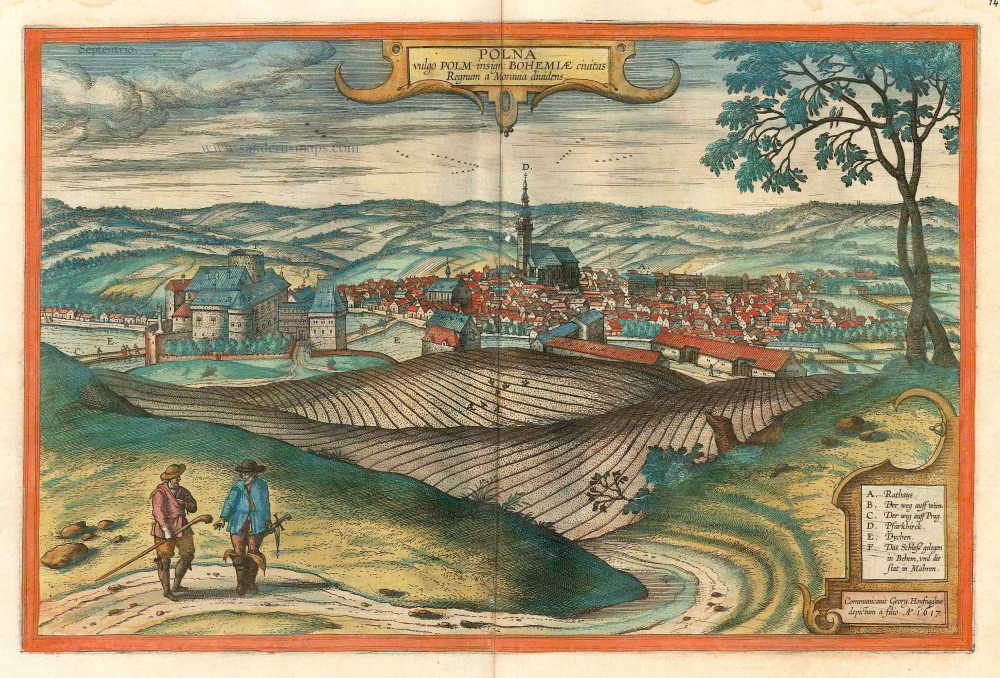
Polna vulgo Polm insign: Bohemiae civitas Regnum a Moravia dividens.. c. 1625
Polna in Bohemia, by Georg Braun and Frans Hogenberg.
[Item number: 16423]
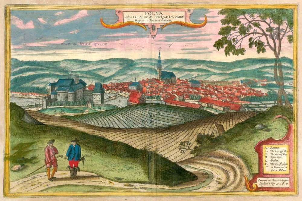
Polna vulgo Polm insign: Bohemiae civitas Regnum a Moravia dividens. 1617-18
Polna in Bohemia, by Georg Braun and Frans Hogenberg.
[Item number: 23432]
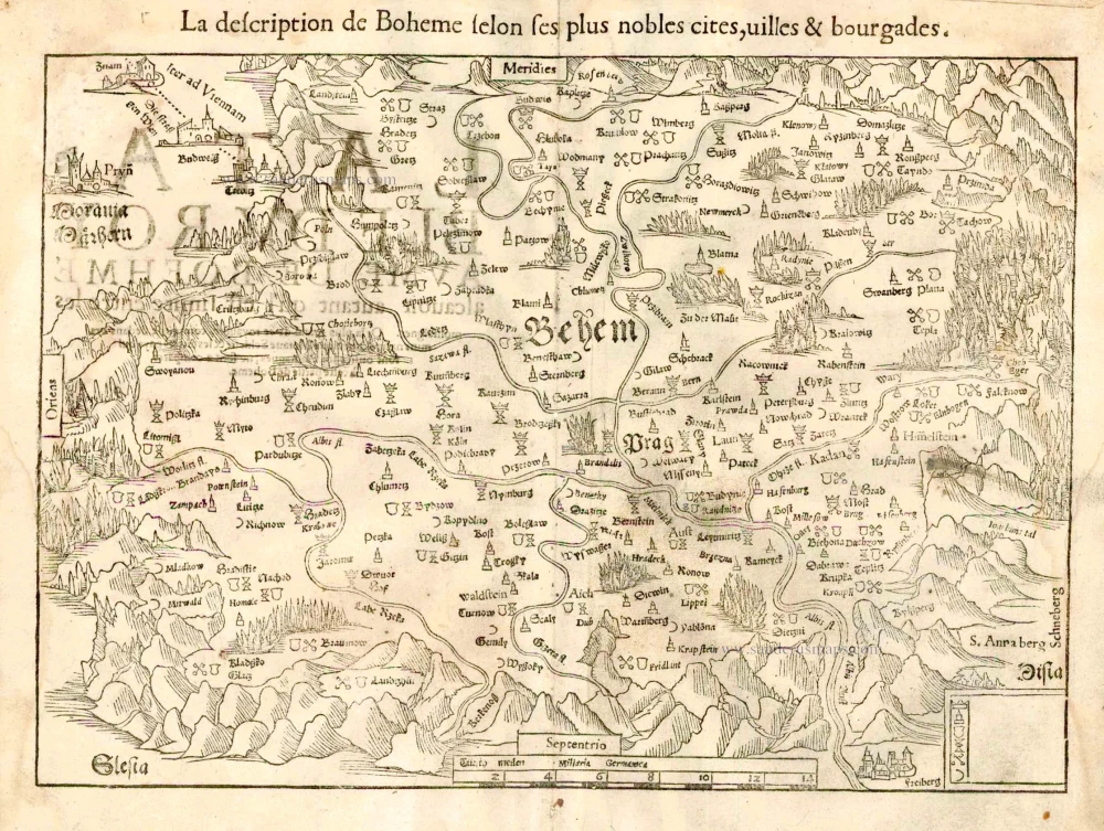
La description de Boheme selon ses plus nobles cites, villes & bourgades. 1555
Bohemia, by S. Munster.
[Item number: 25170]
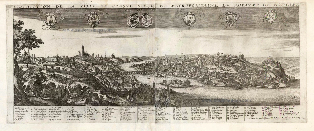
Description de la Ville de Prague Siege et Metropolitaine du Royaume de Boheme. 1648
Prague by Jean Boisseau
[Item number: 25578]
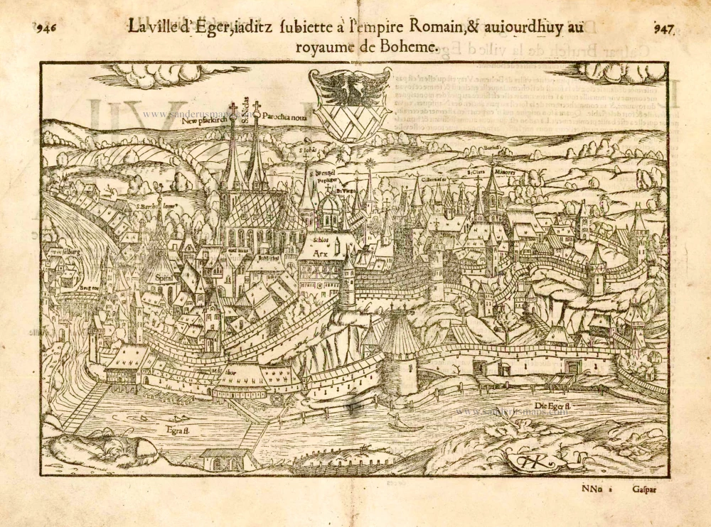
La ville d'Eger ... 1555
Eger (Cheb - Czech Republic), by S. Münster.
[Item number: 25959]