
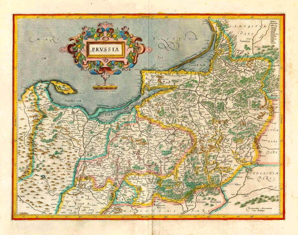
Prussia (East) - Poland by J.B. Homann. c. 1720

The Homann Family: Masters of German Cartography and Publishing
The Homann family stands as one of the most significant names in the history of German cartography and publishing. Their maps, atlases, and geographic works not only shaped contemporary understanding of the world during the 18th century but also left an enduring legacy in the fields of geography, engraving, and scholarly publishing.
The family's prominence began with Johann Baptist Homann (1664–1724), a native of Oberkammlach in Bavaria. Initially trained in law and theology, Johann Baptist later turned to engraving and cartography — a field that was flourishing amid the Age of Discovery and the growing demand for precise geographic knowledge.
In 1702, he founded his own publishing house in Nürnberg, a city then renowned for its vibrant intellectual, artistic, and scientific community. Nuremberg’s rich tradition of printmaking and map production provided fertile ground for Homann's enterprise.
Johann Baptist Homann quickly rose to prominence as one of Germany’s leading cartographers and publishers. His works combined technical accuracy, artistic merit, and rich ornamentation, often embellished with elaborate cartouches, mythological scenes, and heraldic symbols.
In 1715, Homann was appointed Imperial Geographer to the Holy Roman Emperor Charles VI. He obtained the "Imperial Privilege" (Privilegium Imperialis). This prestigious title solidified his status and bestowed upon his publishing house both credibility and influence. His most famous works include:
- Atlas Novus Terrarum Orbis (1707) — an early and ambitious atlas project.
- Grosser Atlas über die ganze Welt (1716) — one of the most crucial German world atlases of the early 18th century.
Homann’s maps covered both European and global territories, including the Americas, Asia, and Africa, reflecting contemporary geographical knowledge and political boundaries.
The Homann Heirs (Homannische Erben)
After Johann Baptist Homann died in 1724, his son Johann Christoph Homann (1703–1730) briefly took over the business. However, Johann Christoph died at a young age, and the enterprise was then continued under the name Homännische Erben ("Homann Heirs"), a partnership of family members and associates.
Despite the loss of its founder, the firm remained highly productive and influential for several decades. The Homann Heirs continued to publish atlases, wall maps, city views, and geographical treatises well into the late 18th century. Their catalogue included works by noted cartographers such as Johann Matthias Hase, Leonhard Euler, and Tobias Conrad Lotter.
The Homann publishing house played a crucial role in disseminating geographic and scientific knowledge during the Enlightenment. Their maps combined artistry with empirical detail and were sought after by scholars, navigators, governments, and collectors.
Several of their works are now prized as valuable historical artefacts, housed in museums, libraries, and private collections around the world. The Homann Heirs' firm gradually declined by the end of the 18th century, overtaken by newer publishing houses and changing technologies, but their contribution to the cartographic tradition remains significant.
The Homann family’s name is indelibly linked to the golden age of German cartography. Through meticulous craftsmanship and a keen sense of visual storytelling, they charted the known world of their time, leaving a remarkable record of early modern geography. Today, their maps not only inform historians of cartography but also captivate collectors and enthusiasts for their aesthetic beauty and historical value.
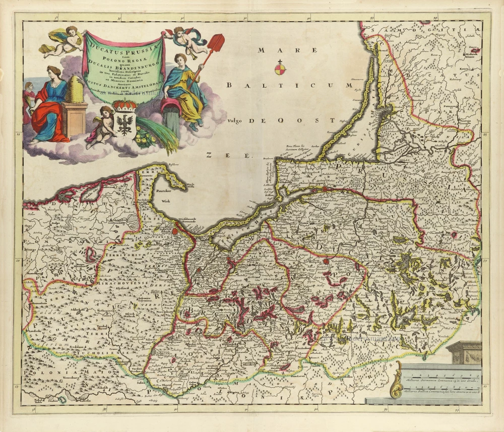
Regnum Borussiae
Item Number: 32272 Authenticity Guarantee
Category: Antique maps > Europe > Eastern Europe
Prussia (East) - Poland by J.B. Homann.
Title: Regnum Borussiae
Gloriosis auspicijs Seerenissimi et Potentissimi Princip Friderici III. Primi Borussiae Regis March. et Elect. Brandenburg. inauguratum die 18 Jan. A. 1701.
Geographice cum vicinis Regionibus adumbratum à Ioh. Baptista Homanno Norimbergae.
Date of the first edition: 1707.
Date of this map: c. 1720.
Copper engraving, printed on paper.
Image size: 485 x 575mm (19 x 22¾ inches).
Sheet size: 520 x 595mm (20½ x 23½ inches).
Verso: Blank.
Condition: Original coloured, sharp impression, excellent.
Condition Rating: A+.
From: Atlas Novus Terrarum Orbis Imperia, regna et status exactis tabulis geographice demonstrans. Nuremberg, J.B. Homann, [c. 1720].
With an impressive title cartouche featuring Frederick I, the first King of Prussia.
The Homann Family: Masters of German Cartography and Publishing
The Homann family stands as one of the most significant names in the history of German cartography and publishing. Their maps, atlases, and geographic works not only shaped contemporary understanding of the world during the 18th century but also left an enduring legacy in the fields of geography, engraving, and scholarly publishing.
The family's prominence began with Johann Baptist Homann (1664–1724), a native of Oberkammlach in Bavaria. Initially trained in law and theology, Johann Baptist later turned to engraving and cartography — a field that was flourishing amid the Age of Discovery and the growing demand for precise geographic knowledge.
In 1702, he founded his own publishing house in Nürnberg, a city then renowned for its vibrant intellectual, artistic, and scientific community. Nuremberg’s rich tradition of printmaking and map production provided fertile ground for Homann's enterprise.
Johann Baptist Homann quickly rose to prominence as one of Germany’s leading cartographers and publishers. His works combined technical accuracy, artistic merit, and rich ornamentation, often embellished with elaborate cartouches, mythological scenes, and heraldic symbols.
In 1715, Homann was appointed Imperial Geographer to the Holy Roman Emperor Charles VI. He obtained the "Imperial Privilege" (Privilegium Imperialis). This prestigious title solidified his status and bestowed upon his publishing house both credibility and influence. His most famous works include:
- Atlas Novus Terrarum Orbis (1707) — an early and ambitious atlas project.
- Grosser Atlas über die ganze Welt (1716) — one of the most crucial German world atlases of the early 18th century.
Homann’s maps covered both European and global territories, including the Americas, Asia, and Africa, reflecting contemporary geographical knowledge and political boundaries.
The Homann Heirs (Homannische Erben)
After Johann Baptist Homann died in 1724, his son Johann Christoph Homann (1703–1730) briefly took over the business. However, Johann Christoph died at a young age, and the enterprise was then continued under the name Homännische Erben ("Homann Heirs"), a partnership of family members and associates.
Despite the loss of its founder, the firm remained highly productive and influential for several decades. The Homann Heirs continued to publish atlases, wall maps, city views, and geographical treatises well into the late 18th century. Their catalogue included works by noted cartographers such as Johann Matthias Hase, Leonhard Euler, and Tobias Conrad Lotter.
The Homann publishing house played a crucial role in disseminating geographic and scientific knowledge during the Enlightenment. Their maps combined artistry with empirical detail and were sought after by scholars, navigators, governments, and collectors.
Several of their works are now prized as valuable historical artefacts, housed in museums, libraries, and private collections around the world. The Homann Heirs' firm gradually declined by the end of the 18th century, overtaken by newer publishing houses and changing technologies, but their contribution to the cartographic tradition remains significant.
The Homann family’s name is indelibly linked to the golden age of German cartography. Through meticulous craftsmanship and a keen sense of visual storytelling, they charted the known world of their time, leaving a remarkable record of early modern geography. Today, their maps not only inform historians of cartography but also captivate collectors and enthusiasts for their aesthetic beauty and historical value.
Related items
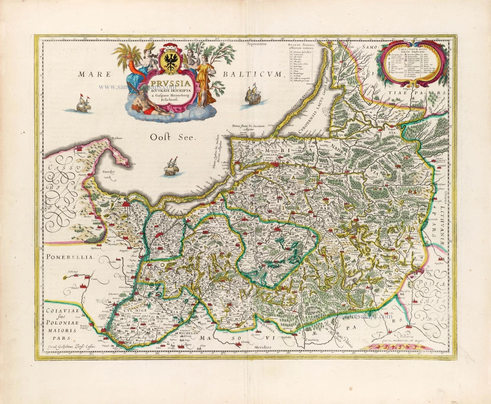
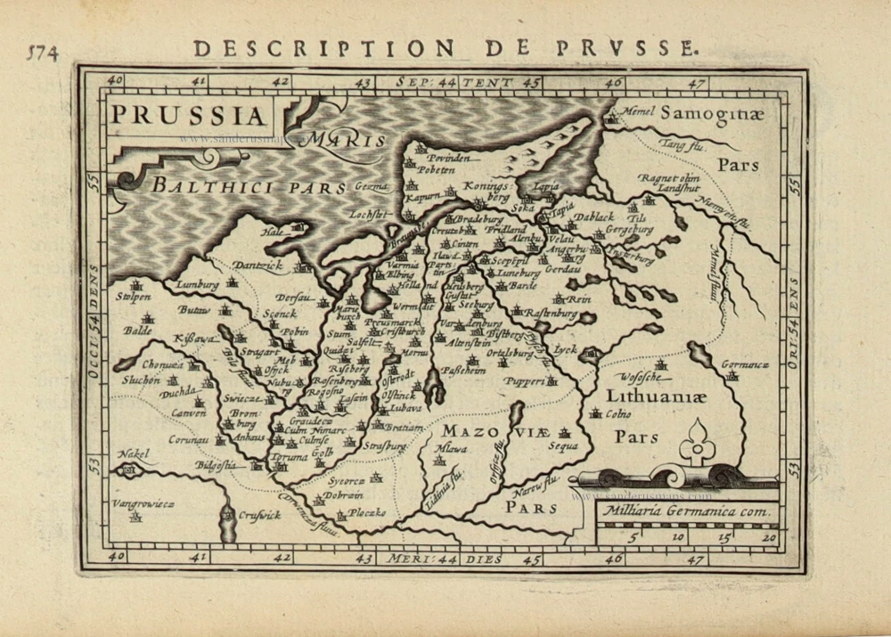
Prussia Accurate Descripta a Gasparo Henneberg Erlichensi. 1644-45
Prussia by Willem & Joan Blaeu
[Item number: 13183]
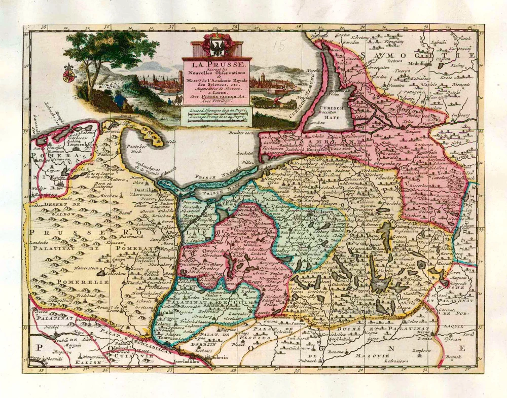
La Prusse, Suivant les Nouvelles Observations de Mess.rs de l'Academie Royale des Sciences, etc. 1713
Prussia, by Pieter van der Aa.
[Item number: 26047]
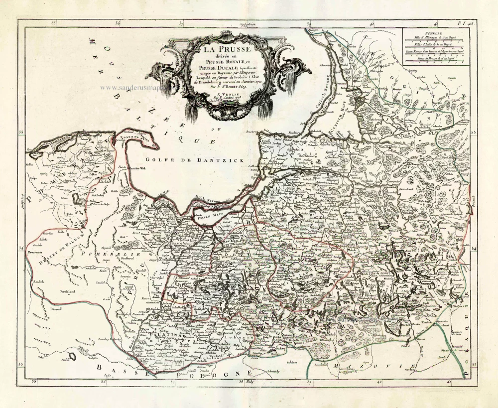
La Prusse divisée en Prusse Royale, et Prusse Ducale. 1776-79
Prussia, by Francesco Santini.
[Item number: 26967]
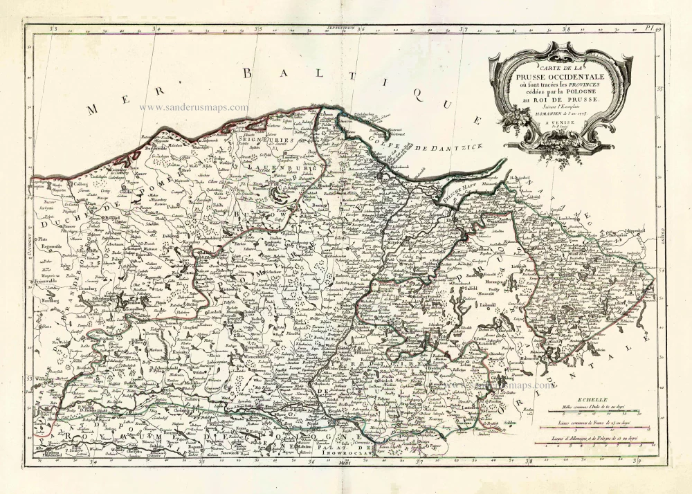
Carte de la Prusse Occidentale où sont tracées les Provinces cédées par la Pologne au Roi de Prusse. 1776-79
Prussia, by Francesco Santini.
[Item number: 26968]
Prussia. 1619
Prussia, by Gerard Mercator.
[Item number: 27197]

Regni Prussiae et Prussiae Polonicae. after 1721
Prussia by Frederik de Wit, published by Covens & Mortier.
[Item number: 28263]
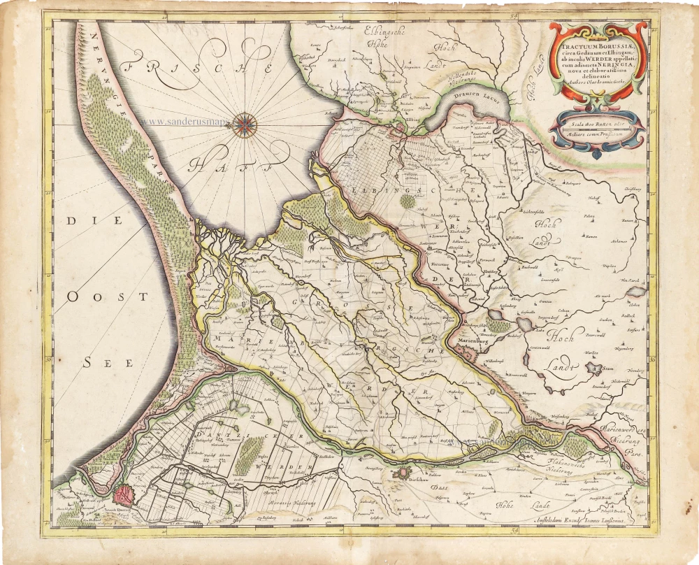
Tractuum Borussiae, circa Gedanum et Elbingam, ab incolis Werder appellati, cum adiunta Neringia, nova et elaboratissima delineatio. 1641
Eastern Prussia (Gdansk Werders), by Johannes Janssonius.
[Item number: 29015]
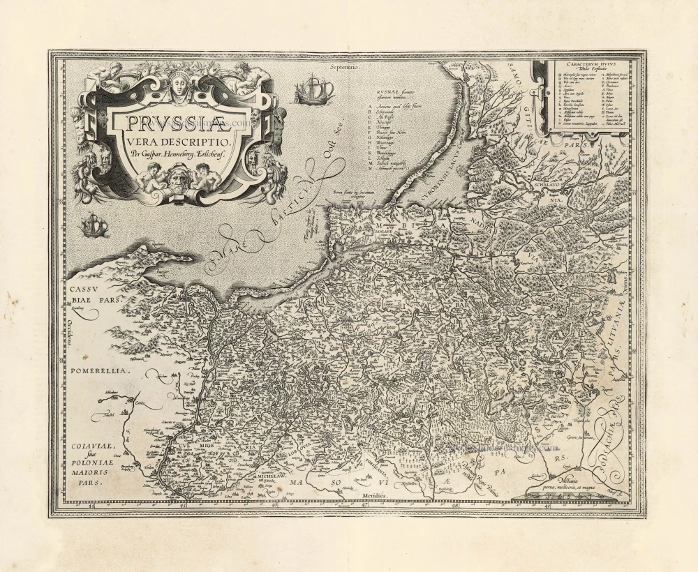
Prussiae Vera Descriptio. 1601
Prussia (Poland) by Abraham Ortelius.
[Item number: 30679]
Prussia. 1618
Prussia by Petrus Bertius, published by Jodocus Hondius II.
[Item number: 31856]

Il Regno di Prussia con la Prussia Polacca. 1779-1785
Prussia, by Antonio Zatta.
[Item number: 32038]
Ducatus Prussiae tam Polono Regiae, quam Brandenburgo, correcta Descriptio, et Divisio Regiae scilicet in tres Palatinatus, et Ducalis in totidem Circulos, cim Utriusq. Subdivisione in Tractus minores. 1696-1713
Prussia (Poland - Lithuania) by Justus Danckerts.
[Item number: 32521]