
Saint-Germain-en-Laye and Fontainebleau, by Georg Braun and Frans Hogenberg. c. 1625


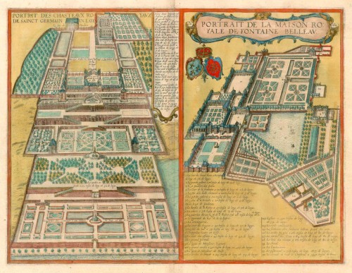
PALACE OF SAINT-GERMAIN-EN-LAYE
COMMENTARY BY BRAUN (on verso): "What can I say about the wide open spaces, the splendid, truly royal palaces, the most charming pleasure gardens [...], to say nothing of the fountains and man-made waterworks, which especially in the summer provide special pleasure and enjoyment? [...] Even more surprising is a nymph or virgin who plays on pleasantly sounding organ driven by the water. And mechanical nightingales can be seen and heard, singing as lustily as if they were alive."
The engraving shows an aerial view from the east of the palace built by Henry II on a hill above the Seine, one of the main residences of the French kings until the removal of the court to Versailles in 1682. In the centre the Château Neuf can be identified, built by Henry II, which forms a unit with the rigorously symmetrical gardens laid out by Henry IV. These consist of great ramps, stairways and parterres arranged along a central axis, in the walls of terraces were grottoes with waterworks. The Château Vieux, the outlines of which can be made out in the background, is still preserved today, but the Château Neuf and its famous gardens have been almost completely built over.
PALACE OF FONTAINEBLEAU
COMMENTARY BY BRAUN (on verso): "Francis I, king of France, decided to build a royal palace at this place, which was to become as it were the head of all the châteaux in France. To achieve this he commisioned the most renowned architects that could be found in all Europe [...]. This brave prince, as charitable father and protector of the liberal arts and of scholars, also built a handsome library here, in which he himself often liked to sit."
This is an isometric view from the west of the palace of Fontainebleau. The Renaissance palace, built around several courtyards, was laid out by King Francis I at the beginning of the 16th century. For the interior decoration he engaged reputed Italian artists such as Rosso Fiorentino, Francesco Primaticcio and Niccolo dell'Abbate. The gardens to the east of the palace were designed in the Italian Renaissance style for his son, Henry II, husband of Catherine de' Medici. (Taschen)
Braun G. & Hogenberg F. and the Civitates Orbis Terrarum.
The Civitates Orbis Terrarum, also known as the 'Braun & Hogenberg', is a six-volume town atlas and the most excellent book of town views and plans ever published: 363 engravings, sometimes beautifully coloured. It was one of the best-selling works in the last quarter of the 16th century. Georg Braun, a skilled writer, wrote the text accompanying the plans and views on the verso. Many plates were engraved after the original drawings of a professional artist, Joris Hoefnagel (1542-1600). The first volume was published in Latin in 1572 and the sixth in 1617. Frans Hogenberg, a talented engraver, created the tables for volumes I through IV, and Simon van den Neuwel made those for volumes V and VI. Other contributors were cartographers Daniel Freese and Heinrich Rantzau, who provided valuable geographical information. Works by Jacob van Deventer, Sebastian Münster, and Johannes Stumpf were also used as references. Translations appeared in German and French, making the atlas accessible to a broader audience.
Since its original publication of volume 1 in 1572, the Civitates Orbis Terrarum has left an indelible mark on the history of cartography. Seven more editions followed the first volume in 1575, 1577, 1582, 1588, 1593, 1599, and 1612. Vol.2, initially released in 1575, saw subsequent editions in 1597 and 1612. The subsequent volumes, each a treasure trove of historical insights, graced the world in 1581, 1588, 1593, 1599, and 1606. The German translation of the first volume, a testament to its widespread appeal, debuted in 1574, followed by the French edition in 1575.
Several printers were involved: Theodor Graminaeus, Heinrich von Aich, Gottfried von Kempen, Johannis Sinniger, Bertram Buchholtz, and Peter von Brachel, all of whom worked in Cologne.
Georg Braun (1541-1622)
Georg Braun, the author of the text accompanying the plans and views in the Civitates Orbis Terrarum, was born in Cologne in 1541. After his studies in Cologne, he entered the Jesuit Order as a novice, indicating his commitment to learning and intellectual pursuits. In 1561, he obtained his bachelor's degree; in 1562, he received his Magister Artium, further demonstrating his academic achievements. Although he left the Jesuit Order, he continued his studies in theology, gaining a licentiate in theology. His theological background likely influenced the content and tone of the text in the Civitates Orbis Terrarum, adding a unique perspective to the work.
Frans Hogenberg (1535-1590)
Frans Hogenberg was a Flemish and German painter, engraver, and mapmaker. He was born in Mechelen as the son of Nicolaas Hogenberg.
By the end of the 1560s, Frans Hogenberg was employed upon Abraham Ortelius's Theatrum Orbis Terrarum, published in 1570; he is named an engraver of numerous maps. In 1568, he was banned from Antwerp by the Duke of Alva and travelled to London, where he stayed a few years before emigrating to Cologne. He immediately embarked on his two most important works, the Civitates, published in 1572 and the Geschichtsblätter, which appeared in several series from 1569 until about 1587.
Thanks to large-scale projects like the Geschichtsblätter and the Civitates, Hogenberg's social circumstances improved with each passing year. He died as a wealthy man in Cologne in 1590.
Portrait des Chasteaux Royaux de Sainct Germain en Laye [on sheet with] Portrait de la Maison Royale de Fontaine Belleau.
Item Number: 16387 Authenticity Guarantee
Category: Antique maps > Europe > France - Cities
Old, antique bird’s-eye view plan of Saint-Germain-en-Laye and Fontainebleau, by Georg Braun and Frans Hogenberg.
Title: Portrait des Chasteaux Royaux de Sainct Germain en Laye [on sheet with] Portrait de la Maison Royale de Fontaine Belleau.
Date of the first edition: 1617.
Date of this map: c. 1625.
Copper engraving, printed on paper.
Size (not including margins): 350 x 465mm (13.78 x 18.31 inches).
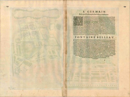
Verso: French text.
Condition: Original coloured, excellent.
Condition Rating: A+.
From: Théatre des Principales Villes de tout l'Univers Vol. VI. c. 1625. (Van der Krogt 4, 41:3.6)
PALACE OF SAINT-GERMAIN-EN-LAYE
COMMENTARY BY BRAUN (on verso): "What can I say about the wide open spaces, the splendid, truly royal palaces, the most charming pleasure gardens [...], to say nothing of the fountains and man-made waterworks, which especially in the summer provide special pleasure and enjoyment? [...] Even more surprising is a nymph or virgin who plays on pleasantly sounding organ driven by the water. And mechanical nightingales can be seen and heard, singing as lustily as if they were alive."
The engraving shows an aerial view from the east of the palace built by Henry II on a hill above the Seine, one of the main residences of the French kings until the removal of the court to Versailles in 1682. In the centre the Château Neuf can be identified, built by Henry II, which forms a unit with the rigorously symmetrical gardens laid out by Henry IV. These consist of great ramps, stairways and parterres arranged along a central axis, in the walls of terraces were grottoes with waterworks. The Château Vieux, the outlines of which can be made out in the background, is still preserved today, but the Château Neuf and its famous gardens have been almost completely built over.
PALACE OF FONTAINEBLEAU
COMMENTARY BY BRAUN (on verso): "Francis I, king of France, decided to build a royal palace at this place, which was to become as it were the head of all the châteaux in France. To achieve this he commisioned the most renowned architects that could be found in all Europe [...]. This brave prince, as charitable father and protector of the liberal arts and of scholars, also built a handsome library here, in which he himself often liked to sit."
This is an isometric view from the west of the palace of Fontainebleau. The Renaissance palace, built around several courtyards, was laid out by King Francis I at the beginning of the 16th century. For the interior decoration he engaged reputed Italian artists such as Rosso Fiorentino, Francesco Primaticcio and Niccolo dell'Abbate. The gardens to the east of the palace were designed in the Italian Renaissance style for his son, Henry II, husband of Catherine de' Medici. (Taschen)
Braun G. & Hogenberg F. and the Civitates Orbis Terrarum.
The Civitates Orbis Terrarum, also known as the 'Braun & Hogenberg', is a six-volume town atlas and the most excellent book of town views and plans ever published: 363 engravings, sometimes beautifully coloured. It was one of the best-selling works in the last quarter of the 16th century. Georg Braun, a skilled writer, wrote the text accompanying the plans and views on the verso. Many plates were engraved after the original drawings of a professional artist, Joris Hoefnagel (1542-1600). The first volume was published in Latin in 1572 and the sixth in 1617. Frans Hogenberg, a talented engraver, created the tables for volumes I through IV, and Simon van den Neuwel made those for volumes V and VI. Other contributors were cartographers Daniel Freese and Heinrich Rantzau, who provided valuable geographical information. Works by Jacob van Deventer, Sebastian Münster, and Johannes Stumpf were also used as references. Translations appeared in German and French, making the atlas accessible to a broader audience.
Since its original publication of volume 1 in 1572, the Civitates Orbis Terrarum has left an indelible mark on the history of cartography. Seven more editions followed the first volume in 1575, 1577, 1582, 1588, 1593, 1599, and 1612. Vol.2, initially released in 1575, saw subsequent editions in 1597 and 1612. The subsequent volumes, each a treasure trove of historical insights, graced the world in 1581, 1588, 1593, 1599, and 1606. The German translation of the first volume, a testament to its widespread appeal, debuted in 1574, followed by the French edition in 1575.
Several printers were involved: Theodor Graminaeus, Heinrich von Aich, Gottfried von Kempen, Johannis Sinniger, Bertram Buchholtz, and Peter von Brachel, all of whom worked in Cologne.
Georg Braun (1541-1622)
Georg Braun, the author of the text accompanying the plans and views in the Civitates Orbis Terrarum, was born in Cologne in 1541. After his studies in Cologne, he entered the Jesuit Order as a novice, indicating his commitment to learning and intellectual pursuits. In 1561, he obtained his bachelor's degree; in 1562, he received his Magister Artium, further demonstrating his academic achievements. Although he left the Jesuit Order, he continued his studies in theology, gaining a licentiate in theology. His theological background likely influenced the content and tone of the text in the Civitates Orbis Terrarum, adding a unique perspective to the work.
Frans Hogenberg (1535-1590)
Frans Hogenberg was a Flemish and German painter, engraver, and mapmaker. He was born in Mechelen as the son of Nicolaas Hogenberg.
By the end of the 1560s, Frans Hogenberg was employed upon Abraham Ortelius's Theatrum Orbis Terrarum, published in 1570; he is named an engraver of numerous maps. In 1568, he was banned from Antwerp by the Duke of Alva and travelled to London, where he stayed a few years before emigrating to Cologne. He immediately embarked on his two most important works, the Civitates, published in 1572 and the Geschichtsblätter, which appeared in several series from 1569 until about 1587.
Thanks to large-scale projects like the Geschichtsblätter and the Civitates, Hogenberg's social circumstances improved with each passing year. He died as a wealthy man in Cologne in 1590.
Related items

Orleans [on sheet with:] Bourges 1582
Orléans - Bourges, by Braun & Hogenberg.
[Item number: 894]
Mets 1593
Metz, by Georg Braun and Frans Hogenberg.
[Item number: 6490]
Autricum, Prolemeo in Gallia Lugdunensis Urbs; vulgo, cum Villa nouano, Chartres. [on sheet with:] Chasteaudunum, Comitatus vulgo Dunoys in Gallia Oppidum primorium. 1581-88
Chartres & Châteaudun, by Braun & Hogenberg.
[Item number: 21377]
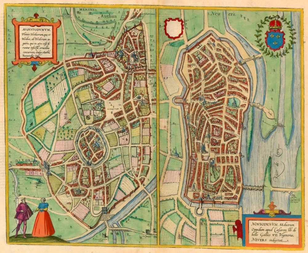
Augustodunum [on sheet with] Noviodunum. 1581-88
Autun - Nevers, by Braun & Hogenberg.
[Item number: 21502]
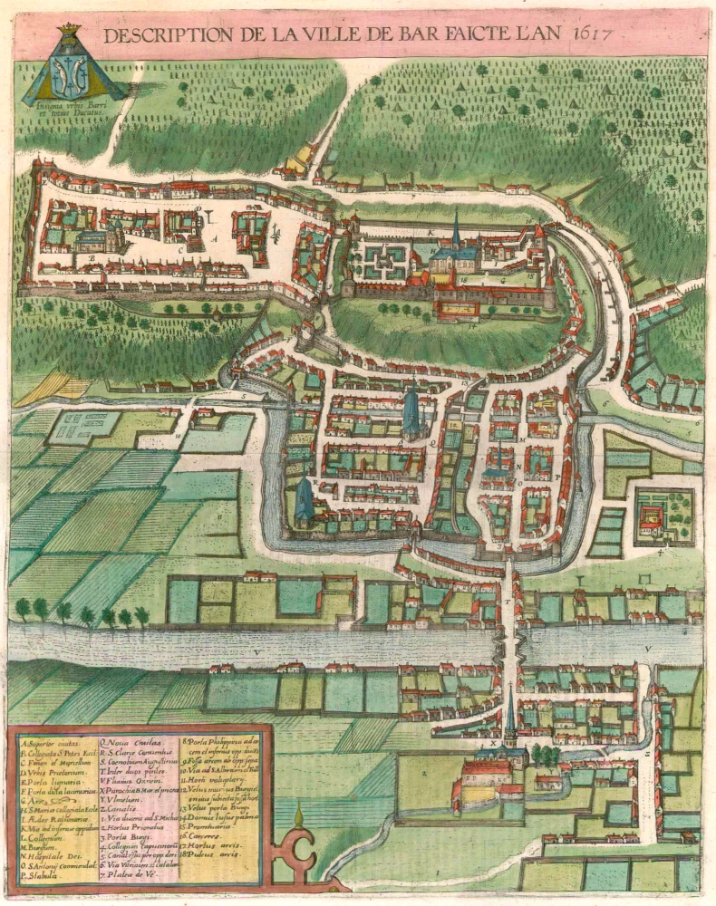
Description de la Ville de Bar Faicte l'An 1617. 1617
Bar-le-Duc, by Braun & Hogenberg.
[Item number: 22128]
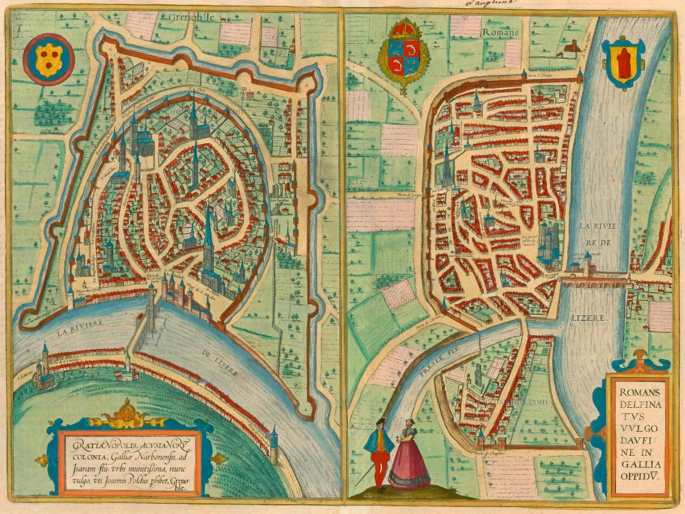
Gratianopolis Acusianoru Colonia, ... [on sheet with] Romans Delfinatus vulgo Daufine in Gallia Oppidu. 1581-88
Grenoble and Romans-sur-Isère, by Georg Braun and Frans Hogenberg.
[Item number: 22192]
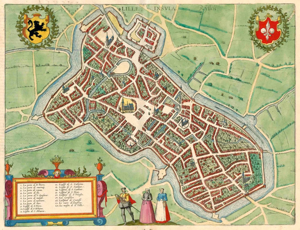
Lille - Insula - Ryssele. 1581-88
Lille, by Braun & Hogenberg.
[Item number: 22202]
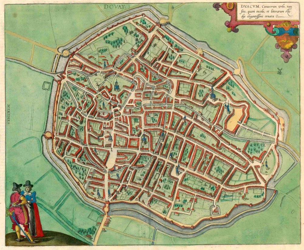
Duacum, Catuacorum Urbs, tam situ, quam incolis, et litterarum studijs elegantissime ornata 1623
Douai, by Braun & Hogenberg.
[Item number: 22203]
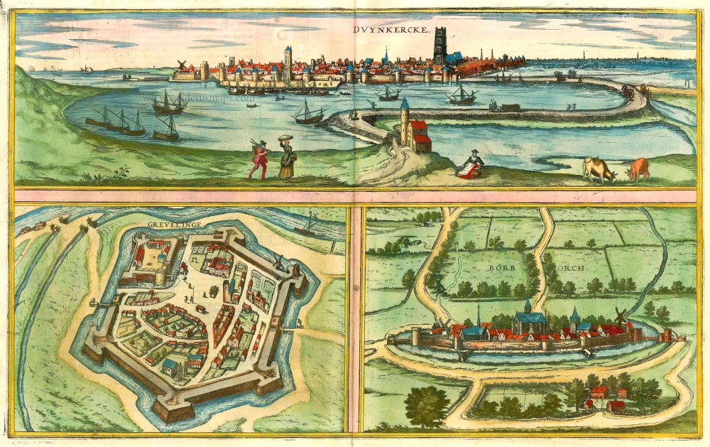
Duynkercke [on sheet with] Grevelinge [and] Borborch 1575-1612
Dunkirk (Dunkerque) - Gravelines - Bourbourg, by Braun & Hogenberg.
[Item number: 22381]
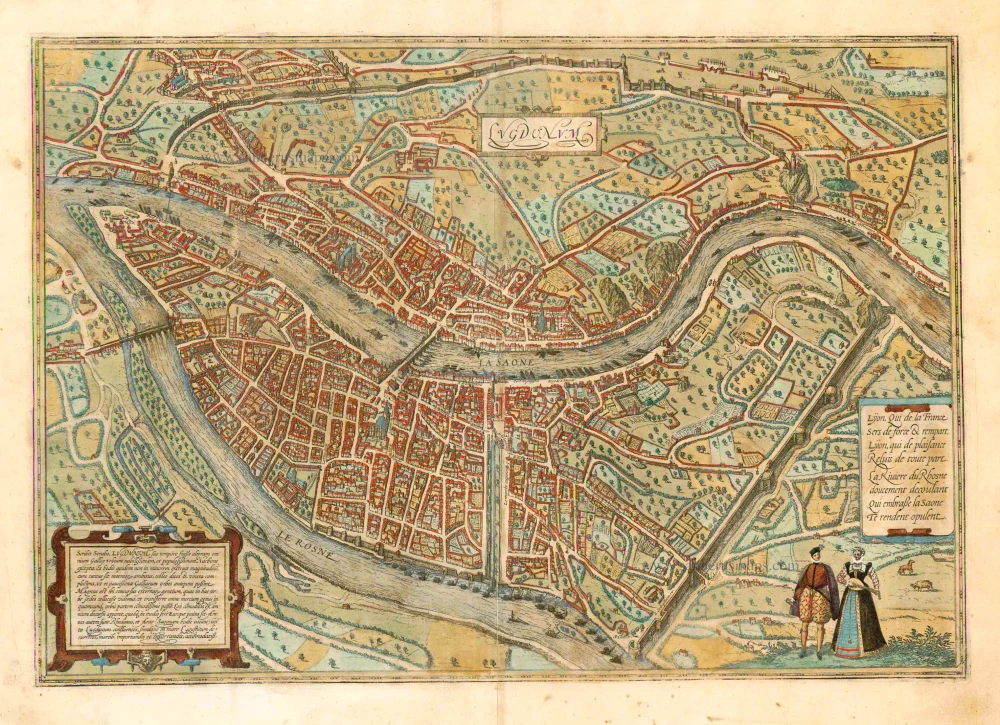
Lugdunum. 1582
Lyon, by Braun and Hogenberg.
[Item number: 24984]
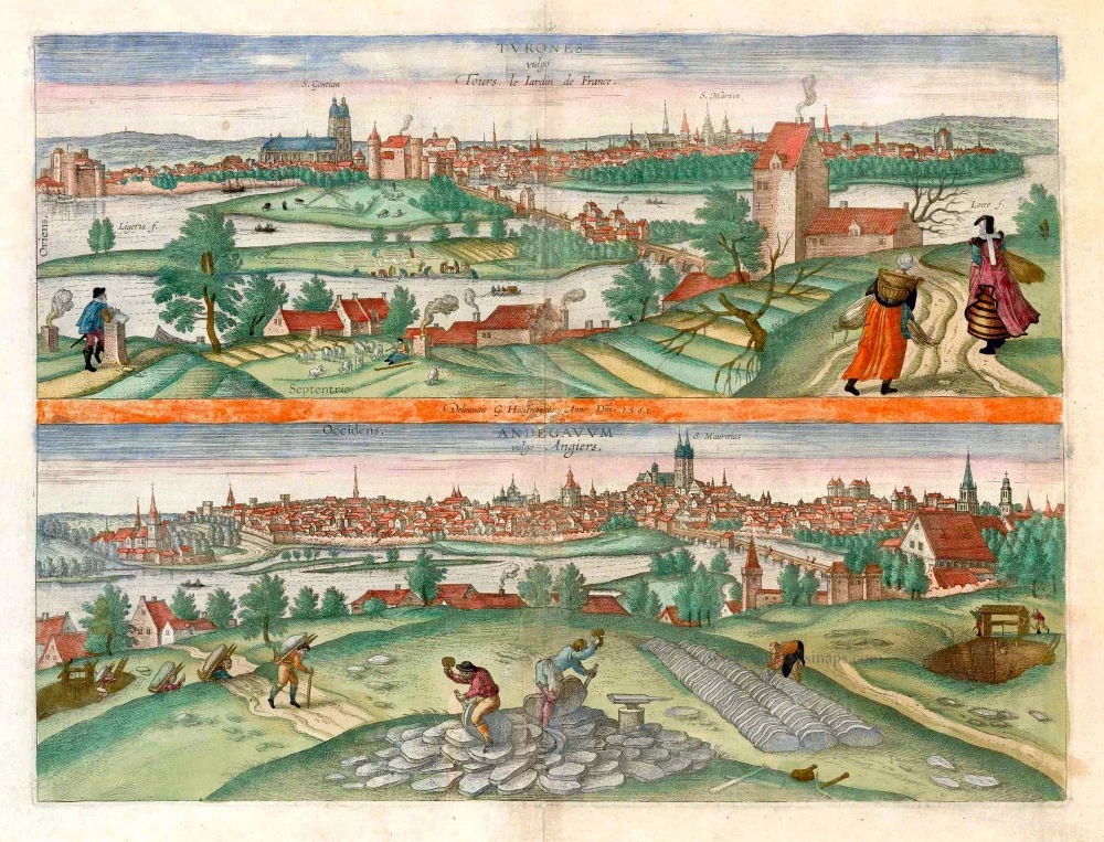
Turones vulgo Tours, le Iardin de France. [on sheet with:] Andegavum vulgo Angiers. c. 1610
Tours and Angers, by Georg Braun and Frans Hogenberg.
[Item number: 25956]