
Montpellier - Tours - Poitiers by Braun & Hogenberg 1612

Montpellier: With a key to locations. In his brief description of the city, Braun focuses on the university Pope Nicholas IV founded in 1289. On the other hand, he does not mention the church of Notre Dame des Tables, which is recognizable by its tall spire. Since the Middle Ages, the church has been a stopping point for pilgrims on their way to Santiago di Compostella.
Tours: With a key to locations. The abbey of Saint-Martin, which was destroyed in 1562, is here still intact. Unmistakable on the right is the late Gothic cathedral of Saint-Gatien (13th-16th cent.), which was built after the previous Romanesque church burned down and which houses the relics of the first bishop of Tours, Gatianus. Standing on the left, outside the first city wall, is the abbey of Saint-Julien from the 12th/13th centuries.
Poitiers: Cartouche: Pictavis or Pictavia, in the local vernacular Poitiers, capital of the Pictavi or Pictones, noteworthy for its university, for the ruins of a large theatre, for ancient monuments, for magnificent ecclesiastical and secular buildings.
The captions in this engraving are given in particular detail. It is thus possible to recognize e.g. the famous Romanesque church of Notre-Dame-la-Grande, and the basilica of Saint-Hilaire-
Monspessulanus, Montpellier [on sheet with] Turo, Tours [and] Pictavis, sive Pictavia, Vernaculo Idiomate Poitiers
Item Number: 22305 Authenticity Guarantee
Category: Antique maps > Europe > France - Cities
Old, antique map with three bird's-eye view plans by Braun and Hogenberg: Montpellier, Tours and Poitiers.
Date of the first edition: 1572
Date of this map: 1612
Copper engraving, printed on paper.
Size (not including margins): 325 x 485mm (12.8 x 19.09 inches).
Verso: Latin text.
Condition: Uncoloured, excellent.
Condition Rating: A.
From: Civitates Orbis Terrarum, Liber Primus. Cologne, Petrus von Brachel, 1612. (Van der Krogt 4, 41:1.1(1612))
Montpellier: With a key to locations. In his brief description of the city, Braun focuses on the university Pope Nicholas IV founded in 1289. On the other hand, he does not mention the church of Notre Dame des Tables, which is recognizable by its tall spire. Since the Middle Ages, the church has been a stopping point for pilgrims on their way to Santiago di Compostella.
Tours: With a key to locations. The abbey of Saint-Martin, which was destroyed in 1562, is here still intact. Unmistakable on the right is the late Gothic cathedral of Saint-Gatien (13th-16th cent.), which was built after the previous Romanesque church burned down and which houses the relics of the first bishop of Tours, Gatianus. Standing on the left, outside the first city wall, is the abbey of Saint-Julien from the 12th/13th centuries.
Poitiers: Cartouche: Pictavis or Pictavia, in the local vernacular Poitiers, capital of the Pictavi or Pictones, noteworthy for its university, for the ruins of a large theatre, for ancient monuments, for magnificent ecclesiastical and secular buildings.
The captions in this engraving are given in particular detail. It is thus possible to recognize e.g. the famous Romanesque church of Notre-Dame-la-Grande, and the basilica of Saint-Hilaire-
Related items
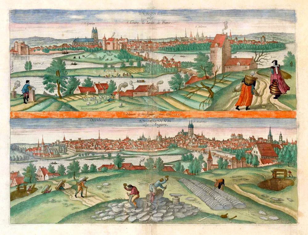
Turones vulgo Tours, le Iardin de France. [on sheet with:] Andegavum vulgo Angiers. c. 1610
Tours and Angers, by Georg Braun and Frans Hogenberg.
[Item number: 25956]

De la ville de Poytiers. 1575
Poitiers, by François de Belleforest.
[Item number: 27194]
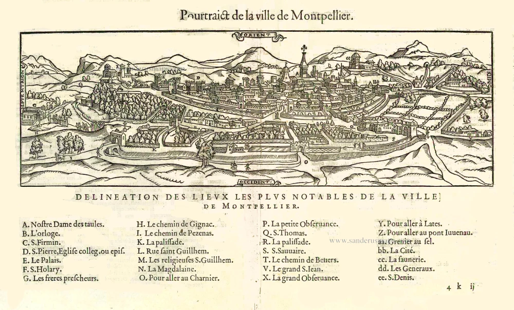
Pourtraict de la ville de Montpellier. 1575
Montpellier, by François de Belleforest.
[Item number: 27254]