
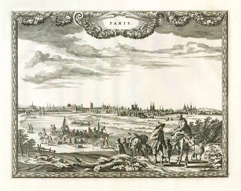
Paris, by P.H. Schut, published by N. Visscher. 1658/60
The Visscher Family
For nearly a century, the members of the Visscher family were essential art dealers and map publishers in Amsterdam.
Claes Jansz. Visscher, or N.J. Piscator (1587-1652)
Claes Jansz. Vischer bought a house in Amsterdam, 'de gulden Bors', on the crucial Kalverstraat and changed the name into "In de Visscher"; under this title, the shop was to flourish for many years.
He was famous for his engravings and etchings of Dutch landscapes and 'historical scenes', such as sieges, battles, etc. These 'historical scenes' were considered contemporary illustrated news items, especially e.g. that of 'the Eighty Years' War'.
For the publication of his first atlas, he bought copperplates of the atlas Germania Inferior by Pieter van den Keere (1623).
In 1649, he published an atlas entitled Tabularum Geographicarum Contractarum, containing the same maps as Langenes' Caert Thresoor, for which Visscher had only new title pages engraved.
Claes Jansz. Visscher died in 1652. His wife, Neeltjen Florisdr., had already died in 1640. They had seven children, four of whom were still alive at Claes Jansz.'s death. One was Nicolaes Visscher I, who was to continue his father's business.
Nicolaes Visscher I (1618-1679)
Nicolaes Visscher I partnered with his father, continued the business, and stayed on the Kalverstraat 'in de Visscher' till his death.
In about 1657, the first edition of his Atlas Contractus Orbis Terrarum appeared.
Between 1664 and 1677, several editions of his Atlas Contractus appeared without a printed index, for these atlases had no fixed contents but were composed according to the buyer's financial leaping pole.
In May 1664, Nicolaes Visscher was admitted as a member of the Booksellers' Guild of his town. In July 1677, he was granted a patent of the States of Holland and West-Friesland for printing and publishing maps and atlases for 15 years.
After this, he again published an Atlas Contractus with a printed index. At about the same time, he also brought out an Atlas Minor.
Nicolaes Visscher II (1649-1702)
Nicolaes Visscher II inherited the 'shop' from his father. To obtain a new privilege, he applied to the States of Holland and West-Friesland in 1682 for a patent for printing and publishing maps. This patent was granted to him the same year. He moved the firm to the Dam, but it kept the same signboard: "In de Visscher".
Around 1683, he published his first Atlas Minor with a printed index of 91 maps. In 1684, an atlas Germania Inferior appeared. Till 1697, he published another number of atlases. He used his grandfather's (Claes Jansz.) maps less often now and relied more and more on his own.
The wars waged at this time initiated the compilation of maps of the countries where the armies operated. Many war maps were included in the various editions of his Atlas Minor.
After Nicolaes's death, his wife, Elizabeth Verseyl, published all the war maps as an atlas under the title De Stoel des Oorlogs in de Wereld (The seat of war in the world).
The widow of Nicolaes Visscher II (?-1726)
His widow continued the business energetically, and by her hand, under the name of her deceased husband, numerous atlases appeared, e.g., several editions of the Atlas Minor, an Atlas Maior and De Stoel des Oorlogs. The shop enjoyed a high reputation due to the assortment's incredible variety. Not only 'Visscher' maps but also maps of other publishers were obtainable. With the death of Elizabeth Verseyl in 1726, the last descendant died of a great map- and atlas-publishing firm in Amsterdam.
Paris.
Item Number: 26631 Authenticity Guarantee
Category: Antique maps > Europe > France - Cities
Panoramic view of Paris, by Paris, by P.H. Schut, published by N. Visscher.
Title: Paris.
Date of the first edition: 1658/60.
Date of this map: 1658/60.
Copper engraving, printed on paper.
Size (not including margins): 215 x 280mm (8.46 x 11.02 inches).
Verso: Blank.
Condition: Excellent.
Condition Rating: A+.
From: Pieter Hendricksz. Schut, Afbeeldinghe der voornaemste steden van Europa. Amsterdam, Nicolaes Visscher, 1658-60. (Van der Krogt 4, 451:3)
The Visscher Family
For nearly a century, the members of the Visscher family were essential art dealers and map publishers in Amsterdam.
Claes Jansz. Visscher, or N.J. Piscator (1587-1652)
Claes Jansz. Vischer bought a house in Amsterdam, 'de gulden Bors', on the crucial Kalverstraat and changed the name into "In de Visscher"; under this title, the shop was to flourish for many years.
He was famous for his engravings and etchings of Dutch landscapes and 'historical scenes', such as sieges, battles, etc. These 'historical scenes' were considered contemporary illustrated news items, especially e.g. that of 'the Eighty Years' War'.
For the publication of his first atlas, he bought copperplates of the atlas Germania Inferior by Pieter van den Keere (1623).
In 1649, he published an atlas entitled Tabularum Geographicarum Contractarum, containing the same maps as Langenes' Caert Thresoor, for which Visscher had only new title pages engraved.
Claes Jansz. Visscher died in 1652. His wife, Neeltjen Florisdr., had already died in 1640. They had seven children, four of whom were still alive at Claes Jansz.'s death. One was Nicolaes Visscher I, who was to continue his father's business.
Nicolaes Visscher I (1618-1679)
Nicolaes Visscher I partnered with his father, continued the business, and stayed on the Kalverstraat 'in de Visscher' till his death.
In about 1657, the first edition of his Atlas Contractus Orbis Terrarum appeared.
Between 1664 and 1677, several editions of his Atlas Contractus appeared without a printed index, for these atlases had no fixed contents but were composed according to the buyer's financial leaping pole.
In May 1664, Nicolaes Visscher was admitted as a member of the Booksellers' Guild of his town. In July 1677, he was granted a patent of the States of Holland and West-Friesland for printing and publishing maps and atlases for 15 years.
After this, he again published an Atlas Contractus with a printed index. At about the same time, he also brought out an Atlas Minor.
Nicolaes Visscher II (1649-1702)
Nicolaes Visscher II inherited the 'shop' from his father. To obtain a new privilege, he applied to the States of Holland and West-Friesland in 1682 for a patent for printing and publishing maps. This patent was granted to him the same year. He moved the firm to the Dam, but it kept the same signboard: "In de Visscher".
Around 1683, he published his first Atlas Minor with a printed index of 91 maps. In 1684, an atlas Germania Inferior appeared. Till 1697, he published another number of atlases. He used his grandfather's (Claes Jansz.) maps less often now and relied more and more on his own.
The wars waged at this time initiated the compilation of maps of the countries where the armies operated. Many war maps were included in the various editions of his Atlas Minor.
After Nicolaes's death, his wife, Elizabeth Verseyl, published all the war maps as an atlas under the title De Stoel des Oorlogs in de Wereld (The seat of war in the world).
The widow of Nicolaes Visscher II (?-1726)
His widow continued the business energetically, and by her hand, under the name of her deceased husband, numerous atlases appeared, e.g., several editions of the Atlas Minor, an Atlas Maior and De Stoel des Oorlogs. The shop enjoyed a high reputation due to the assortment's incredible variety. Not only 'Visscher' maps but also maps of other publishers were obtainable. With the death of Elizabeth Verseyl in 1726, the last descendant died of a great map- and atlas-publishing firm in Amsterdam.
Related items
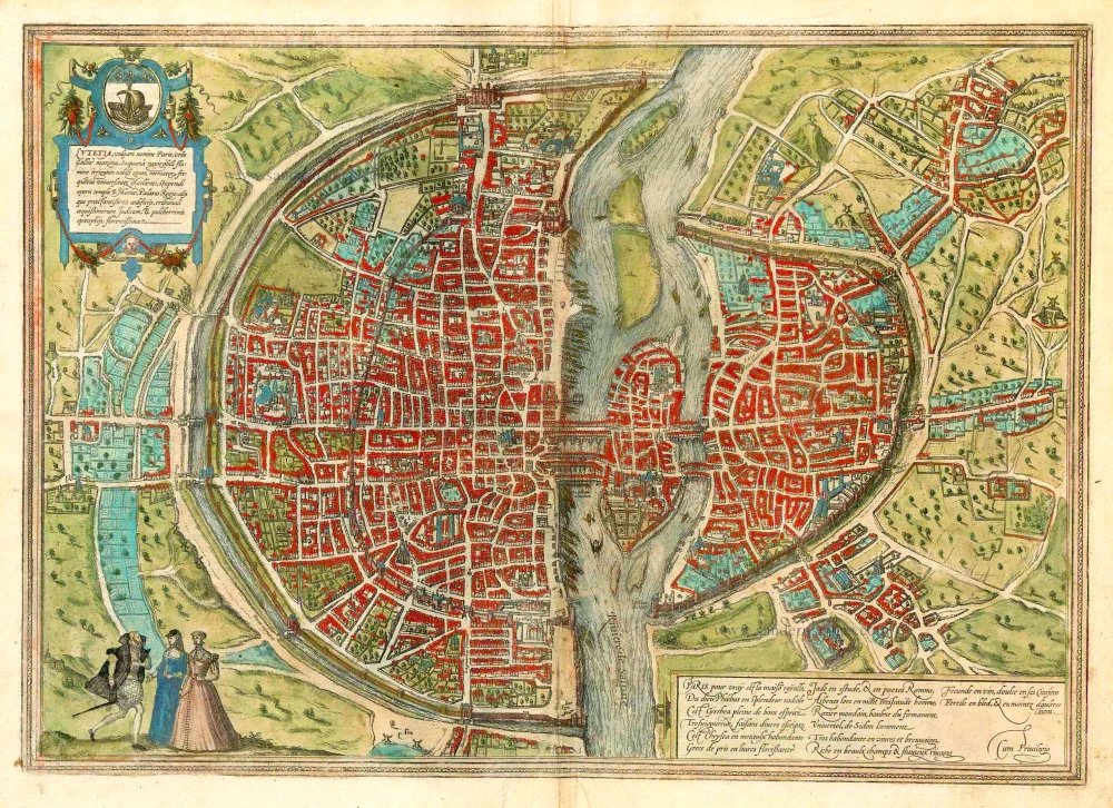
Lutetia vulgari Nomine Paris, Urbs Galliae Maxima, Sequana Navigabili Flumine Irrigatur ... 1582
Paris, by Georg Braun and Frans Hogenberg.
[Item number: 25675]
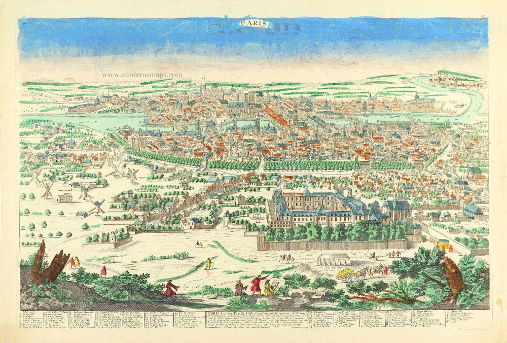
Paris, Lutetia, Paritij, Ville Capitale du Royaume de France, et la principale de l'Europe ... c. 1780
Paris by Pierre Aveline, published in Paris by Jean.
[Item number: 28753]

La ville de Paris, par tout tant renomée, & principalle ville du royaulme de France. 1568
Paris by Sebastian Münster
[Item number: 30606]

Veüe et Perspective du College des 4 Nations. 1728
View of Paris - Collège des Quatre-Nations, by Pieter Van der Aa.
[Item number: 31438]
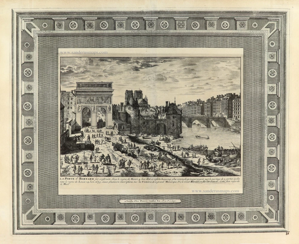
La Porte St. Bernard. 1728
View of Paris - Collège des Quatre-Nations, by Pieter Van der Aa.
[Item number: 31439]
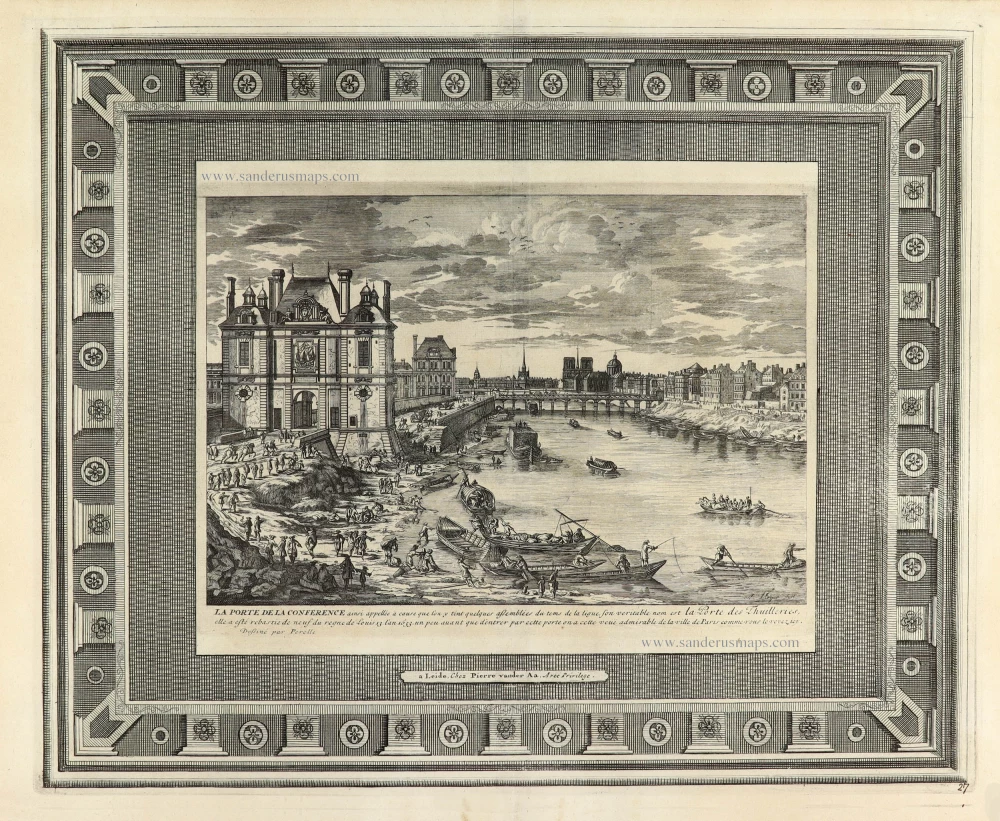
La Porte de la Conference 1728
View of Paris - Porte de la Conference, by Pieter Van der Aa.
[Item number: 31441]
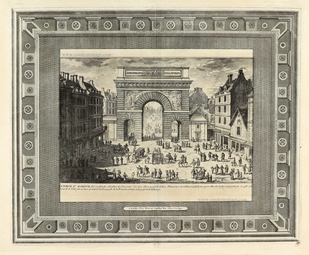
La Porte St. Martin 1728
View of Paris - Porte St. Martin, by Pieter Van der Aa.
[Item number: 31442]

La Nouvelle Porte St. Honoré [...] Le Dôme des Filles de Lassomption. 1728
View of Paris - Porte St. Honoré & Dôme des Filles de Lassomption.
[Item number: 31443]

Vue de la Sortie de Paris prise du Pont Neuf. c. 1750
Optical View of Paris, by Martin Engelbrecht.
[Item number: 31910]
new
Optical View
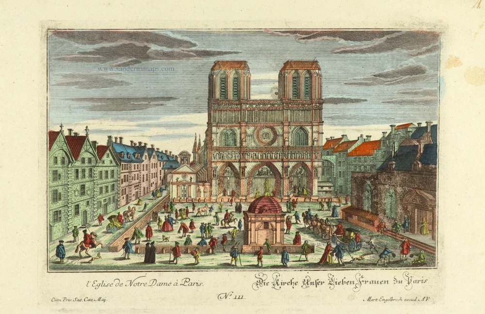
l'Eglise de Notre Dame à Paris - Die Kirche Unser Lieben Frauen zu Paris. c. 1750
Notre Dame of Paris, by Martin Engelbrecht.
[Item number: 31919]
new

Optical View
La Place Dauphine du Cote du Pont neuf à Paris - Place des Dauphins von der Seite der neuen Brücke zu Paris. c. 1750
Place Dauphine of Paris, by Martin Engelbrecht.
[Item number: 31920]
new
Optical view
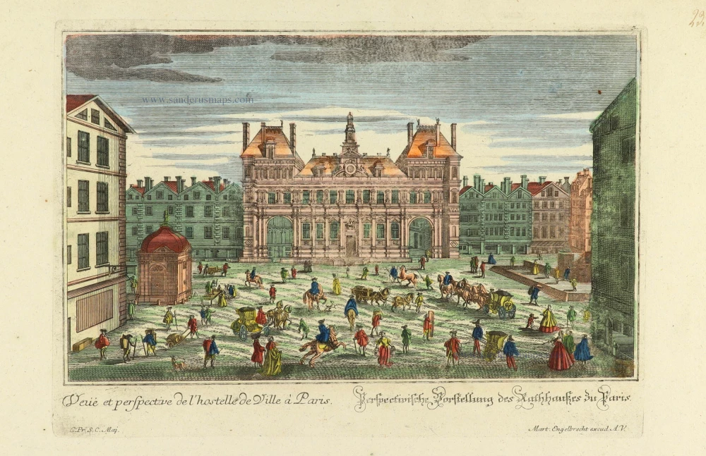
Veuë et perspective de l'hostelle de Ville à Paris. - Perspectivische Vorstellung des Rathhauses zu Paris. c. 1750
City Hall of Paris, by Martin Engelbrecht.
[Item number: 31921]
new

Optical View
La Porte S. Antoine à Paris. - Das Thor des Heil. Antonii zu Paris. c. 1750
Porte St. Antoine of Paris, by Martin Engelbrecht.
[Item number: 31922]
new