
Ile de France by Hondius - Janssonius c. 1630-1650

The Hondius Family
Jodocus Hondius the Elder (1563-1612)
Joost d’Hondt was born at Wakken (Flanders) in 1563. Two years later, his family settled in Ghent, where young Joost displayed an excellent gift for drawing and calligraphy. Through study and lessons, he developed his talents and became an engraver with a good reputation.
Due to the circumstances of the war, he moved to London in 1584, where he settled down as an engraver, instrument-maker, and map-maker. In 1587, he married Coletta van den Keere, sister of the well-known engraver Pieter van den Keere (Petrus Kaerius); some years earlier, his sister, Jacomina, had married Pieter van den Berghe (Petrus Montanus). Joost, who had Latinized his name to Jodocus Hondius, closely co-operated with his two brothers-in-law.
The political situation in the Northern Netherlands in 1593 was such that Jodocus seemed justified in establishing himself in Amsterdam, where many Antwerp printers, publishers, and engravers had gone. In this new centre of cartography, Jodocus Hondius set up his business “In de Wackere Hondt” (in the vigilant dog), this name being an allusion to his birthplace and name. He engraved many maps and published atlases and many other works, such as his continuation of Gerard Mercator’s Atlas.
He suddenly passed away in February 1612. The publishing firm of Jodocus Hondius was continued by his widow, later on, by his two sons, Jodocus Jr. and Henricus, and by his son-in-law, J. Janssonius.
Jodocus Hondius II (1594-1629) & Henricus Hondius (1597-1651)
After the father’s death, the widow and her seven children continued publishing the atlases under the name of Jodocus Hondius till 1620. The firm was reinforced by the very welcome help of Joannes Janssonius (1588-1664), who married 24-year-old Elisabeth Hondius in 1612. After 1619, Mercator’s Atlas was published under the name of Henricus Hondius.
One of the most dramatic events in the early history of commercial cartography in Amsterdam was the sale of Jodocus Hondius Jr.’s copper plates to Willem Jansz. Blaeu in 1629, the year of his death. At least 34 plates, from which Jodocus II had printed single-sheet maps for his benefit, passed into the hands of his great competitor. Immediately after that, his brother, Henricus, and Joannes Janssonius ordered the engraving of identical plates.
Henricus devoted all his energy to publishing the Atlas for an extended period. He saw its growth up to and including the fourth part in 1646; after that, his name no longer figures on the title pages. After 1638, the title of the Atlas was changed to Atlas Novus; Joannes Janssonius mainly carried it on.
The competition with the Blaeu's dates from 1630. In 1630, Willem Janszoon (=Blaeu) first attacked with his Atlantis Appendix. In 1635, Blaeu completed his Theatrum Orbis Terrarum in two volumes with French, Latin, Dutch, and German texts, prompting Henricus Hondius to speed up the enlargement of his Atlas.
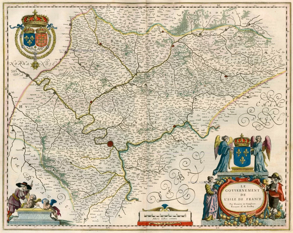
Gouvernement de l'Isle de France.
Item Number: 33147 Authenticity Guarantee
Category: Antique maps > Europe > France
Ile de France by H. Hondius
Title: Gouvernement de l'Isle de France.
Date of the first edition: 1631.
Date of this map: c. 1630-1650.
Copper engraving, printed on paper.
Image size: 375 x 500mm (14¾ x 19¾ inches).
Sheet size: 505 x 685mm (20 x 27 inches).
Verso: Blank.
Condition: Original coloured in outline, printed on heavy paper.
Condition Rating: A+.
Separate publication - from a French Composite Atlas, c. 1630-1650.
Appeared in: Theatrum Universae Galliae, Continens Exactissimam Ducatuum, Comitatuum, Principatuum, & Provinciarum descriptionem Geographicam: Quarum Nomina sequens pagina indicabit. Amstelodami, Sumtibus & typis aeneis Ioannis Ianzonii. M.DC.XXXI. (1631) (Van der Krogt 1, 1:211)
The Hondius Family
Jodocus Hondius the Elder (1563-1612)
Joost d’Hondt was born at Wakken (Flanders) in 1563. Two years later, his family settled in Ghent, where young Joost displayed an excellent gift for drawing and calligraphy. Through study and lessons, he developed his talents and became an engraver with a good reputation.
Due to the circumstances of the war, he moved to London in 1584, where he settled down as an engraver, instrument-maker, and map-maker. In 1587, he married Coletta van den Keere, sister of the well-known engraver Pieter van den Keere (Petrus Kaerius); some years earlier, his sister, Jacomina, had married Pieter van den Berghe (Petrus Montanus). Joost, who had Latinized his name to Jodocus Hondius, closely co-operated with his two brothers-in-law.
The political situation in the Northern Netherlands in 1593 was such that Jodocus seemed justified in establishing himself in Amsterdam, where many Antwerp printers, publishers, and engravers had gone. In this new centre of cartography, Jodocus Hondius set up his business “In de Wackere Hondt” (in the vigilant dog), this name being an allusion to his birthplace and name. He engraved many maps and published atlases and many other works, such as his continuation of Gerard Mercator’s Atlas.
He suddenly passed away in February 1612. The publishing firm of Jodocus Hondius was continued by his widow, later on, by his two sons, Jodocus Jr. and Henricus, and by his son-in-law, J. Janssonius.
Jodocus Hondius II (1594-1629) & Henricus Hondius (1597-1651)
After the father’s death, the widow and her seven children continued publishing the atlases under the name of Jodocus Hondius till 1620. The firm was reinforced by the very welcome help of Joannes Janssonius (1588-1664), who married 24-year-old Elisabeth Hondius in 1612. After 1619, Mercator’s Atlas was published under the name of Henricus Hondius.
One of the most dramatic events in the early history of commercial cartography in Amsterdam was the sale of Jodocus Hondius Jr.’s copper plates to Willem Jansz. Blaeu in 1629, the year of his death. At least 34 plates, from which Jodocus II had printed single-sheet maps for his benefit, passed into the hands of his great competitor. Immediately after that, his brother, Henricus, and Joannes Janssonius ordered the engraving of identical plates.
Henricus devoted all his energy to publishing the Atlas for an extended period. He saw its growth up to and including the fourth part in 1646; after that, his name no longer figures on the title pages. After 1638, the title of the Atlas was changed to Atlas Novus; Joannes Janssonius mainly carried it on.
The competition with the Blaeu's dates from 1630. In 1630, Willem Janszoon (=Blaeu) first attacked with his Atlantis Appendix. In 1635, Blaeu completed his Theatrum Orbis Terrarum in two volumes with French, Latin, Dutch, and German texts, prompting Henricus Hondius to speed up the enlargement of his Atlas.
Related items

L'Isle de France. / Parisiensis Agri Descrip. 1601
Ile de France by Abraham Ortelius.
[Item number: 4055]

L'Isle de France. Parisiensis Agri Descrip. 1612.
Ile de France, by Ortelius A.
[Item number: 18788]

Ager Parisiensis Vulgo L'Isle de France 1635
Ile de France by Blaeu W. & J.
[Item number: 22802]
Le Gouvernement de l'Isle de France. 1635
Ile de France, by Willem & Joan Blaeu.
[Item number: 22805]

L'Ile de France. Parisiensis Agri Descrip. 1612
Ile de France by Ortelius A.
[Item number: 23050]

Le Gouvernement General de l'Isle de France ... [In set with:] Seconde partie du Gouvernement General de L'Isle de France, ... 1710
Ile de France, by N. Sanson - Jaillot - Covens & Mortier.
[Item number: 23768]

Nova Territorii Parisiensis Tabula ad Usum Serenissimi Burgundiae Ducis. 1721-41
Ile de France by Guillaume Delisle, published by Covens & Mortier.
[Item number: 23769]

Le Gouvernement de L'Isle de France c. 1680
Île de France, by F. De Wit.
[Item number: 24375]

L'Isle de France Parisiesiesis Agri Descriptio. - Autore F. Guilloterio Biturigi. 1623
L'Ile de France, by J. Hondius.
[Item number: 24959]

Gubernatio Insulae Franciae, dicisa in Electiones Lutetiae, Augustae Suessionum, Novioduni, Lauduni, Compendii, Bellovaci, Dresiae, Nemursii etc. ... c. 1745
Île de France, by Valk G. & L
[Item number: 25665]

Isle de France, Champagne, Lorraine &c. 1659
Île-de-France, Champagne, Lorraine, by Nicolas Sanson.
[Item number: 33241]
new

Diocese, Prevosté, et Eslection de Paris. 1659
The Diocese of Paris, by Nicolas Sanson.
[Item number: 33242]
new

Agri Parisiensis Tabula particularis, qua maxima Pars Insulae Franciae, seu Regiae, celeberrimaeq. Parisiorum Urbis vicina Regio in suas Castellanias accurate divisa exhibetur. 1712
Surroundings of Paris, by Johann Baptist Homann.
[Item number: 33253]
new