
Halle and Hildesheim, by Georg Braun and Frans Hogenberg. 1596
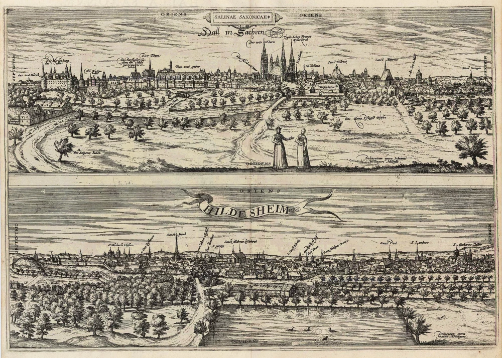
HALLE
COMMENTARY BY BRAUN: "Like Hall in Swabia and Hals in the County of Tyrol, Halle in Saxony takes its name from salt [from the Celtic root hall, meaning "salt"], since much salt is extracted there by evaporation. Halle lies on the Saale, a famous river in Saxony, which has its source in the well-known Fichtelgebirge or Tannengebirge Mountains, from where, along with three other rivers (namely the Eger, Main and Naab, whose waters wondrously flow out to the four corners of the earth), it passes many splendid cities, amongst others the city of Halle, before joining the Elbe."
Halle is presented in a view across the Saale from the west. Particularly prominent on the skyline - hallmarked by the five church towers rising above the marketplace - are the Gothic parish church of Our Lady (Unser Lieben Frauen) and the late Gothic "red tower" (Der rote Thurn), originally the bell tower of the church. Moritzburg castle on the far left of the picture was begun in 1484 and served as the residence of the Magdeburg archbishops. Rising further to the right is Halle Cathedral (Der Thurm), consecrated in the 16th century as the collegiate church of the Magdeburg diocese. In 1531 Albert of Brandenburg commissioned the construction of the New Residence (Das new gebeu) for the university; the building is a masterpiece of the early Renaissance architecture in Germany. On account of its saline springs Halle was settled by Germanic tribes at a very early date. In AD 735 it was conquered by the Frank Charles Martel. Halle became part of the archbishopric of Magdeburg in 968 and was chartered in 1150. A city of economic importance due to its salt industry. Halle became a member of the Hanseatic League in 1281.
HILDESHEIM
COMMENTARY BY BRAUN: "The see of Hildesheim was the first to be instituted in Saxony by the mighty and most Christian Emperor and King Charlemagne after he had conquered the Saxon Duke Widukind, to spread Christianity across the whole of Saxony and to convert the Saxons from their heathenism and pagan worship to the worship of the true God. In Elze, a delightful village at the confluence of the Saale and the Leine, he built a cathedral in honour of Peter the Apostle."
Hildesheim is seen in a very flat view from the southwest, looking across the city moat. The see created by Charlemagne around AD 800 in nearby Elze was transferred to Hildesheim by Louis the Pious in 815. In 852 construction began on the first cathedral, which continued to be enlarged and modified right up to the 1400s (Der Turm, centre right). The early Romanesque structure houses the world-famous bronze works of art installed by Bishop Bernward, namely the Bernward Doors of 1015 and the 380-m-high Pillar of Christ, which illustrates, in a spiralling frieze of bronze reliefs, episodes from the life of Christ, from his Baptism in the River Jordan to his Entry into Jerusalem. On the far left lies the Ottonian church of St Michael, and on the far right St Gotthard's basilica attached to the Benedictine monastery. (Taschen)
Braun G. & Hogenberg F. and the Civitates Orbis Terrarum.
The Civitates Orbis Terrarum, also known as the 'Braun & Hogenberg', is a six-volume town atlas and the most excellent book of town views and plans ever published: 363 engravings, sometimes beautifully coloured. It was one of the best-selling works in the last quarter of the 16th century. Georg Braun, a skilled writer, wrote the text accompanying the plans and views on the verso. Many plates were engraved after the original drawings of a professional artist, Joris Hoefnagel (1542-1600). The first volume was published in Latin in 1572 and the sixth in 1617. Frans Hogenberg, a talented engraver, created the tables for volumes I through IV, and Simon van den Neuwel made those for volumes V and VI. Other contributors were cartographers Daniel Freese and Heinrich Rantzau, who provided valuable geographical information. Works by Jacob van Deventer, Sebastian Münster, and Johannes Stumpf were also used as references. Translations appeared in German and French, making the atlas accessible to a broader audience.
Since its original publication of volume 1 in 1572, the Civitates Orbis Terrarum has left an indelible mark on the history of cartography. Seven more editions followed the first volume in 1575, 1577, 1582, 1588, 1593, 1599, and 1612. Vol.2, initially released in 1575, saw subsequent editions in 1597 and 1612. The subsequent volumes, each a treasure trove of historical insights, graced the world in 1581, 1588, 1593, 1599, and 1606. The German translation of the first volume, a testament to its widespread appeal, debuted in 1574, followed by the French edition in 1575.
Several printers were involved: Theodor Graminaeus, Heinrich von Aich, Gottfried von Kempen, Johannis Sinniger, Bertram Buchholtz, and Peter von Brachel, all of whom worked in Cologne.
Georg Braun (1541-1622)
Georg Braun, the author of the text accompanying the plans and views in the Civitates Orbis Terrarum, was born in Cologne in 1541. After his studies in Cologne, he entered the Jesuit Order as a novice, indicating his commitment to learning and intellectual pursuits. In 1561, he obtained his bachelor's degree; in 1562, he received his Magister Artium, further demonstrating his academic achievements. Although he left the Jesuit Order, he continued his studies in theology, gaining a licentiate in theology. His theological background likely influenced the content and tone of the text in the Civitates Orbis Terrarum, adding a unique perspective to the work.
Frans Hogenberg (1535-1590)
Frans Hogenberg was a Flemish and German painter, engraver, and mapmaker. He was born in Mechelen as the son of Nicolaas Hogenberg.
By the end of the 1560s, Frans Hogenberg was employed upon Abraham Ortelius's Theatrum Orbis Terrarum, published in 1570; he is named an engraver of numerous maps. In 1568, he was banned from Antwerp by the Duke of Alva and travelled to London, where he stayed a few years before emigrating to Cologne. He immediately embarked on his two most important works, the Civitates, published in 1572 and the Geschichtsblätter, which appeared in several series from 1569 until about 1587.
Thanks to large-scale projects like the Geschichtsblätter and the Civitates, Hogenberg's social circumstances improved with each passing year. He died as a wealthy man in Cologne in 1590.
Salinae Saxoniae. Hall in Sachsen [on sheet with:] Hildesheim
Item Number: 24180 Authenticity Guarantee
Category: Antique maps > Europe > Germany - Cities
Halle and Hildesheim, by Georg Braun and Frans Hogenberg.
Title: Salinae Saxoniae. Hall in Sachsen [on sheet with:] Hildesheim
Date of the first edition: 1596.
Date of this map: 1596.
Copper engraving, printed on paper.
Size (not including margins): 365 x 520mm (14.37 x 20.47 inches).
Verso: Latin text.
Condition: Uncoloured.
Condition Rating: A.
From: Urbium Praecipuarum Mundi Theatrum Quintum Auctore Georgio Braunio Agrippinate. Part 5. Köln, 1596/97. (Van der Krogt 4, 41:1.5)
HALLE
COMMENTARY BY BRAUN: "Like Hall in Swabia and Hals in the County of Tyrol, Halle in Saxony takes its name from salt [from the Celtic root hall, meaning "salt"], since much salt is extracted there by evaporation. Halle lies on the Saale, a famous river in Saxony, which has its source in the well-known Fichtelgebirge or Tannengebirge Mountains, from where, along with three other rivers (namely the Eger, Main and Naab, whose waters wondrously flow out to the four corners of the earth), it passes many splendid cities, amongst others the city of Halle, before joining the Elbe."
Halle is presented in a view across the Saale from the west. Particularly prominent on the skyline - hallmarked by the five church towers rising above the marketplace - are the Gothic parish church of Our Lady (Unser Lieben Frauen) and the late Gothic "red tower" (Der rote Thurn), originally the bell tower of the church. Moritzburg castle on the far left of the picture was begun in 1484 and served as the residence of the Magdeburg archbishops. Rising further to the right is Halle Cathedral (Der Thurm), consecrated in the 16th century as the collegiate church of the Magdeburg diocese. In 1531 Albert of Brandenburg commissioned the construction of the New Residence (Das new gebeu) for the university; the building is a masterpiece of the early Renaissance architecture in Germany. On account of its saline springs Halle was settled by Germanic tribes at a very early date. In AD 735 it was conquered by the Frank Charles Martel. Halle became part of the archbishopric of Magdeburg in 968 and was chartered in 1150. A city of economic importance due to its salt industry. Halle became a member of the Hanseatic League in 1281.
HILDESHEIM
COMMENTARY BY BRAUN: "The see of Hildesheim was the first to be instituted in Saxony by the mighty and most Christian Emperor and King Charlemagne after he had conquered the Saxon Duke Widukind, to spread Christianity across the whole of Saxony and to convert the Saxons from their heathenism and pagan worship to the worship of the true God. In Elze, a delightful village at the confluence of the Saale and the Leine, he built a cathedral in honour of Peter the Apostle."
Hildesheim is seen in a very flat view from the southwest, looking across the city moat. The see created by Charlemagne around AD 800 in nearby Elze was transferred to Hildesheim by Louis the Pious in 815. In 852 construction began on the first cathedral, which continued to be enlarged and modified right up to the 1400s (Der Turm, centre right). The early Romanesque structure houses the world-famous bronze works of art installed by Bishop Bernward, namely the Bernward Doors of 1015 and the 380-m-high Pillar of Christ, which illustrates, in a spiralling frieze of bronze reliefs, episodes from the life of Christ, from his Baptism in the River Jordan to his Entry into Jerusalem. On the far left lies the Ottonian church of St Michael, and on the far right St Gotthard's basilica attached to the Benedictine monastery. (Taschen)
Braun G. & Hogenberg F. and the Civitates Orbis Terrarum.
The Civitates Orbis Terrarum, also known as the 'Braun & Hogenberg', is a six-volume town atlas and the most excellent book of town views and plans ever published: 363 engravings, sometimes beautifully coloured. It was one of the best-selling works in the last quarter of the 16th century. Georg Braun, a skilled writer, wrote the text accompanying the plans and views on the verso. Many plates were engraved after the original drawings of a professional artist, Joris Hoefnagel (1542-1600). The first volume was published in Latin in 1572 and the sixth in 1617. Frans Hogenberg, a talented engraver, created the tables for volumes I through IV, and Simon van den Neuwel made those for volumes V and VI. Other contributors were cartographers Daniel Freese and Heinrich Rantzau, who provided valuable geographical information. Works by Jacob van Deventer, Sebastian Münster, and Johannes Stumpf were also used as references. Translations appeared in German and French, making the atlas accessible to a broader audience.
Since its original publication of volume 1 in 1572, the Civitates Orbis Terrarum has left an indelible mark on the history of cartography. Seven more editions followed the first volume in 1575, 1577, 1582, 1588, 1593, 1599, and 1612. Vol.2, initially released in 1575, saw subsequent editions in 1597 and 1612. The subsequent volumes, each a treasure trove of historical insights, graced the world in 1581, 1588, 1593, 1599, and 1606. The German translation of the first volume, a testament to its widespread appeal, debuted in 1574, followed by the French edition in 1575.
Several printers were involved: Theodor Graminaeus, Heinrich von Aich, Gottfried von Kempen, Johannis Sinniger, Bertram Buchholtz, and Peter von Brachel, all of whom worked in Cologne.
Georg Braun (1541-1622)
Georg Braun, the author of the text accompanying the plans and views in the Civitates Orbis Terrarum, was born in Cologne in 1541. After his studies in Cologne, he entered the Jesuit Order as a novice, indicating his commitment to learning and intellectual pursuits. In 1561, he obtained his bachelor's degree; in 1562, he received his Magister Artium, further demonstrating his academic achievements. Although he left the Jesuit Order, he continued his studies in theology, gaining a licentiate in theology. His theological background likely influenced the content and tone of the text in the Civitates Orbis Terrarum, adding a unique perspective to the work.
Frans Hogenberg (1535-1590)
Frans Hogenberg was a Flemish and German painter, engraver, and mapmaker. He was born in Mechelen as the son of Nicolaas Hogenberg.
By the end of the 1560s, Frans Hogenberg was employed upon Abraham Ortelius's Theatrum Orbis Terrarum, published in 1570; he is named an engraver of numerous maps. In 1568, he was banned from Antwerp by the Duke of Alva and travelled to London, where he stayed a few years before emigrating to Cologne. He immediately embarked on his two most important works, the Civitates, published in 1572 and the Geschichtsblätter, which appeared in several series from 1569 until about 1587.
Thanks to large-scale projects like the Geschichtsblätter and the Civitates, Hogenberg's social circumstances improved with each passing year. He died as a wealthy man in Cologne in 1590.
Related items
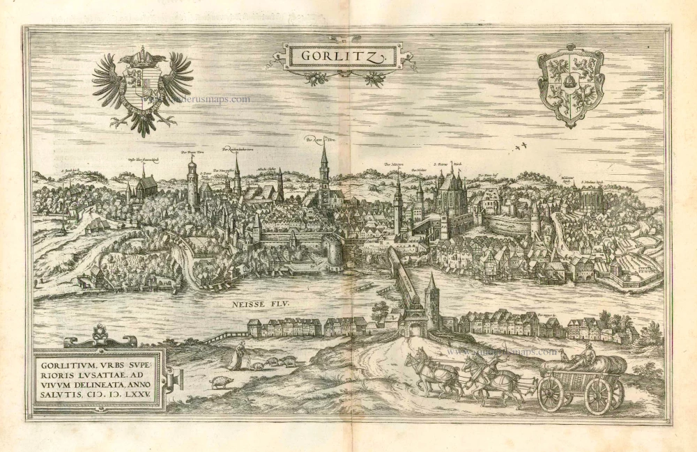
Gorlitz - Gorlitium, Urbs Superioris Lusatiae, ad vivum delineata, Anno Salutis MDLXXV 1576
Gorlitz, by Georg Braun and Frans Hogenberg.
[Item number: 4057]
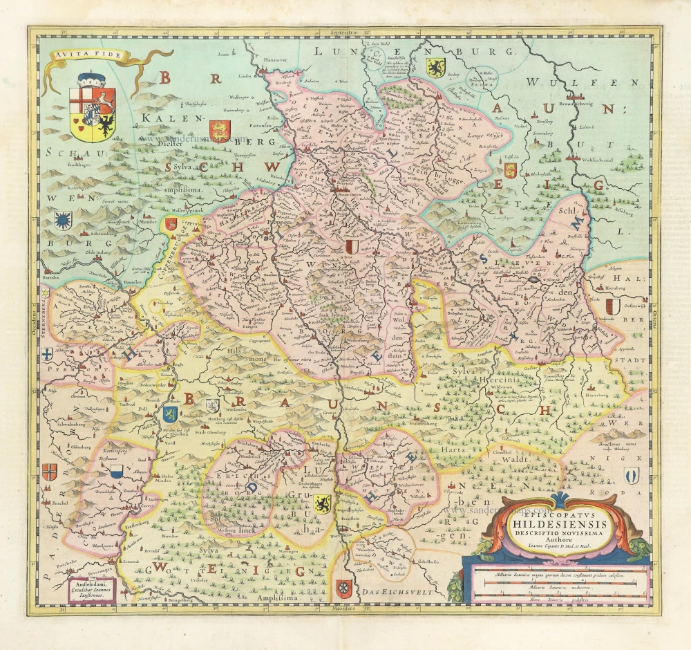
Episcopatus HIldesiensis Decriptio Novissima. 1636
Hildesheim, by Joannes Janssonius.
[Item number: 8594]
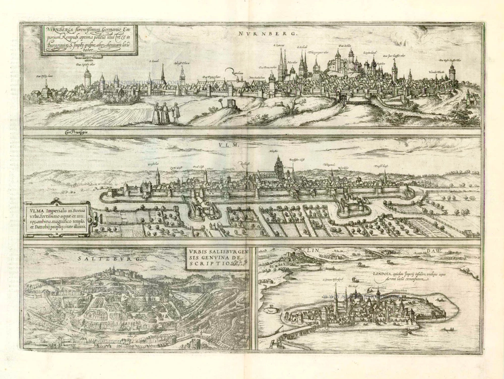
Nurnberga Florentissimum Germaniae Emporium, ... [on sheet with] Ulma Imperialis in Suevia [and] Saltzburg Urbis Salisburgensis Genvina Descriptio [and] Lindaw - Lindoia, Oppidum Imperij insulare, ... 1599
Nürnberg, Ulm, Salzburg, and Lindau, by Georg Braun and Frans Hogenberg.
[Item number: 23926]
Francenbergum, vel ut alij Francoburgum Hassiae Opp. 1599
Frankenberg, by Georg Braun and Frans Hogenberg.
[Item number: 24053]