
Hamburg by Johann Theodor Reinke. 1787
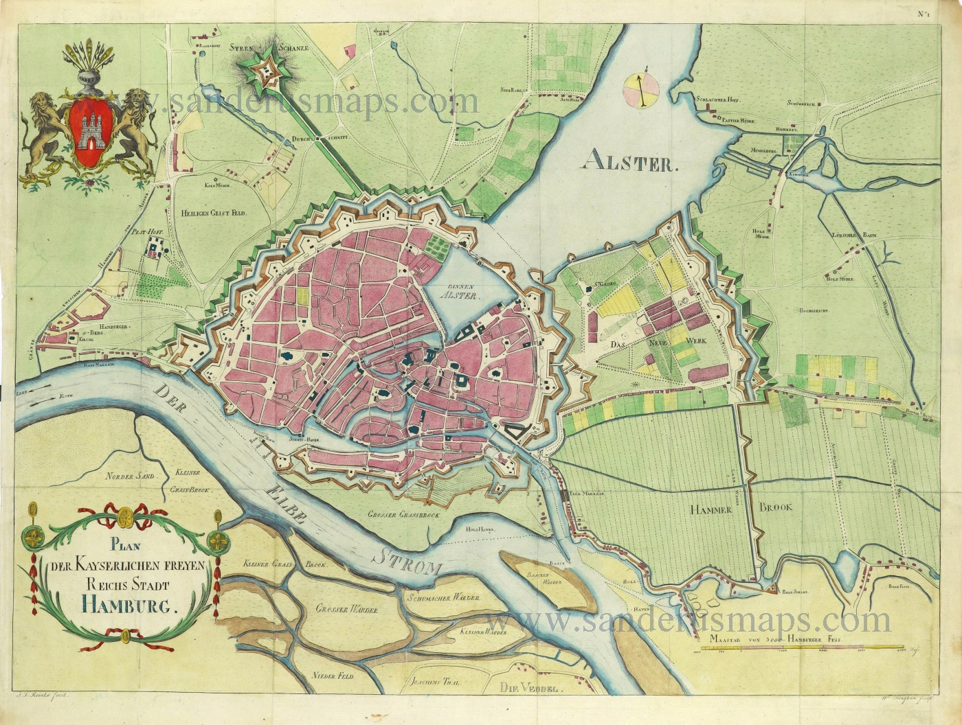
Plan der Kayserlichen Freyen Reichs Stadt Hamburg.
Item Number: 28485 Authenticity Guarantee
Category: Antique maps > Europe > Germany - Cities
Old, antique bird’s-eye view plan of Hamburg, by Johann Theodor Reinke.
Title: Plan der Kayserlichen Freyen Reichs Stadt Hamburg.
J.T. Reinke fecit.
W. Tringham sculp.
Engraver: W. Tringham.
Copper engraving, printed on paper.
Map size: 380 x 525mm (14.96 x 20.67 inches).
Sheet size: 420 x 545mm (16.54 x 21.46 inches).
Verso: Blank.
Condition: Hand coloured, folds as issued, excellent.
Condition Rating: A+.
From: Hamburg topographisch, politisch und historisch. 1787.
Related items
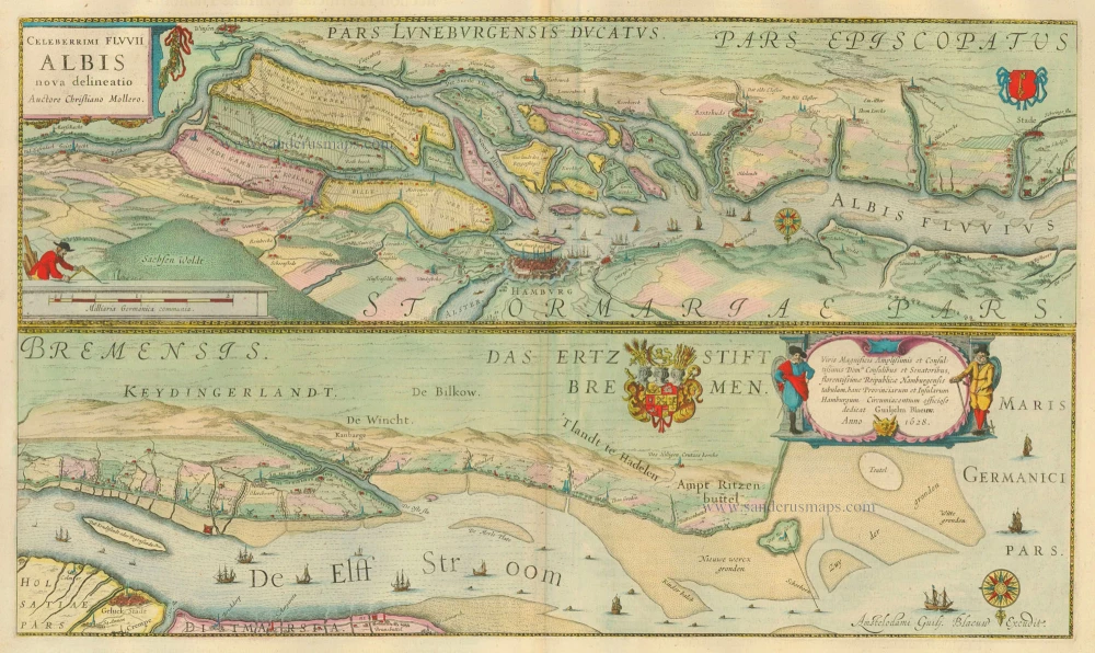
Celeberrimi Fluvii Albis nova delineatio. 1635
The Elbe River - Hamburg, by Blaeu W. & J.
[Item number: 20896]
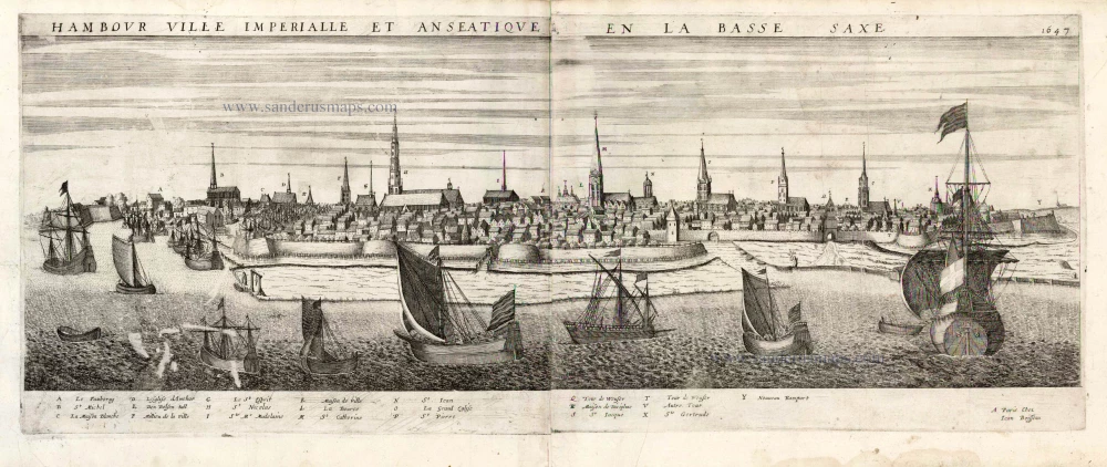
Hambour Ville Imperiale et Anseatique en la Bassa Saxe. 1477 1648
Hamburg by J. Boisseau.
[Item number: 25580]
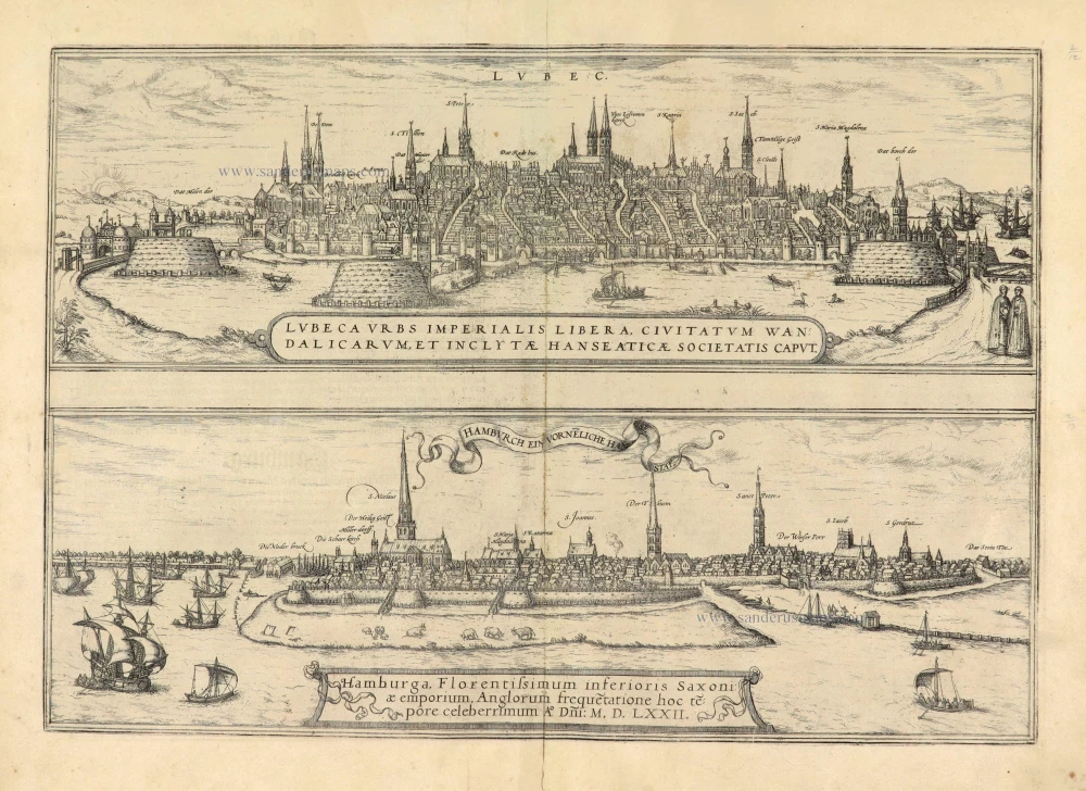
Lubeca Urbs Imperialis Libera, Civitatum Wandalicarum, et Inclytae Hanseaticae Societatis Caput [on sheet with] Hamburga, Florentissimum Inferioris Saxoniae Emporium, Anglorum frequetatione hoc tepore celeberrimum A° Dñi: M.D.LXXII. 1574
Lubeck - Hamburg, by Georg Braun & Frans Hogenberg.
[Item number: 28037]