
Trier, Koblenz, and Rothenburg, by Georg Braun and Frans Hogenberg. 1582
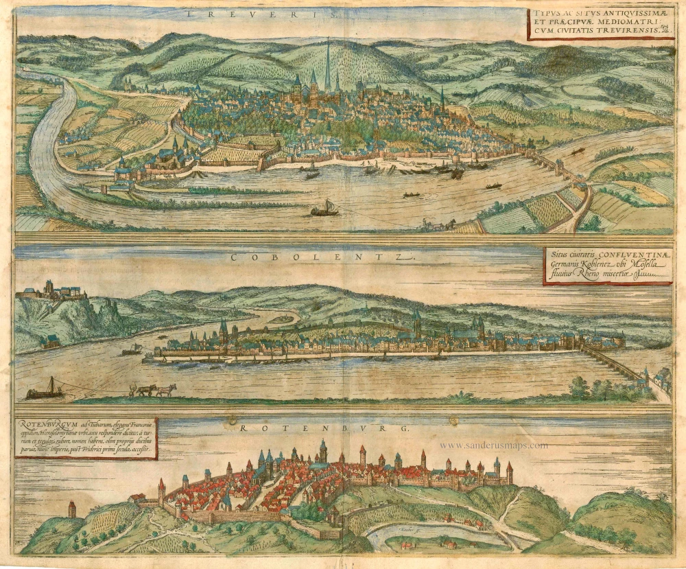


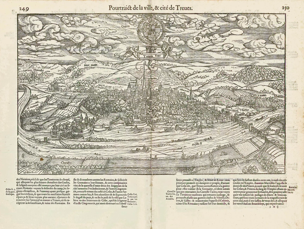
TRIER
TRANSLATION OF CARTOUCHE TEXT: The picture shows the location of the ancient and outstanding city of Trier in the land of the Mediomatricians.
COMMENTARY BY BRAUN: "Trier is a special city on account of its famous deeds and also due to its great age. Ample evidence of how influential, wealthy and skilled the city was in earlier times is still provided by the magnificent ruins of old buildings. There is a wonderful palace here of fired bricks, like the walls of Babylon, built so solidly that it could not be destroyed by any means."
This illustration looks down upon the city from the left bank of the Moselle. Founded as Augusta Treverorum by Augustus in 16 BC, Trier is Germany's oldest city. Amongst its Roman remains, the massive basilica of Constantine from the start of the 4th century (right of the centre) is partucularly striking. Dominating the city centre is the architectural ensemble of three chruches: Trier cathedral, Germany's oldest sacred building, and beside it the early Gothic Liebfrauenkirche, with its distinctive tall crossing tower, followed by St Gangolf's.
KOBLENZ
CARTOUCHE: Site of the town of Confluentia, in German Koblenz, where the Moselle joins the Rhine.
COMMENTARY BY BRAUN: " Koblenz is a city in Gaul, between Mainz and Cologne, and subject to the bishop of Trier. The Moselle flows into the Rhine here, at such a speed that for a whole stretch you can recognize and distinguish between the two rivers from their different colours: the Moselle keeps to the left-hand side and the Rhine to the right."
The view shows Koblenz from the north. On the left, opposite the mouth of the Moselle, sits the 11th-century castle of Ehrenbreitstein, remodelled into a Trier electoral fortress at the start of the 16th century by Archbishop Richard von Greiffenklau zu Vollrads. On the far right the 325-m-long stone bridge over the Moselle was begun in 1342 by Elector Baldwin of Luxembourg and completed 85 years later. Near the spit of land (today called the Deutsches Eck) at the confluence of the two rivers stands the late Romanesque basilica of St Castor, and on the right the late Romanesque Liebfrauenkriche.
ROTHENBURG OB DER TAUBER
CARTOUCHE: Rothenburg ob der Tauber, a fine town in Franconia, is said to correspond to the city of Jerusalem in terms of location and takes its name from the redness of the towers and roof tiles. It was formerly ruled by its own Dukes, but joined the Empire after the time of Frederick I.
View of the small town from the opposite side of the Tauber Valley. Rothenburg "above the Tauber" is still known for its picturesque cityscape, and the numerous towers along the medieval ramparts in the engraving punctuate the skyline even today. Visible on the left with its two towers is the parish church of St James, which in 1544 became Protestant and which houses Tilman Riemenschneider's famous Altarpiece of the Holy Blood from the early 16th century. (Taschen)
Braun G. & Hogenberg F. and the Civitates Orbis Terrarum.
The Civitates Orbis Terrarum, also known as the 'Braun & Hogenberg', is a six-volume town atlas and the most excellent book of town views and plans ever published: 363 engravings, sometimes beautifully coloured. It was one of the best-selling works in the last quarter of the 16th century. Georg Braun, a skilled writer, wrote the text accompanying the plans and views on the verso. Many plates were engraved after the original drawings of a professional artist, Joris Hoefnagel (1542-1600). The first volume was published in Latin in 1572 and the sixth in 1617. Frans Hogenberg, a talented engraver, created the tables for volumes I through IV, and Simon van den Neuwel made those for volumes V and VI. Other contributors were cartographers Daniel Freese and Heinrich Rantzau, who provided valuable geographical information. Works by Jacob van Deventer, Sebastian Münster, and Johannes Stumpf were also used as references. Translations appeared in German and French, making the atlas accessible to a broader audience.
Since its original publication of volume 1 in 1572, the Civitates Orbis Terrarum has left an indelible mark on the history of cartography. Seven more editions followed the first volume in 1575, 1577, 1582, 1588, 1593, 1599, and 1612. Vol.2, initially released in 1575, saw subsequent editions in 1597 and 1612. The subsequent volumes, each a treasure trove of historical insights, graced the world in 1581, 1588, 1593, 1599, and 1606. The German translation of the first volume, a testament to its widespread appeal, debuted in 1574, followed by the French edition in 1575.
Several printers were involved: Theodor Graminaeus, Heinrich von Aich, Gottfried von Kempen, Johannis Sinniger, Bertram Buchholtz, and Peter von Brachel, all of whom worked in Cologne.
Georg Braun (1541-1622)
Georg Braun, the author of the text accompanying the plans and views in the Civitates Orbis Terrarum, was born in Cologne in 1541. After his studies in Cologne, he entered the Jesuit Order as a novice, indicating his commitment to learning and intellectual pursuits. In 1561, he obtained his bachelor's degree; in 1562, he received his Magister Artium, further demonstrating his academic achievements. Although he left the Jesuit Order, he continued his studies in theology, gaining a licentiate in theology. His theological background likely influenced the content and tone of the text in the Civitates Orbis Terrarum, adding a unique perspective to the work.
Frans Hogenberg (1535-1590)
Frans Hogenberg was a Flemish and German painter, engraver, and mapmaker. He was born in Mechelen as the son of Nicolaas Hogenberg.
By the end of the 1560s, Frans Hogenberg was employed upon Abraham Ortelius's Theatrum Orbis Terrarum, published in 1570; he is named an engraver of numerous maps. In 1568, he was banned from Antwerp by the Duke of Alva and travelled to London, where he stayed a few years before emigrating to Cologne. He immediately embarked on his two most important works, the Civitates, published in 1572 and the Geschichtsblätter, which appeared in several series from 1569 until about 1587.
Thanks to large-scale projects like the Geschichtsblätter and the Civitates, Hogenberg's social circumstances improved with each passing year. He died as a wealthy man in Cologne in 1590.
Treveris - Typus ac Situs antiquissimae ... [on sheet with] Cobolentz - Situs civitatis confluentinae, ... [and] Rotenburgum ad Tubarum, ...
Item Number: 8452 Authenticity Guarantee
Category: Antique maps > Europe > Germany - Cities
Three views by Braun and Hogenberg on one sheet: Trier, Koblenz and Rothenburg.
Date of the first edition: 1572
Date of this map: 1582
Copper engraving
Size: 38.5 x 46.5cm (15 x 18.1 inches)
Verso text: German
Condition: Contemporary old coloured, age-toned
Condition Rating: B
References: Van der Krogt 4, State 2; Taschen, Braun and Hogenberg, p.99.
From: Beschreibung und Contrafactur der vornembster Stät der Welt. [Part 1] Cologne, Gottfried von Kempen, 1582. (Van der Krogt 4, 41:2.1)
TRIER
TRANSLATION OF CARTOUCHE TEXT: The picture shows the location of the ancient and outstanding city of Trier in the land of the Mediomatricians.
COMMENTARY BY BRAUN: "Trier is a special city on account of its famous deeds and also due to its great age. Ample evidence of how influential, wealthy and skilled the city was in earlier times is still provided by the magnificent ruins of old buildings. There is a wonderful palace here of fired bricks, like the walls of Babylon, built so solidly that it could not be destroyed by any means."
This illustration looks down upon the city from the left bank of the Moselle. Founded as Augusta Treverorum by Augustus in 16 BC, Trier is Germany's oldest city. Amongst its Roman remains, the massive basilica of Constantine from the start of the 4th century (right of the centre) is partucularly striking. Dominating the city centre is the architectural ensemble of three chruches: Trier cathedral, Germany's oldest sacred building, and beside it the early Gothic Liebfrauenkirche, with its distinctive tall crossing tower, followed by St Gangolf's.
KOBLENZ
CARTOUCHE: Site of the town of Confluentia, in German Koblenz, where the Moselle joins the Rhine.
COMMENTARY BY BRAUN: " Koblenz is a city in Gaul, between Mainz and Cologne, and subject to the bishop of Trier. The Moselle flows into the Rhine here, at such a speed that for a whole stretch you can recognize and distinguish between the two rivers from their different colours: the Moselle keeps to the left-hand side and the Rhine to the right."
The view shows Koblenz from the north. On the left, opposite the mouth of the Moselle, sits the 11th-century castle of Ehrenbreitstein, remodelled into a Trier electoral fortress at the start of the 16th century by Archbishop Richard von Greiffenklau zu Vollrads. On the far right the 325-m-long stone bridge over the Moselle was begun in 1342 by Elector Baldwin of Luxembourg and completed 85 years later. Near the spit of land (today called the Deutsches Eck) at the confluence of the two rivers stands the late Romanesque basilica of St Castor, and on the right the late Romanesque Liebfrauenkriche.
ROTHENBURG OB DER TAUBER
CARTOUCHE: Rothenburg ob der Tauber, a fine town in Franconia, is said to correspond to the city of Jerusalem in terms of location and takes its name from the redness of the towers and roof tiles. It was formerly ruled by its own Dukes, but joined the Empire after the time of Frederick I.
View of the small town from the opposite side of the Tauber Valley. Rothenburg "above the Tauber" is still known for its picturesque cityscape, and the numerous towers along the medieval ramparts in the engraving punctuate the skyline even today. Visible on the left with its two towers is the parish church of St James, which in 1544 became Protestant and which houses Tilman Riemenschneider's famous Altarpiece of the Holy Blood from the early 16th century. (Taschen)
Braun G. & Hogenberg F. and the Civitates Orbis Terrarum.
The Civitates Orbis Terrarum, also known as the 'Braun & Hogenberg', is a six-volume town atlas and the most excellent book of town views and plans ever published: 363 engravings, sometimes beautifully coloured. It was one of the best-selling works in the last quarter of the 16th century. Georg Braun, a skilled writer, wrote the text accompanying the plans and views on the verso. Many plates were engraved after the original drawings of a professional artist, Joris Hoefnagel (1542-1600). The first volume was published in Latin in 1572 and the sixth in 1617. Frans Hogenberg, a talented engraver, created the tables for volumes I through IV, and Simon van den Neuwel made those for volumes V and VI. Other contributors were cartographers Daniel Freese and Heinrich Rantzau, who provided valuable geographical information. Works by Jacob van Deventer, Sebastian Münster, and Johannes Stumpf were also used as references. Translations appeared in German and French, making the atlas accessible to a broader audience.
Since its original publication of volume 1 in 1572, the Civitates Orbis Terrarum has left an indelible mark on the history of cartography. Seven more editions followed the first volume in 1575, 1577, 1582, 1588, 1593, 1599, and 1612. Vol.2, initially released in 1575, saw subsequent editions in 1597 and 1612. The subsequent volumes, each a treasure trove of historical insights, graced the world in 1581, 1588, 1593, 1599, and 1606. The German translation of the first volume, a testament to its widespread appeal, debuted in 1574, followed by the French edition in 1575.
Several printers were involved: Theodor Graminaeus, Heinrich von Aich, Gottfried von Kempen, Johannis Sinniger, Bertram Buchholtz, and Peter von Brachel, all of whom worked in Cologne.
Georg Braun (1541-1622)
Georg Braun, the author of the text accompanying the plans and views in the Civitates Orbis Terrarum, was born in Cologne in 1541. After his studies in Cologne, he entered the Jesuit Order as a novice, indicating his commitment to learning and intellectual pursuits. In 1561, he obtained his bachelor's degree; in 1562, he received his Magister Artium, further demonstrating his academic achievements. Although he left the Jesuit Order, he continued his studies in theology, gaining a licentiate in theology. His theological background likely influenced the content and tone of the text in the Civitates Orbis Terrarum, adding a unique perspective to the work.
Frans Hogenberg (1535-1590)
Frans Hogenberg was a Flemish and German painter, engraver, and mapmaker. He was born in Mechelen as the son of Nicolaas Hogenberg.
By the end of the 1560s, Frans Hogenberg was employed upon Abraham Ortelius's Theatrum Orbis Terrarum, published in 1570; he is named an engraver of numerous maps. In 1568, he was banned from Antwerp by the Duke of Alva and travelled to London, where he stayed a few years before emigrating to Cologne. He immediately embarked on his two most important works, the Civitates, published in 1572 and the Geschichtsblätter, which appeared in several series from 1569 until about 1587.
Thanks to large-scale projects like the Geschichtsblätter and the Civitates, Hogenberg's social circumstances improved with each passing year. He died as a wealthy man in Cologne in 1590.
Related items
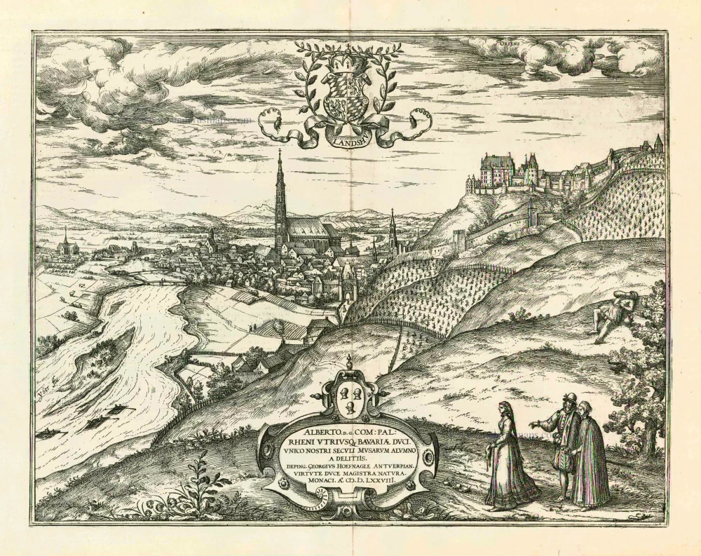
Landshut 1599
Landshut, by Georg Braun and Frans Hogenberg.
[Item number: 24060]
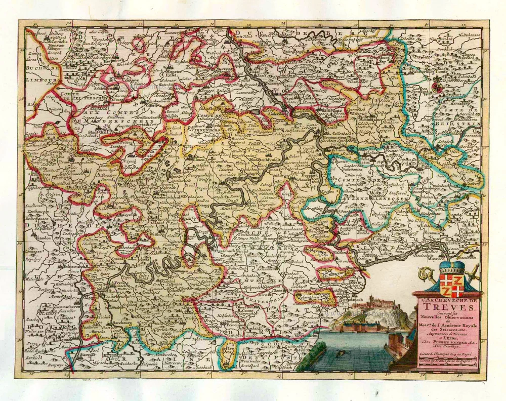
L'Archeveché de Treves. 1713
Trier, by Pieter van der Aa.
[Item number: 26194]
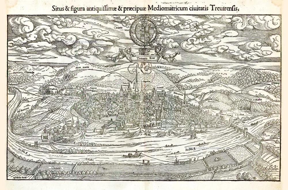
Situs & figura antiquissimae & praecipuae Mediomatricum civitatis Trevirensis. 1552
Trier, by S. Münster.
[Item number: 26271]
Treveris Trier [Au-dessus de la carte:] Pourtraict de la ville, & cité de Treves. 1575
Trier, by François de Belleforest.
[Item number: 27213]