
Landshut, by Georg Braun and Frans Hogenberg. 1599

TRANSLATION OF CARTOUCHE TEXT: To Albert, Count Palatine of the Rhine by the grace of God and Duke of both Bavarias, the unrivalled patron of the Muses in our time, for his delight. Painted by Georg Hoefnagel, Antwerp. Let artistry be the guide and the mistress of Nature. Munich, 1578.
COMMENTARY BY BRAUN: "The surrounding farmland yields many fruits and thoroughly delicious wine, intended to refresh God and man and good grain, but also has many pastures for grazing cattle. There is virtually no other land that is richer in dairy products. Therefore, this region can rightly be counted among the most beautiful and fertile in all of Europe."
The town of Landshut and Trausnitz castle lying above it on the right is seen here from the southwest, looking across the banks of the Isar. Trausnitz castle was visited in 1235 by Emperor Frederick II and the Minnesingers Walther von der Vogelweide and Tannhäuser. In the 15th century, it was expanded under George the Rich and fortified with ring walls and defensive towers. Soaring above the town itself is the brick Gothic collegiate church of SS Martin and Castulus, with the world's tallest brick tower (130 m high). (Taschen)
Braun G. & Hogenberg F. and the Civitates Orbis Terrarum.
The Civitates Orbis Terrarum, also known as the 'Braun & Hogenberg', is a six-volume town atlas and the most excellent book of town views and plans ever published: 363 engravings, sometimes beautifully coloured. It was one of the best-selling works in the last quarter of the 16th century. Georg Braun, a skilled writer, wrote the text accompanying the plans and views on the verso. Many plates were engraved after the original drawings of a professional artist, Joris Hoefnagel (1542-1600). The first volume was published in Latin in 1572 and the sixth in 1617. Frans Hogenberg, a talented engraver, created the tables for volumes I through IV, and Simon van den Neuwel made those for volumes V and VI. Other contributors were cartographers Daniel Freese and Heinrich Rantzau, who provided valuable geographical information. Works by Jacob van Deventer, Sebastian Münster, and Johannes Stumpf were also used as references. Translations appeared in German and French, making the atlas accessible to a broader audience.
Since its original publication of volume 1 in 1572, the Civitates Orbis Terrarum has left an indelible mark on the history of cartography. Seven more editions followed the first volume in 1575, 1577, 1582, 1588, 1593, 1599, and 1612. Vol.2, initially released in 1575, saw subsequent editions in 1597 and 1612. The subsequent volumes, each a treasure trove of historical insights, graced the world in 1581, 1588, 1593, 1599, and 1606. The German translation of the first volume, a testament to its widespread appeal, debuted in 1574, followed by the French edition in 1575.
Several printers were involved: Theodor Graminaeus, Heinrich von Aich, Gottfried von Kempen, Johannis Sinniger, Bertram Buchholtz, and Peter von Brachel, all of whom worked in Cologne.
Georg Braun (1541-1622)
Georg Braun, the author of the text accompanying the plans and views in the Civitates Orbis Terrarum, was born in Cologne in 1541. After his studies in Cologne, he entered the Jesuit Order as a novice, indicating his commitment to learning and intellectual pursuits. In 1561, he obtained his bachelor's degree; in 1562, he received his Magister Artium, further demonstrating his academic achievements. Although he left the Jesuit Order, he continued his studies in theology, gaining a licentiate in theology. His theological background likely influenced the content and tone of the text in the Civitates Orbis Terrarum, adding a unique perspective to the work.
Frans Hogenberg (1535-1590)
Frans Hogenberg was a Flemish and German painter, engraver, and mapmaker. He was born in Mechelen as the son of Nicolaas Hogenberg.
By the end of the 1560s, Frans Hogenberg was employed upon Abraham Ortelius's Theatrum Orbis Terrarum, published in 1570; he is named an engraver of numerous maps. In 1568, he was banned from Antwerp by the Duke of Alva and travelled to London, where he stayed a few years before emigrating to Cologne. He immediately embarked on his two most important works, the Civitates, published in 1572 and the Geschichtsblätter, which appeared in several series from 1569 until about 1587.
Thanks to large-scale projects like the Geschichtsblätter and the Civitates, Hogenberg's social circumstances improved with each passing year. He died as a wealthy man in Cologne in 1590.
Landshut
Item Number: 24060 Authenticity Guarantee
Category: Antique maps > Europe > Germany - Cities
Old, antique bird’s-eye view of Landshut, by Georg Braun and Frans Hogenberg.
Title: Landshut.
Date of the first edition: 1581.
Date of this map: 1599.
Copper engraving, printed on paper.
Size (not including margins): 330 x 420mm (12.99 x 16.54 inches).
Verso: Latin text.
Condition: Uncoloured, excellent.
Condition Rating: A.
From: Civitates Orbis Terrarum. Liber tertius. Köln, Bertram Buchholtz, 1599. (Koeman, B&H3)
TRANSLATION OF CARTOUCHE TEXT: To Albert, Count Palatine of the Rhine by the grace of God and Duke of both Bavarias, the unrivalled patron of the Muses in our time, for his delight. Painted by Georg Hoefnagel, Antwerp. Let artistry be the guide and the mistress of Nature. Munich, 1578.
COMMENTARY BY BRAUN: "The surrounding farmland yields many fruits and thoroughly delicious wine, intended to refresh God and man and good grain, but also has many pastures for grazing cattle. There is virtually no other land that is richer in dairy products. Therefore, this region can rightly be counted among the most beautiful and fertile in all of Europe."
The town of Landshut and Trausnitz castle lying above it on the right is seen here from the southwest, looking across the banks of the Isar. Trausnitz castle was visited in 1235 by Emperor Frederick II and the Minnesingers Walther von der Vogelweide and Tannhäuser. In the 15th century, it was expanded under George the Rich and fortified with ring walls and defensive towers. Soaring above the town itself is the brick Gothic collegiate church of SS Martin and Castulus, with the world's tallest brick tower (130 m high). (Taschen)
Braun G. & Hogenberg F. and the Civitates Orbis Terrarum.
The Civitates Orbis Terrarum, also known as the 'Braun & Hogenberg', is a six-volume town atlas and the most excellent book of town views and plans ever published: 363 engravings, sometimes beautifully coloured. It was one of the best-selling works in the last quarter of the 16th century. Georg Braun, a skilled writer, wrote the text accompanying the plans and views on the verso. Many plates were engraved after the original drawings of a professional artist, Joris Hoefnagel (1542-1600). The first volume was published in Latin in 1572 and the sixth in 1617. Frans Hogenberg, a talented engraver, created the tables for volumes I through IV, and Simon van den Neuwel made those for volumes V and VI. Other contributors were cartographers Daniel Freese and Heinrich Rantzau, who provided valuable geographical information. Works by Jacob van Deventer, Sebastian Münster, and Johannes Stumpf were also used as references. Translations appeared in German and French, making the atlas accessible to a broader audience.
Since its original publication of volume 1 in 1572, the Civitates Orbis Terrarum has left an indelible mark on the history of cartography. Seven more editions followed the first volume in 1575, 1577, 1582, 1588, 1593, 1599, and 1612. Vol.2, initially released in 1575, saw subsequent editions in 1597 and 1612. The subsequent volumes, each a treasure trove of historical insights, graced the world in 1581, 1588, 1593, 1599, and 1606. The German translation of the first volume, a testament to its widespread appeal, debuted in 1574, followed by the French edition in 1575.
Several printers were involved: Theodor Graminaeus, Heinrich von Aich, Gottfried von Kempen, Johannis Sinniger, Bertram Buchholtz, and Peter von Brachel, all of whom worked in Cologne.
Georg Braun (1541-1622)
Georg Braun, the author of the text accompanying the plans and views in the Civitates Orbis Terrarum, was born in Cologne in 1541. After his studies in Cologne, he entered the Jesuit Order as a novice, indicating his commitment to learning and intellectual pursuits. In 1561, he obtained his bachelor's degree; in 1562, he received his Magister Artium, further demonstrating his academic achievements. Although he left the Jesuit Order, he continued his studies in theology, gaining a licentiate in theology. His theological background likely influenced the content and tone of the text in the Civitates Orbis Terrarum, adding a unique perspective to the work.
Frans Hogenberg (1535-1590)
Frans Hogenberg was a Flemish and German painter, engraver, and mapmaker. He was born in Mechelen as the son of Nicolaas Hogenberg.
By the end of the 1560s, Frans Hogenberg was employed upon Abraham Ortelius's Theatrum Orbis Terrarum, published in 1570; he is named an engraver of numerous maps. In 1568, he was banned from Antwerp by the Duke of Alva and travelled to London, where he stayed a few years before emigrating to Cologne. He immediately embarked on his two most important works, the Civitates, published in 1572 and the Geschichtsblätter, which appeared in several series from 1569 until about 1587.
Thanks to large-scale projects like the Geschichtsblätter and the Civitates, Hogenberg's social circumstances improved with each passing year. He died as a wealthy man in Cologne in 1590.
Related items

Gorlitz - Gorlitium, Urbs Superioris Lusatiae, ad vivum delineata, Anno Salutis MDLXXV 1576
Gorlitz, by Georg Braun and Frans Hogenberg.
[Item number: 4057]

Urbs Holsatiae Plona. c. 1610
Plön, by Georg Braun and Frans Hogenberg.
[Item number: 16701]

Campidonia vulgo Kemptten, Peruetus Sacri Romani Imperij Oppid. 1575-1612
Kempten in Allgäu, by Braun & Hogenberg.
[Item number: 18014]

Francenbergum, vel ut alij Francoburgum Hassiae Opp. 1581-88
Frankenberg, by Braun & Hogenberg.
[Item number: 22219]

Lippe [on sheet with] Dortmund 1617
Dortmund and Lippstadt, by Georg Braun and Frans Hogenberg.
[Item number: 22265]

Moguntia, Germaniae Metropolis, ... [on sheet with] Herbipolis, comuniter Wirtzburg, ... [and] Sedunum, primaria & Metropolitica ... 1635
Mainz, Würzburg and Sitten, by Georg Braun and Frans Hogenberg.
[Item number: 22335]
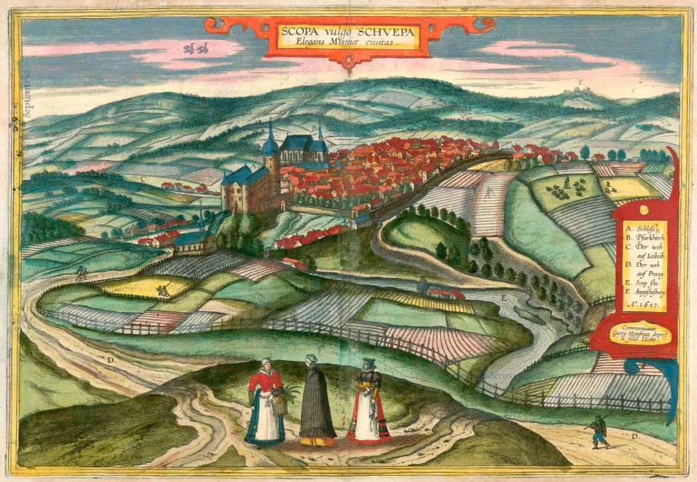
Scopa vulgo Schuepa Elegans Misniae Civitas 1618
Zschopau, by Braun & Hogenberg
[Item number: 23419]
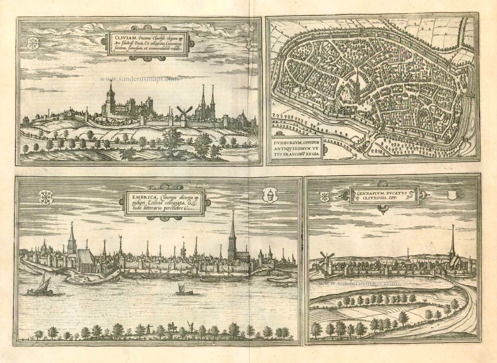
Cliviam, Ducatus Clivensis elegans opp: ... [on sheet with] Duisburgum, Oppidum Antiquissimum Vetus Francoru Regia [on sheet with] Embrica, Clivensis ditionis oppidum Ecclesia collegiata... [on sheet with] Gennapium, Ducatus Clivensis, Opp: 1597
Kleve, Duisburg, Emmerich, and Gennep, by Georg Braun and Frans Hogenberg.
[Item number: 23988]
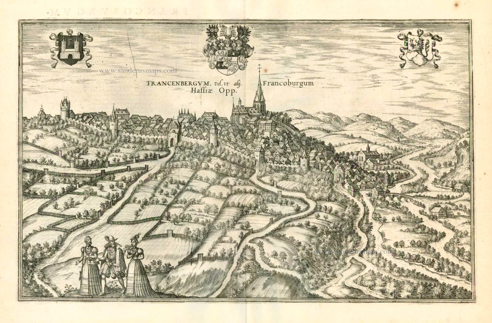
Francenbergum, vel ut alij Francoburgum Hassiae Opp. 1599
Frankenberg, by Georg Braun and Frans Hogenberg.
[Item number: 24053]

Lippe [on sheet with] Dortmund. 1599
Dortmund and Lippstadt, by Georg Braun and Frans Hogenberg.
[Item number: 24094]

Crempa Holsatiae Opp. ... [on sheet with] Reinholdsburga - Rendesburga .. 1588-97
Krempe and Rendsburg, by Georg Braun and Frans Hogenberg.
[Item number: 24109]