
Caiazzo, by Braun & Hogenberg. 1596

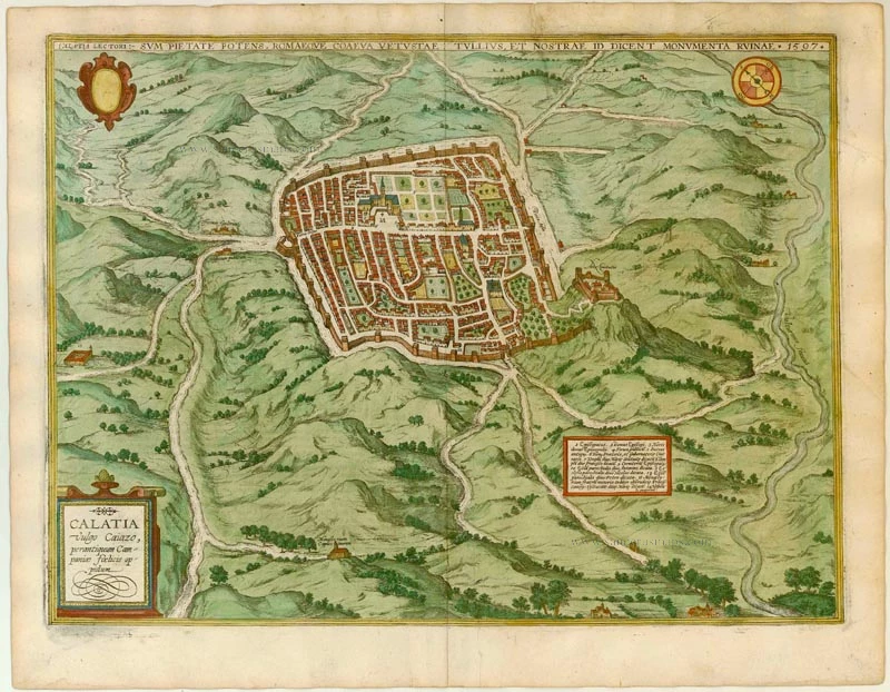
TRANSLATION OF CAPTION TOP: Caiazzo speaks to the reader: I am mighty through piety and the equal of Rome in age; Tullius (Cicero) and our ruins bear witness to this. 1597.
CARTOUCHE LEFT: Calatia, in Italian Caiazzo, very ancient town in fertile Campania.
COMMENTARY BY BRAUN: "Caiazzo is an old town in the fertile countryside of Campania beside the River Volturno. It formerly had a Roman civic right, as can be read in the inscription on an ancient stone in the marketplace. A large part of the Old Town wall still survives and makes no meaningful contribution to the beauty of the town. There are further antiquities and old inscriptions in the town, which cannot all be described on this page [...]. The church of Caiazzo maintains the old tradition of icons, little known in Germany and France.
The well-fortified town of Caiazzo (also called the Città dell'Olio, "City of Oil") lies northeast of Capua near the Vilturno and is seen in a bird's-eye view from the southwest. Caiazzo became a bishopric as early as AD 966, and the episcopal complex with its house, gardens and church occupies a large part of the town centre. The fortifications were built in the 13th century. The fortress (Arx Civitatis) is strategically situated on a hill overlooking the town and was built on top of an earlier Lombard castle that stood on the ruins of a Roman fort. Lying within the hilly, picturesque countryside around Caiazzo are a Franciscan monastery towards the west, a Capuchin monastery (bottom left) and - near the Porta Vetus - a hospital (Hospicium publicum) and a potters' workshop (officina figulorum) (Taschen).
Braun G. & Hogenberg F. and the Civitates Orbis Terrarum.
The Civitates Orbis Terrarum, also known as the 'Braun & Hogenberg', is a six-volume town atlas and the most excellent book of town views and plans ever published: 363 engravings, sometimes beautifully coloured. It was one of the best-selling works in the last quarter of the 16th century. Georg Braun, a skilled writer, wrote the text accompanying the plans and views on the verso. Many plates were engraved after the original drawings of a professional artist, Joris Hoefnagel (1542-1600). The first volume was published in Latin in 1572 and the sixth in 1617. Frans Hogenberg, a talented engraver, created the tables for volumes I through IV, and Simon van den Neuwel made those for volumes V and VI. Other contributors were cartographers Daniel Freese and Heinrich Rantzau, who provided valuable geographical information. Works by Jacob van Deventer, Sebastian Münster, and Johannes Stumpf were also used as references. Translations appeared in German and French, making the atlas accessible to a broader audience.
Since its original publication of volume 1 in 1572, the Civitates Orbis Terrarum has left an indelible mark on the history of cartography. Seven more editions followed the first volume in 1575, 1577, 1582, 1588, 1593, 1599, and 1612. Vol.2, initially released in 1575, saw subsequent editions in 1597 and 1612. The subsequent volumes, each a treasure trove of historical insights, graced the world in 1581, 1588, 1593, 1599, and 1606. The German translation of the first volume, a testament to its widespread appeal, debuted in 1574, followed by the French edition in 1575.
Several printers were involved: Theodor Graminaeus, Heinrich von Aich, Gottfried von Kempen, Johannis Sinniger, Bertram Buchholtz, and Peter von Brachel, all of whom worked in Cologne.
Georg Braun (1541-1622)
Georg Braun, the author of the text accompanying the plans and views in the Civitates Orbis Terrarum, was born in Cologne in 1541. After his studies in Cologne, he entered the Jesuit Order as a novice, indicating his commitment to learning and intellectual pursuits. In 1561, he obtained his bachelor's degree; in 1562, he received his Magister Artium, further demonstrating his academic achievements. Although he left the Jesuit Order, he continued his studies in theology, gaining a licentiate in theology. His theological background likely influenced the content and tone of the text in the Civitates Orbis Terrarum, adding a unique perspective to the work.
Frans Hogenberg (1535-1590)
Frans Hogenberg was a Flemish and German painter, engraver, and mapmaker. He was born in Mechelen as the son of Nicolaas Hogenberg.
By the end of the 1560s, Frans Hogenberg was employed upon Abraham Ortelius's Theatrum Orbis Terrarum, published in 1570; he is named an engraver of numerous maps. In 1568, he was banned from Antwerp by the Duke of Alva and travelled to London, where he stayed a few years before emigrating to Cologne. He immediately embarked on his two most important works, the Civitates, published in 1572 and the Geschichtsblätter, which appeared in several series from 1569 until about 1587.
Thanks to large-scale projects like the Geschichtsblätter and the Civitates, Hogenberg's social circumstances improved with each passing year. He died as a wealthy man in Cologne in 1590.
Calatia vulgo Caiazo, perantiquum Campaniae foelicis oppidum.
Item Number: 22118 Authenticity Guarantee
Category: Antique maps > Europe > Italy - Cities
Antique map of Caiazzo by Braun & Hogenberg.
Title: Calatia vulgo Caiazo, perantiquum Campaniae foelicis oppidum.
Date of the first edition: 1596.
Date of this map: 1596.
Copper engraving, printed on paper.
Size (not including margins): 370 x 500mm (14.57 x 19.69 inches).
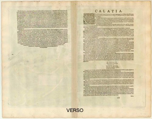
Verso: Latin text.
Condition: Original coloured, excellent.
Condition Rating: A.
From: Urbium Praecipuarum Mundi Theatrum Quintum Auctore Georgio Braunio Agrippinate. Part 5. Köln, 1596/97. (Van der Krogt 4, 41:1.5)
TRANSLATION OF CAPTION TOP: Caiazzo speaks to the reader: I am mighty through piety and the equal of Rome in age; Tullius (Cicero) and our ruins bear witness to this. 1597.
CARTOUCHE LEFT: Calatia, in Italian Caiazzo, very ancient town in fertile Campania.
COMMENTARY BY BRAUN: "Caiazzo is an old town in the fertile countryside of Campania beside the River Volturno. It formerly had a Roman civic right, as can be read in the inscription on an ancient stone in the marketplace. A large part of the Old Town wall still survives and makes no meaningful contribution to the beauty of the town. There are further antiquities and old inscriptions in the town, which cannot all be described on this page [...]. The church of Caiazzo maintains the old tradition of icons, little known in Germany and France.
The well-fortified town of Caiazzo (also called the Città dell'Olio, "City of Oil") lies northeast of Capua near the Vilturno and is seen in a bird's-eye view from the southwest. Caiazzo became a bishopric as early as AD 966, and the episcopal complex with its house, gardens and church occupies a large part of the town centre. The fortifications were built in the 13th century. The fortress (Arx Civitatis) is strategically situated on a hill overlooking the town and was built on top of an earlier Lombard castle that stood on the ruins of a Roman fort. Lying within the hilly, picturesque countryside around Caiazzo are a Franciscan monastery towards the west, a Capuchin monastery (bottom left) and - near the Porta Vetus - a hospital (Hospicium publicum) and a potters' workshop (officina figulorum) (Taschen).
Braun G. & Hogenberg F. and the Civitates Orbis Terrarum.
The Civitates Orbis Terrarum, also known as the 'Braun & Hogenberg', is a six-volume town atlas and the most excellent book of town views and plans ever published: 363 engravings, sometimes beautifully coloured. It was one of the best-selling works in the last quarter of the 16th century. Georg Braun, a skilled writer, wrote the text accompanying the plans and views on the verso. Many plates were engraved after the original drawings of a professional artist, Joris Hoefnagel (1542-1600). The first volume was published in Latin in 1572 and the sixth in 1617. Frans Hogenberg, a talented engraver, created the tables for volumes I through IV, and Simon van den Neuwel made those for volumes V and VI. Other contributors were cartographers Daniel Freese and Heinrich Rantzau, who provided valuable geographical information. Works by Jacob van Deventer, Sebastian Münster, and Johannes Stumpf were also used as references. Translations appeared in German and French, making the atlas accessible to a broader audience.
Since its original publication of volume 1 in 1572, the Civitates Orbis Terrarum has left an indelible mark on the history of cartography. Seven more editions followed the first volume in 1575, 1577, 1582, 1588, 1593, 1599, and 1612. Vol.2, initially released in 1575, saw subsequent editions in 1597 and 1612. The subsequent volumes, each a treasure trove of historical insights, graced the world in 1581, 1588, 1593, 1599, and 1606. The German translation of the first volume, a testament to its widespread appeal, debuted in 1574, followed by the French edition in 1575.
Several printers were involved: Theodor Graminaeus, Heinrich von Aich, Gottfried von Kempen, Johannis Sinniger, Bertram Buchholtz, and Peter von Brachel, all of whom worked in Cologne.
Georg Braun (1541-1622)
Georg Braun, the author of the text accompanying the plans and views in the Civitates Orbis Terrarum, was born in Cologne in 1541. After his studies in Cologne, he entered the Jesuit Order as a novice, indicating his commitment to learning and intellectual pursuits. In 1561, he obtained his bachelor's degree; in 1562, he received his Magister Artium, further demonstrating his academic achievements. Although he left the Jesuit Order, he continued his studies in theology, gaining a licentiate in theology. His theological background likely influenced the content and tone of the text in the Civitates Orbis Terrarum, adding a unique perspective to the work.
Frans Hogenberg (1535-1590)
Frans Hogenberg was a Flemish and German painter, engraver, and mapmaker. He was born in Mechelen as the son of Nicolaas Hogenberg.
By the end of the 1560s, Frans Hogenberg was employed upon Abraham Ortelius's Theatrum Orbis Terrarum, published in 1570; he is named an engraver of numerous maps. In 1568, he was banned from Antwerp by the Duke of Alva and travelled to London, where he stayed a few years before emigrating to Cologne. He immediately embarked on his two most important works, the Civitates, published in 1572 and the Geschichtsblätter, which appeared in several series from 1569 until about 1587.
Thanks to large-scale projects like the Geschichtsblätter and the Civitates, Hogenberg's social circumstances improved with each passing year. He died as a wealthy man in Cologne in 1590.
Related items
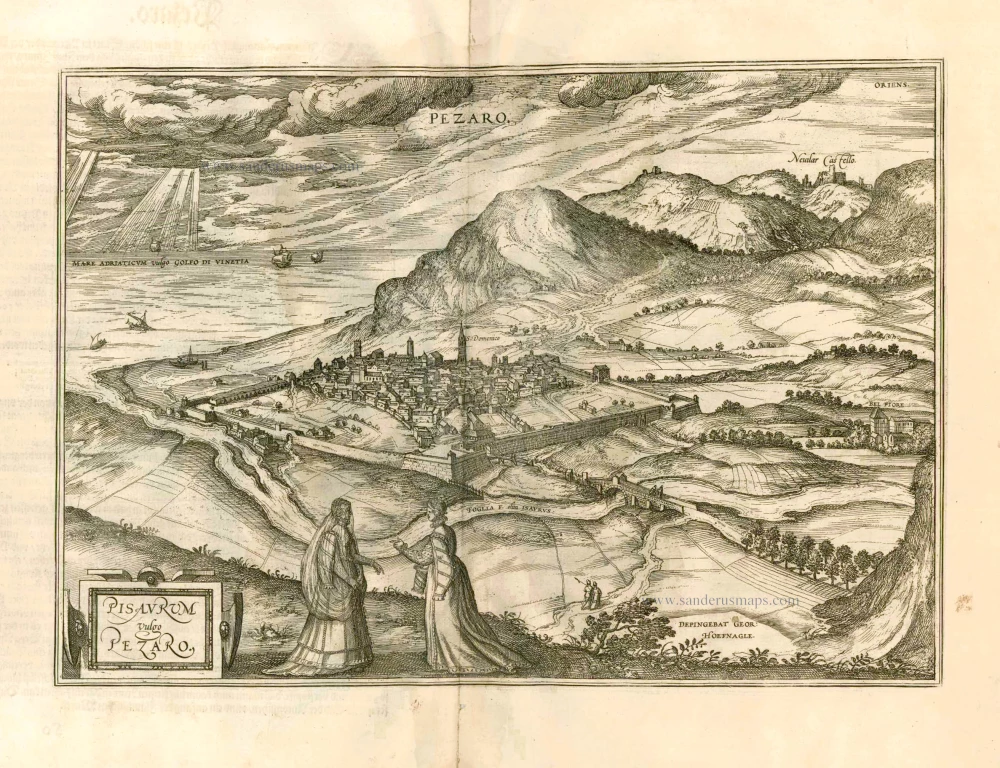
Pisaurum Vulgo Pezaro. 1582
Pesaro by Braun & Hogenberg.
[Item number: 14164]

Puteoli - Baiae 1575
Pozzuoli - Baia, by Braun & Hogenberg.
[Item number: 17963]

Pisaurum Vulgo Pezaro. 1588
Pesaro, by Braun & Hogenberg.
[Item number: 21465]

Novara Mediolanensis Ducatus Civitas c. 1625
Novara by Braun and Hogenberg.
[Item number: 24530]