
Rimini, by Braun & Hogenberg. 1612
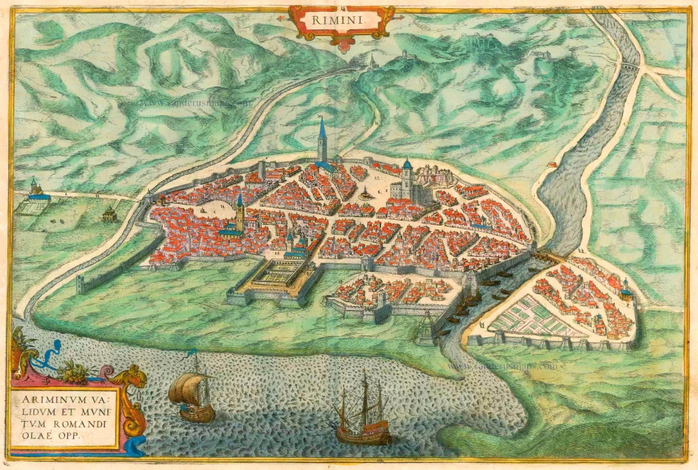


CARTOUCHE: Rimini, a fortified city in the Romagna.
COMMENTARY BY BRAUN (on verso): "However, it is universally acknowledged that this city of Rimini was visibly embellished by Octavian with massive buildings, especially since he also had inter alia a beautiful bridge built across the River Ariminus, which we shall come to present and which still stands today, replete with its arches. The very ancient-looking remains of a theatre built of fired brick have also survived; inscriptions from antiquity are encountered here and there, indicating how old the city is. Moreover, there are still some handsome palaces there, most of which were built by the noble House of Malatesta and a splendid fountain in the market square."
The fortified city is seen from the northeast in a bird's-eye view. The Roman grid-like layout of the streets is still recognisable, with the Corse d'Augusto as the decumanus, forming the east-west axis with the triumphal arch of Augustus at the west end and the Ponte Augusto (Ponte di Tiberio) in the east. This bridge across the Marecchia, finished in AD 21 in the reign of Tiberius, is a pioneering achievement of Roman engineering with its breakwater spurs set at an oblique angle to the bridge, offering the least resistance to the river's current. Left of the centre is the cathedral, the Tempio Malestiano, built by Leon Battista Alberti in the 15th century, and, standing tall in the background, the church of San Agostino. To the right is the Castello Sigismondo, the stronghold of the Malatesta, who ruled the city for centuries - not always to its advantage. At the end of the 16th cent., however, Rimini had already been incorporated into the Papal States. (Taschen)
Braun G. & Hogenberg F. and the Civitates Orbis Terrarum.
The Civitates Orbis Terrarum, also known as the 'Braun & Hogenberg', is a six-volume town atlas and the most excellent book of town views and plans ever published: 363 engravings, sometimes beautifully coloured. It was one of the best-selling works in the last quarter of the 16th century. Georg Braun, a skilled writer, wrote the text accompanying the plans and views on the verso. Many plates were engraved after the original drawings of a professional artist, Joris Hoefnagel (1542-1600). The first volume was published in Latin in 1572 and the sixth in 1617. Frans Hogenberg, a talented engraver, created the tables for volumes I through IV, and Simon van den Neuwel made those for volumes V and VI. Other contributors were cartographers Daniel Freese and Heinrich Rantzau, who provided valuable geographical information. Works by Jacob van Deventer, Sebastian Münster, and Johannes Stumpf were also used as references. Translations appeared in German and French, making the atlas accessible to a broader audience.
Since its original publication of volume 1 in 1572, the Civitates Orbis Terrarum has left an indelible mark on the history of cartography. Seven more editions followed the first volume in 1575, 1577, 1582, 1588, 1593, 1599, and 1612. Vol.2, initially released in 1575, saw subsequent editions in 1597 and 1612. The subsequent volumes, each a treasure trove of historical insights, graced the world in 1581, 1588, 1593, 1599, and 1606. The German translation of the first volume, a testament to its widespread appeal, debuted in 1574, followed by the French edition in 1575.
Several printers were involved: Theodor Graminaeus, Heinrich von Aich, Gottfried von Kempen, Johannis Sinniger, Bertram Buchholtz, and Peter von Brachel, all of whom worked in Cologne.
Georg Braun (1541-1622)
Georg Braun, the author of the text accompanying the plans and views in the Civitates Orbis Terrarum, was born in Cologne in 1541. After his studies in Cologne, he entered the Jesuit Order as a novice, indicating his commitment to learning and intellectual pursuits. In 1561, he obtained his bachelor's degree; in 1562, he received his Magister Artium, further demonstrating his academic achievements. Although he left the Jesuit Order, he continued his studies in theology, gaining a licentiate in theology. His theological background likely influenced the content and tone of the text in the Civitates Orbis Terrarum, adding a unique perspective to the work.
Frans Hogenberg (1535-1590)
Frans Hogenberg was a Flemish and German painter, engraver, and mapmaker. He was born in Mechelen as the son of Nicolaas Hogenberg.
By the end of the 1560s, Frans Hogenberg was employed upon Abraham Ortelius's Theatrum Orbis Terrarum, published in 1570; he is named an engraver of numerous maps. In 1568, he was banned from Antwerp by the Duke of Alva and travelled to London, where he stayed a few years before emigrating to Cologne. He immediately embarked on his two most important works, the Civitates, published in 1572 and the Geschichtsblätter, which appeared in several series from 1569 until about 1587.
Thanks to large-scale projects like the Geschichtsblätter and the Civitates, Hogenberg's social circumstances improved with each passing year. He died as a wealthy man in Cologne in 1590.
Rimini - Ariminum validum et munitum romandi olae opp.
Item Number: 16426 Authenticity Guarantee
Category: Antique maps > Europe > Italy - Cities
Old antique plan of Rimini by Braun & Hogenberg.
Title: Rimini - Ariminum validum et munitum romandi olae opp.
Date of the first edition: 1588.
Date of this map: 1612.
Copper engraving, printed on paper.
Size (not including margins): 310 x 470mm (12.2 x 18.5 inches).
Verso: Latin text.
Condition: Original coloured, excellent.
Condition Rating: A+.
From: Liber Quartus Urbium Praecipuarum Totius Mundi. Cologne,Petrus von Brachel, 1612. (Van der Krogt 4, 41:1.4(1612))
CARTOUCHE: Rimini, a fortified city in the Romagna.
COMMENTARY BY BRAUN (on verso): "However, it is universally acknowledged that this city of Rimini was visibly embellished by Octavian with massive buildings, especially since he also had inter alia a beautiful bridge built across the River Ariminus, which we shall come to present and which still stands today, replete with its arches. The very ancient-looking remains of a theatre built of fired brick have also survived; inscriptions from antiquity are encountered here and there, indicating how old the city is. Moreover, there are still some handsome palaces there, most of which were built by the noble House of Malatesta and a splendid fountain in the market square."
The fortified city is seen from the northeast in a bird's-eye view. The Roman grid-like layout of the streets is still recognisable, with the Corse d'Augusto as the decumanus, forming the east-west axis with the triumphal arch of Augustus at the west end and the Ponte Augusto (Ponte di Tiberio) in the east. This bridge across the Marecchia, finished in AD 21 in the reign of Tiberius, is a pioneering achievement of Roman engineering with its breakwater spurs set at an oblique angle to the bridge, offering the least resistance to the river's current. Left of the centre is the cathedral, the Tempio Malestiano, built by Leon Battista Alberti in the 15th century, and, standing tall in the background, the church of San Agostino. To the right is the Castello Sigismondo, the stronghold of the Malatesta, who ruled the city for centuries - not always to its advantage. At the end of the 16th cent., however, Rimini had already been incorporated into the Papal States. (Taschen)
Braun G. & Hogenberg F. and the Civitates Orbis Terrarum.
The Civitates Orbis Terrarum, also known as the 'Braun & Hogenberg', is a six-volume town atlas and the most excellent book of town views and plans ever published: 363 engravings, sometimes beautifully coloured. It was one of the best-selling works in the last quarter of the 16th century. Georg Braun, a skilled writer, wrote the text accompanying the plans and views on the verso. Many plates were engraved after the original drawings of a professional artist, Joris Hoefnagel (1542-1600). The first volume was published in Latin in 1572 and the sixth in 1617. Frans Hogenberg, a talented engraver, created the tables for volumes I through IV, and Simon van den Neuwel made those for volumes V and VI. Other contributors were cartographers Daniel Freese and Heinrich Rantzau, who provided valuable geographical information. Works by Jacob van Deventer, Sebastian Münster, and Johannes Stumpf were also used as references. Translations appeared in German and French, making the atlas accessible to a broader audience.
Since its original publication of volume 1 in 1572, the Civitates Orbis Terrarum has left an indelible mark on the history of cartography. Seven more editions followed the first volume in 1575, 1577, 1582, 1588, 1593, 1599, and 1612. Vol.2, initially released in 1575, saw subsequent editions in 1597 and 1612. The subsequent volumes, each a treasure trove of historical insights, graced the world in 1581, 1588, 1593, 1599, and 1606. The German translation of the first volume, a testament to its widespread appeal, debuted in 1574, followed by the French edition in 1575.
Several printers were involved: Theodor Graminaeus, Heinrich von Aich, Gottfried von Kempen, Johannis Sinniger, Bertram Buchholtz, and Peter von Brachel, all of whom worked in Cologne.
Georg Braun (1541-1622)
Georg Braun, the author of the text accompanying the plans and views in the Civitates Orbis Terrarum, was born in Cologne in 1541. After his studies in Cologne, he entered the Jesuit Order as a novice, indicating his commitment to learning and intellectual pursuits. In 1561, he obtained his bachelor's degree; in 1562, he received his Magister Artium, further demonstrating his academic achievements. Although he left the Jesuit Order, he continued his studies in theology, gaining a licentiate in theology. His theological background likely influenced the content and tone of the text in the Civitates Orbis Terrarum, adding a unique perspective to the work.
Frans Hogenberg (1535-1590)
Frans Hogenberg was a Flemish and German painter, engraver, and mapmaker. He was born in Mechelen as the son of Nicolaas Hogenberg.
By the end of the 1560s, Frans Hogenberg was employed upon Abraham Ortelius's Theatrum Orbis Terrarum, published in 1570; he is named an engraver of numerous maps. In 1568, he was banned from Antwerp by the Duke of Alva and travelled to London, where he stayed a few years before emigrating to Cologne. He immediately embarked on his two most important works, the Civitates, published in 1572 and the Geschichtsblätter, which appeared in several series from 1569 until about 1587.
Thanks to large-scale projects like the Geschichtsblätter and the Civitates, Hogenberg's social circumstances improved with each passing year. He died as a wealthy man in Cologne in 1590.
Related items
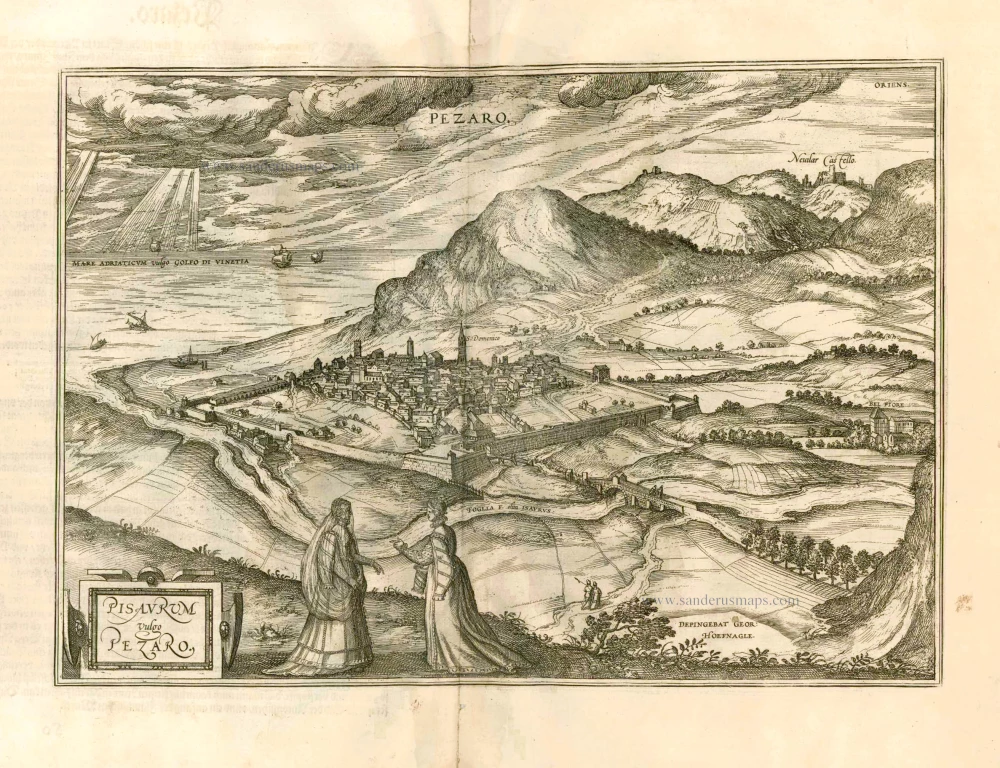
Pisaurum Vulgo Pezaro. 1582
Pesaro by Braun & Hogenberg.
[Item number: 14164]
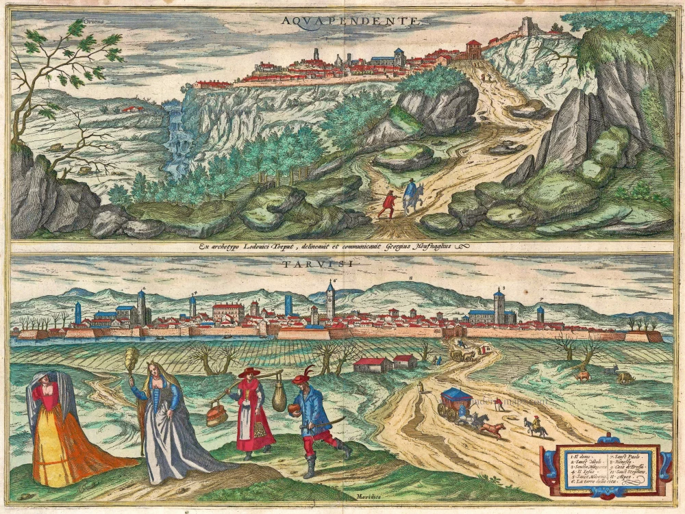
Aquapendente [on sheet with] Tarvisi c. 1610
Acquapendente and Tarvisio by Braun and Hogenberg.
[Item number: 14608]
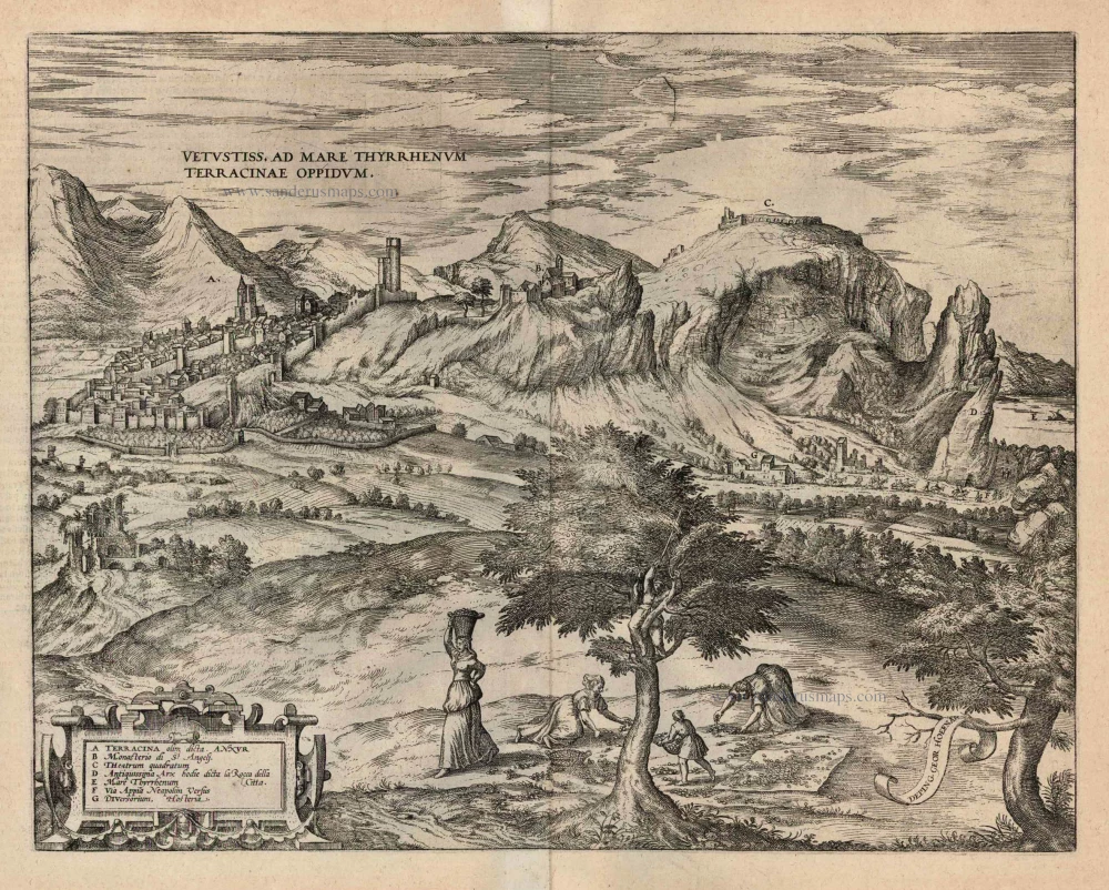
Vetustiss. Ad Mare Thyrrhenum Terracinae Oppidum. 1599
Terracina by Braun and Hogenberg.
[Item number: 24069]

Rimini - Ariminum validum et munitum romandi olae opp. 1657
Rimini, by J. Janssonius, after Braun & Hogenberg.
[Item number: 31008]
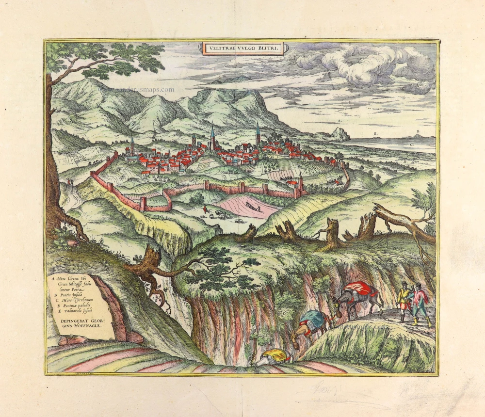
Velitrae vulgo Blitri 1657
Velletri, by Georg Braun and Frans Hogenberg after Georg Hoefnagel.
[Item number: 31009]