
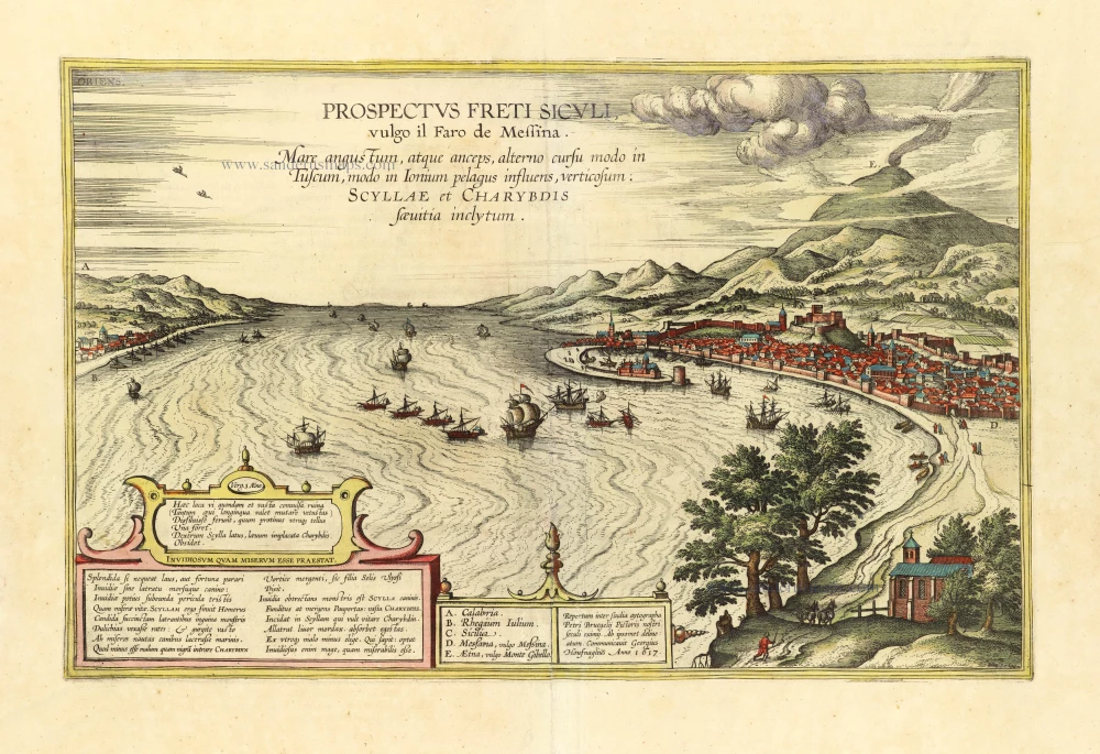
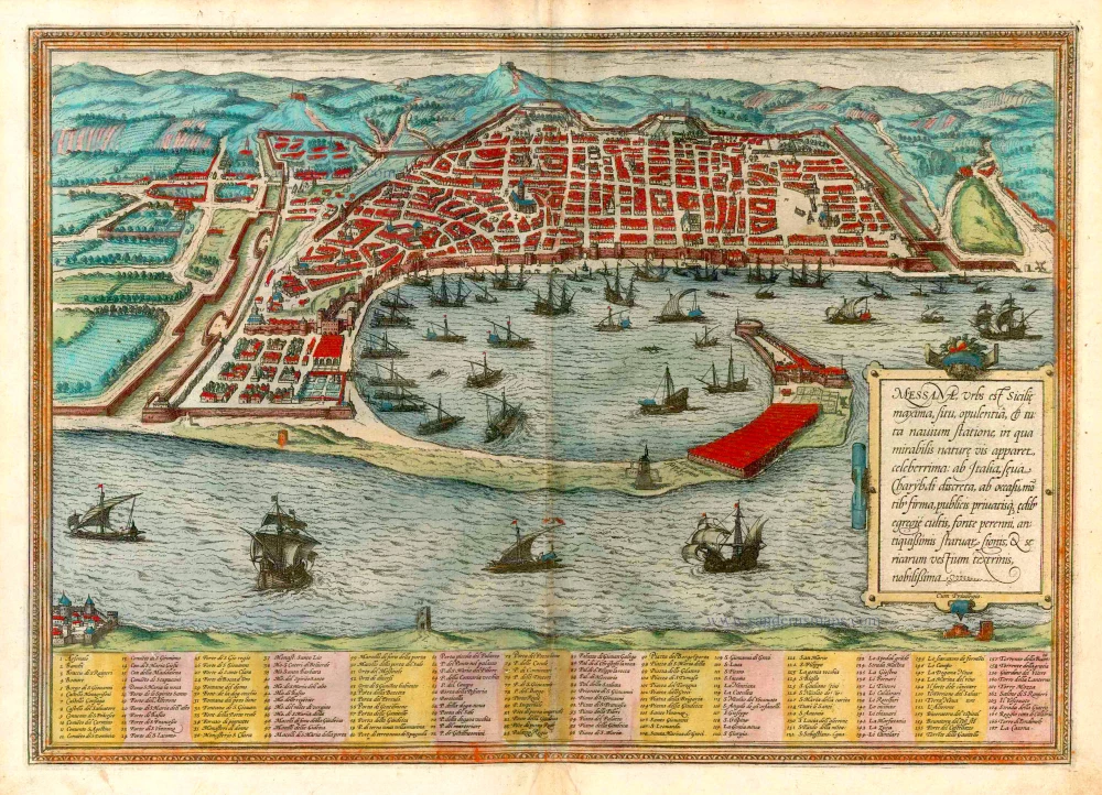
The Strait of Messina, by Georg Braun & Frans Hogenberg, after a drawing by Pieter Brueghel, adapted by Georg Hoefnagel, published by J. Janssonius. 1657

The Janssonius Family
Joannes Janssonius (Arnhem, 1588-1664), son of the Arnhem publisher Jan Janssen, married Elisabeth Hondius, daughter of Jodocus Hondius, in Amsterdam in 1612. After his marriage, he settled down in this town as a bookseller and publisher of cartographic material. In 1618, he established himself in Amsterdam next door to Blaeu’s bookshop. He entered into serious competition with Willem Jansz. Blaeu when copying Blaeu’s Licht der Zeevaert after the expiration of the privilege in 1620. His activities concerned the publication of atlases, books, single maps, and an extensive book trade with branches in Frankfurt, Danzig, Stockholm, Copenhagen, Berlin, Koningsbergen, Geneva, and Lyon. In 1631, he began publishing atlases together with Henricus Hondius.
In the early 1640s, Henricus Hondius left the atlas publishing business to Janssonius. Competition with Joan Blaeu, Willem’s son and successor, in atlas production, prompted Janssonius to enlarge his Atlas Novus finally into a work of six volumes, into which a sea atlas and an atlas of the Old World were inserted. Other atlases published by Janssonius are Mercator’s Atlas Minor, Hornius’s historical atlas (1652), the townbooks in eight volumes (1657), Cellarius’s Atlas Coelestis and several sea atlases and pilot guides.
After the death of Joannes Janssonius, the shop and publishing firm were continued by the heirs under the direction of Johannes van Waesbergen (c. 1616-1681), son-in-law of Joannes Janssonius. Van Waesbergen added Janssonius's name to his own.
In 1676, Joannes Janssonius’s heirs sold by auction “all the remaining Atlases in Latin, French, High and Low German, as well as the Stedeboecken in Latin, in 8 volumes, bound and unbound, maps, plates belonging to the Atlas and Stedeboecken.” The copperplates from Janssonius’s atlases were afterwards sold to Schenk and Valck.
Prospectus Freti Siculi vulgo il Faro di Messina.
Item Number: 31822 Authenticity Guarantee
Category: Antique maps > Europe > Italy - Cities
The Strait of Messina, by Georg Braun & Frans Hogenberg, after a drawing by Pieter Brueghel, adapted by Georg Hoefnagel, published by J. Janssonius.
Title: Prospectus Freti Siculi vulgo il Faro di Messina.
Repertum inter studia aytographe Petri Bruegelij Pictoris nostri seculi eximij. Ab ipsomet delineatum. Communicavit Georgius Houfnaglius Anno 1617.
Date of the first edition: 1596.
Date of this map: 1657.
Copper engraving, printed on paper.
Image size: 305 x 475mm (12 x 18¾ inches).
Sheet size: 465 x 565mm (18¼ x 22¼ inches).
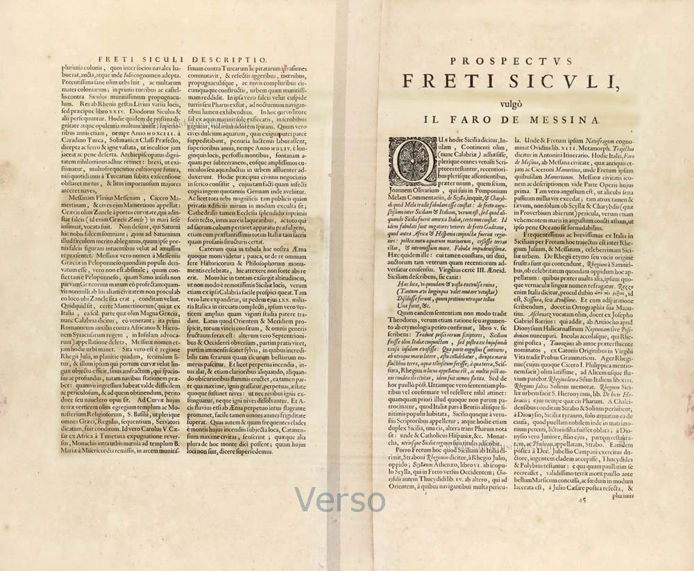
Verso: Latin text.
Condition: Original coloured, small repairs along centrefold, some creasing, flattened.
Condition Rating: B.
From: Theatrum Celebriorum Urbium Italiae, aliarumque in Insulis Maris Mediterranei. Amsterdam, J. Janssonius [1657]. (Van der Krogt 4, p. 282, 42:15)
The Janssonius Family
Joannes Janssonius (Arnhem, 1588-1664), son of the Arnhem publisher Jan Janssen, married Elisabeth Hondius, daughter of Jodocus Hondius, in Amsterdam in 1612. After his marriage, he settled down in this town as a bookseller and publisher of cartographic material. In 1618, he established himself in Amsterdam next door to Blaeu’s bookshop. He entered into serious competition with Willem Jansz. Blaeu when copying Blaeu’s Licht der Zeevaert after the expiration of the privilege in 1620. His activities concerned the publication of atlases, books, single maps, and an extensive book trade with branches in Frankfurt, Danzig, Stockholm, Copenhagen, Berlin, Koningsbergen, Geneva, and Lyon. In 1631, he began publishing atlases together with Henricus Hondius.
In the early 1640s, Henricus Hondius left the atlas publishing business to Janssonius. Competition with Joan Blaeu, Willem’s son and successor, in atlas production, prompted Janssonius to enlarge his Atlas Novus finally into a work of six volumes, into which a sea atlas and an atlas of the Old World were inserted. Other atlases published by Janssonius are Mercator’s Atlas Minor, Hornius’s historical atlas (1652), the townbooks in eight volumes (1657), Cellarius’s Atlas Coelestis and several sea atlases and pilot guides.
After the death of Joannes Janssonius, the shop and publishing firm were continued by the heirs under the direction of Johannes van Waesbergen (c. 1616-1681), son-in-law of Joannes Janssonius. Van Waesbergen added Janssonius's name to his own.
In 1676, Joannes Janssonius’s heirs sold by auction “all the remaining Atlases in Latin, French, High and Low German, as well as the Stedeboecken in Latin, in 8 volumes, bound and unbound, maps, plates belonging to the Atlas and Stedeboecken.” The copperplates from Janssonius’s atlases were afterwards sold to Schenk and Valck.
Related items
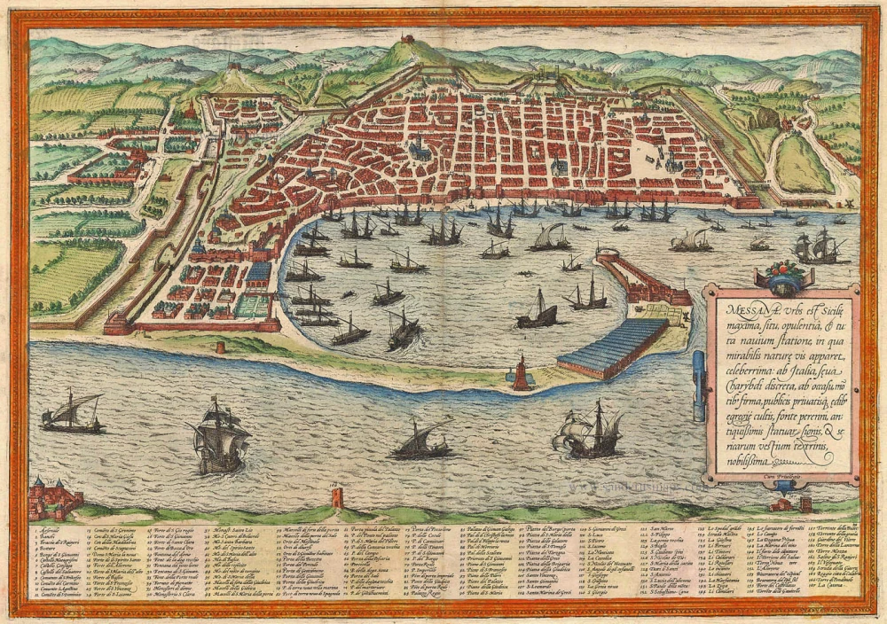
Messana, Urbs est Sicilie maxima, situ, opulentia, & tuta navium statione, ... 1574
Messina by Braun & Hogenberg
[Item number: 5497]

Messina Ville de la Sicile. 1704
Sicily - Messina, by Blaeu - Mortier.
[Item number: 18139]

Messana, Urbs est Sicilie maxima, situ, opulentia, & tuta navium statione, ... 1612
Messina in Sicily, by Georg Braun and Frans Hogenberg.
[Item number: 22348]
Messana, Urbs est Sicilie maxima, situ, opulentia, & tuta navium statione, ... 1582
Sicily - Messina by Georg Braun & Frans Hogenberg
[Item number: 25465]
Messina. 1638
Messina, by M. Merian.
[Item number: 26033]

Rare
La Nobile Città di Messina. 1569
Messina by Giulio Ballino
[Item number: 28297]

Messina Colle Nuove Fortificationi. 1696
Messina by Vincenzo Coronelli.
[Item number: 28714]

Messina. 1657
Sicily - Messina by J. Janssonius.
[Item number: 31004]

Famous view after Pieter Breugel
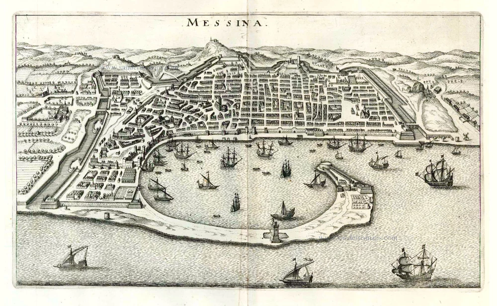
Prospectus Freti Siculi vulgo il Faro di Messina. 1635
Strait of Messina by Braun & Hogenberg
[Item number: 31875]