
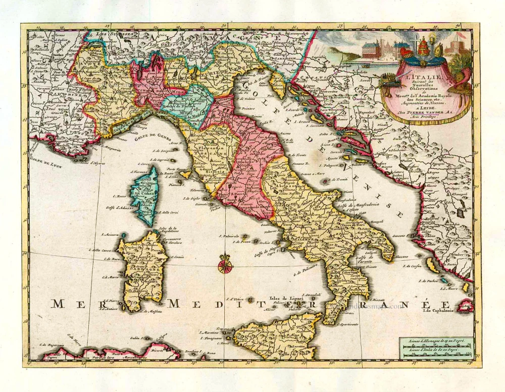
Italy, by Pieter Van der Aa. 1713
Pieter van der Aa (Leiden, 1659-1733)
Pieter van der Aa was already in 1682 owner of a bookshop and auction house. During his life, he has published an enormous amount of printed material.
After 1700, van der Aa increasingly specialised in books on geography and travel.
He published composite atlases, a series of geographical descriptions of European countries, and some very spectacular works. Between 1706 and 1708 he published the Naauweurige versameling der gedenkwaardigste zee- en land-reysen, in 28 volumes.
Many of Van der Aa’s publications are richly illustrated with maps and plates. He took over many copperplates and prints from other publishers such as Carel Allard and Frederik De Wit. The composite atlases that appeared from his workshop contain a curious mixture of his own material, copies of maps from other publishers, and reprints made from old copper plates, now with his own imprint.
The Galérie agréable du monde, was completed in 1729, and comprised 66 parts, bound in 27 volumes. Van der Aa presented it as a good investment; after publication, the antiquarian value of the work would double, the more so since it was printed in a limited edition of only one hundred copies.
L'Italie.
Item Number: 26083 Authenticity Guarantee
Category: Antique maps > Europe > Italy
Italy, by Pieter Van der Aa.
Title: L'Italie.
Date of the first edition: 1713.
Date of this map: 1713.
Copper engraving, printed on paper.
Size (not including margins): 223 x 295mm (8.78 x 11.61 inches).
Verso: Blank.
Condition: Original coloured, trimmed to neatline and mounted on heavy paper at an early time.
Condition Rating: A.
From: Nouvel Atlas, très exact et fort commode pour toutes sortes de personnes, Contenant Les Principales cartes géographiques. Leiden, P. Van der Aa, n.d. (1713) (Koeman, Aa7).
Engraved by D. Stoopendaal.
Date of the first edition: 1713
Date of t
Pieter van der Aa (Leiden, 1659-1733)
Pieter van der Aa was already in 1682 owner of a bookshop and auction house. During his life, he has published an enormous amount of printed material.
After 1700, van der Aa increasingly specialised in books on geography and travel.
He published composite atlases, a series of geographical descriptions of European countries, and some very spectacular works. Between 1706 and 1708 he published the Naauweurige versameling der gedenkwaardigste zee- en land-reysen, in 28 volumes.
Many of Van der Aa’s publications are richly illustrated with maps and plates. He took over many copperplates and prints from other publishers such as Carel Allard and Frederik De Wit. The composite atlases that appeared from his workshop contain a curious mixture of his own material, copies of maps from other publishers, and reprints made from old copper plates, now with his own imprint.
The Galérie agréable du monde, was completed in 1729, and comprised 66 parts, bound in 27 volumes. Van der Aa presented it as a good investment; after publication, the antiquarian value of the work would double, the more so since it was printed in a limited edition of only one hundred copies.
Related items

Italia, Divisa in Statum Ecclesiasticum, Regnum Neapolitanum, Resp. Venetiarum, Genuae, et Lucae: Magnum Ducatum Etruriae, Ducatus Sabaudiae, Mediolani, Mutinae, Parmae et Mirandulae: Insulas Siliciam, Sardiniam, et Superjacentia Regna et Regiones c. 1730.
Italy, by Valk G.& L.
[Item number: 14145]
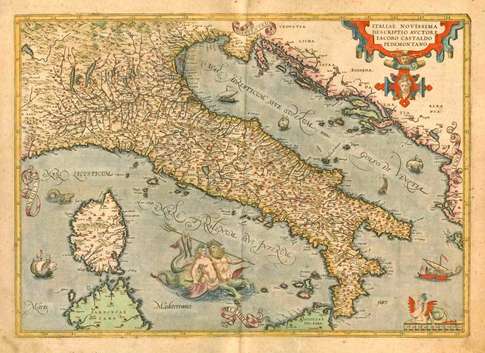
Italiae Novissima Descriptio Auctore Iacobo Castaldo Pedemontano. 1612
Italy by Abraham Ortelius
[Item number: 22982]
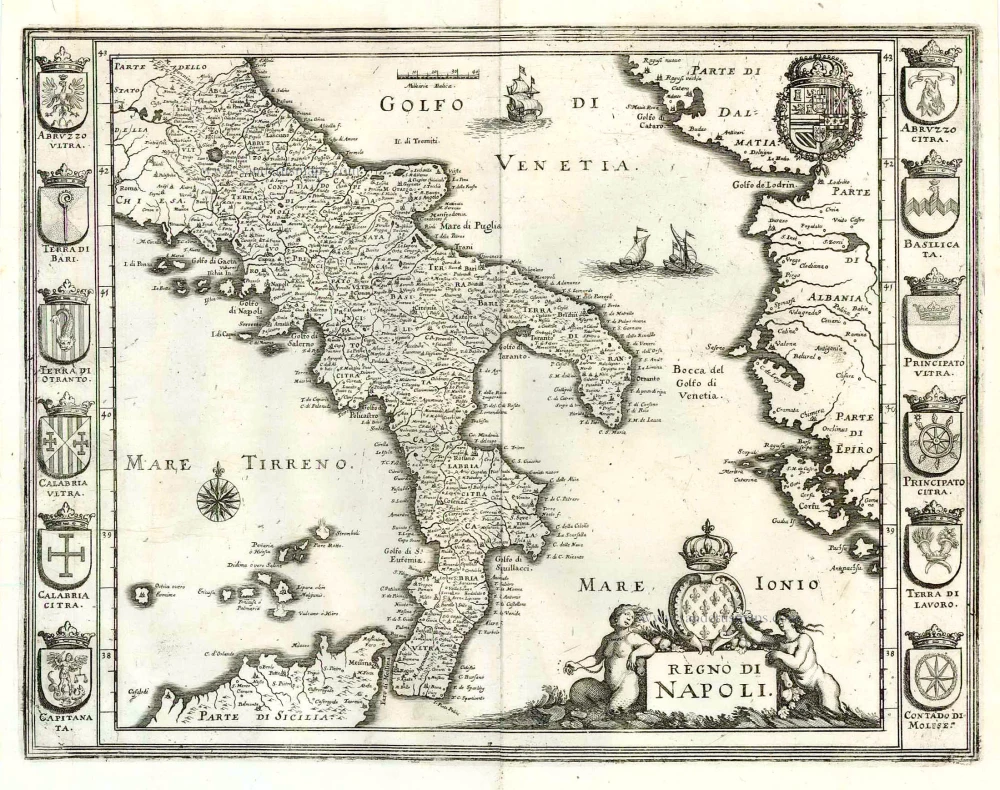
Regno di Napoli. 1638
Southern Italy, by M. Merian.
[Item number: 25925]

In rare original colour.
L'Ile de Sicile. 1713
Sicily, by Pieter Van der Aa.
[Item number: 26077]

Le Grand Duché de Toscane. 1713
Tuscany (Toscana) by P. Van der Aa.
[Item number: 26079]

Carte Nouvelle du Cremonois, Avec ses confins. 1713
Cremona by Pieter Van der Aa
[Item number: 26082]

Italia Antiqua Philippo Cluvero Borusso Designatore. / Iodocus Hondius excud. 1630
Ancient Italy, by J. Janssonius - J. Hondius.
[Item number: 26223]

Italia. 1597
Italy, by Giovanni Magini.
[Item number: 26517]

L'Italie Divisée en ses différents Etats, Royaumes et Républiques. 1776-79
Italy, by Sr. Janvier Jean Denis.
[Item number: 28076]

Nova Italiae Delineatio. 1642-43
Italy by Willem Blaeu.
[Item number: 28676]
Rare
L'Italia nobilissima provincia della Europa su nominata con diversi nomi, ... 1664
Italy by Donato Rascicotti, published in Venice by Steffano Scolari.
[Item number: 28782]

Nouvelle Carte de L'Etat present de l'Italie pour parvenir par une Methode nouvelle, a la connoissance de la Geographie, et de l'Histoire; et tres utile pour les voiages. 1713
Map of Italy by Zacharias Châtelain.
[Item number: 29641]

Carte Generale de l'Italie et des Isles et Pays Circonvoisins. 1652
Italy by Nicolas Sanson.
[Item number: 29672]

Italia Antiqua Cum Insulis Sicilia Sardinia & Corsica. 1652
Ancient Italy (Italia) by Nicolas Sanson.
[Item number: 29692]
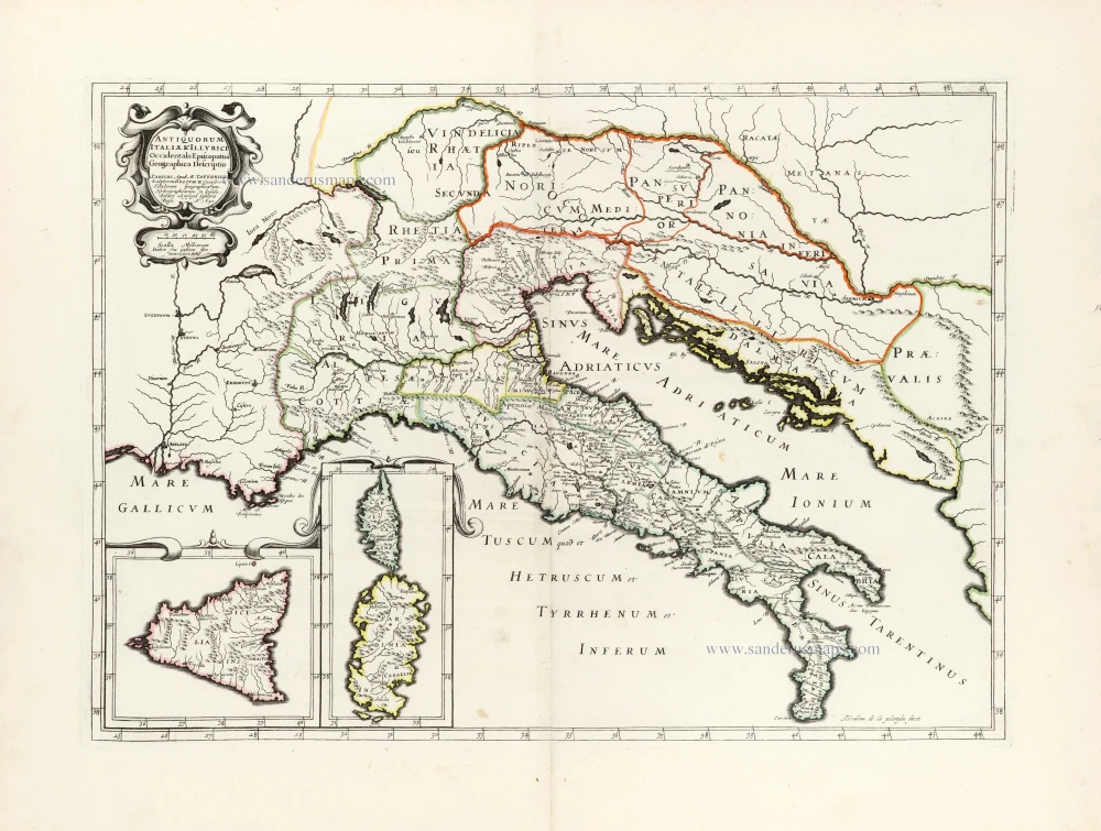
Antiquorum Italiae & Illyrici Occidentalis Episcopatuu Geographica descriptio. 1641 or later
Ancient Italy (Italia) & Dalmatia by Melchior Tavernier.
[Item number: 30035]
Ta .NO. Italiae. 1525
Italy, by Lorenz Fries.
[Item number: 30321]

Tabula .VI. Euro. 1525
Ptolemy map of Italy by Lorenz Fries, after Martin Waldseemüller.
[Item number: 30370]

Italiae Novissima Descriptio Auctore Iacobo Castaldo Pedemontano. 1584
Italy by Abraham Ortelius.
[Item number: 30985]

Italien in seine unterschiedene Laender eingeteilet c. 1745.
Italy by J.G. Schreiber.
[Item number: 31106]

L'Italie distinguée suivant l'estendue de tous les Estats, Royaumes, Republiques, Duchés, Principautés qui la partagent presentement. 1692
Italy by N. Sanson, so-called published by Hubert Jaillot. (Pirated edition by Pierre Mortier).
[Item number: 31275]
Italia. 1618
Italy by Petrus Bertius, published by Jodocus Hondius II.
[Item number: 31645]
Scarce and decorative map
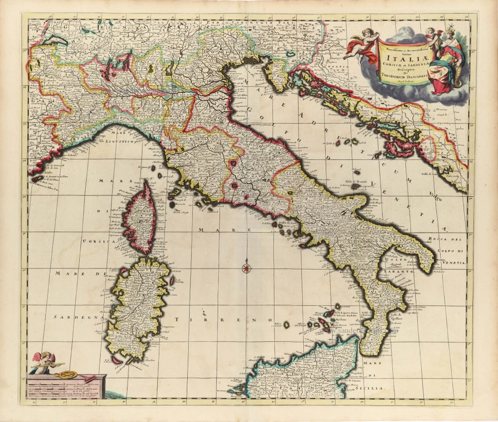
Novissima et Accuratissima totius Italiae Corsicae et Sardiniae. c. 1680
Italy by Theodore Danckerts.
[Item number: 32501]