
Tyrrhenian coast, by Willem Barentsz. 1599
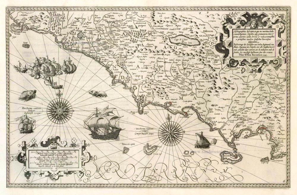
### Willem Barentz. (1550-1597)
Willem Barentz. was a Dutch navigator and cartographer from Amsterdam who died in Novaya Zemlya. He attempted to find a Northeast passage to China (1594-97, two voyages). He published the earliest printed sea atlas of the whole of the Mediterranean sea: Nieuwe Beschryvinghe ended Caertboeck vande Midlandtsche Zee, 1593-95.
Hydrographica descriptio, in qua orae maritimae Italiae à monte Argentato Napolim usq. promontoria item & portus, ajacentes insulae, brevia & vada accuratissimèa pertissimo nauclero Guiljelmo Barentsono designantur
Item Number: 4034 Authenticity Guarantee
Category: Antique maps > Europe > Italy
Old, antique map of the Italian coast between Monte Argentario and Sorrento, by Willem Barentsz.
Date of the first edition: 1595
Date of this map: 1599
Date on map: 1593
Title: Hydrographica descriptio, in qua orae maritimae Italiae à monte Argentato Napolim usq. promontoria item & portus, ajacentes insulae, brevia & vada accuratissimèa pertissimo nauclero Guiljelmo Barentsono designantur
Copper engraving, printed on paper.
Size (not including margins): 338 x 527mm (13.31 x 20.75 inches).
Verso: French text.
Condition: New side margins with reinstatement of a small part of neatline.
Condition Rating: B.
From: Description De La Mer Mediterranee, ... Amsterdam, Corneille Nicolas, 1599. (Koeman IV, Bar2)
### Willem Barentz. (1550-1597)
Willem Barentz. was a Dutch navigator and cartographer from Amsterdam who died in Novaya Zemlya. He attempted to find a Northeast passage to China (1594-97, two voyages). He published the earliest printed sea atlas of the whole of the Mediterranean sea: Nieuwe Beschryvinghe ended Caertboeck vande Midlandtsche Zee, 1593-95.
Related items

Italiae Novissima Descriptio Auctore Iacobo Castaldo Pedemontano. 1612
Italy by Abraham Ortelius
[Item number: 22982]
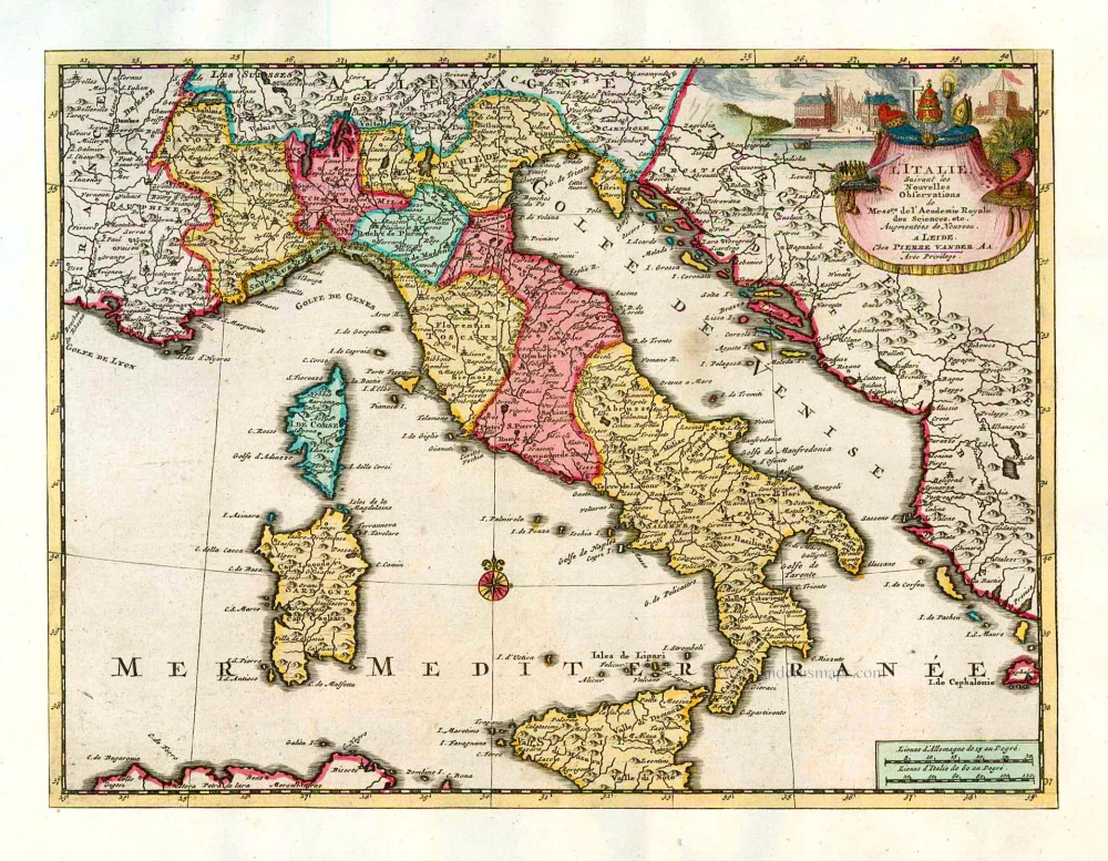
L'Italie. 1713
Italy, by Pieter Van der Aa.
[Item number: 26083]
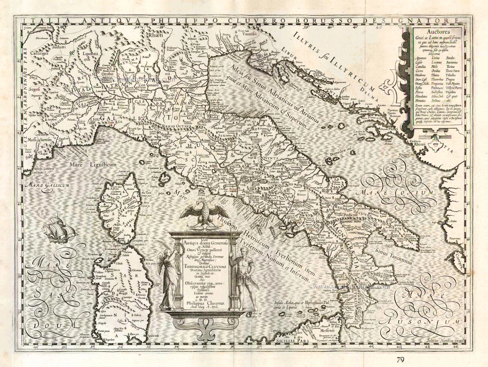
Italia Antiqua Philippo Cluvero Borusso Designatore. / Iodocus Hondius excud. 1630
Ancient Italy, by J. Janssonius - J. Hondius.
[Item number: 26223]
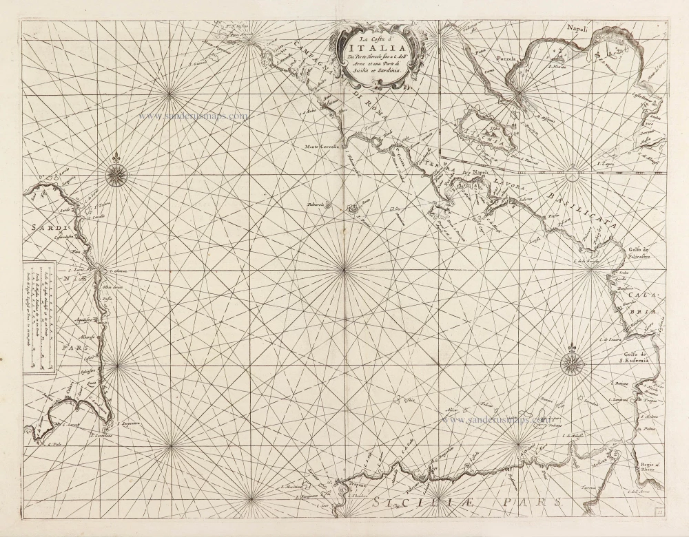
La Costa d'Italia Da Porto Hercole fino a C. dell' Arme et una Parte di Sicilia et Sardinia. 1696
Chart of the Tyrrhenian Sea (Il Mar Tirenno) - between Italy, Sicily, and Sardinia, by Vincenzo Coronelli.
[Item number: 28726]