
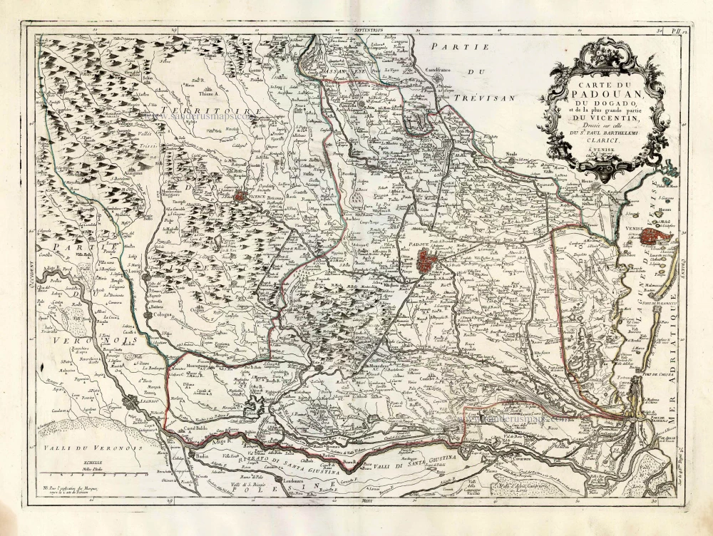
Vicenza, Padua and Venice, by Paolo Santini. 1776-79
Francesco and Paolo Santini (c.1729-1793)
Francesco Santini, a Venetian publisher, acquired the printing plates of Vaugondy’s Atlas Universel …, a commercial and cartographic success, with widespread influence on mapmakers throughout Europe. Together with his brother Paolo, he commissioned a new set of plates and reissued the atlas in 1776. The following year, Paolo Santini assigned all his publication rights to M. Remondini, who in 1777 reissued the same atlas but with his name.
Carte du Padouan, du Dogado, et de la plus grande partie du Vincentin. Dressée sur celle du Sr. Paul Barthelemi Clarici.
Item Number: 27717 Authenticity Guarantee
Category: Antique maps > Europe > Italy
Old, antique map of Vicenza, Padua and Venice, by Paolo Santini.
Title: Carte du Padouan, du Dogado, et de la plus grande partie du Vincentin. Dressée sur celle du Sr. Paul Barthelemi Clarici.
Date of the first edition: 1780.
Date of this map: 1776-79.
Copper engraving, printed on paper.
Size (not including margins): 480 x 650mm (18.9 x 25.59 inches).
Verso: Blank.
Condition: Original coloured in outline, excellent.
Condition Rating: A+.
From: Atlas Universel dressé sur les meilleures cartes modernes. Venice, Remondini, 1776-79.
Francesco and Paolo Santini (c.1729-1793)
Francesco Santini, a Venetian publisher, acquired the printing plates of Vaugondy’s Atlas Universel …, a commercial and cartographic success, with widespread influence on mapmakers throughout Europe. Together with his brother Paolo, he commissioned a new set of plates and reissued the atlas in 1776. The following year, Paolo Santini assigned all his publication rights to M. Remondini, who in 1777 reissued the same atlas but with his name.
Related items

Territorio Padovano. 1644-58
Padova, by Janssonius J. - Hondius H.
[Item number: 9582]

Padoue, ou Padua, Ville Capitale du Padouani aux Venetiens. 1704
Padova, by Blaeu - Mortier.
[Item number: 18093]

Patavini Territorii Corographia [on sheet with:] Tarvisini Agri Typus. 1612
Padova and Tarviso, by Abraham Ortelius.
[Item number: 23123]

Patavini Territorii Corographia - Apuliae quae olim Iapygia, Nova Corographia 1579
Padova and Apulia by Abraham Ortelius..
[Item number: 23490]

Territorio Padovano. 1641-42
Padova, by J. Blaeu.
[Item number: 24642]

Patavini Territorii Corographia [on sheet with:] Apuliae quae olim Iapygia, Nova Corographia. 1573
Padova & Puglia, by Abraham Ortelius.
[Item number: 25875]

Territorio Padovano. 1641
Padova, by Henricus Hondius.
[Item number: 26369]
In rare original colour
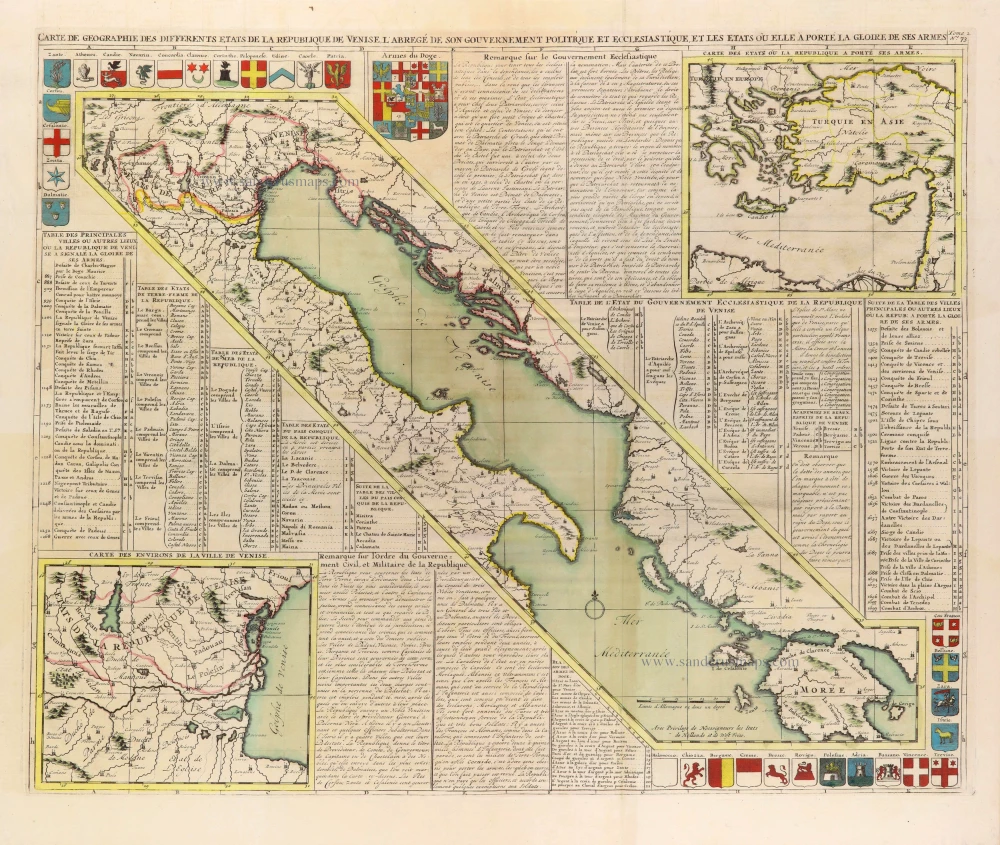
Carte de Géographie des differents Etats de la République de Venise, ... 1708
Gulf of Venice, by Zacharias Châtelain.
[Item number: 31420]
In rare original colour. - Two plates
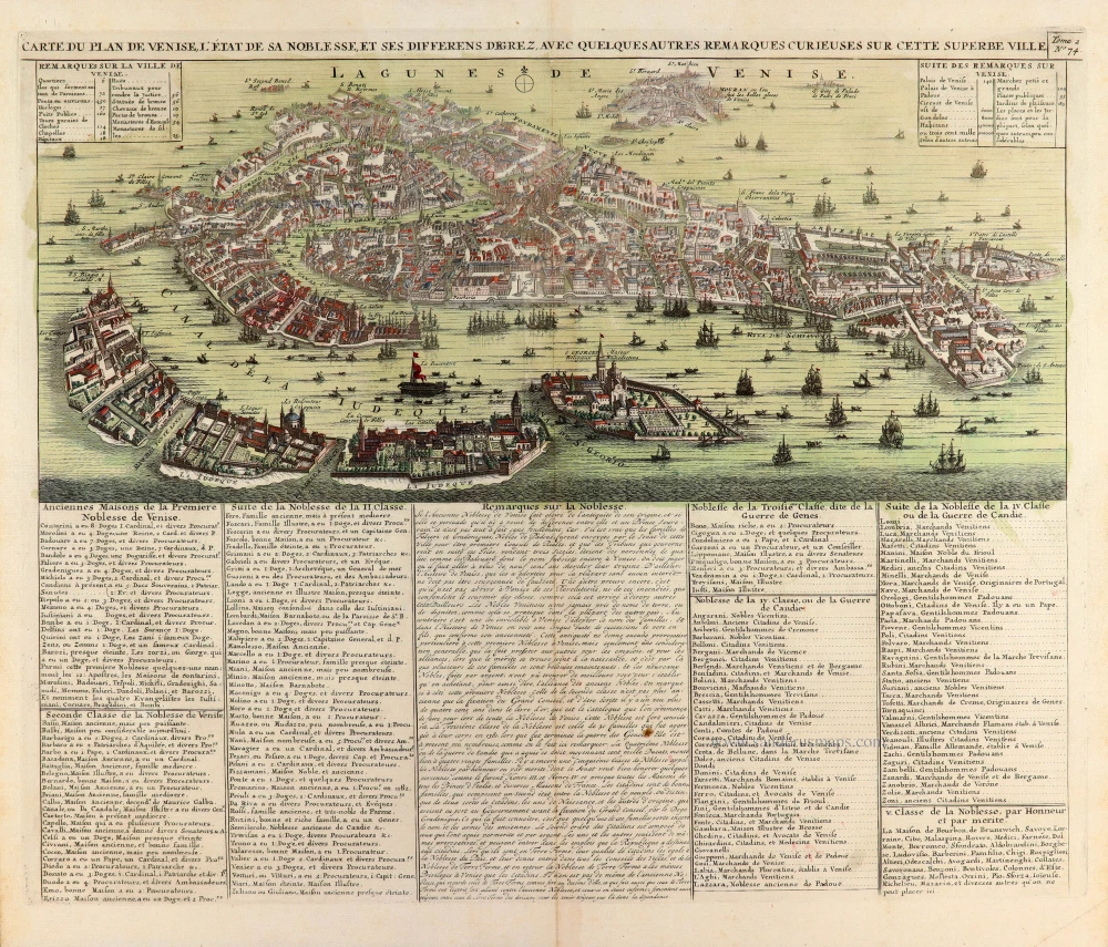
Carte du Plan de Venise, l'Etat de sa Noblesse, et ses differens degrez, avec quelques autres remarques curieuses sur cette superbe ville. [With:] Carte du Gouvernement Militaire de la République de Venise ... 1708
Venice, by Zacharias Châtelain.
[Item number: 31423]

Veduta della Piazza di S. Marco verso D. Giminiano à Venetia. - Prospect des Platzes von S. Marco gegen S. Giminiano in Venedig. [in set with] Altra veduta della Piazza di S. Marco à Venetia. - Anderer Prospect des Platzes von S. Marco in Venedig. c. 1750
Two views of the Piazza di San Marco in Venice (Venezia), by Martin Engelbrecht.
[Item number: 31991]

Palazzo Vidimano a S. Canciano à Venetia. - Der Vidimanische Pallast beij S. Canciano in Venedig. c. 1750
Palazzo Vidimano a S. Canciano in Venice (Venezia), by Martin Engelbrecht.
[Item number: 31993]

Chiesa del Spirito Santo di Monache Agostiniani su le Zattare à Venetia. - Die Kirch des Heil: Geistes der Augustiner Mönch in Venedig. c. 1750
Church of the Holy Ghost in Venice (Venezia), by Martin Engelbrecht.
[Item number: 31994]

Veduta della Chiesa e Spiagia di S. Nicolo di Castello à Venetia. - Prospect der Kirchen von St. Nicolaus vom Schloß und derselben angenehmen Gegens in Venedig. c. 1750
Church of S. Nicolo di Castello in Venice (Venezia), by Martin Engelbrecht.
[Item number: 31999]

Chiesa di SS. Gio e Paulo à Venezia. - Prospect der Kirchen von SS. Iohann ù: Paul in Venedig. c. 1750
Basilica dei Santi Giovanni e Paolo in Venice (Venezia), by Martin Engelbrecht.
[Item number: 32000]

Altra Veduta di S. Giorgio Maggiore à Venetia. - Prospect der Kirchen St. Georgio des größern in Venedig. c. 1750
Basilica di San Giorgio Maggiore in Venice (Venezia), by Martin Engelbrecht.
[Item number: 32001]
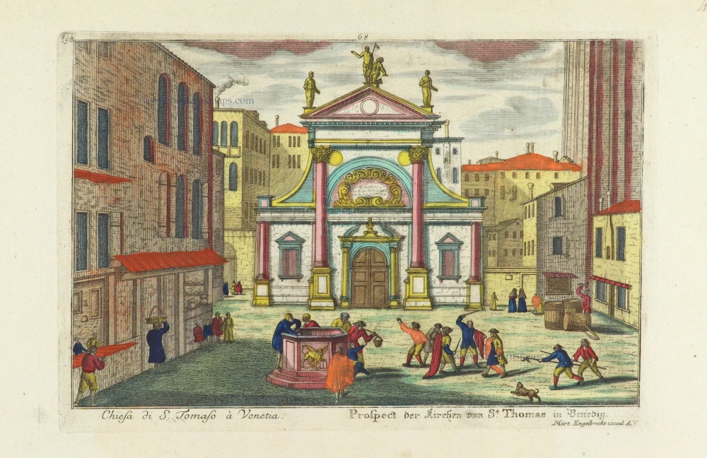
Chiesa di S. Tomaso à Venetia. - Prospect der Kirchen von St. Thomas in Venedig. c. 1750
Church of S. Tomaso in Venice (Venezia), by Martin Engelbrecht.
[Item number: 32012]
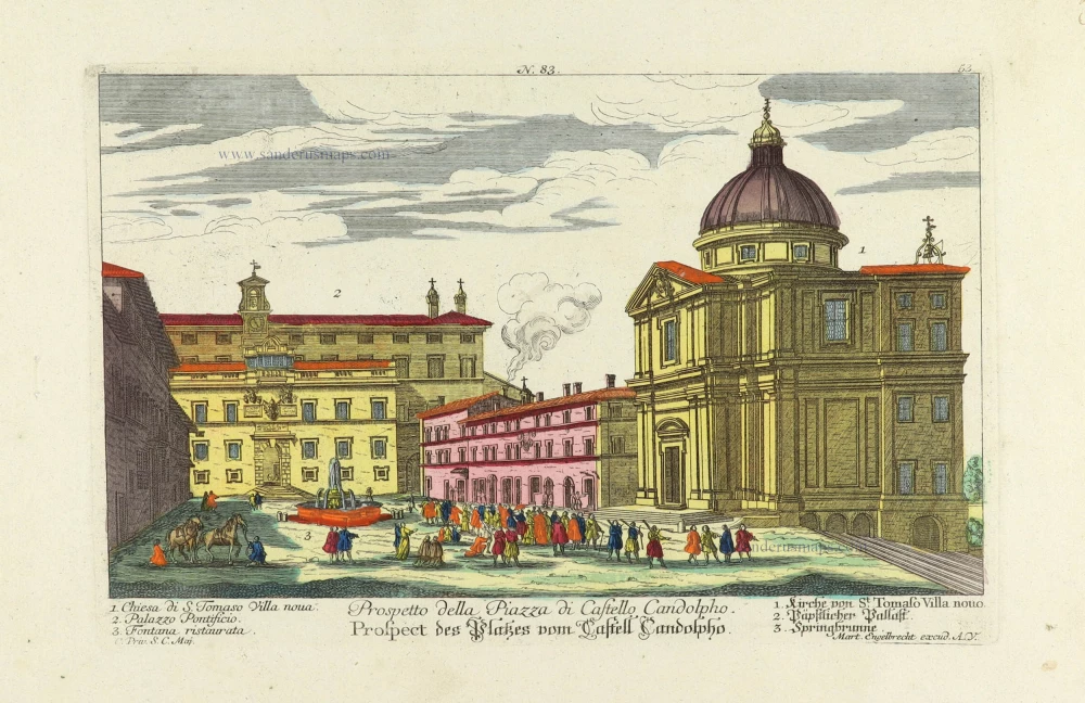
Prospetto della Piazza di Castello Candolpho. - Prospect des Platzes vom Castell Candolpho. c. 1750
Rome (Roma) - Castel Candolfo (Papal residence), by Martin Engelbrecht.
[Item number: 32013]

Piazza e Chiesa di S. Andrea della Valle. - Platz und Kirche des Heil. Andrea della Valle. c. 1750
Rome (Roma) - Church of S. Andrea della Valle, by Martin Engelbrecht.
[Item number: 32014]

Palazzo Vendramino alla Giudecea à Venetia. - Vendraminischer Pallast auf der Insel Guidecca in Venedig. c. 1750
Venice (Venezia) - Palazzo Vendramin, by Martin Engelbrecht.
[Item number: 32017]

Palazzo Mocenigi a S. Samuele à Venetia. - Mocenigischer Pallast beij S. Samuel in Venedig. c. 1750
Venice (Venezia) - Palazzo Mocenigo, by Martin Engelbrecht.
[Item number: 32018]

Palazzo Fini sopra il Canal Grande à Venetia. - Finischer Pallast auf dem grossen Canal in Venedig. c. 1750
Venice (Venezia) - Palazzo Fini, by Martin Engelbrecht.
[Item number: 32044]

Facciata della Chiese del Ospitaletto à Venetia. - Prospect der Hospital Kirche in Venedig. c. 1750
Venice (Venezia) - Chiese del Ospitaletto, by Martin Engelbrecht.
[Item number: 32045]
Scarce
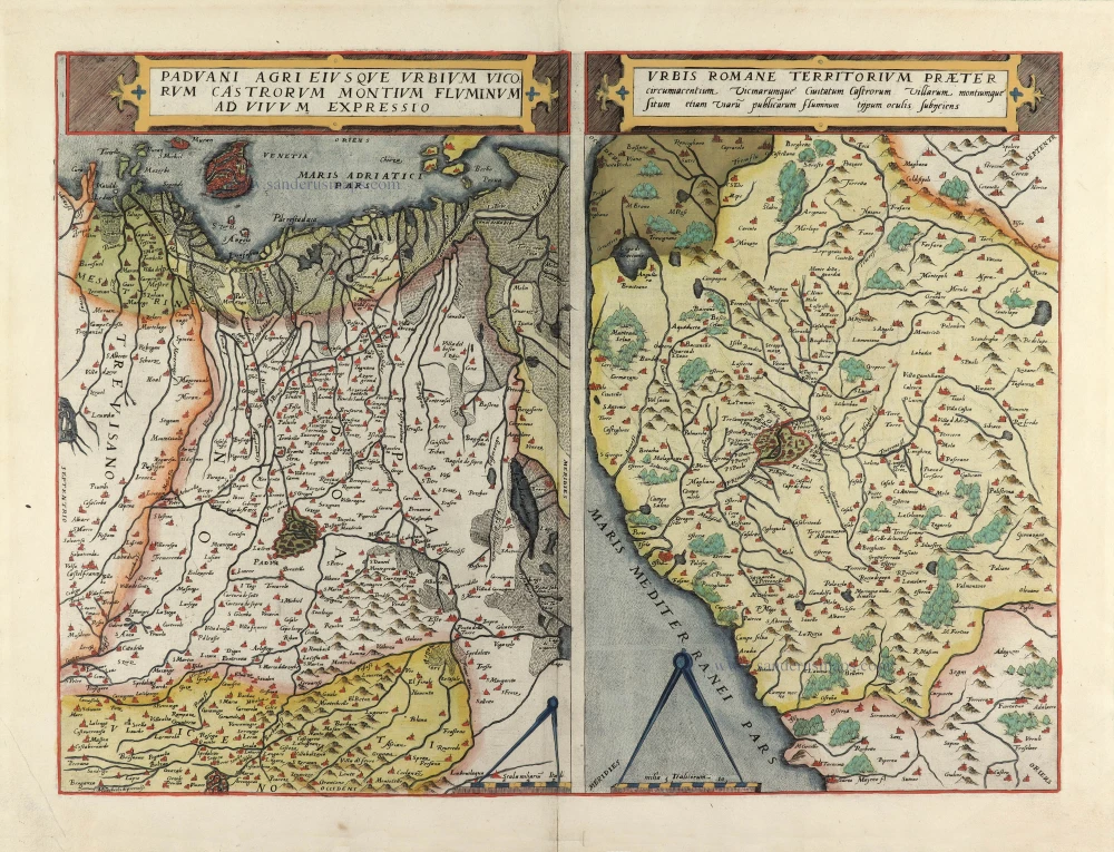
Paduani Agri Eiusque Urbium Vicorum Castorum Montium Fluminum ad Vivum Expressio [on sheet with] Urbis Romane Territorium Praeter Circumacentium ... 1593
Padua / Lazio , by G. de Jode.
[Item number: 32270]
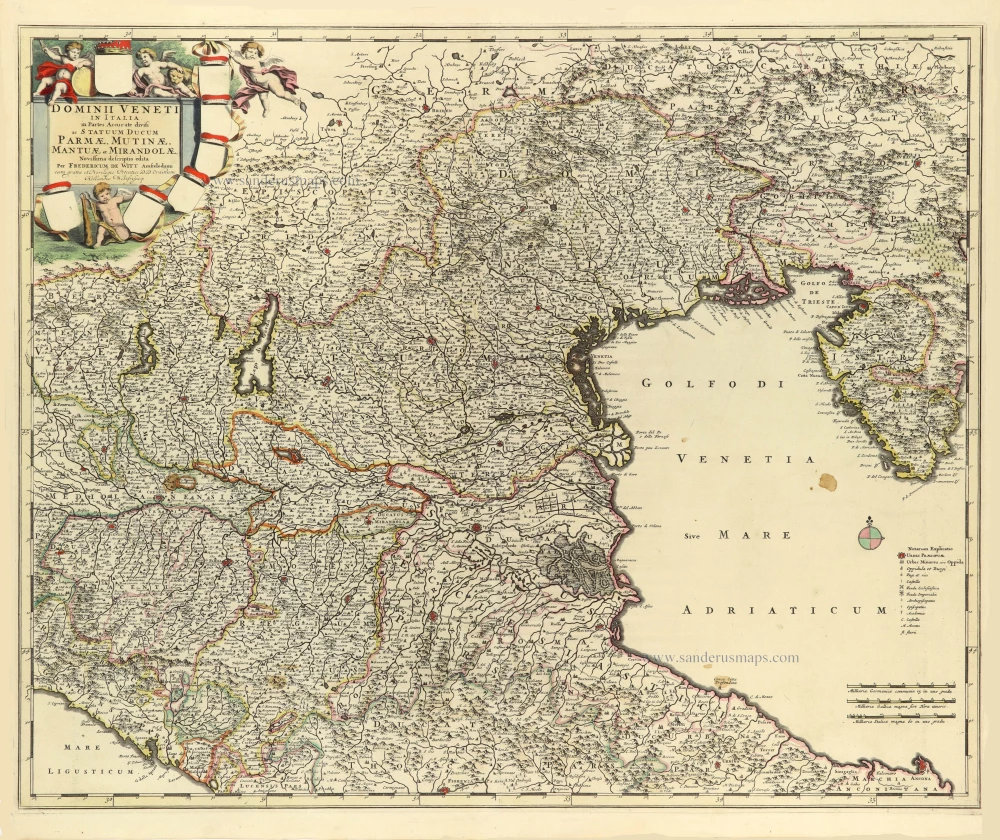
Dominii Veneti in Italia in Partes Accurate divisi ac Statuum Ducum Parmae, Mutinae, Mantuae et Mirandolae. 1691-96
Republic of Venice by Frederik de Wit.
[Item number: 32603]