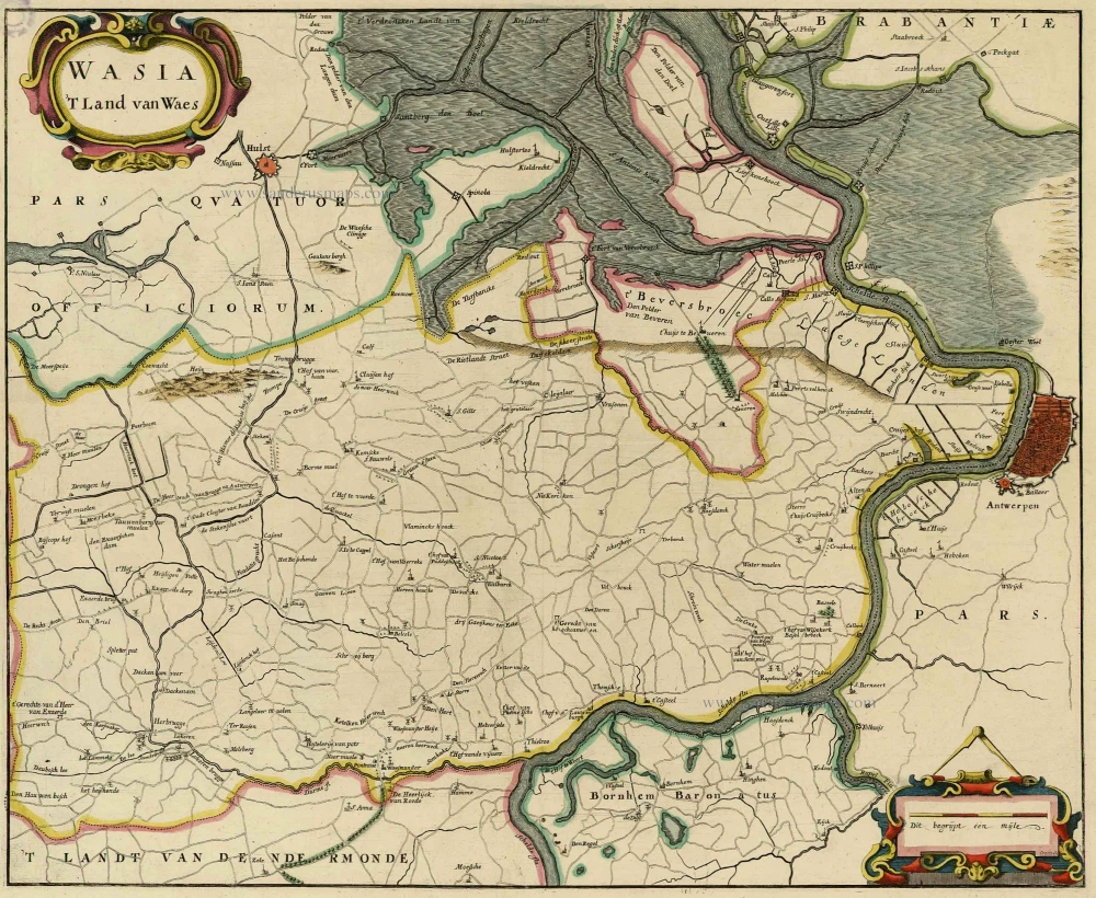
Land van Waas by E. Fricx, published by Pierre Husson. c. 1709


Pierre Husson (1678-1733)
Pierre (Pieter), a publisher in Den Haag, was a neighbour of Mrs Anna Beek, with whom he shared his interest in publishing plans of battlefields and fortifications during the War of Succession (1702-1713).
A collection of maps and plans by various authors was brought together in an atlas, to which was added the title page of Nicolas Visscher's Variae tabulae geographicae in quibus loca in orbe bello, now with the address of Pierre Husson.
Fricx Eugène (1644-c.1740)
The bookseller and printer Eugène Henri Fricx was one of the most crucial map publishers of the Southern Netherlands in the 18th century. He lived in Brussels, where he had his shop on the Rue de la Madeleine. His activities in this field began in 1706 with the production of military plans of battles and sieges during the War of Succession. In the same year, he also began publishing the map of the Southern Netherlands in 24 sheets; it was finished in 1712, except for the sheet of Luxembourg, which was engraved in 1727. He employed Jean Harrewijn of Brussels as an engraver and Cornelis Marke of Middelburg as a contractor for the 'enluminators'. Although he had children, his business was not continued after his death.
Carte particulière des environs d'Anvers, Gand, Hulst, et de tout le Pays de Waes, et le Marquisat du St Empire.
Item Number: 29593 Authenticity Guarantee
Category: Antique maps > Europe > Belgium
Antique map of "Land van Waas" by E. Fricx, published by Pierre Husson.
Title: Carte particulière des environs d'Anvers, Gand, Hulst, et de tout le Pays de Waes, et le Marquisat du St Empire.
Cartographer: E. Fricx.
Date: c. 1709.
Copper engraving, printed on paper.
Map size: 430 x 560mm (16.93 x 22.05 inches).
Sheet size: 510 x 610mm (20.08 x 24.02 inches).
Verso: Blank.
Condition: Original coloured, excellent.
Condition Rating: A+.
From: Variae tabulae geographicae un quibus loca in orbe bello flagrantia conspiciuntur ut in Flandria, Brabantia, Leodiensi Tractu, Germania, Hungaria, . . . Diverses cartes de geographie, où l'on peut voir le theatre de la guerre dans tout le monde. Comme dans les pais de Flandres, de Brabant, de Liège, d'Allemagne, de Hongrie, . . . Den Haag, P. Husson, s.d. (c. 1709). (Koeman II, p. 155, Hus1)
Pierre Husson (1678-1733)
Pierre (Pieter), a publisher in Den Haag, was a neighbour of Mrs Anna Beek, with whom he shared his interest in publishing plans of battlefields and fortifications during the War of Succession (1702-1713).
A collection of maps and plans by various authors was brought together in an atlas, to which was added the title page of Nicolas Visscher's Variae tabulae geographicae in quibus loca in orbe bello, now with the address of Pierre Husson.
Fricx Eugène (1644-c.1740)
The bookseller and printer Eugène Henri Fricx was one of the most crucial map publishers of the Southern Netherlands in the 18th century. He lived in Brussels, where he had his shop on the Rue de la Madeleine. His activities in this field began in 1706 with the production of military plans of battles and sieges during the War of Succession. In the same year, he also began publishing the map of the Southern Netherlands in 24 sheets; it was finished in 1712, except for the sheet of Luxembourg, which was engraved in 1727. He employed Jean Harrewijn of Brussels as an engraver and Cornelis Marke of Middelburg as a contractor for the 'enluminators'. Although he had children, his business was not continued after his death.