
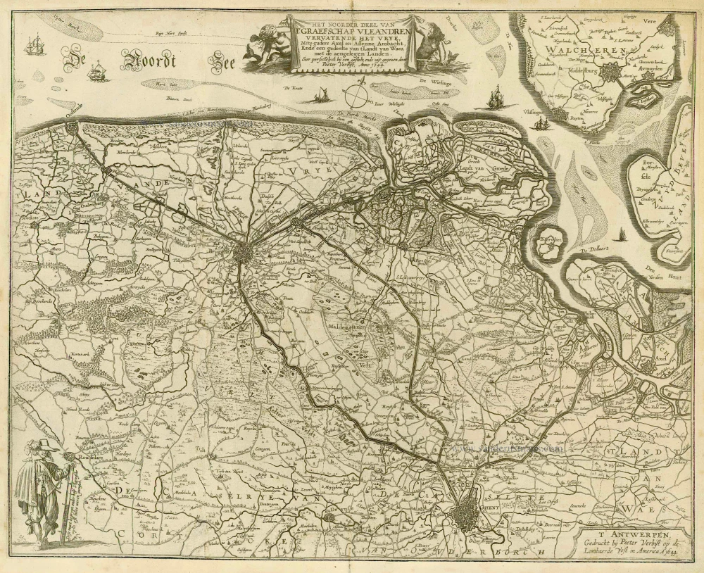
Antique map of Vlaanderen by Verbiest P. 1644
Pieter Verbiest (Petrus Verbist) and Isaak Verbiest (Isack Verbist)
Pieter Verbiest (Antwerpen, 1607-1674) was an Antwerp cartographer and engraver. Little is known about his life.
One of his most important works is the Novus Tabularum Geographicorum Belgicae (Antwerp, 1636), a pocket atlas of which two more editions were published later (1644 and 1652). Isaak Verbiest, probably a brother of Pieter, drew and engraved certain maps. Their collaboration also led to the production of two rare world maps.
Pieter Verbiest also published folio maps as separate publications. Koeman describes three editions of a Verbiest atlas of the Netherlands, published between 1636 and 1652. Only one copy of each of these atlases is known.
Verbiest-maps, some with beautiful decorative borders with city views, costumed figures and coats of arms, were sometimes bound in composite atlases. Occasionally, copies of these scarce maps come onto the market.
Het Noorder Deel van t'Graefschap Vleandren ... t'Antwerpen, Gedruckt bij Peeter Verbist op de Lombaerde Vest in America. Anno 1644
Item Number: 21558 Authenticity Guarantee
Category: Antique maps > Europe > Belgium
Copper engraving
Size: 40 x 50cm (16 x 20 inches)
Verso: Blank
Condition: Remargined and flattened.
Separate publication.
Pieter Verbiest (Petrus Verbist) and Isaak Verbiest (Isack Verbist)
Pieter Verbiest (Antwerpen, 1607-1674) was an Antwerp cartographer and engraver. Little is known about his life.
One of his most important works is the Novus Tabularum Geographicorum Belgicae (Antwerp, 1636), a pocket atlas of which two more editions were published later (1644 and 1652). Isaak Verbiest, probably a brother of Pieter, drew and engraved certain maps. Their collaboration also led to the production of two rare world maps.
Pieter Verbiest also published folio maps as separate publications. Koeman describes three editions of a Verbiest atlas of the Netherlands, published between 1636 and 1652. Only one copy of each of these atlases is known.
Verbiest-maps, some with beautiful decorative borders with city views, costumed figures and coats of arms, were sometimes bound in composite atlases. Occasionally, copies of these scarce maps come onto the market.