
Diocese of Liège, by Willem Blaeu. 1643


The Blaeus: Willem Janszoon, Cornelis & Joan
Willem Jansz. Blaeu and his son Joan Blaeu are the seventeenth century's most widely known cartographic publishers.
Willem Jansz. (also written Guilielmus Janssonius) = Willem Janszoon Blaeu was born in Uitgeest (Netherlands), near Alkmaar, in 1571. He studied mathematics under Tycho Brahe and learned the theory and practice of astronomical observations and the art of instrument- and globe-making.
In 1596, he came to Amsterdam, where he settled down as a globe-, instrument- and mapmaker. He published his first cartographic work (a globe) in 1599 and probably published his first printed map (a map of the Netherlands) in 1604. He specialised in maritime cartography, published the first edition of the pilot guide Het Licht der Zeevaert in 1608, and was appointed Hydrographer of the V.O.C. (United East India Company) in 1633. After publishing books, wall maps, globes, charts and pilot guides for thirty years, he brought out his first atlas, Atlas Appendix (1630). This was the beginning of the great tradition of atlas-making by the Blaeus.
In 1618, another mapmaker, bookseller and publisher, Johannes Janssonius, established himself in Amsterdam next door to Blaeu's shop. No wonder these two neighbours began accusing each other of copying and stealing their information and became fierce competitors who did not have a good word to say about each other. In about 1621 Willem Jansz. decided to end the confusion between his name and his competitor's and assumed his grandfather's nickname, 'blauwe Willem' ('blue Willem'), as the family name; after that, he called himself Willem Jansz. Blaeu.
Willem Janszoon Blaeu died in 1638, leaving his prospering business to his sons, Cornelis and Joan. We only know that Cornelis's name occurs in the prefaces of books and atlases until c. 1645.
Joan Blaeu, born in Amsterdam in 1596, became a partner in his father's book trade and printing business. 1638, he was appointed his father's successor in the Hydrographic Office of the V.O.C. His efforts culminated in the magnificent Atlas Major and the town books of the Netherlands and Italy – works unsurpassed in history and modern times, giving eternal fame to the name of the Blaeu's.
A fire ruined the business on February 23, 1672, and one year later, Dr. Joan Blaeu died. The fire and the director's passing caused the complete sale of the Blaeu House's stock. Five public auctions dispersed the remaining books, atlases, copperplates, globes, etc., among many other map dealers and publishers in Amsterdam. The majority was acquired by several booksellers acting in partnership.
In the succeeding years, the remaining printing department remained in the hands of the Blaeu family until 1695, when the printing house's inventory was sold at a public auction. That meant the end of the Blaeu family as a printing house of world renown.
Leodiensis Dioecesis.
Item Number: 29933 Authenticity Guarantee
Category: Antique maps > Europe > Belgium
Old, antique map of the diocese of Liège, by Willem Blaeu.
Title: Leodiensis Dioecesis.
Amsterdami Apud Guiljelmum et Joannem Blaeu.
Oriented to the West.
Date of the first edition: 1634.
Date of this map: 1643.
Copper engraving, printed on paper.
Image size: 380 x 500mm (14.96 x 19.69 inches).
Sheet size: 500 x 610mm (19.75 x 24.02 inches).
Verso: French text.
Condition: Original coloured, excellent.
Condition Rating: A+.
From: Le Theatre du Monde ou Nouvel Atlas contenant les Chartes et Descriptions de tous les Païs de la terre. Mis en lumiere Par Guillaume et Iean Blaeu. Amsterdam, Joan Blaeu, 1643. (Van der Krogt 2, 212.1F)
The Blaeus: Willem Janszoon, Cornelis & Joan
Willem Jansz. Blaeu and his son Joan Blaeu are the seventeenth century's most widely known cartographic publishers.
Willem Jansz. (also written Guilielmus Janssonius) = Willem Janszoon Blaeu was born in Uitgeest (Netherlands), near Alkmaar, in 1571. He studied mathematics under Tycho Brahe and learned the theory and practice of astronomical observations and the art of instrument- and globe-making.
In 1596, he came to Amsterdam, where he settled down as a globe-, instrument- and mapmaker. He published his first cartographic work (a globe) in 1599 and probably published his first printed map (a map of the Netherlands) in 1604. He specialised in maritime cartography, published the first edition of the pilot guide Het Licht der Zeevaert in 1608, and was appointed Hydrographer of the V.O.C. (United East India Company) in 1633. After publishing books, wall maps, globes, charts and pilot guides for thirty years, he brought out his first atlas, Atlas Appendix (1630). This was the beginning of the great tradition of atlas-making by the Blaeus.
In 1618, another mapmaker, bookseller and publisher, Johannes Janssonius, established himself in Amsterdam next door to Blaeu's shop. No wonder these two neighbours began accusing each other of copying and stealing their information and became fierce competitors who did not have a good word to say about each other. In about 1621 Willem Jansz. decided to end the confusion between his name and his competitor's and assumed his grandfather's nickname, 'blauwe Willem' ('blue Willem'), as the family name; after that, he called himself Willem Jansz. Blaeu.
Willem Janszoon Blaeu died in 1638, leaving his prospering business to his sons, Cornelis and Joan. We only know that Cornelis's name occurs in the prefaces of books and atlases until c. 1645.
Joan Blaeu, born in Amsterdam in 1596, became a partner in his father's book trade and printing business. 1638, he was appointed his father's successor in the Hydrographic Office of the V.O.C. His efforts culminated in the magnificent Atlas Major and the town books of the Netherlands and Italy – works unsurpassed in history and modern times, giving eternal fame to the name of the Blaeu's.
A fire ruined the business on February 23, 1672, and one year later, Dr. Joan Blaeu died. The fire and the director's passing caused the complete sale of the Blaeu House's stock. Five public auctions dispersed the remaining books, atlases, copperplates, globes, etc., among many other map dealers and publishers in Amsterdam. The majority was acquired by several booksellers acting in partnership.
In the succeeding years, the remaining printing department remained in the hands of the Blaeu family until 1695, when the printing house's inventory was sold at a public auction. That meant the end of the Blaeu family as a printing house of world renown.
Related items

Lüttich. 1726
Liège by D. Fassmann
[Item number: 6112]

Leodiensis Dioecesis Typus. 1598
Liège, by Abraham Ortelius.
[Item number: 6346]

Leodiensis Episcopatus in omnes subjacentes Provincias distincte divisus. 1683-1696
Liège, by N. Visscher II.
[Item number: 10967]

Leodiensis Episcopatus pars Media 1683-1696
Liège, by N. Visscher.
[Item number: 13094]

Scarce
Panorama von Lüttich - Panorama de Liége. c. 1840
Liège by Eisen F.C.
[Item number: 17581]

Liège. 1588
Liège by Ludovico Guicciardini.
[Item number: 18509]

Leodium 1612
Liège, by Georg Braun and Frans Hogenberg.
[Item number: 22308]

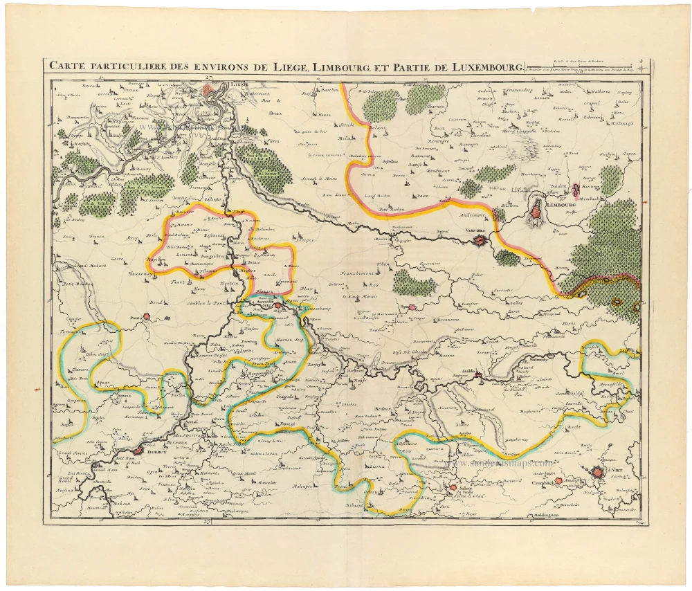
Carte Particulière des environs de Liège, Limbourg et Partie de Luxembourg. 1721-41
Liège, by Covens & Mortier.
[Item number: 23682]

Panorama de la ville de Liège pris de la tour appartenant ci-devant au Comte de Méan. 1836
Liège by Ch. Mozin.
[Item number: 25610]

Leodiensis Dioecesis Typus. 1623
Liège, by Jodocus Hondius.
[Item number: 27964]

Dioecesis Leodiensis Accurata Tabula. 1653
Diocese of Liège by Johannes Janssonius.
[Item number: 30372]

Leodiensis Dioecesis Typus. c. 1610-1650
Liège, by Jodocus Hondius.
[Item number: 31214]

Dioecesis Leodiensis Accurata Tabula. c. 1630-1650
Diocese of Liège by Henricus Hondius.
[Item number: 31215]
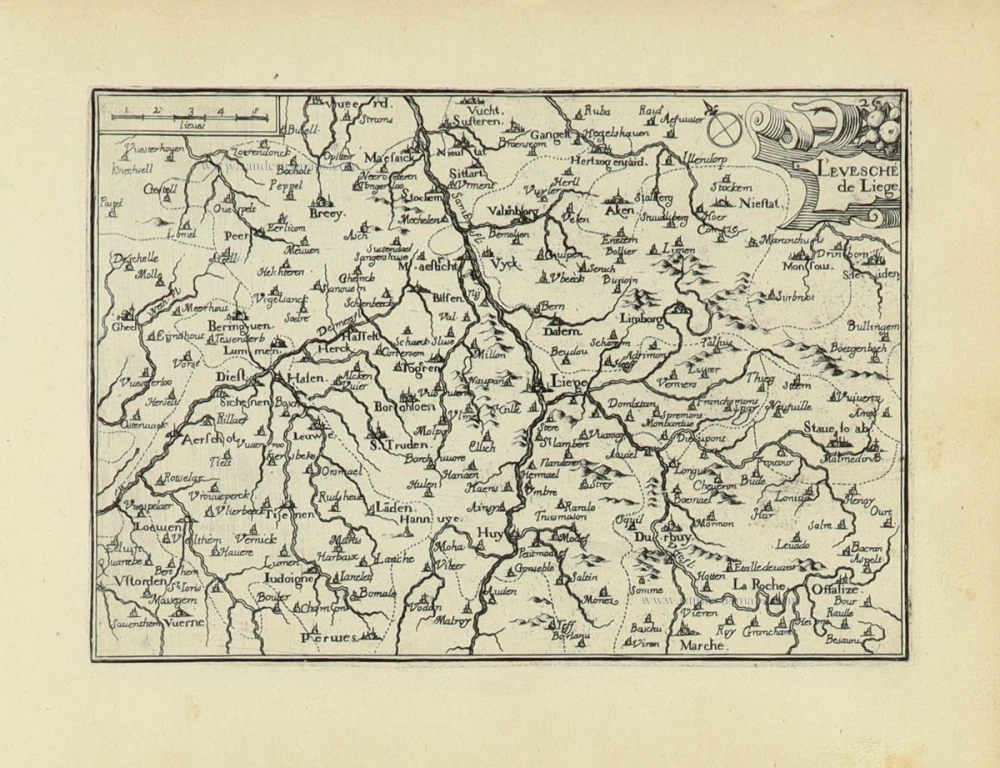
L'Evesché de Liège. 1633
Liège by Christophe Tassin.
[Item number: 31935]
Carte Particulière des environs de Liège, Limbourg, et partie de Luxembourg. 1712
Liège - Verviers - Durbuy, by E.H. Fricx.
[Item number: 32829]
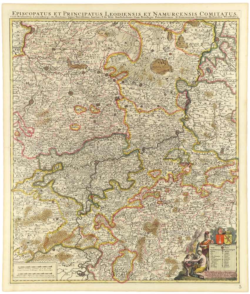
Episcopatus et Principatus Leodiensis et Namurcensis Comitatus, Cum Brabantiae, Luxemburgi etc. c. 1705-06
Liège - Namur, by Frederick de Wit.
[Item number: 33158]