
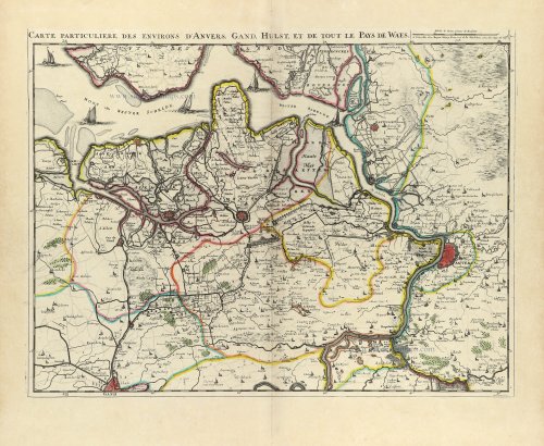
Westerschelde -Waasland
Land van Waas by E.H. Fricx. 1712


Fricx Eugène (1644-c.1740)
The bookseller and printer Eugène Henri Fricx was one of the most crucial map publishers of the Southern Netherlands in the 18th century. He lived in Brussels, where he had his shop on the Rue de la Madeleine. His activities in this field began in 1706 with the production of military plans of battles and sieges during the War of Succession. In the same year, he also began publishing the map of the Southern Netherlands in 24 sheets; it was finished in 1712, except for the sheet of Luxembourg, which was engraved in 1727. He employed Jean Harrewijn of Brussels as an engraver and Cornelis Marke of Middelburg as a contractor for the 'enluminators'. Although he had children, his business was not continued after his death.
Carte Particulière des environs d'Anvers, Gand, Hulst, et de tout le Pays de Waes.
Item Number: 32591 Authenticity Guarantee
Category: Antique maps > Europe > Belgium
Land van Waas by E.H. Fricx.
Title: Carte Particulière des environs d'Anvers, Gand, Hulst, et de tout le Pays de Waes.
A Bruselles chez Eugen Henry Fricx rue de la Madelene avec Privilege du Roy 1708
Harrewyn fecit.
Engraver: Jean Harrewijn.
Date of the first edition: 1708.
Date of this map: 1712.
Date on map: 1708.
Copper engraving, printed on paper.
Image size (title included): 420 x 550mm (16½ x 21¾ inches).
Sheet size: 530 x 625mm (20¾ x 24½ inches).
Verso: Blank.
Condition: Original coloured, excellent.
Condition Rating: A+.
From: Table des cartes des Pays Bas et des Frontières de France, Avec un recueil des plans des villes, sièges et battailles données entre les Hauts Alliés et la France. Bruxelles, H. Fricx, 1712.
Fricx Eugène (1644-c.1740)
The bookseller and printer Eugène Henri Fricx was one of the most crucial map publishers of the Southern Netherlands in the 18th century. He lived in Brussels, where he had his shop on the Rue de la Madeleine. His activities in this field began in 1706 with the production of military plans of battles and sieges during the War of Succession. In the same year, he also began publishing the map of the Southern Netherlands in 24 sheets; it was finished in 1712, except for the sheet of Luxembourg, which was engraved in 1727. He employed Jean Harrewijn of Brussels as an engraver and Cornelis Marke of Middelburg as a contractor for the 'enluminators'. Although he had children, his business was not continued after his death.
Related items
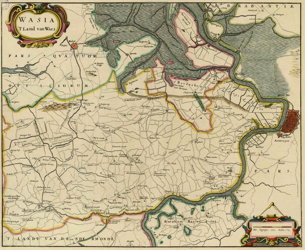
Wasia. 't Land van Waes. 1732
Land van Waas by Antonius Sanderus.
[Item number: 20792]

Carte tres-particuliere du Paijs de Waes, ou sont marqués les Lignes depuis Anvers jusques à Gand. 1712
Land van Waas by Eugène Fricx.
[Item number: 29545]

Wasia. 't Land van Waes. 1644
Land van Waas by Antonius Sanderus.
[Item number: 29997]

Wasia. 't Land van Waes. 1662
Land van Waas by Antonius Sanderus, published by Joan Blaeu.
[Item number: 31255]

Carte Particulière des environs de Bruxelles avec le Bois de Soigne et d'une partie de la Flandre jusques à Gand. 1712
Aalst - Brussels by E.H. Fricx.
[Item number: 32595]