
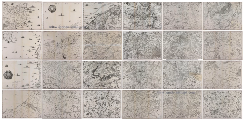
Wall map of the Southern Netherlands, by Eugene Fricx. 1744
Fricx Eugène (1644-c.1740)
The bookseller and printer Eugène Henri Fricx was one of the most crucial map publishers of the Southern Netherlands in the 18th century. He lived in Brussels, where he had his shop on the Rue de la Madeleine. His activities in this field started in 1706 with the production of military plans of battles and sieges of the War of Succession. In the same year, he also started the publication of the map of the Southern Netherlands in 24 sheets; it was finished in 1712, apart from the sheet Luxembourg, which was engraved in 1727. He employed Jean Harrewijn of Brussels as an engraver and Cornelis Marke of Middelburg as a contractor for the 'enluminators'. Although he had children, his business was not continued after his death.
[No title.]
Item Number: 29537 Authenticity Guarantee
Category: Antique maps > Europe > Belgium
Old, antique wall map of the Southern Netherlands, by Eugene Fricx.
Composed of 24 sheets, most of which have a separate title to be cut off when joined.
[No title.]
Date of the first edition: 1712.
Date of this map: 1744.
Date on map(s): 1744.
Copper engraving, printed on paper.
Size each map: 410 x 575mm (16.14 x 22.64 inches).
Size each sheet: 164 x 610mm (18.11 x 24.02 inches).
Total size when assembled: 246 x 345cm (97 x 136 inches).
Verso: Blank.
Condition: 24 loose sheets, excellent.
Condition Rating: A+.
From: Carte des Provinces des Pays Bas, contenant les Comtés de Flandre, de Hainault, de Cambresis, le Duché de Brabant, partie des Duchés de Luxembourg, de Limbourg, de Juliers, l'évêché de Liège, Boulebois et frontière de Picardie. Dressée sur les mémoires de E.H. Fricx. Crepy: Paris, 1744. (Koeman II, p. 110, Fri 2A)
Fricx Eugène (1644-c.1740)
The bookseller and printer Eugène Henri Fricx was one of the most crucial map publishers of the Southern Netherlands in the 18th century. He lived in Brussels, where he had his shop on the Rue de la Madeleine. His activities in this field started in 1706 with the production of military plans of battles and sieges of the War of Succession. In the same year, he also started the publication of the map of the Southern Netherlands in 24 sheets; it was finished in 1712, apart from the sheet Luxembourg, which was engraved in 1727. He employed Jean Harrewijn of Brussels as an engraver and Cornelis Marke of Middelburg as a contractor for the 'enluminators'. Although he had children, his business was not continued after his death.
Related items
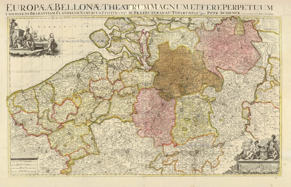
Europae (Ae) Bellonae Theatrum Magnum et Fere Perpetuum continens Brabantiam, Flandriam, Namurcum finitimasque Praefecturas ac Toparchias. c. 1730-1760
Southern Netherlands, by Petrus Schenk.
[Item number: 28008]
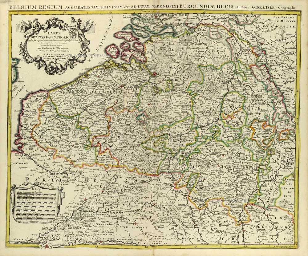
Carte des Pays Bas Catholiques. [Title above map:] Belgium Regium Accuratissime divisum. &c. ad usum serenissimi Burgundiae Ducis. Aythore G. De L'Isle, Geographe. ca. 1730.
Southern Netherlands by G. De L'Isle, published by Covens & Mortier.
[Item number: 28338]
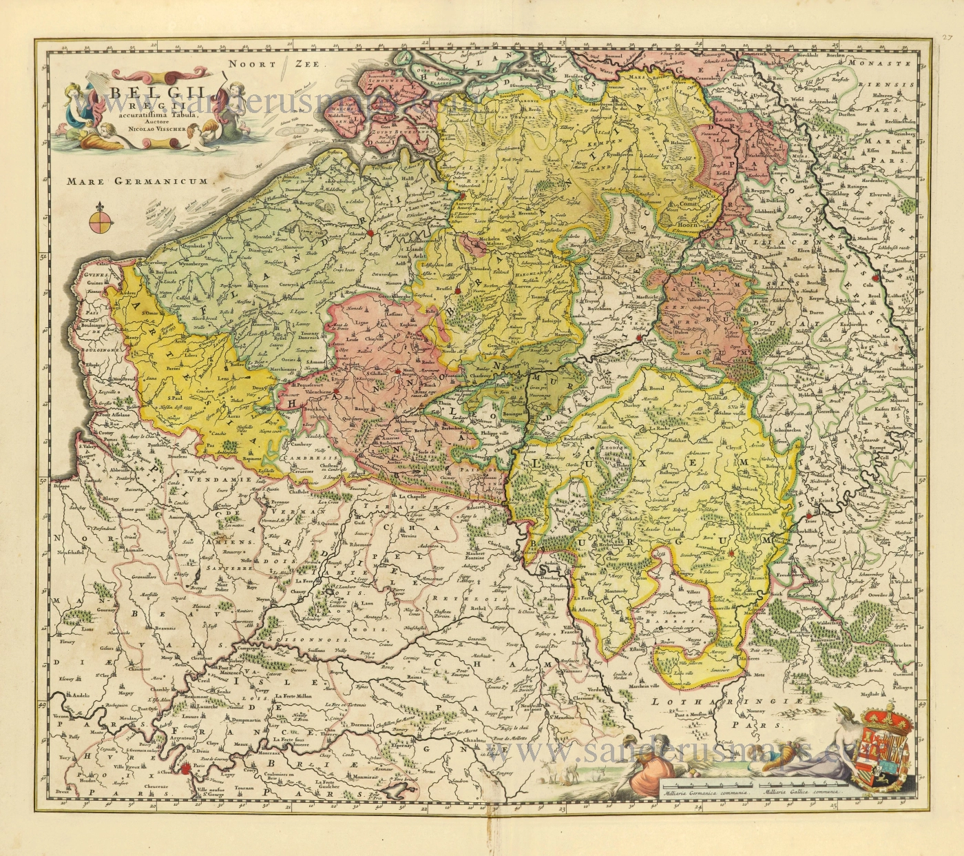
Belgii Regii accuratissima Tabula. c. 1678
Southern Netherlands (Zuidelijke Nederlanden) by Nicolaes Visscher I.
[Item number: 28518]