
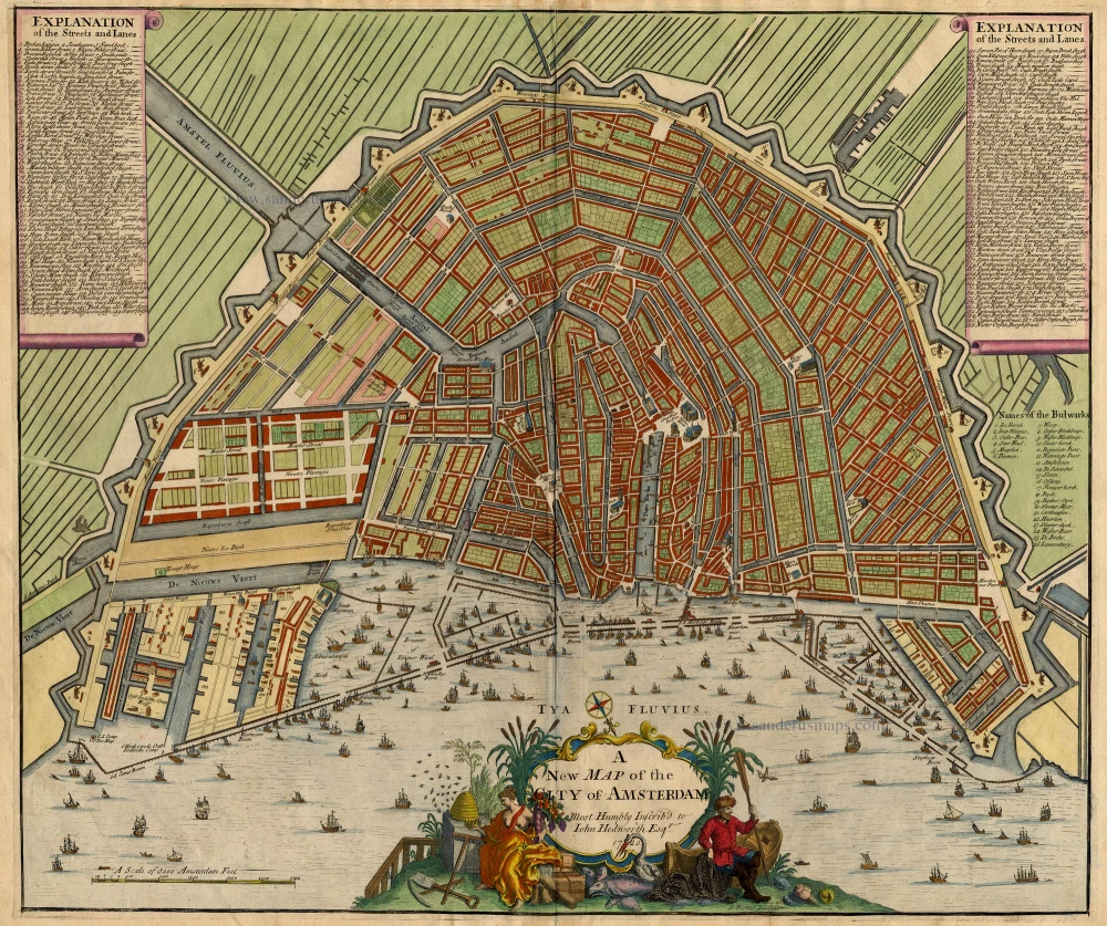
Antique map of Amsterdam by J. Senex 1720
John Senex (c. 1678 - 1740)
John Senex was an engraver and map seller, later cultivating his scientific interests as a maker of instruments and globes. He apprenticed to London bookseller Robert Clavell in 1695. By 1702, he had set up in business by himself. From about 1706 to 1711, he was in association with the London publisher Charles Price, and together they produced sets of large-sized maps. The partnership between Senex and Price split up in 1710, with Senex being joined by John Maxwell and Price collaborating with George Willdey. Later collections of the double-folio maps carry the imprint of Senex and Maxwell, culminating in their joint English Atlas of 1714.
As well as compiling general atlases, Senex produced a popular book of strip road maps based on Ogilby and engraved the maps used in several editions of Patrick Gordon's Geography Anatomiz'd. Senex also contributed to the Atlas Maritimus.
A new map of the City of Amsterdam
Item Number: 18551 Authenticity Guarantee
Category: Antique maps > Europe > The Netherlands
Copper engraving
Size: 49 x 58.5cm (19.1 x 22.8 inches)
Verso: Blank
Condition: Old coloured.
John Senex (c. 1678 - 1740)
John Senex was an engraver and map seller, later cultivating his scientific interests as a maker of instruments and globes. He apprenticed to London bookseller Robert Clavell in 1695. By 1702, he had set up in business by himself. From about 1706 to 1711, he was in association with the London publisher Charles Price, and together they produced sets of large-sized maps. The partnership between Senex and Price split up in 1710, with Senex being joined by John Maxwell and Price collaborating with George Willdey. Later collections of the double-folio maps carry the imprint of Senex and Maxwell, culminating in their joint English Atlas of 1714.
As well as compiling general atlases, Senex produced a popular book of strip road maps based on Ogilby and engraved the maps used in several editions of Patrick Gordon's Geography Anatomiz'd. Senex also contributed to the Atlas Maritimus.