
's Hertogenbosch, by Georg Braun and Frans Hogenberg. 1572-1624


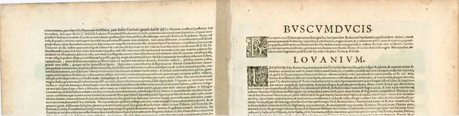


TRANSLATION OF CARTOUCHE TEXT: The town of 's Hertogenbosch is known for its school and its belligerent populace, who raised their weapons more than once in the past against the people of Guelders. Here stands a magnificent church of Our Lady (Hadrianus Barlandus).
COMMENTARY BY BRAUN: "'s-Hertogenbosch takes its name from the woods and "bushes" that this place formerly possessed at the time of the Duke of Brabant; it is considered one of the four noblest towns in all of Brabant; it has a school, a large number of inhabitants and solid buildings and is considered important and noble on account of its valiant people. There is also a richly decorated church with a splendid clock here."
's-Hertogenbosch was granted a municipal charter in 1185, and in the late Middle Ages, it was a market centre for farmers from the surrounding region, who traded here in linen spun from flax and cloth woven from wool. Besides having been a centre of the cloth industry, 's-Hertogenbosch was a distribution point for wine, fish and sandstone and was of cultural significance: the painter Hieronymus Bosch lived and worked here, and the humanist Georgius Macropedius, really Joris van Lanckfelt, was a teacher at the Latin school in 's-Hertogenbosch. Situated on a sandy ridge in the middle of marshes and strongly fortified, this strategically important city was for a long time considered impregnable. The Dutch Revolt in the 16th century ended the economic prosperity it enjoyed in the late Middle Ages. (Taschen)
Braun G. & Hogenberg F. and the Civitates Orbis Terrarum.
The Civitates Orbis Terrarum, also known as the 'Braun & Hogenberg', is a six-volume town atlas and the most excellent book of town views and plans ever published: 363 engravings, sometimes beautifully coloured. It was one of the best-selling works in the last quarter of the 16th century. Georg Braun, a skilled writer, wrote the text accompanying the plans and views on the verso. Many plates were engraved after the original drawings of a professional artist, Joris Hoefnagel (1542-1600). The first volume was published in Latin in 1572 and the sixth in 1617. Frans Hogenberg, a talented engraver, created the tables for volumes I through IV, and Simon van den Neuwel made those for volumes V and VI. Other contributors were cartographers Daniel Freese and Heinrich Rantzau, who provided valuable geographical information. Works by Jacob van Deventer, Sebastian Münster, and Johannes Stumpf were also used as references. Translations appeared in German and French, making the atlas accessible to a broader audience.
Since its original publication of volume 1 in 1572, the Civitates Orbis Terrarum has left an indelible mark on the history of cartography. Seven more editions followed the first volume in 1575, 1577, 1582, 1588, 1593, 1599, and 1612. Vol.2, initially released in 1575, saw subsequent editions in 1597 and 1612. The subsequent volumes, each a treasure trove of historical insights, graced the world in 1581, 1588, 1593, 1599, and 1606. The German translation of the first volume, a testament to its widespread appeal, debuted in 1574, followed by the French edition in 1575.
Several printers were involved: Theodor Graminaeus, Heinrich von Aich, Gottfried von Kempen, Johannis Sinniger, Bertram Buchholtz, and Peter von Brachel, all of whom worked in Cologne.
Georg Braun (1541-1622)
Georg Braun, the author of the text accompanying the plans and views in the Civitates Orbis Terrarum, was born in Cologne in 1541. After his studies in Cologne, he entered the Jesuit Order as a novice, indicating his commitment to learning and intellectual pursuits. In 1561, he obtained his bachelor's degree; in 1562, he received his Magister Artium, further demonstrating his academic achievements. Although he left the Jesuit Order, he continued his studies in theology, gaining a licentiate in theology. His theological background likely influenced the content and tone of the text in the Civitates Orbis Terrarum, adding a unique perspective to the work.
Frans Hogenberg (1535-1590)
Frans Hogenberg was a Flemish and German painter, engraver, and mapmaker. He was born in Mechelen as the son of Nicolaas Hogenberg.
By the end of the 1560s, Frans Hogenberg was employed upon Abraham Ortelius's Theatrum Orbis Terrarum, published in 1570; he is named an engraver of numerous maps. In 1568, he was banned from Antwerp by the Duke of Alva and travelled to London, where he stayed a few years before emigrating to Cologne. He immediately embarked on his two most important works, the Civitates, published in 1572 and the Geschichtsblätter, which appeared in several series from 1569 until about 1587.
Thanks to large-scale projects like the Geschichtsblätter and the Civitates, Hogenberg's social circumstances improved with each passing year. He died as a wealthy man in Cologne in 1590.
Tshertogenbosch - Buscumducis oppidum ludo Literario, ...
Item Number: 4235 Authenticity Guarantee
Category: Antique maps > Europe > The Netherlands - Cities
Old, antique panoramic view of 's Hertogenbosch, by Georg Braun and Frans Hogenberg.
Title: Tshertogenbosch - Buscumducis oppidum ludo Literario, ...
Date of the first edition: 1572.
Date of this map: 1572-1624.
Copper engraving, printed on paper.
Size (not including margins): 110 x 480mm (4.33 x 18.9 inches).
Verso: Latin text.
Condition: Old coloured, excellent.
Condition Rating: A.
From: Civitates Orbis Terrarum, ... Part 1. Köln, 1572-1624. (Van der Krogt 4, 41:1.1)
TRANSLATION OF CARTOUCHE TEXT: The town of 's Hertogenbosch is known for its school and its belligerent populace, who raised their weapons more than once in the past against the people of Guelders. Here stands a magnificent church of Our Lady (Hadrianus Barlandus).
COMMENTARY BY BRAUN: "'s-Hertogenbosch takes its name from the woods and "bushes" that this place formerly possessed at the time of the Duke of Brabant; it is considered one of the four noblest towns in all of Brabant; it has a school, a large number of inhabitants and solid buildings and is considered important and noble on account of its valiant people. There is also a richly decorated church with a splendid clock here."
's-Hertogenbosch was granted a municipal charter in 1185, and in the late Middle Ages, it was a market centre for farmers from the surrounding region, who traded here in linen spun from flax and cloth woven from wool. Besides having been a centre of the cloth industry, 's-Hertogenbosch was a distribution point for wine, fish and sandstone and was of cultural significance: the painter Hieronymus Bosch lived and worked here, and the humanist Georgius Macropedius, really Joris van Lanckfelt, was a teacher at the Latin school in 's-Hertogenbosch. Situated on a sandy ridge in the middle of marshes and strongly fortified, this strategically important city was for a long time considered impregnable. The Dutch Revolt in the 16th century ended the economic prosperity it enjoyed in the late Middle Ages. (Taschen)
Braun G. & Hogenberg F. and the Civitates Orbis Terrarum.
The Civitates Orbis Terrarum, also known as the 'Braun & Hogenberg', is a six-volume town atlas and the most excellent book of town views and plans ever published: 363 engravings, sometimes beautifully coloured. It was one of the best-selling works in the last quarter of the 16th century. Georg Braun, a skilled writer, wrote the text accompanying the plans and views on the verso. Many plates were engraved after the original drawings of a professional artist, Joris Hoefnagel (1542-1600). The first volume was published in Latin in 1572 and the sixth in 1617. Frans Hogenberg, a talented engraver, created the tables for volumes I through IV, and Simon van den Neuwel made those for volumes V and VI. Other contributors were cartographers Daniel Freese and Heinrich Rantzau, who provided valuable geographical information. Works by Jacob van Deventer, Sebastian Münster, and Johannes Stumpf were also used as references. Translations appeared in German and French, making the atlas accessible to a broader audience.
Since its original publication of volume 1 in 1572, the Civitates Orbis Terrarum has left an indelible mark on the history of cartography. Seven more editions followed the first volume in 1575, 1577, 1582, 1588, 1593, 1599, and 1612. Vol.2, initially released in 1575, saw subsequent editions in 1597 and 1612. The subsequent volumes, each a treasure trove of historical insights, graced the world in 1581, 1588, 1593, 1599, and 1606. The German translation of the first volume, a testament to its widespread appeal, debuted in 1574, followed by the French edition in 1575.
Several printers were involved: Theodor Graminaeus, Heinrich von Aich, Gottfried von Kempen, Johannis Sinniger, Bertram Buchholtz, and Peter von Brachel, all of whom worked in Cologne.
Georg Braun (1541-1622)
Georg Braun, the author of the text accompanying the plans and views in the Civitates Orbis Terrarum, was born in Cologne in 1541. After his studies in Cologne, he entered the Jesuit Order as a novice, indicating his commitment to learning and intellectual pursuits. In 1561, he obtained his bachelor's degree; in 1562, he received his Magister Artium, further demonstrating his academic achievements. Although he left the Jesuit Order, he continued his studies in theology, gaining a licentiate in theology. His theological background likely influenced the content and tone of the text in the Civitates Orbis Terrarum, adding a unique perspective to the work.
Frans Hogenberg (1535-1590)
Frans Hogenberg was a Flemish and German painter, engraver, and mapmaker. He was born in Mechelen as the son of Nicolaas Hogenberg.
By the end of the 1560s, Frans Hogenberg was employed upon Abraham Ortelius's Theatrum Orbis Terrarum, published in 1570; he is named an engraver of numerous maps. In 1568, he was banned from Antwerp by the Duke of Alva and travelled to London, where he stayed a few years before emigrating to Cologne. He immediately embarked on his two most important works, the Civitates, published in 1572 and the Geschichtsblätter, which appeared in several series from 1569 until about 1587.
Thanks to large-scale projects like the Geschichtsblätter and the Civitates, Hogenberg's social circumstances improved with each passing year. He died as a wealthy man in Cologne in 1590.
Related items
Icon civitatis Campensis, cuius situs Isulam fluvium, eleganti venustate, decorat 1575
Kampen, by Georg Braun and Frans Hogenberg.
[Item number: 9364]

Dordrecht 1599
Dordrecht, by Georg Braun and Frans Hogenberg.
[Item number: 24043]
First edition
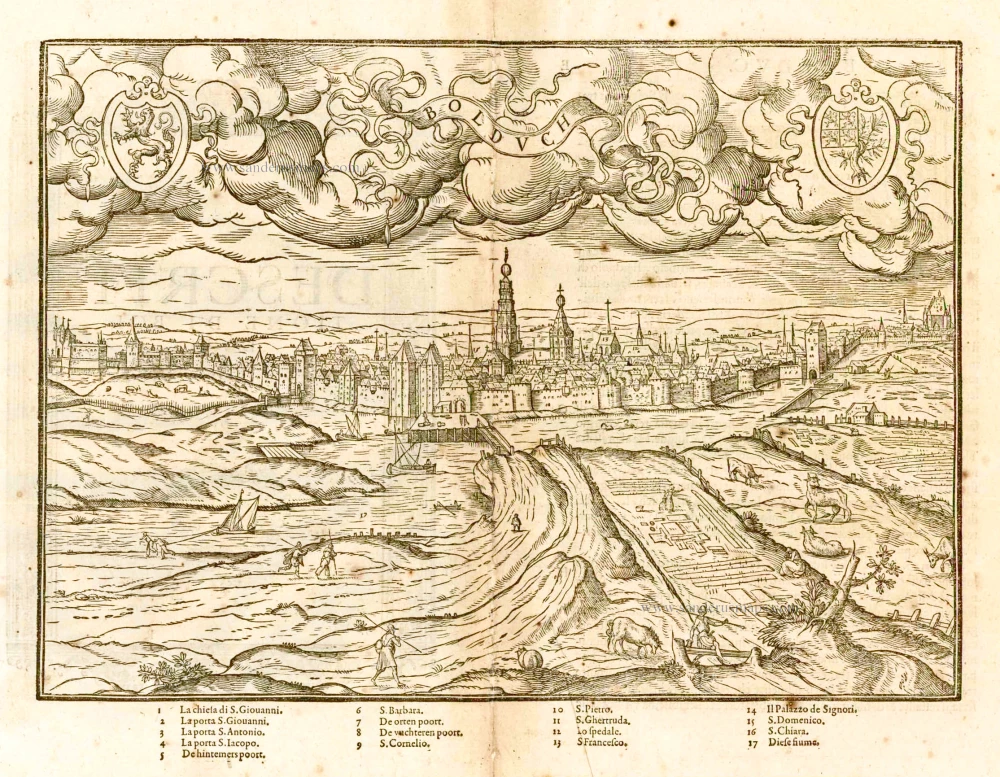
Bolduch. 1567
's-Hertogenbosch by L. Guicciardini
[Item number: 25198]

s' Hertogenbosch. 1656
's-Hertogenbosch by Visscher N. - Schut P.H.
[Item number: 25370]

A print of the 'Geschichtsblätter'
Hertzogen Busch - Eigentliche abcontrafactur der weitberumbten stat Hertzogen Bosch in Brabant gelegen, 1601-1612
Siege of s' Hertogenbosch by Maurice of Orange, published by Frans Hogenberg (Atelier)..
[Item number: 29947]

First edition
Bolduch. 1567
's-Hertogenbosch by L. Guicciardini
[Item number: 30815]

Tshertogenbosch - Buscumducis oppidum ludo literario, et pugnaci populo nobile Horum arma superiorib. annis haud semel Geldrij sensere, ... 1609
's-Hertogenbosch by Lodovico Guicciardini
[Item number: 32854]