
Kampen, by Georg Braun and Frans Hogenberg. 1575
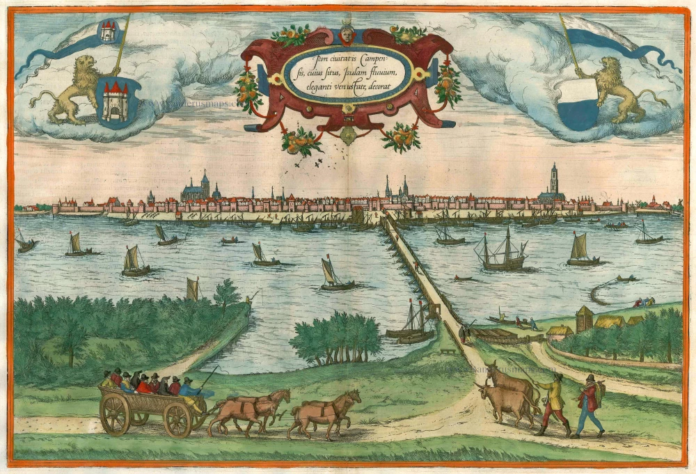

TRANSLATION OF CARTOUCHE TEXT: Picture of the city of Kampen, the beautiful and charming appearance of which embellishes the IJssel.
COMMENTARY BY BRAUN: "Kampen lies on the bank of the IJssel, not far from its mouth, well laid out in an attractive place with splendid buildings. Kampen is also a trade city [...], an honest community and a solid alliance of many cities, towns, villages, for the benefit of trade by water and on land."
The bird's-eye view shows Kampen, which was an important trade centre from the 13th to the 17th century thanks to its favourable geographical location on the IJssel. The former wealth of this Hanseatic city is attested for instance by the magnificent Gothic Sint-Nicolaaskerk. The church tower in line with the bridge over the IJssel belongs to the Broederkerk, a Dutch Reformed church, which was once part of a monastery dating from the 15th century. The Onze-Lieve-Vrouwekerk or Buitenkerk rises up on the right. (Taschen)
Braun G. & Hogenberg F. and the Civitates Orbis Terrarum.
The Civitates Orbis Terrarum, also known as the 'Braun & Hogenberg', is a six-volume town atlas and the most excellent book of town views and plans ever published: 363 engravings, sometimes beautifully coloured. It was one of the best-selling works in the last quarter of the 16th century. Georg Braun, a skilled writer, wrote the text accompanying the plans and views on the verso. Many plates were engraved after the original drawings of a professional artist, Joris Hoefnagel (1542-1600). The first volume was published in Latin in 1572 and the sixth in 1617. Frans Hogenberg, a talented engraver, created the tables for volumes I through IV, and Simon van den Neuwel made those for volumes V and VI. Other contributors were cartographers Daniel Freese and Heinrich Rantzau, who provided valuable geographical information. Works by Jacob van Deventer, Sebastian Münster, and Johannes Stumpf were also used as references. Translations appeared in German and French, making the atlas accessible to a broader audience.
Since its original publication of volume 1 in 1572, the Civitates Orbis Terrarum has left an indelible mark on the history of cartography. Seven more editions followed the first volume in 1575, 1577, 1582, 1588, 1593, 1599, and 1612. Vol.2, initially released in 1575, saw subsequent editions in 1597 and 1612. The subsequent volumes, each a treasure trove of historical insights, graced the world in 1581, 1588, 1593, 1599, and 1606. The German translation of the first volume, a testament to its widespread appeal, debuted in 1574, followed by the French edition in 1575.
Several printers were involved: Theodor Graminaeus, Heinrich von Aich, Gottfried von Kempen, Johannis Sinniger, Bertram Buchholtz, and Peter von Brachel, all of whom worked in Cologne.
Georg Braun (1541-1622)
Georg Braun, the author of the text accompanying the plans and views in the Civitates Orbis Terrarum, was born in Cologne in 1541. After his studies in Cologne, he entered the Jesuit Order as a novice, indicating his commitment to learning and intellectual pursuits. In 1561, he obtained his bachelor's degree; in 1562, he received his Magister Artium, further demonstrating his academic achievements. Although he left the Jesuit Order, he continued his studies in theology, gaining a licentiate in theology. His theological background likely influenced the content and tone of the text in the Civitates Orbis Terrarum, adding a unique perspective to the work.
Frans Hogenberg (1535-1590)
Frans Hogenberg was a Flemish and German painter, engraver, and mapmaker. He was born in Mechelen as the son of Nicolaas Hogenberg.
By the end of the 1560s, Frans Hogenberg was employed upon Abraham Ortelius's Theatrum Orbis Terrarum, published in 1570; he is named an engraver of numerous maps. In 1568, he was banned from Antwerp by the Duke of Alva and travelled to London, where he stayed a few years before emigrating to Cologne. He immediately embarked on his two most important works, the Civitates, published in 1572 and the Geschichtsblätter, which appeared in several series from 1569 until about 1587.
Thanks to large-scale projects like the Geschichtsblätter and the Civitates, Hogenberg's social circumstances improved with each passing year. He died as a wealthy man in Cologne in 1590.
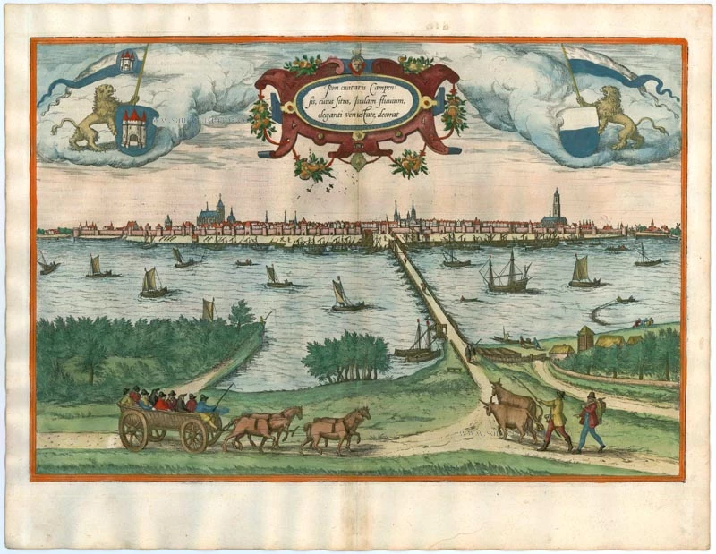
Icon civitatis Campensis, cuius situs Isulam fluvium, eleganti venustate, decorat
Item Number: 9364 Authenticity Guarantee
Category: Antique maps > Europe > The Netherlands - Cities
Old, antique bird’s-eye view of Kampen, by Georg Braun and Frans Hogenberg.
Title: Icon civitatis Campensis, cuius situs Isulam fluvium, eleganti venustate, decorat
Date of the first edition: 1575.
Date of this map: 1575.
Copper engraving, printed on paper.
Size (not including margins): 330 x 485mm (12.99 x 19.09 inches).
Verso: Latin text.
Condition: Old coloured, centrefold reinforced.
Condition Rating: A.
From: Civitates Orbis Terrarum, ... Part 2: De Praecipuis, Totius Universi Urbibus, Liber Secundus. Köln, Gottfried von Kempen, 1575. (Van der Krogt 4, 41:1.2)
TRANSLATION OF CARTOUCHE TEXT: Picture of the city of Kampen, the beautiful and charming appearance of which embellishes the IJssel.
COMMENTARY BY BRAUN: "Kampen lies on the bank of the IJssel, not far from its mouth, well laid out in an attractive place with splendid buildings. Kampen is also a trade city [...], an honest community and a solid alliance of many cities, towns, villages, for the benefit of trade by water and on land."
The bird's-eye view shows Kampen, which was an important trade centre from the 13th to the 17th century thanks to its favourable geographical location on the IJssel. The former wealth of this Hanseatic city is attested for instance by the magnificent Gothic Sint-Nicolaaskerk. The church tower in line with the bridge over the IJssel belongs to the Broederkerk, a Dutch Reformed church, which was once part of a monastery dating from the 15th century. The Onze-Lieve-Vrouwekerk or Buitenkerk rises up on the right. (Taschen)
Braun G. & Hogenberg F. and the Civitates Orbis Terrarum.
The Civitates Orbis Terrarum, also known as the 'Braun & Hogenberg', is a six-volume town atlas and the most excellent book of town views and plans ever published: 363 engravings, sometimes beautifully coloured. It was one of the best-selling works in the last quarter of the 16th century. Georg Braun, a skilled writer, wrote the text accompanying the plans and views on the verso. Many plates were engraved after the original drawings of a professional artist, Joris Hoefnagel (1542-1600). The first volume was published in Latin in 1572 and the sixth in 1617. Frans Hogenberg, a talented engraver, created the tables for volumes I through IV, and Simon van den Neuwel made those for volumes V and VI. Other contributors were cartographers Daniel Freese and Heinrich Rantzau, who provided valuable geographical information. Works by Jacob van Deventer, Sebastian Münster, and Johannes Stumpf were also used as references. Translations appeared in German and French, making the atlas accessible to a broader audience.
Since its original publication of volume 1 in 1572, the Civitates Orbis Terrarum has left an indelible mark on the history of cartography. Seven more editions followed the first volume in 1575, 1577, 1582, 1588, 1593, 1599, and 1612. Vol.2, initially released in 1575, saw subsequent editions in 1597 and 1612. The subsequent volumes, each a treasure trove of historical insights, graced the world in 1581, 1588, 1593, 1599, and 1606. The German translation of the first volume, a testament to its widespread appeal, debuted in 1574, followed by the French edition in 1575.
Several printers were involved: Theodor Graminaeus, Heinrich von Aich, Gottfried von Kempen, Johannis Sinniger, Bertram Buchholtz, and Peter von Brachel, all of whom worked in Cologne.
Georg Braun (1541-1622)
Georg Braun, the author of the text accompanying the plans and views in the Civitates Orbis Terrarum, was born in Cologne in 1541. After his studies in Cologne, he entered the Jesuit Order as a novice, indicating his commitment to learning and intellectual pursuits. In 1561, he obtained his bachelor's degree; in 1562, he received his Magister Artium, further demonstrating his academic achievements. Although he left the Jesuit Order, he continued his studies in theology, gaining a licentiate in theology. His theological background likely influenced the content and tone of the text in the Civitates Orbis Terrarum, adding a unique perspective to the work.
Frans Hogenberg (1535-1590)
Frans Hogenberg was a Flemish and German painter, engraver, and mapmaker. He was born in Mechelen as the son of Nicolaas Hogenberg.
By the end of the 1560s, Frans Hogenberg was employed upon Abraham Ortelius's Theatrum Orbis Terrarum, published in 1570; he is named an engraver of numerous maps. In 1568, he was banned from Antwerp by the Duke of Alva and travelled to London, where he stayed a few years before emigrating to Cologne. He immediately embarked on his two most important works, the Civitates, published in 1572 and the Geschichtsblätter, which appeared in several series from 1569 until about 1587.
Thanks to large-scale projects like the Geschichtsblätter and the Civitates, Hogenberg's social circumstances improved with each passing year. He died as a wealthy man in Cologne in 1590.
Related items

Tshertogenbosch - Buscumducis oppidum ludo Literario, ... 1572-1624
's Hertogenbosch, by Georg Braun and Frans Hogenberg.
[Item number: 4235]
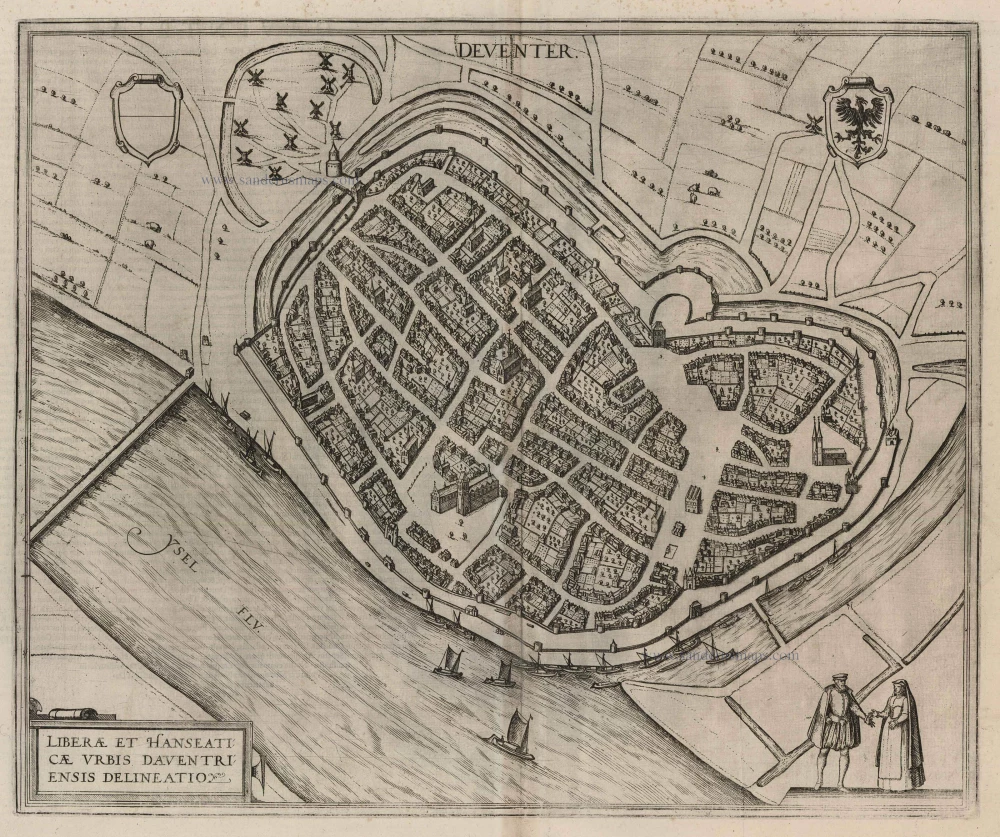
Deventer - Liberae et Hanseaticae Urbis Daventriensis Delineatio 1581
Deventer, by Georg Braun and Frans Hogenberg.
[Item number: 11568]

Campen - Urbis Campensis ad isolam Fluvium icon. 1582
Kampen by Lodovico Guicciardini.
[Item number: 13628]

Arnhemium (on sheet with) Venlonum (and) Gelria (and) Ruremunda. 1623
Arnhem, Venlo, Gelre, Roermond, by Georg Braun & Frans Hogenberg.
[Item number: 22200]

Urbis Campensis ad Isalam Fluvium Icon. 1581-88
Kampen, by Georg Braun and Frans Hogenberg.
[Item number: 22215]
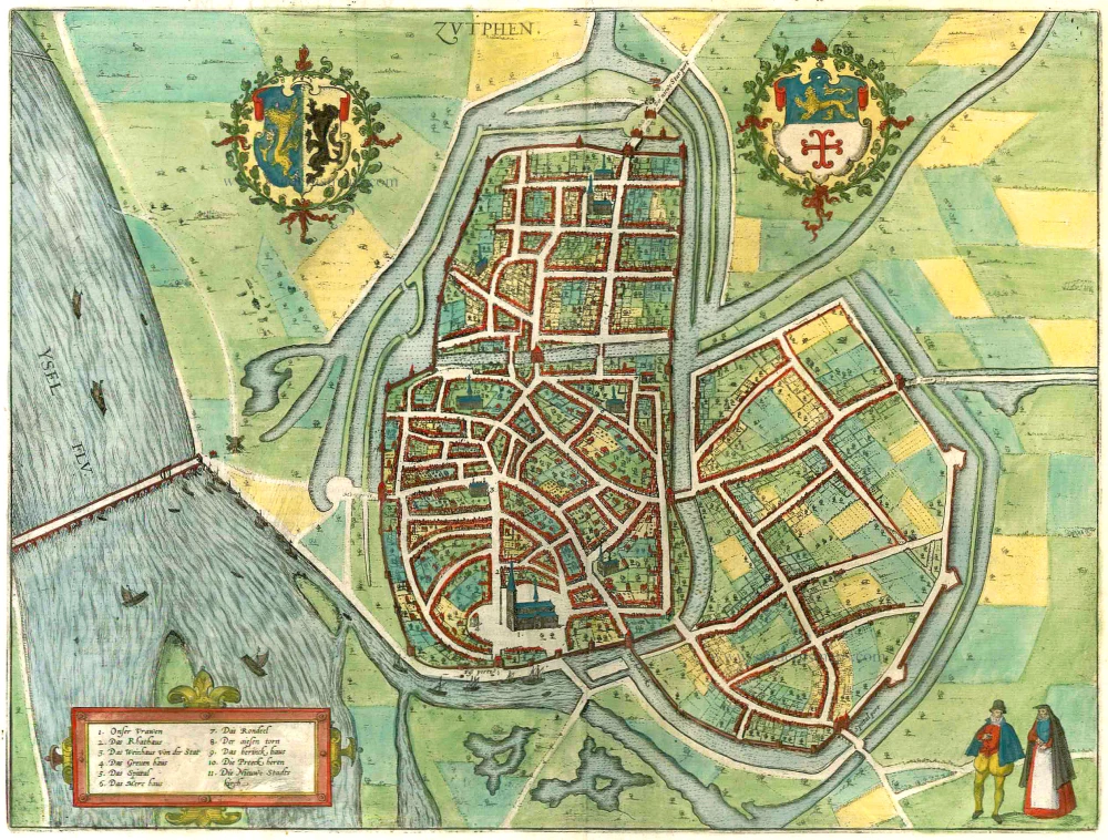
Zutphen. 1599
Zutphen by Braun & Hogenberg.
[Item number: 22260]
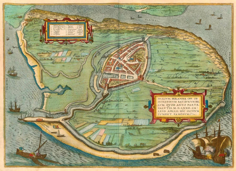
Brilium, Holandiae opp. ob Intestinum Batavicum Bellum, ... 1575-1612
Den Briel, by Georg Braun and Frans Hogenberg.
[Item number: 23267]

Campi Vulgo Campen. 1652
Kampen by Joan Blaeu.
[Item number: 23357]

Bergen op Zoom - Berga, ad Somam, Brabantiae Opp: a fluvi olo sic dicto, ... 1599
Bergen-op-Zoom, by Braun and Hogenberg.
[Item number: 24029]

Slusa, Teutonicae Flandriae Opp. ad Modum Elegans. 1599
Sluis, by Georg Braun and Frans Hogenberg.
[Item number: 24036]

Roterodamum Hollandiae Opp. 1599
Rotterdam, by Georg Braun and Frans Hogenberg.
[Item number: 24046]

Zutphen. 1599
Zutphen by Braun and Hogenberg, after Jacob van Deventer.
[Item number: 24090]

Flissinga munitissimu Zelandiae oppidum, tutissimum Nautarum et Nauclerorum domicilium c. 1610
Vlissingen, by Georg Braun and Frans Hogenberg.
[Item number: 24597]

Campia. Campen. 1638
Kampen, by Matthäus Merian.
[Item number: 27901]

Campen - Urbis Campensis ad isolam Fluvium icon. 1612
Kampen by Lodovico Guicciardini, after Braun & Hogenberg.
[Item number: 32895]