
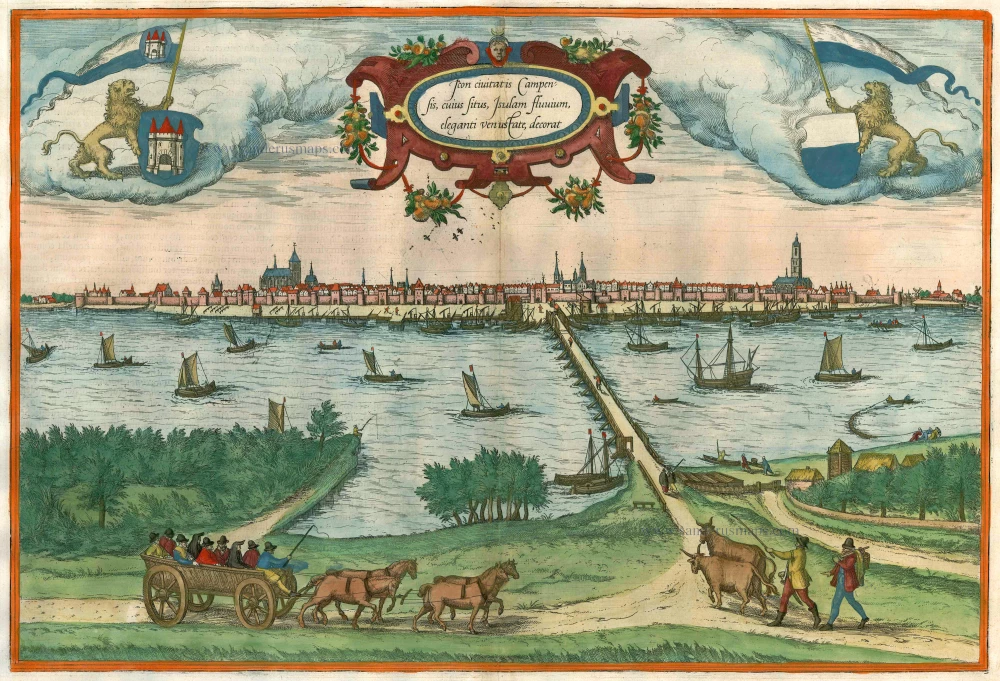
Kampen, by Georg Braun and Frans Hogenberg. 1581-88


CARTOUCHE: View of the city of Kampen in the IJssel.
COMMENTARY BY BRAUN: "The churches of St Nicolai and Our Lady surpass all others, also on account of their height. The town hall, which stands not far from the bridge over the IJssel, is also a handsome and commanding structure. However, the most magnificent is the tollhouse with its imposing proportions."
In this second view of Kampen, the city is shown in a bird's-eye view from the northeast, from the opposite bank of the IJssel River, just before it flows into the Zuiderzee. The city's elongated shape along the broad river is apparent, while numerous ships underscore Kampen's role as an important river port.
Braun G. & Hogenberg F. and the Civitates Orbis Terrarum.
The Civitates Orbis Terrarum, also known as the 'Braun & Hogenberg', is a six-volume town atlas and the most excellent book of town views and plans ever published: 363 engravings, sometimes beautifully coloured. It was one of the best-selling works in the last quarter of the 16th century. Georg Braun, a skilled writer, wrote the text accompanying the plans and views on the verso. Many plates were engraved after the original drawings of a professional artist, Joris Hoefnagel (1542-1600). The first volume was published in Latin in 1572 and the sixth in 1617. Frans Hogenberg, a talented engraver, created the tables for volumes I through IV, and Simon van den Neuwel made those for volumes V and VI. Other contributors were cartographers Daniel Freese and Heinrich Rantzau, who provided valuable geographical information. Works by Jacob van Deventer, Sebastian Münster, and Johannes Stumpf were also used as references. Translations appeared in German and French, making the atlas accessible to a broader audience.
Since its original publication of volume 1 in 1572, the Civitates Orbis Terrarum has left an indelible mark on the history of cartography. Seven more editions followed the first volume in 1575, 1577, 1582, 1588, 1593, 1599, and 1612. Vol.2, initially released in 1575, saw subsequent editions in 1597 and 1612. The subsequent volumes, each a treasure trove of historical insights, graced the world in 1581, 1588, 1593, 1599, and 1606. The German translation of the first volume, a testament to its widespread appeal, debuted in 1574, followed by the French edition in 1575.
Several printers were involved: Theodor Graminaeus, Heinrich von Aich, Gottfried von Kempen, Johannis Sinniger, Bertram Buchholtz, and Peter von Brachel, all of whom worked in Cologne.
Georg Braun (1541-1622)
Georg Braun, the author of the text accompanying the plans and views in the Civitates Orbis Terrarum, was born in Cologne in 1541. After his studies in Cologne, he entered the Jesuit Order as a novice, indicating his commitment to learning and intellectual pursuits. In 1561, he obtained his bachelor's degree; in 1562, he received his Magister Artium, further demonstrating his academic achievements. Although he left the Jesuit Order, he continued his studies in theology, gaining a licentiate in theology. His theological background likely influenced the content and tone of the text in the Civitates Orbis Terrarum, adding a unique perspective to the work.
Frans Hogenberg (1535-1590)
Frans Hogenberg was a Flemish and German painter, engraver, and mapmaker. He was born in Mechelen as the son of Nicolaas Hogenberg.
By the end of the 1560s, Frans Hogenberg was employed upon Abraham Ortelius's Theatrum Orbis Terrarum, published in 1570; he is named an engraver of numerous maps. In 1568, he was banned from Antwerp by the Duke of Alva and travelled to London, where he stayed a few years before emigrating to Cologne. He immediately embarked on his two most important works, the Civitates, published in 1572 and the Geschichtsblätter, which appeared in several series from 1569 until about 1587.
Thanks to large-scale projects like the Geschichtsblätter and the Civitates, Hogenberg's social circumstances improved with each passing year. He died as a wealthy man in Cologne in 1590.
Urbis Campensis ad Isalam Fluvium Icon.
Item Number: 22215 Authenticity Guarantee
Category: Antique maps > Europe > The Netherlands - Cities
Old, antique bird’s-eye view plan of Kampen, by Georg Braun and Frans Hogenberg.
Title: Urbis Campensis ad Isalam Fluvium Icon.
Date: 1581-88.
Copper engraving, printed on paper.
Size (not including margins): 340 x 485mm (13.39 x 19.09 inches).
Verso: Latin text.
Condition: Excellent, nice old colour.
Condition Rating: A+.
From: Civitates Orbis Terrarum. . Liber tertius. Köln, G. Kempen, 1581-88. (Koeman, B&H3)
CARTOUCHE: View of the city of Kampen in the IJssel.
COMMENTARY BY BRAUN: "The churches of St Nicolai and Our Lady surpass all others, also on account of their height. The town hall, which stands not far from the bridge over the IJssel, is also a handsome and commanding structure. However, the most magnificent is the tollhouse with its imposing proportions."
In this second view of Kampen, the city is shown in a bird's-eye view from the northeast, from the opposite bank of the IJssel River, just before it flows into the Zuiderzee. The city's elongated shape along the broad river is apparent, while numerous ships underscore Kampen's role as an important river port.
Braun G. & Hogenberg F. and the Civitates Orbis Terrarum.
The Civitates Orbis Terrarum, also known as the 'Braun & Hogenberg', is a six-volume town atlas and the most excellent book of town views and plans ever published: 363 engravings, sometimes beautifully coloured. It was one of the best-selling works in the last quarter of the 16th century. Georg Braun, a skilled writer, wrote the text accompanying the plans and views on the verso. Many plates were engraved after the original drawings of a professional artist, Joris Hoefnagel (1542-1600). The first volume was published in Latin in 1572 and the sixth in 1617. Frans Hogenberg, a talented engraver, created the tables for volumes I through IV, and Simon van den Neuwel made those for volumes V and VI. Other contributors were cartographers Daniel Freese and Heinrich Rantzau, who provided valuable geographical information. Works by Jacob van Deventer, Sebastian Münster, and Johannes Stumpf were also used as references. Translations appeared in German and French, making the atlas accessible to a broader audience.
Since its original publication of volume 1 in 1572, the Civitates Orbis Terrarum has left an indelible mark on the history of cartography. Seven more editions followed the first volume in 1575, 1577, 1582, 1588, 1593, 1599, and 1612. Vol.2, initially released in 1575, saw subsequent editions in 1597 and 1612. The subsequent volumes, each a treasure trove of historical insights, graced the world in 1581, 1588, 1593, 1599, and 1606. The German translation of the first volume, a testament to its widespread appeal, debuted in 1574, followed by the French edition in 1575.
Several printers were involved: Theodor Graminaeus, Heinrich von Aich, Gottfried von Kempen, Johannis Sinniger, Bertram Buchholtz, and Peter von Brachel, all of whom worked in Cologne.
Georg Braun (1541-1622)
Georg Braun, the author of the text accompanying the plans and views in the Civitates Orbis Terrarum, was born in Cologne in 1541. After his studies in Cologne, he entered the Jesuit Order as a novice, indicating his commitment to learning and intellectual pursuits. In 1561, he obtained his bachelor's degree; in 1562, he received his Magister Artium, further demonstrating his academic achievements. Although he left the Jesuit Order, he continued his studies in theology, gaining a licentiate in theology. His theological background likely influenced the content and tone of the text in the Civitates Orbis Terrarum, adding a unique perspective to the work.
Frans Hogenberg (1535-1590)
Frans Hogenberg was a Flemish and German painter, engraver, and mapmaker. He was born in Mechelen as the son of Nicolaas Hogenberg.
By the end of the 1560s, Frans Hogenberg was employed upon Abraham Ortelius's Theatrum Orbis Terrarum, published in 1570; he is named an engraver of numerous maps. In 1568, he was banned from Antwerp by the Duke of Alva and travelled to London, where he stayed a few years before emigrating to Cologne. He immediately embarked on his two most important works, the Civitates, published in 1572 and the Geschichtsblätter, which appeared in several series from 1569 until about 1587.
Thanks to large-scale projects like the Geschichtsblätter and the Civitates, Hogenberg's social circumstances improved with each passing year. He died as a wealthy man in Cologne in 1590.
Related items

Arnhemium (on sheet with) Venlonum (and) Gelria (and) Ruremunda 1588
Arnhem, Venlo, Gelre, Roermond, by Georg Braun and Frans Hogenberg.
[Item number: 2009]

Middelburgum, Selandiae Opp: Situ, Opere, et Mercimoniis, Florentiss: 1575
Middelburg by Braun & Hogenberg
[Item number: 4669]

Groninga, opulenta, populosa, et valide contra hostiles insultus munita Phrisie urbs, ... 1575
Groningen, by Georg Braun and Frans Hogenberg.
[Item number: 8108]
Icon civitatis Campensis, cuius situs Isulam fluvium, eleganti venustate, decorat 1575
Kampen, by Georg Braun and Frans Hogenberg.
[Item number: 9364]

Campen - Urbis Campensis ad isolam Fluvium icon. 1582
Kampen by Lodovico Guicciardini.
[Item number: 13628]

t's Hertogenbosch 1612
s-Hertogenbosch by Braun & Hogenberg
[Item number: 13655]
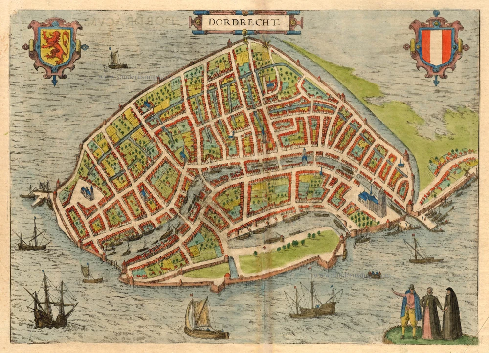
Dordrecht. 1581
Dordrecht, by Braun & Hogenberg
[Item number: 18009]

Arnhemium (on sheet with) Venlonum (and) Gelria (and) Ruremunda. 1623
Arnhem, Venlo, Gelre, Roermond, by Georg Braun & Frans Hogenberg.
[Item number: 22200]

Bolzvardia vetus in Frisia Foederis Anzae teurinicae Op. [on sheet with] Stavria, vulgo Stavere ... [and] Harlinga [and] Hindelop. 1599
Bolsward, Stavoren, Harlingen, Hindelopen by Braun & Hogenberg.
[Item number: 22261]

Groeninga, sive ut alij, Gruninga, Frisiae urb, ... ([on sheet with] Bouersavia, eius Insule in Zelandia oppidum, .. [and] Goricum, nobile Hollandiae Oppidum 1612
Groningen, Brouwershaven and Gorinchem, by Georg Braun and Frans Hogenberg.
[Item number: 22319]

Bergen op Zoom - Berga, ad Somam, Brabantiae Opp: a fluvi olo sic dicto, ... 1581-88
Bergen-op-Zoom, by Georg Braun and Frans Hogenberg.
[Item number: 23306]

Campi Vulgo Campen. 1652
Kampen by Joan Blaeu.
[Item number: 23357]
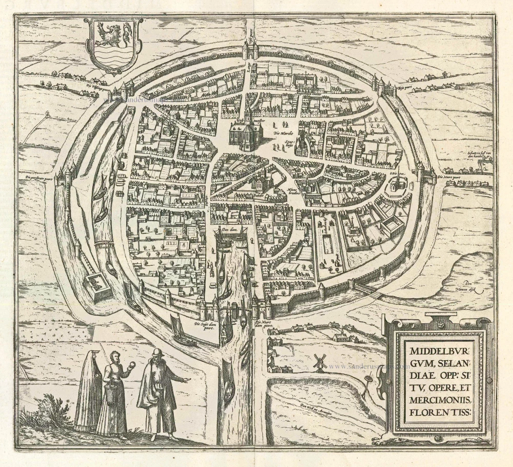
Middelburgum, Selandiae Opp: Situ, Opere, et Mercimoniis, Florentiss: 1597
Middelburg, by Braun & Hogenberg.
[Item number: 23982]
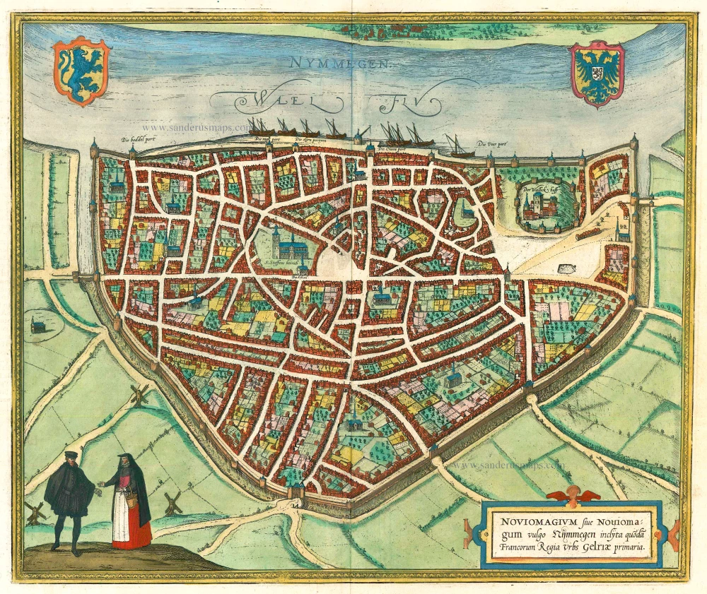
Noviomagium. 1599
Nijmegen, by Georg Braun and Frans Hogenberg.
[Item number: 24033]

Goude 1599
Gouda, by Georg Braun and Frans Hogenberg.
[Item number: 24486]

Campia. Campen. 1638
Kampen, by Matthäus Merian.
[Item number: 27901]

Campen - Urbis Campensis ad isolam Fluvium icon. 1612
Kampen by Lodovico Guicciardini, after Braun & Hogenberg.
[Item number: 32895]