Den Briel, by Georg Braun and Frans Hogenberg. 1575-1612
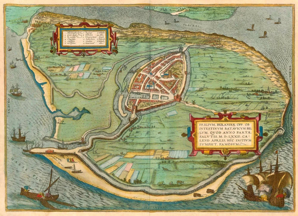


TRANSLATION OF CARTOUCHE TEXT: Brielle, a town in Holland, is well known because of the civil war in Batavia, which began here at the beginning of April 1572.
COMMENTARY BY BRAUN: "Most of the inhabitants of Brielle earn their living by fishing, which they carry on from their youth in the North Sea, where they catch chiefly plaice and cod, which are then processed in Brielle and the surrounding towns."
This bird's-eye view shows the topographical situation of the Island of Voorne at the mouth of the River Meuse. The fishermen underline the economic importance of fishing here in the lower left-hand corner of the plate. The sea battle (bottom right) refers to Brielle's role in the Dutch Revolt: on 1 April 1572, Brielle - formerly anglicized as Brill - was the first town to be taken by the rebels, the Watergeuzen. The first day of April is still celebrated today as Liberation Day. However, in August 1585, Brielle was given to Queen Elizabeth I of England as a security in the Treaty of Nonsuch in exchange for 5,000 English soldiers to help fight the Spanish troops. The pledged areas were not returned to the Netherlands until 1616.
Braun G. & Hogenberg F. and the Civitates Orbis Terrarum.
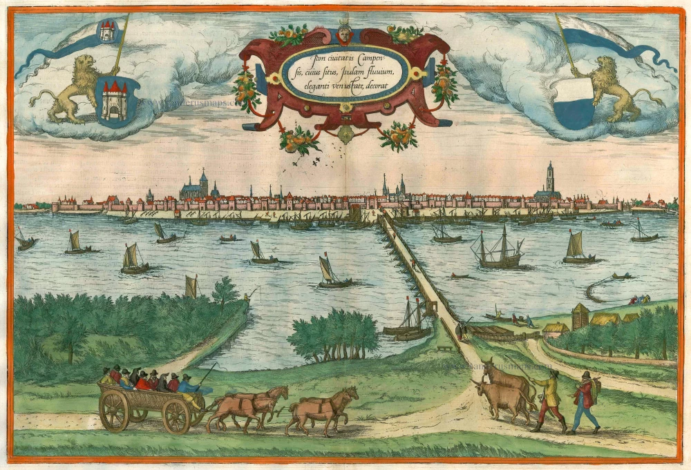
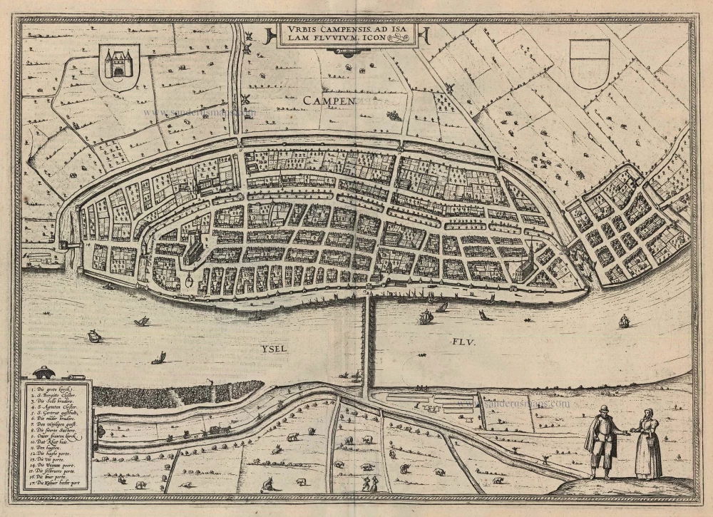
The Civitates Orbis Terrarum, also known as the 'Braun & Hogenberg', is a six-volume town atlas and the most excellent book of town views and plans ever published: 363 engravings, sometimes beautifully coloured. It was one of the best-selling works in the last quarter of the 16th century. Georg Braun, a skilled writer, wrote the text accompanying the plans and views on the verso. Many plates were engraved after the original drawings of a professional artist, Joris Hoefnagel (1542-1600). The first volume was published in Latin in 1572 and the sixth in 1617. Frans Hogenberg, a talented engraver, created the tables for volumes I through IV, and Simon van den Neuwel made those for volumes V and VI. Other contributors were cartographers Daniel Freese and Heinrich Rantzau, who provided valuable geographical information. Works by Jacob van Deventer, Sebastian Münster, and Johannes Stumpf were also used as references. Translations appeared in German and French, making the atlas accessible to a broader audience.
Since its original publication of volume 1 in 1572, the Civitates Orbis Terrarum has left an indelible mark on the history of cartography. Seven more editions followed the first volume in 1575, 1577, 1582, 1588, 1593, 1599, and 1612. Vol.2, initially released in 1575, saw subsequent editions in 1597 and 1612. The subsequent volumes, each a treasure trove of historical insights, graced the world in 1581, 1588, 1593, 1599, and 1606. The German translation of the first volume, a testament to its widespread appeal, debuted in 1574, followed by the French edition in 1575.
Several printers were involved: Theodor Graminaeus, Heinrich von Aich, Gottfried von Kempen, Johannis Sinniger, Bertram Buchholtz, and Peter von Brachel, all of whom worked in Cologne.
Georg Braun (1541-1622)
Georg Braun, the author of the text accompanying the plans and views in the Civitates Orbis Terrarum, was born in Cologne in 1541. After his studies in Cologne, he entered the Jesuit Order as a novice, indicating his commitment to learning and intellectual pursuits. In 1561, he obtained his bachelor's degree; in 1562, he received his Magister Artium, further demonstrating his academic achievements. Although he left the Jesuit Order, he continued his studies in theology, gaining a licentiate in theology. His theological background likely influenced the content and tone of the text in the Civitates Orbis Terrarum, adding a unique perspective to the work.
Frans Hogenberg (1535-1590)
Frans Hogenberg was a Flemish and German painter, engraver, and mapmaker. He was born in Mechelen as the son of Nicolaas Hogenberg.
By the end of the 1560s, Frans Hogenberg was employed upon Abraham Ortelius's Theatrum Orbis Terrarum, published in 1570; he is named an engraver of numerous maps. In 1568, he was banned from Antwerp by the Duke of Alva and travelled to London, where he stayed a few years before emigrating to Cologne. He immediately embarked on his two most important works, the Civitates, published in 1572 and the Geschichtsblätter, which appeared in several series from 1569 until about 1587.
Thanks to large-scale projects like the Geschichtsblätter and the Civitates, Hogenberg's social circumstances improved with each passing year. He died as a wealthy man in Cologne in 1590.
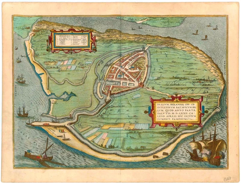
Brilium, Holandiae opp. ob Intestinum Batavicum Bellum, ...
Item Number: 23267 Authenticity Guarantee
Category: Antique maps > Europe > The Netherlands - Cities
Old, antique bird’s-eye view plan of Den Briel, by Georg Braun and Frans Hogenberg.
Title: Brilium, Holandiae opp. ob Intestinum Batavicum Bellum, ...
Date of the first edition: 1575.
Date of this map: 1575-1612.
Copper engraving, printed on paper.
Size (not including margins): 350 x 490mm (13.78 x 19.29 inches).
Verso: Latin text.
Condition: Excellent, superb old colour.
Condition Rating: A+.
From: Civitates Orbis Terrarum, ... Part 2. Köln, 1575-1612.
TRANSLATION OF CARTOUCHE TEXT: Brielle, a town in Holland, is well known because of the civil war in Batavia, which began here at the beginning of April 1572.
COMMENTARY BY BRAUN: "Most of the inhabitants of Brielle earn their living by fishing, which they carry on from their youth in the North Sea, where they catch chiefly plaice and cod, which are then processed in Brielle and the surrounding towns."
This bird's-eye view shows the topographical situation of the Island of Voorne at the mouth of the River Meuse. The fishermen underline the economic importance of fishing here in the lower left-hand corner of the plate. The sea battle (bottom right) refers to Brielle's role in the Dutch Revolt: on 1 April 1572, Brielle - formerly anglicized as Brill - was the first town to be taken by the rebels, the Watergeuzen. The first day of April is still celebrated today as Liberation Day. However, in August 1585, Brielle was given to Queen Elizabeth I of England as a security in the Treaty of Nonsuch in exchange for 5,000 English soldiers to help fight the Spanish troops. The pledged areas were not returned to the Netherlands until 1616.
Braun G. & Hogenberg F. and the Civitates Orbis Terrarum.
The Civitates Orbis Terrarum, also known as the 'Braun & Hogenberg', is a six-volume town atlas and the most excellent book of town views and plans ever published: 363 engravings, sometimes beautifully coloured. It was one of the best-selling works in the last quarter of the 16th century. Georg Braun, a skilled writer, wrote the text accompanying the plans and views on the verso. Many plates were engraved after the original drawings of a professional artist, Joris Hoefnagel (1542-1600). The first volume was published in Latin in 1572 and the sixth in 1617. Frans Hogenberg, a talented engraver, created the tables for volumes I through IV, and Simon van den Neuwel made those for volumes V and VI. Other contributors were cartographers Daniel Freese and Heinrich Rantzau, who provided valuable geographical information. Works by Jacob van Deventer, Sebastian Münster, and Johannes Stumpf were also used as references. Translations appeared in German and French, making the atlas accessible to a broader audience.
Since its original publication of volume 1 in 1572, the Civitates Orbis Terrarum has left an indelible mark on the history of cartography. Seven more editions followed the first volume in 1575, 1577, 1582, 1588, 1593, 1599, and 1612. Vol.2, initially released in 1575, saw subsequent editions in 1597 and 1612. The subsequent volumes, each a treasure trove of historical insights, graced the world in 1581, 1588, 1593, 1599, and 1606. The German translation of the first volume, a testament to its widespread appeal, debuted in 1574, followed by the French edition in 1575.
Several printers were involved: Theodor Graminaeus, Heinrich von Aich, Gottfried von Kempen, Johannis Sinniger, Bertram Buchholtz, and Peter von Brachel, all of whom worked in Cologne.
Georg Braun (1541-1622)
Georg Braun, the author of the text accompanying the plans and views in the Civitates Orbis Terrarum, was born in Cologne in 1541. After his studies in Cologne, he entered the Jesuit Order as a novice, indicating his commitment to learning and intellectual pursuits. In 1561, he obtained his bachelor's degree; in 1562, he received his Magister Artium, further demonstrating his academic achievements. Although he left the Jesuit Order, he continued his studies in theology, gaining a licentiate in theology. His theological background likely influenced the content and tone of the text in the Civitates Orbis Terrarum, adding a unique perspective to the work.
Frans Hogenberg (1535-1590)
Frans Hogenberg was a Flemish and German painter, engraver, and mapmaker. He was born in Mechelen as the son of Nicolaas Hogenberg.
By the end of the 1560s, Frans Hogenberg was employed upon Abraham Ortelius's Theatrum Orbis Terrarum, published in 1570; he is named an engraver of numerous maps. In 1568, he was banned from Antwerp by the Duke of Alva and travelled to London, where he stayed a few years before emigrating to Cologne. He immediately embarked on his two most important works, the Civitates, published in 1572 and the Geschichtsblätter, which appeared in several series from 1569 until about 1587.
Thanks to large-scale projects like the Geschichtsblätter and the Civitates, Hogenberg's social circumstances improved with each passing year. He died as a wealthy man in Cologne in 1590.