
The Hague (Den Haag), by Georg Braun and Frans Hogenberg. c. 1625


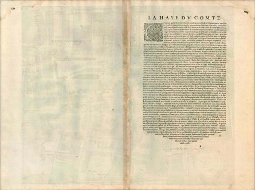
CARTOUCHE: Impression of the Hague, a city famous in all Europe.
COMMENTARY BY BRAUN: "The residence of the counts, called the court, is very well known, and is surrounded by poor walls and ditches. It is said to have been built by Count William, who was also the Roman king. As far as the village itself is concerned, it is as big as a medium-sized town, and, like other towns, has paved streets with houses standing very close together."
The bird's-eye view plan from the southwest shows an impressive unfortified residential city, traversed by canals, with densely packed and often very uniform town houses. Standing out clearly in the plan is the curious late Gothic Sint-Jacobskerk (4). On the right immediately next to it is the Renaissance town hall (3) and below the court pond is the palace (1) with its big, rectangular inner courtyard and the Knights' Hall (Ridderzaal). Originally there was a hunting lodge here, which was extended to a seat of government by Counts William II and Floris V of Holland in the 13th century. Today the city has a population of around 475,000 and is the royal residence and seat of the Dutch government and Parliament, as well as a number of international institutions such as the International Court of Justice. (Taschen)
Braun G. & Hogenberg F. and the Civitates Orbis Terrarum.
The Civitates Orbis Terrarum, also known as the 'Braun & Hogenberg', is a six-volume town atlas and the most excellent book of town views and plans ever published: 363 engravings, sometimes beautifully coloured. It was one of the best-selling works in the last quarter of the 16th century. Georg Braun, a skilled writer, wrote the text accompanying the plans and views on the verso. Many plates were engraved after the original drawings of a professional artist, Joris Hoefnagel (1542-1600). The first volume was published in Latin in 1572 and the sixth in 1617. Frans Hogenberg, a talented engraver, created the tables for volumes I through IV, and Simon van den Neuwel made those for volumes V and VI. Other contributors were cartographers Daniel Freese and Heinrich Rantzau, who provided valuable geographical information. Works by Jacob van Deventer, Sebastian Münster, and Johannes Stumpf were also used as references. Translations appeared in German and French, making the atlas accessible to a broader audience.
Since its original publication of volume 1 in 1572, the Civitates Orbis Terrarum has left an indelible mark on the history of cartography. Seven more editions followed the first volume in 1575, 1577, 1582, 1588, 1593, 1599, and 1612. Vol.2, initially released in 1575, saw subsequent editions in 1597 and 1612. The subsequent volumes, each a treasure trove of historical insights, graced the world in 1581, 1588, 1593, 1599, and 1606. The German translation of the first volume, a testament to its widespread appeal, debuted in 1574, followed by the French edition in 1575.
Several printers were involved: Theodor Graminaeus, Heinrich von Aich, Gottfried von Kempen, Johannis Sinniger, Bertram Buchholtz, and Peter von Brachel, all of whom worked in Cologne.
Georg Braun (1541-1622)
Georg Braun, the author of the text accompanying the plans and views in the Civitates Orbis Terrarum, was born in Cologne in 1541. After his studies in Cologne, he entered the Jesuit Order as a novice, indicating his commitment to learning and intellectual pursuits. In 1561, he obtained his bachelor's degree; in 1562, he received his Magister Artium, further demonstrating his academic achievements. Although he left the Jesuit Order, he continued his studies in theology, gaining a licentiate in theology. His theological background likely influenced the content and tone of the text in the Civitates Orbis Terrarum, adding a unique perspective to the work.
Frans Hogenberg (1535-1590)
Frans Hogenberg was a Flemish and German painter, engraver, and mapmaker. He was born in Mechelen as the son of Nicolaas Hogenberg.
By the end of the 1560s, Frans Hogenberg was employed upon Abraham Ortelius's Theatrum Orbis Terrarum, published in 1570; he is named an engraver of numerous maps. In 1568, he was banned from Antwerp by the Duke of Alva and travelled to London, where he stayed a few years before emigrating to Cologne. He immediately embarked on his two most important works, the Civitates, published in 1572 and the Geschichtsblätter, which appeared in several series from 1569 until about 1587.
Thanks to large-scale projects like the Geschichtsblätter and the Civitates, Hogenberg's social circumstances improved with each passing year. He died as a wealthy man in Cologne in 1590.
Hagae Comitis celeberrimi totius Europae municipij typus.
Item Number: 16400 Authenticity Guarantee
Category: Antique maps > Europe > The Netherlands - Cities
Old, antique bird’s-eye view plan of The Hague (Den Haag), by Georg Braun and Frans Hogenberg.
Title: Hagae Comitis celeberrimi totius Europae municipij typus.
Date of the first edition: 1617.
Date of this map: c. 1625.
Copper engraving, printed on paper.
Size (not including margins): 383 x 460mm (15.08 x 18.11 inches).
Verso: French text.
Condition: Original coloured, excellent.
Condition Rating: A+.
From: Théatre des Principales Villes de tout l'Univers Vol. VI. c. 1625. (Van der Krogt 4, 41:3.6)
CARTOUCHE: Impression of the Hague, a city famous in all Europe.
COMMENTARY BY BRAUN: "The residence of the counts, called the court, is very well known, and is surrounded by poor walls and ditches. It is said to have been built by Count William, who was also the Roman king. As far as the village itself is concerned, it is as big as a medium-sized town, and, like other towns, has paved streets with houses standing very close together."
The bird's-eye view plan from the southwest shows an impressive unfortified residential city, traversed by canals, with densely packed and often very uniform town houses. Standing out clearly in the plan is the curious late Gothic Sint-Jacobskerk (4). On the right immediately next to it is the Renaissance town hall (3) and below the court pond is the palace (1) with its big, rectangular inner courtyard and the Knights' Hall (Ridderzaal). Originally there was a hunting lodge here, which was extended to a seat of government by Counts William II and Floris V of Holland in the 13th century. Today the city has a population of around 475,000 and is the royal residence and seat of the Dutch government and Parliament, as well as a number of international institutions such as the International Court of Justice. (Taschen)
Braun G. & Hogenberg F. and the Civitates Orbis Terrarum.
The Civitates Orbis Terrarum, also known as the 'Braun & Hogenberg', is a six-volume town atlas and the most excellent book of town views and plans ever published: 363 engravings, sometimes beautifully coloured. It was one of the best-selling works in the last quarter of the 16th century. Georg Braun, a skilled writer, wrote the text accompanying the plans and views on the verso. Many plates were engraved after the original drawings of a professional artist, Joris Hoefnagel (1542-1600). The first volume was published in Latin in 1572 and the sixth in 1617. Frans Hogenberg, a talented engraver, created the tables for volumes I through IV, and Simon van den Neuwel made those for volumes V and VI. Other contributors were cartographers Daniel Freese and Heinrich Rantzau, who provided valuable geographical information. Works by Jacob van Deventer, Sebastian Münster, and Johannes Stumpf were also used as references. Translations appeared in German and French, making the atlas accessible to a broader audience.
Since its original publication of volume 1 in 1572, the Civitates Orbis Terrarum has left an indelible mark on the history of cartography. Seven more editions followed the first volume in 1575, 1577, 1582, 1588, 1593, 1599, and 1612. Vol.2, initially released in 1575, saw subsequent editions in 1597 and 1612. The subsequent volumes, each a treasure trove of historical insights, graced the world in 1581, 1588, 1593, 1599, and 1606. The German translation of the first volume, a testament to its widespread appeal, debuted in 1574, followed by the French edition in 1575.
Several printers were involved: Theodor Graminaeus, Heinrich von Aich, Gottfried von Kempen, Johannis Sinniger, Bertram Buchholtz, and Peter von Brachel, all of whom worked in Cologne.
Georg Braun (1541-1622)
Georg Braun, the author of the text accompanying the plans and views in the Civitates Orbis Terrarum, was born in Cologne in 1541. After his studies in Cologne, he entered the Jesuit Order as a novice, indicating his commitment to learning and intellectual pursuits. In 1561, he obtained his bachelor's degree; in 1562, he received his Magister Artium, further demonstrating his academic achievements. Although he left the Jesuit Order, he continued his studies in theology, gaining a licentiate in theology. His theological background likely influenced the content and tone of the text in the Civitates Orbis Terrarum, adding a unique perspective to the work.
Frans Hogenberg (1535-1590)
Frans Hogenberg was a Flemish and German painter, engraver, and mapmaker. He was born in Mechelen as the son of Nicolaas Hogenberg.
By the end of the 1560s, Frans Hogenberg was employed upon Abraham Ortelius's Theatrum Orbis Terrarum, published in 1570; he is named an engraver of numerous maps. In 1568, he was banned from Antwerp by the Duke of Alva and travelled to London, where he stayed a few years before emigrating to Cologne. He immediately embarked on his two most important works, the Civitates, published in 1572 and the Geschichtsblätter, which appeared in several series from 1569 until about 1587.
Thanks to large-scale projects like the Geschichtsblätter and the Civitates, Hogenberg's social circumstances improved with each passing year. He died as a wealthy man in Cologne in 1590.
Related items

Curia Hollandiae Exterior. 1652
Den Haag - Buitenhof by Joan Blaeu
[Item number: 6711]
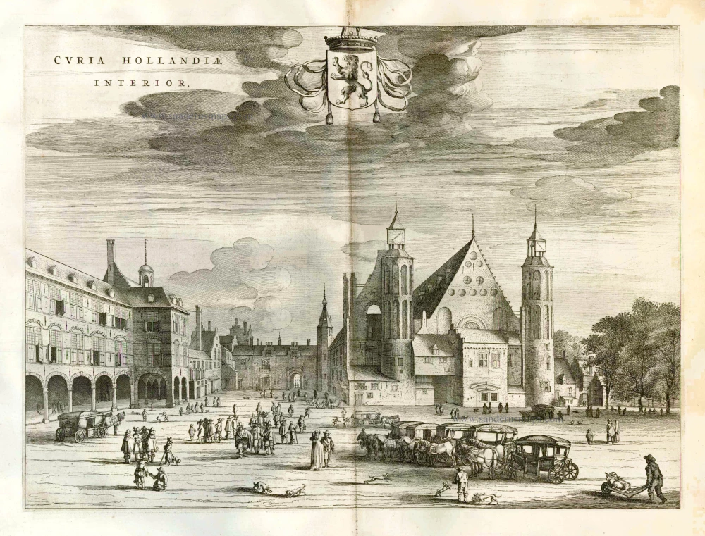
Curia Hollandiae Interior. 1652
Den Haag by Joan Blaeu, Binnenhof
[Item number: 6713]

Curia Hollandiae Exterior. 1649
Den Haag by Joan Blaeu, Buitenhof
[Item number: 28717]

Curia Hollandiae Interior. 1652
Den Haag by Joan Blaeu, Binnenhof
[Item number: 28749]

Gesicht by de Doelen over de Korte Vijverberg; tot Gravenhaghe. ca. 1780
Perspective view of Den Haag, by Georg Balthasar Probst.
[Item number: 31603]
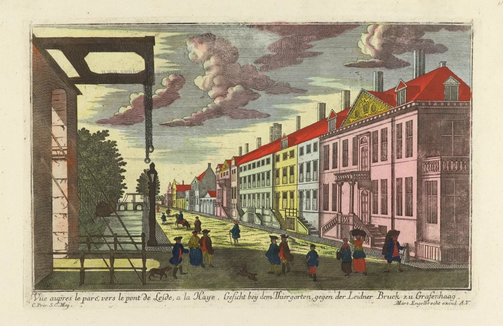
Vue aupres le parc, vers le pont de Leide, a la Haye. - Gesicht bey dem Thiergarten, gegen der Leidner Bruck zu Grafenhaag. c. 1750
Optical View of Den Haag, by Martin Engelbrecht.
[Item number: 31897]

Vue vers le vivier vers la jardin des Tireurs a la Haye. - Gesicht gegen den kleinen fischteich bey dem Schützen Garten zu Grafenhaag. c. 1750
Optical View of Den Haag, by Martin Engelbrecht.
[Item number: 31901]

Haag. 1686
Den Haag by Christoph Riegel.
[Item number: 32108]

Haga Comitis Vulgo 'S Graven-Hage. 1652
Den Haag, by Joan Blaeu.
[Item number: 32922]

Graven Hage, t'Hof van Holla[n]t. 1612
Den Haag by Guicciardini Lodovico
[Item number: 32984]