
Southern Schleswig by J. Janssonius, published by Moses Pitt and J. Janssonius-Waesberge. 1680
Moses Pitt (1641-1697)
Moses Pitt, a London based map publisher and bookseller, planned a 12-volume world atlas based on Janssonius’ Atlas Maior. He entered into a partnership with Johann van Waesbergen, one of the heirs of Johannes Janssonius, and Steven Swart. Both publishers had versions with their own imprint. Only four volumes were issued. The undertaking ruined him, and he was imprisoned for two years for debt.
The maps are generally printed from reworked plates of Janssonius. The imprint of Janssonius van Waesbergen and Pitt is added and, to facilitate finding places with the index, the grid of parallels and meridians is added. In all probability, the maps were printed in Amsterdam and shipped to Oxford to be bound with the text.
The Janssonius Family
Joannes Janssonius (Arnhem, 1588-1664), son of the Arnhem publisher Jan Janssen, married Elisabeth Hondius, daughter of Jodocus Hondius, in Amsterdam in 1612. After his marriage, he settled down in this town as a bookseller and publisher of cartographic material. In 1618 he established himself in Amsterdam next door to Blaeu’s book shop. He entered into serious competition with Willem Jansz. Blaeu when copying Blaeu’s Licht der Zeevaert after the expiration of the privilege in 1620. His activities not only concerned the publication of atlases and books, but also of single maps and an extensive book trade with branches in Frankfurt, Danzig, Stockholm, Copenhagen, Berlin, Koningsbergen, Geneva, and Lyon. In 1631 he began publishing atlases together with Henricus Hondius.
In the early 1640s Henricus Hondius left the atlas publishing business completely to Janssonius. Competition with Joan Blaeu, Willem’s son and successor, in atlas production prompted Janssonius to enlarge his Atlas Novus finally into a work of six volumes, into which a sea atlas and an atlas of the Old World were inserted. Other atlases published by Janssonius are Mercator’s Atlas Minor, Hornius’s historical atlas (1652), the townbooks in eight volumes (1657), Cellarius’s Atlas Coelestis and several sea atlases and pilot guides.
After the death of Joannes Janssonius, the shop and publishing firm were continued by the heirs under the direction of Johannes van Waesbergen (c. 1616-1681), son-in-law of Joannes Janssonius. Van Waesbergen added the name of Janssonius to his own.
In 1676, Joannes Janssonius’s heirs sold by auction “all the remaining Atlases in Latin, French, High and Low German, as well as the Stedeboecken in Latin, in 8 volumes, bound and unbound, maps, plates belonging to the Atlas and Stedeboecken.” The copperplates from Janssonius’s atlases were afterwards sold to Schenk and Valck.
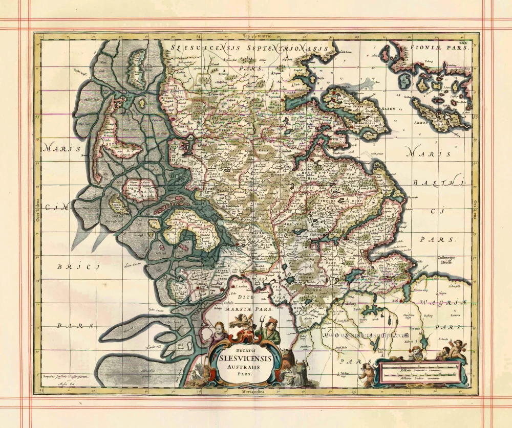
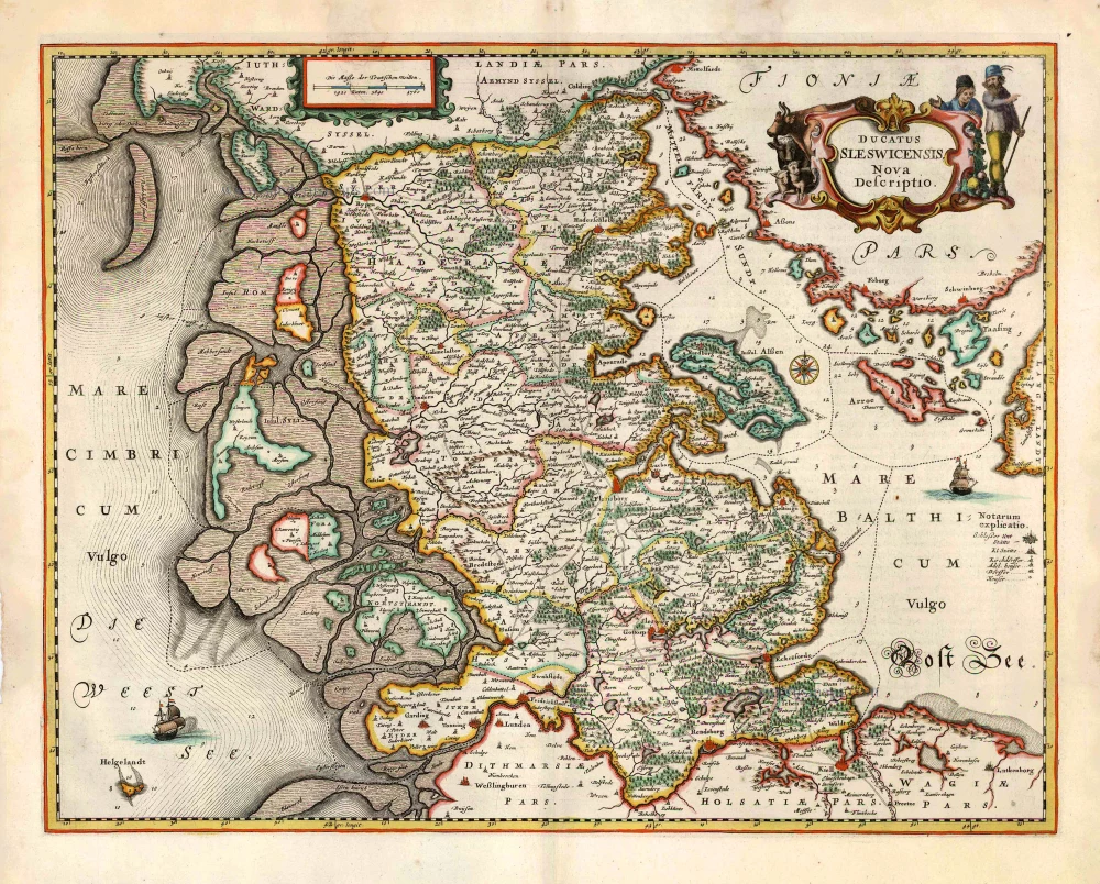
Ducatus Slesvicensis Australis Pars
Item Number: 1521 Authenticity Guarantee
Category: Antique maps > Europe > Northern Europe
Old, antique map of Southern Schleswig by J. Janssonius, published by Moses Pitt and J. Janssonius-Waesberge.
Title: Ducatus Slesvicensis Australis Pars.
Date of the first edition: 1656.
Date of this map: 1680.
Copper engraving, printed on paper.
Size (not including margins): 435 x 540mm (17.13 x 21.26 inches).
Verso: Blank.
Condition: Hand coloured, on large, heavy paper, ruled in red, excellent.
Condition Rating: A+
From: The English Atlas. Oxford, Moses Pitt, 1680. (Van der Krogt 1, 451)
Moses Pitt (1641-1697)
Moses Pitt, a London based map publisher and bookseller, planned a 12-volume world atlas based on Janssonius’ Atlas Maior. He entered into a partnership with Johann van Waesbergen, one of the heirs of Johannes Janssonius, and Steven Swart. Both publishers had versions with their own imprint. Only four volumes were issued. The undertaking ruined him, and he was imprisoned for two years for debt.
The maps are generally printed from reworked plates of Janssonius. The imprint of Janssonius van Waesbergen and Pitt is added and, to facilitate finding places with the index, the grid of parallels and meridians is added. In all probability, the maps were printed in Amsterdam and shipped to Oxford to be bound with the text.
The Janssonius Family
Joannes Janssonius (Arnhem, 1588-1664), son of the Arnhem publisher Jan Janssen, married Elisabeth Hondius, daughter of Jodocus Hondius, in Amsterdam in 1612. After his marriage, he settled down in this town as a bookseller and publisher of cartographic material. In 1618 he established himself in Amsterdam next door to Blaeu’s book shop. He entered into serious competition with Willem Jansz. Blaeu when copying Blaeu’s Licht der Zeevaert after the expiration of the privilege in 1620. His activities not only concerned the publication of atlases and books, but also of single maps and an extensive book trade with branches in Frankfurt, Danzig, Stockholm, Copenhagen, Berlin, Koningsbergen, Geneva, and Lyon. In 1631 he began publishing atlases together with Henricus Hondius.
In the early 1640s Henricus Hondius left the atlas publishing business completely to Janssonius. Competition with Joan Blaeu, Willem’s son and successor, in atlas production prompted Janssonius to enlarge his Atlas Novus finally into a work of six volumes, into which a sea atlas and an atlas of the Old World were inserted. Other atlases published by Janssonius are Mercator’s Atlas Minor, Hornius’s historical atlas (1652), the townbooks in eight volumes (1657), Cellarius’s Atlas Coelestis and several sea atlases and pilot guides.
After the death of Joannes Janssonius, the shop and publishing firm were continued by the heirs under the direction of Johannes van Waesbergen (c. 1616-1681), son-in-law of Joannes Janssonius. Van Waesbergen added the name of Janssonius to his own.
In 1676, Joannes Janssonius’s heirs sold by auction “all the remaining Atlases in Latin, French, High and Low German, as well as the Stedeboecken in Latin, in 8 volumes, bound and unbound, maps, plates belonging to the Atlas and Stedeboecken.” The copperplates from Janssonius’s atlases were afterwards sold to Schenk and Valck.
Related items
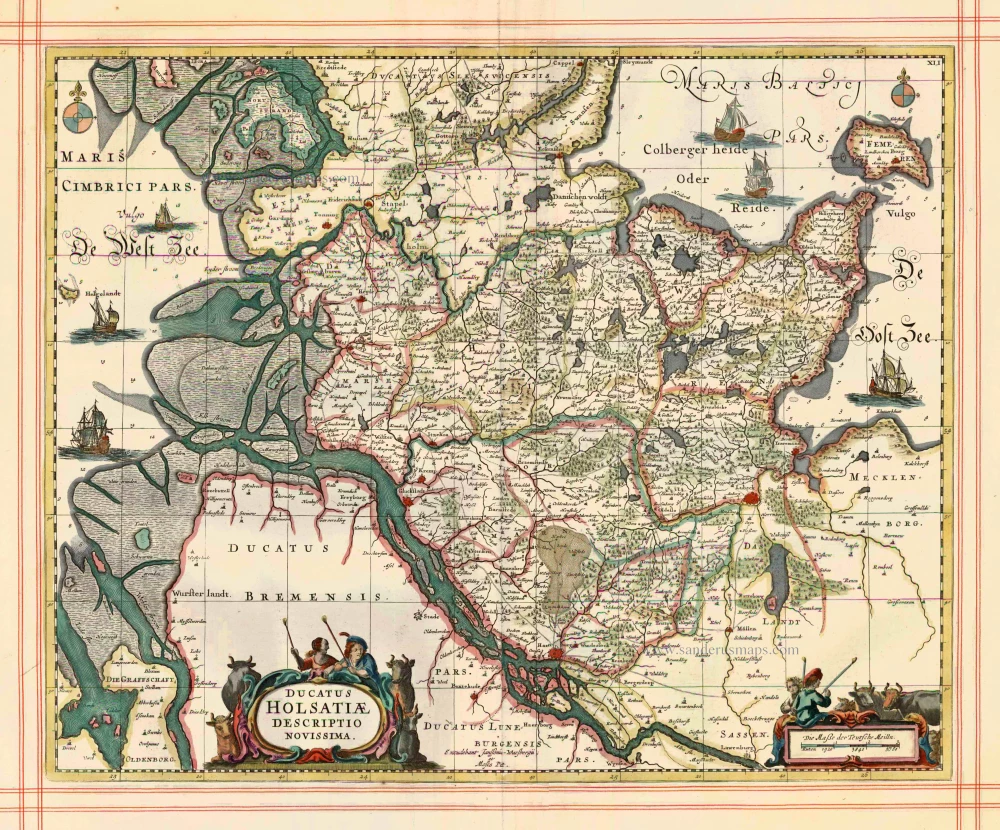
Ducatus Holsatiae Descriptio Novissima 1680
Holstein by J. Janssonius, published by Moses Pitt and J. Janssonius-Waesberge.
[Item number: 1576]
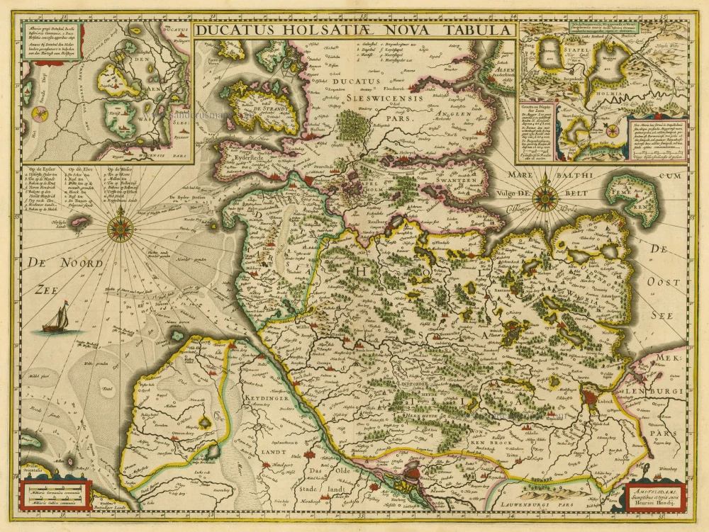
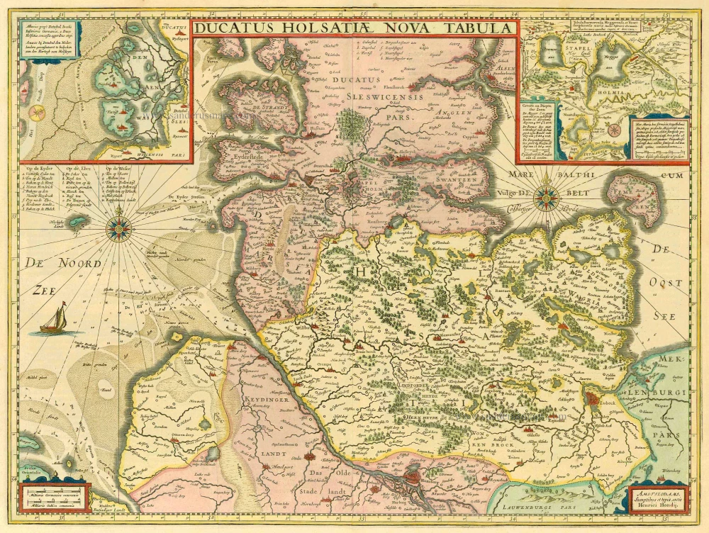
Ducatus Holsatiae Nova Tabula. Amstelodami, Sumptibus et typis aeneis Henrici Hondij. 1630
Holstein, by Janssonius J.
[Item number: 6780]
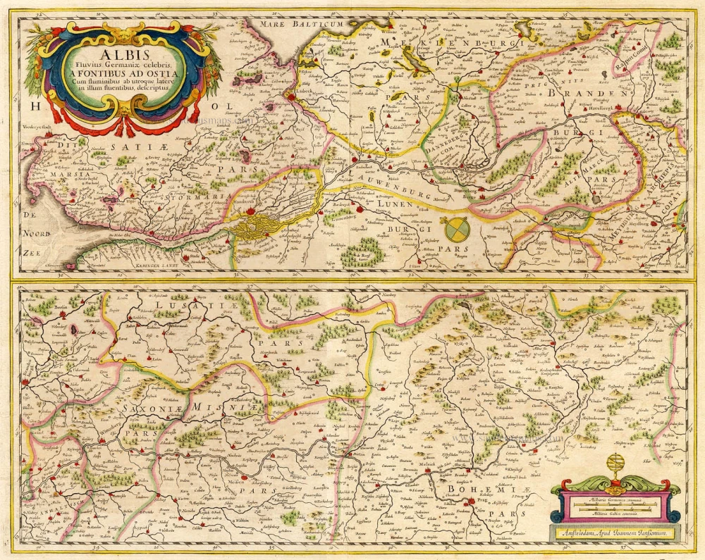
Albis Fluvius Germaniae celebris, ... Ca. 1650
Elbe River, by Hondius H. - Janssonius J
[Item number: 6941]
Ducatus Holsatiae Nova Tabula 1633
Holstein, by Janssonius - Hondius.
[Item number: 7751]
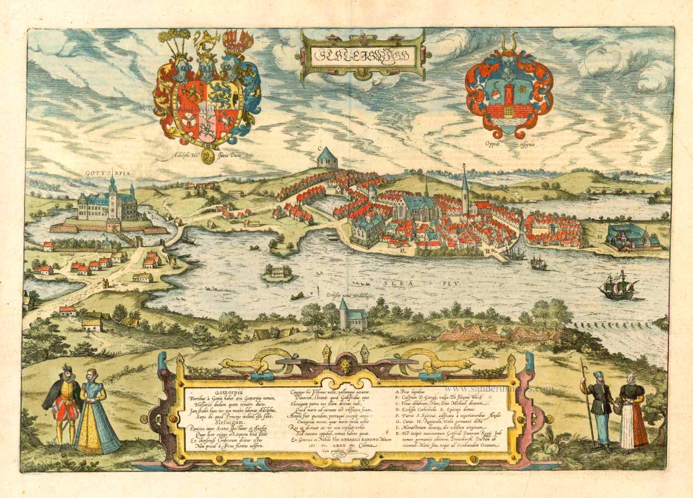
Schleiswygh. 1617
Schleswig by Georg Braun & Frans Hogenberg.
[Item number: 8792]
Ducatus Sleswicensis Nova Descriptio. 1666
Schleswig, by Joannes Janssonius.
[Item number: 26765]