
North Atlantic Ocean by Giovanni Magini 1597
Magini Giovanni Antonio (1555-1617)
Giovanni Antonio Magini was an Italian astronomer, astrologer, cartographer, and mathematician. He was born in Padua and completed his philosophy studies in Bologna in 1579. In 1588, he was chosen over Galileo Galilei to occupy the chair of mathematics position at the University of Bologna. He was in contact with many well-known figures of his day, including Ortelius, Tycho Brahe, Galileo and Johannes Kepler.
Magini supported a geocentric system of the world in preference to Copernicus's heliocentric system. Magini devised his planetary theory in preference to other existing ones. The Maginian System consisted of eleven rotating spheres, which he described in his Novæ Cœlestium orbium theoricæ congruentes cum observationibus N. Copernici (Venice, 1589). His most important work was the first printed atlas of Italy, published posthumously by his son Fabio.
He died in Bologna on 11 February 1617.
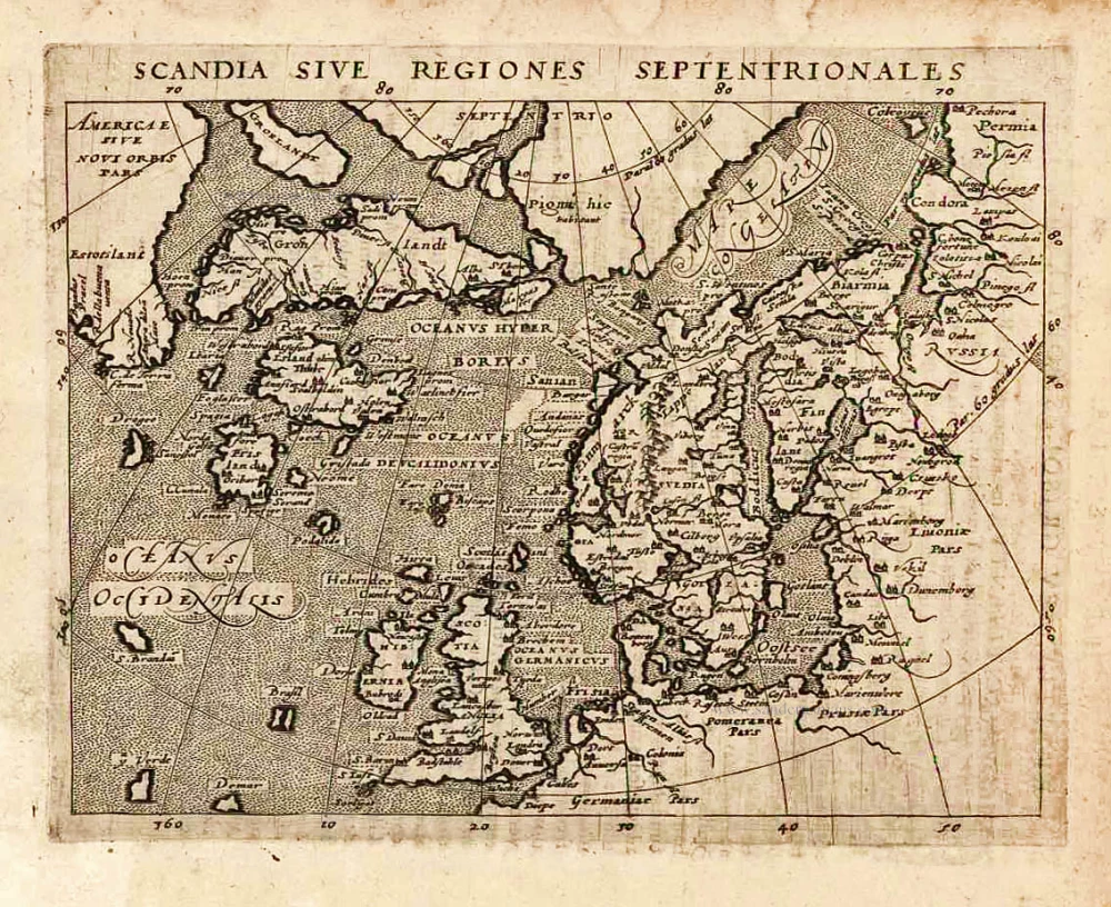
Scandia, sive Regiones Septentrionales.
Item Number: 26520 Authenticity Guarantee
Category: Antique maps > Europe > Northern Europe
Old, antique map of the North Atlantic Ocean, by Giovanni Magini.
Engraved by Girolamo Porro.
Based on Ortelius' Septentrionalium of 1570, after Zeno.
Date of the first edition: 1596
Date of this map: 1597
Copper engraving, printed on paper.
Size (not including margins): 13 x 18cm (5.1 x 7 inches)
Verso text: Latin
Condition: Excellent.
Condition Rating: A+
References: Burden, 98; Ginsberg (Scandinavia), #24.
From: Geographicae Universae tum veteris novae . . . Auctore Io. Ant. Magino. Cologne, P. Keschedt, 1597. - Pirate edition after Magini's original work of 1596.
Ortelius informed Magini in November 1597 about this and the publication was stopped till 1608 when a new edition was issued by Keschedt.
Magini Giovanni Antonio (1555-1617)
Giovanni Antonio Magini was an Italian astronomer, astrologer, cartographer, and mathematician. He was born in Padua and completed his philosophy studies in Bologna in 1579. In 1588, he was chosen over Galileo Galilei to occupy the chair of mathematics position at the University of Bologna. He was in contact with many well-known figures of his day, including Ortelius, Tycho Brahe, Galileo and Johannes Kepler.
Magini supported a geocentric system of the world in preference to Copernicus's heliocentric system. Magini devised his planetary theory in preference to other existing ones. The Maginian System consisted of eleven rotating spheres, which he described in his Novæ Cœlestium orbium theoricæ congruentes cum observationibus N. Copernici (Venice, 1589). His most important work was the first printed atlas of Italy, published posthumously by his son Fabio.
He died in Bologna on 11 February 1617.
Related items
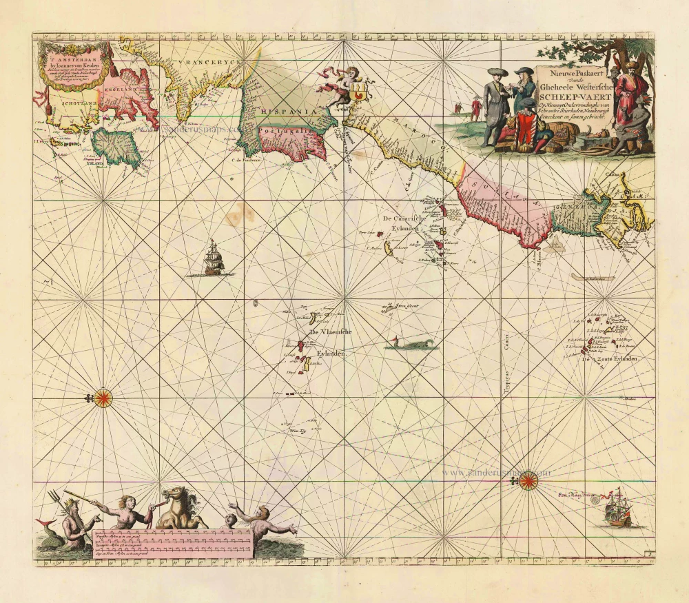
Nieuwe Paskaert vande Gheheele Westersche Scheep-Vaert, op Nieus uyt Ondervindinghe van Schrandre Stierlieden Naaukeurigh Geteeckent en Samen Gebracht. 1697-1709
The Atlantic Ocean, by J. Van Keulen.
[Item number: 11218]

Ocean Atlantique et Mers Adjacentes en Quatre Feuilles Contenant les Cotes de l'Europe, de l'Afrique et de l'Amerique ... 1778
The Atlantic Ocean, by G.L. Le Rouge.
[Item number: 14086]

The first sea chart relating to North America to use the Mercator projection
West-Indische Paskaert waer in de graden der breedde over wederzijden vande middellijn wassende so vergrooten dat die geproportioneert sijn tegen hunne nevenstaende graden der lengde; ... c. 1680
Atlantic Ocean. by P. Goos - J. Van Keulen
[Item number: 25938]
Rare.
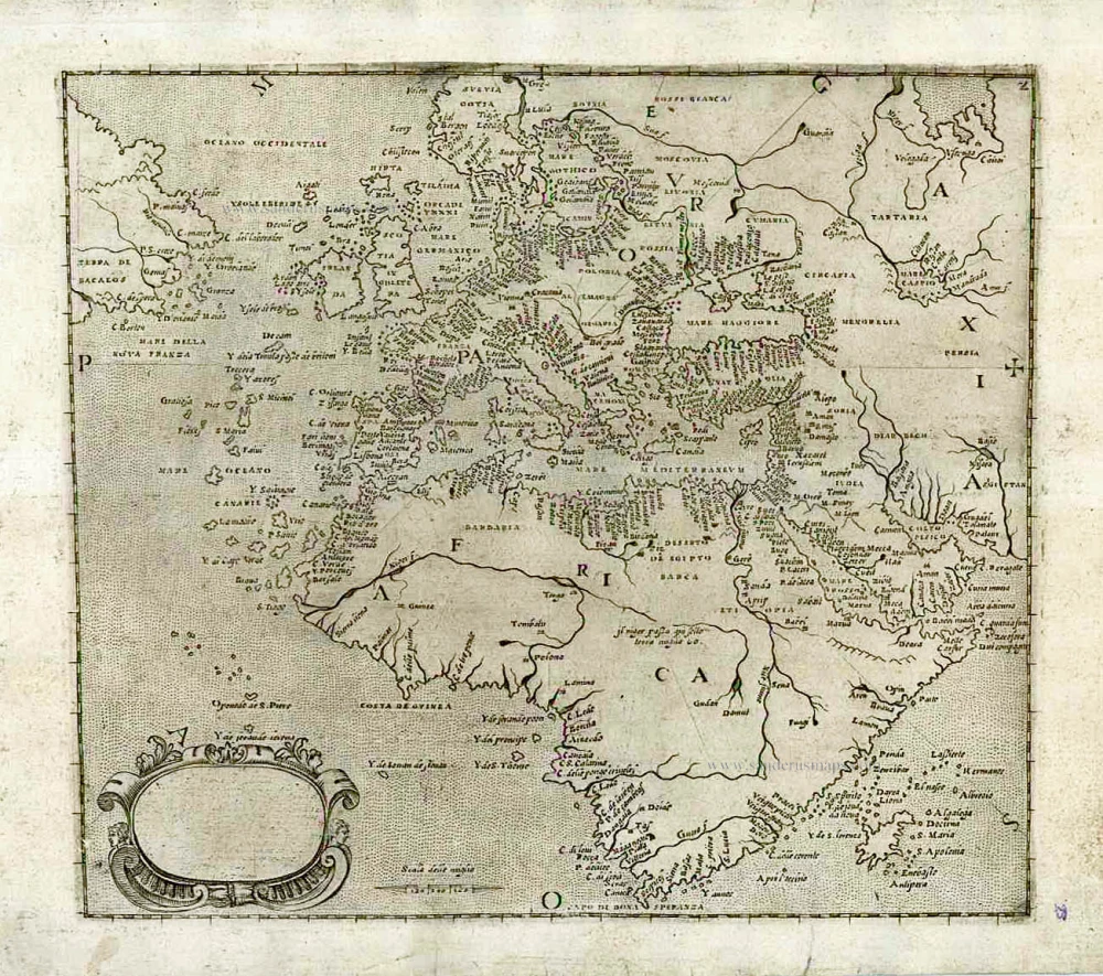
[No title] c. 1575
Atlantic Ocean - Europe, Africa & Eastern Canada by Giovanni Francesco Camocio
[Item number: 27086]