
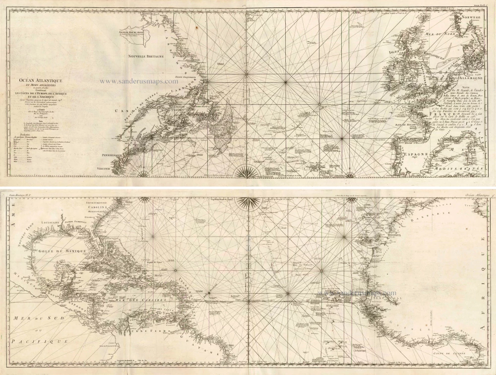
The Atlantic Ocean, by G.L. Le Rouge. 1778
Georges-Louis Le Rouge (c.1712-c.1790)
Lieutenant in the regiment of Saxe before establishing himself as a publisher, compiler, and editor of maps at the 'rue des Grands Augustins vis à vis le Panier Fleuri', Paris, c. 1740. He later became 'Ingénieur Géographe du Roi'.
Ocean Atlantique et Mers Adjacentes en Quatre Feuilles Contenant les Cotes de l'Europe, de l'Afrique et de l'Amerique ...
Item Number: 14086 Authenticity Guarantee
Category: Antique maps > America > North America
Old, antique map of The Atlantic Ocean, by G.L. Le Rouge.
Title: Ocean Atlantique et Mers Adjacentes en Quatre Feuilles Contenant les Cotes de l'Europe, de l'Afrique et de l'Amerique ...
Date: 1778.
Copper engraving, printed on paper.
Size (not including margins): 960 x 1370mm (37.8 x 53.94 inches).
Verso: Blank.
Condition: Four sheets, joined as two, excellent.
Condition Rating: A.
From: Le Rouge G.L. Pilote Americain Septentrionale. Paris, 1778.
The atlas was compiled for use by the French Navy during the American Revolution. It contains about twenty-five French versions of maps published originally by William Faden and Thomas Jefferys.
Georges-Louis Le Rouge (c.1712-c.1790)
Lieutenant in the regiment of Saxe before establishing himself as a publisher, compiler, and editor of maps at the 'rue des Grands Augustins vis à vis le Panier Fleuri', Paris, c. 1740. He later became 'Ingénieur Géographe du Roi'.
Related items
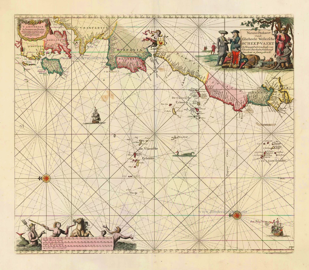
Nieuwe Paskaert vande Gheheele Westersche Scheep-Vaert, op Nieus uyt Ondervindinghe van Schrandre Stierlieden Naaukeurigh Geteeckent en Samen Gebracht. 1697-1709
The Atlantic Ocean, by J. Van Keulen.
[Item number: 11218]

Isles du Cap Verd Hispanis Islas de Cabo Verde Belgis de Soute Eylanden. 1721-41
Cape Verde Islands, by Covens & Mortier.
[Item number: 23621]
Heightened in gold!
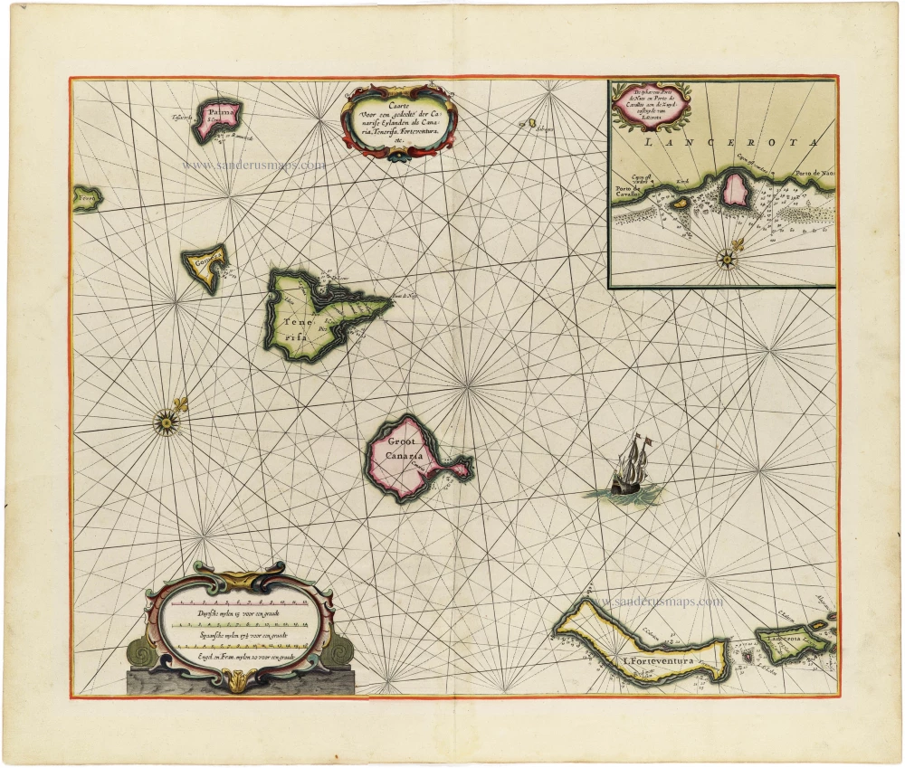
Caarte voor en Gedeelte der Canarise Eylanden als Canaria, Tenerifa, Forteventura, etc. 1666
The Canary Islands, by Pieter Goos.
[Item number: 25612]

The first sea chart - wall map - relating to North America to use the Mercator projection
West-Indische Paskaert waer in de graden der breedde over wederzijden vande middellijn wassende so vergrooten dat die geproportioneert sijn tegen hunne nevenstaende graden der lengde; ... c. 1680
Atlantic Ocean. by P. Goos - J. Van Keulen
[Item number: 25938]
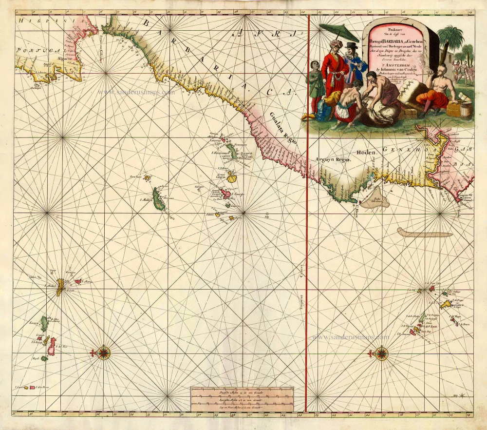
Paskaart van de Cust van Portugal, Barbaria, en Genehoa Beginnende van d'Barlengers tot aan C. Verde. 1680-1694
Sea chart of the northwest coast of Africa, with the Azores, Canary Islands and Cape Verde Islands, by Johannes Van Keulen.
[Item number: 26808]
Rare.
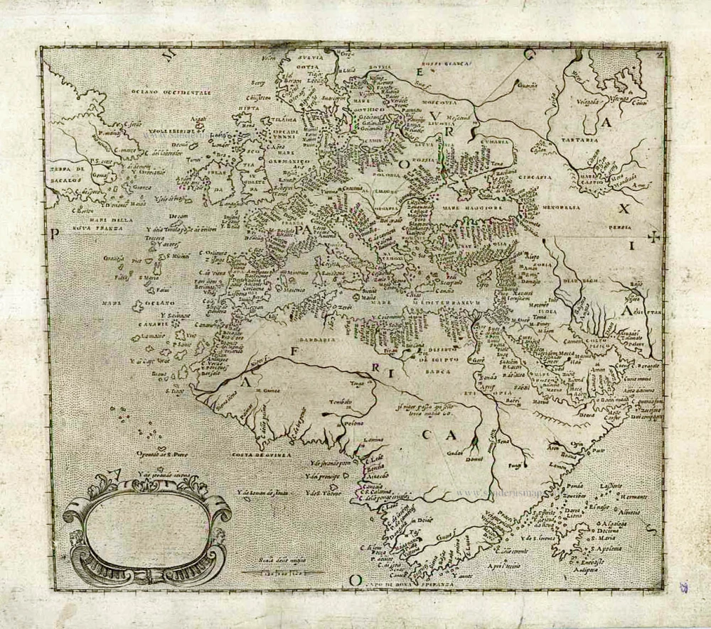
[No title] c. 1575
Europe, Africa, Arabia & Canada
[Item number: 27086]
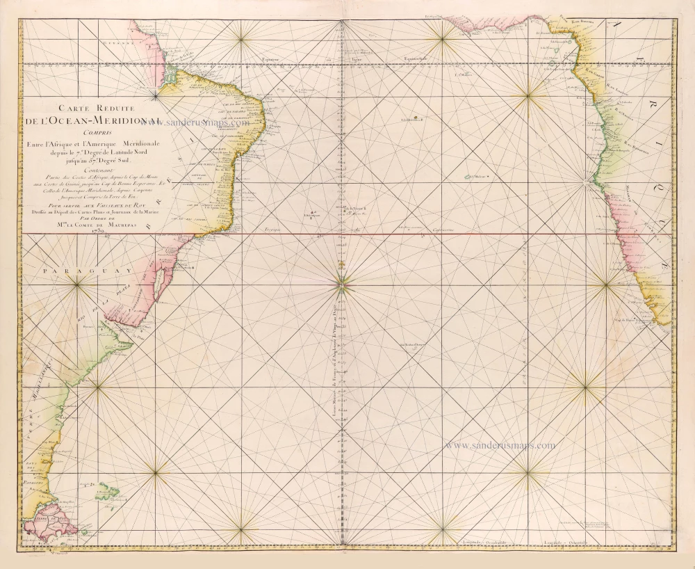
Carte réduite de l'Océan-méridional, compris entre l'Afrique et l'Amérique méridionale depuis le 7° degré de latitude Nord jusqu'au 57° degré Sud, contenant partie des costes d'Afrique depuis le cap de Monte... jusqu'au cap de Bonne Espérance et celles de l'Amérique méridionale depuis Cayenne jusques- et compris la Terre de Feu. 1765
Southern Atlantic Ocean by Jacques Nicolas Bellin.
[Item number: 31446]
Early map of the North Atlantic
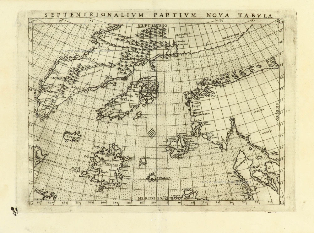
Septenirionalium Partium Nova Tabula. 1574
Northern Atlantic Ocean by Girolamo Ruscelli.
[Item number: 32185]