
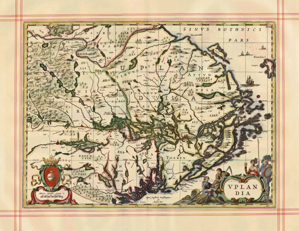
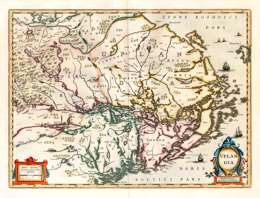
Uppland by J. Janssonius, published by Moses Pitt and J. Janssonius-Waesberge. 1680
Moses Pitt (1641-1697)
Moses Pitt, a London based map publisher and bookseller, planned a 12-volume world atlas based on Janssonius’ Atlas Maior. He entered into a partnership with Johann van Waesbergen, one of the heirs of Johannes Janssonius, and Steven Swart. Both publishers had versions with their own imprint. Only four volumes were issued. The undertaking ruined him, and he was imprisoned for two years for debt.
The maps are generally printed from reworked plates of Janssonius. The imprint of Janssonius van Waesbergen and Pitt is added and, to facilitate finding places with the index, the grid of parallels and meridians is added. In all probability, the maps were printed in Amsterdam and shipped to Oxford to be bound with the text.
Uplandia
Item Number: 1246 Authenticity Guarantee
Category: Antique maps > Europe > Northern Europe
Old, antique map of Uppland by J. Janssonius, published by Moses Pitt and J. Janssonius-Waesberge.
Title: Uplandia.
Date of the first edition: 1638.
Date of this map: 1680.
Copper engraving, printed on paper.
Size (not including margins): 362 x 490mm (14.25 x 19.29 inches).
Verso: Blank.
Condition: Hand coloured, on large, heavy paper, ruled in red, excellent.
Condition Rating: A+.
From: The English Atlas. Oxford, Moses Pitt, 1680. (Van der Krogt 1, 451)
Moses Pitt (1641-1697)
Moses Pitt, a London based map publisher and bookseller, planned a 12-volume world atlas based on Janssonius’ Atlas Maior. He entered into a partnership with Johann van Waesbergen, one of the heirs of Johannes Janssonius, and Steven Swart. Both publishers had versions with their own imprint. Only four volumes were issued. The undertaking ruined him, and he was imprisoned for two years for debt.
The maps are generally printed from reworked plates of Janssonius. The imprint of Janssonius van Waesbergen and Pitt is added and, to facilitate finding places with the index, the grid of parallels and meridians is added. In all probability, the maps were printed in Amsterdam and shipped to Oxford to be bound with the text.
Related items
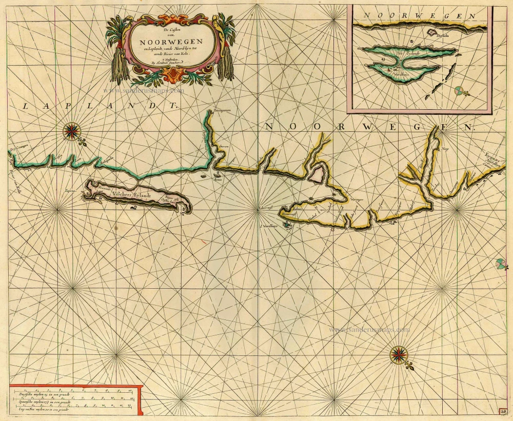
De Custen van Noorwegen en Laplandt, vande Noord-kyn tot aende Rivier van Kola. 1686
Sea chart of the coast of Norway, by Doncker H.
[Item number: 12920]
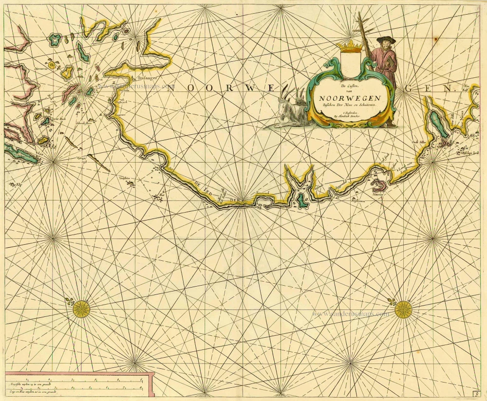
De Custen van Noorwegen tusschen Der Neus en Schuitenes. 1686
Sea chart of Norway, by Doncker H.
[Item number: 15775]
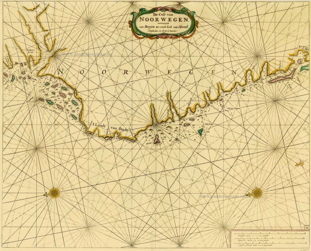
De Cust van Noorwegen vertoonende van Bergen tot aen de hoek van Horrel. 1686
Norway, by Doncker H.
[Item number: 17064]
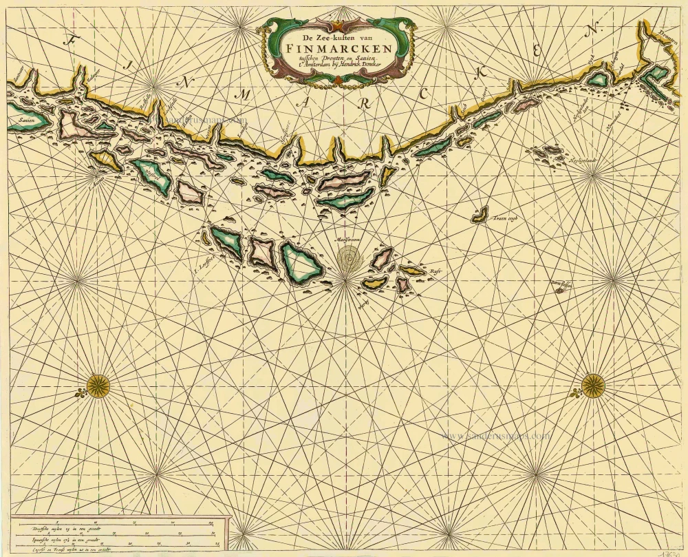
De Zee-kusten van Finmarcken tusschen Dronten en Sanien. 1686
Sea chart of Norway - Finnmark, by Doncker H.
[Item number: 17630]

Caarte van Finmargken van 't Eylandt Sanien tot Noordkyn. 1686
Sea chart of Norway - Finnmark, by Doncker H.
[Item number: 17900]
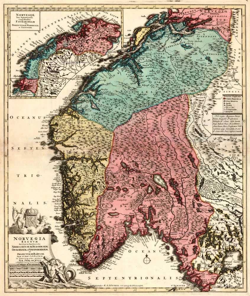
Norvegia Regnum Divisum in suos Dioeceses Nidrosiensem, Bergensem, Opsloensem, et Stavangriensem et Praefecturam Bahusiae ... After 1721
Norway by F. de Wit - R. & J. Ottens.
[Item number: 23499]
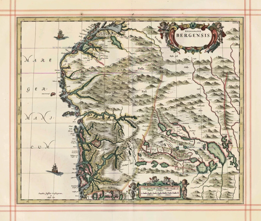
Episcopatus Bergensis 1680
Norway - Bergen, by J. Janssonius, published by Moses Pitt and J. Janssonius-Waesberge.
[Item number: 25068]
Uplandia. 1641
Uppland, by Henricus Hondius.
[Item number: 26261]