
Scandinavia, by Gerard Mercator. 1628
Gerard Mercator (1512 – 1594)
Gerard Mercator was born Gerard de Cremere in Rupelmonde (near Antwerp) on 5 March 1512.
Young Gerard learned what Latin he could in Rupelmonde, and when he was about fifteen, his uncle sent him to s'Hertogenbosch to study at a school run by the Brothers of the Common Life. One of Mercator’s teachers was the celebrated humanist Macropedius. After three and a half years with the brothers, Gerard went to Louvain, where he enrolled in the university in 1530 as one of the poor students at Castle College.
By this time, he had Latinized his name to Mercator. He studied philosophy and took his master’s degree in 1532. The problems of the creation of the Universe and the Earth interested him in particular, and this is reflected in his works written in later years.
After spending a few years in Antwerp, he returned to Louvain in c. 1535, where he took courses in mathematics under Gemma Frisius. Soon, he was recognised as an expert on the construction of mathematical instruments, as a land surveyor and, after 1537, as a cartographer. He drew his income from these activities after his marriage on August 3, 1536. He also qualified himself as a copper engraver, the first to introduce italic handwriting to this trade. The first maps, drawn and engraved by Gerard Mercator, are Palestine, 1537; the World in double heart-shaped projection, 1538; and Flanders, 1540.
In 1544, Mercator came into great danger: he was arrested on the accusation of heresy and put into jail. Thanks to the intervention of the University of Louvain, he was released after four months. In 1552, he moved with his family to Duisburg (Germany). In 1560, Mercator became a cosmographer in service of the Duke of Jülich-Cleve-Berge, and in 1563, he became a lecturer at the Grammar School of the new University in Duisburg. During this period, he made wall maps of Europe, 1554; of Loraine, 1564; the British Isles, 1564; and the famous world map with increasing latitudes, 1569. About this time, Mercator was also working on the project for a complete description of the creation, the Heavens, Earth, Sea and world history. This resulted in his Atlas, sive cosmographicae meditationes de fabrica mundi et fabricati figura. He also worked on an edition of Ptolemy’s Geographia in 1578. The first part of his book, which contains modern maps (France, Germany, and the Netherlands), appeared in 1585.
Shortly after the publication of the second part of his map book (not yet called Atlas) with the maps of Italy (1589), he had a stroke that ended his highly significant productivity. The great man passed away on 2 December 1594, leaving the responsibility of finishing the map book to his son Rumold. The final part of it appeared in 1595. Its title is Pars Altera, and it constitutes an essential part of what was then called Mercator’s Atlas.
The map of Europe and the world map in the Atlas are by Rumold Mercator. After Rumold died in 1599, the Atlas was reissued in 1602.
The plates of the maps, both of the Ptolemy edition and the Atlas, were sold in 1604 to Jodocus Hondius of Amsterdam. The following year, Hondius managed to bring out Ptolemy’s Geographia. In 1606, the first Amsterdam edition of the Mercator Atlas appeared in the next year. From then to 1638, the Atlas saw many enlarged editions in various languages.
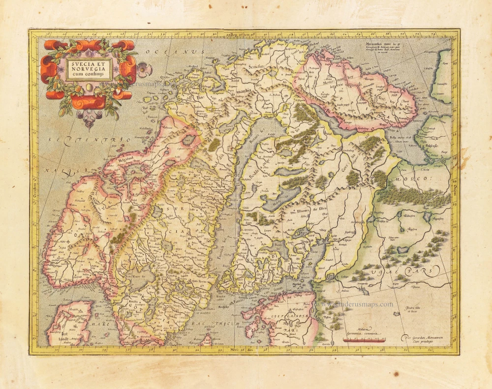
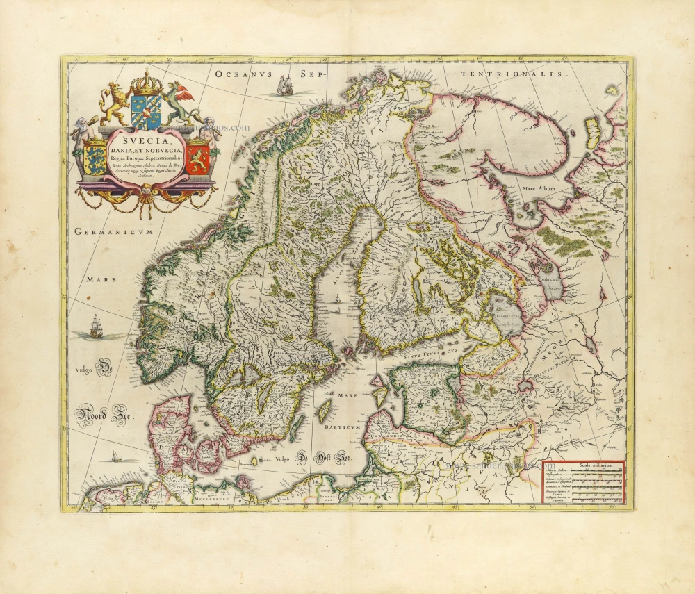
Svecia et Norvegia cum confinijs.
Item Number: 28815 Authenticity Guarantee
Category: Antique maps > Europe > Northern Europe
Old, antique map of Scandinavia, by Gerard Mercator.
Title: Svecia et Norvegia cum confinijs.
Per Gerardum Mercatorem
Cum privilegio.
Date of the first edition: 1606.
Date of this map: 1628.
Copper engraving, printed on paper.
Map size: 385 x 485mm (15.16 x 19.09 inches).
Sheet size: 475 x 570mm (18.7 x 22.44 inches).
Verso: French text.
Condition: Original coloured, age-toned, some staining.
Condition Rating: A.
From: Gerardi Mercatoris - ATLAS Sive Cosmographicae Meditationes de Fabrica Mundi et Fabricati Figura. Amsterdam, H. Hondius, 1628. (Van der Krogt 1, 1:114)
Gerard Mercator (1512 – 1594)
Gerard Mercator was born Gerard de Cremere in Rupelmonde (near Antwerp) on 5 March 1512.
Young Gerard learned what Latin he could in Rupelmonde, and when he was about fifteen, his uncle sent him to s'Hertogenbosch to study at a school run by the Brothers of the Common Life. One of Mercator’s teachers was the celebrated humanist Macropedius. After three and a half years with the brothers, Gerard went to Louvain, where he enrolled in the university in 1530 as one of the poor students at Castle College.
By this time, he had Latinized his name to Mercator. He studied philosophy and took his master’s degree in 1532. The problems of the creation of the Universe and the Earth interested him in particular, and this is reflected in his works written in later years.
After spending a few years in Antwerp, he returned to Louvain in c. 1535, where he took courses in mathematics under Gemma Frisius. Soon, he was recognised as an expert on the construction of mathematical instruments, as a land surveyor and, after 1537, as a cartographer. He drew his income from these activities after his marriage on August 3, 1536. He also qualified himself as a copper engraver, the first to introduce italic handwriting to this trade. The first maps, drawn and engraved by Gerard Mercator, are Palestine, 1537; the World in double heart-shaped projection, 1538; and Flanders, 1540.
In 1544, Mercator came into great danger: he was arrested on the accusation of heresy and put into jail. Thanks to the intervention of the University of Louvain, he was released after four months. In 1552, he moved with his family to Duisburg (Germany). In 1560, Mercator became a cosmographer in service of the Duke of Jülich-Cleve-Berge, and in 1563, he became a lecturer at the Grammar School of the new University in Duisburg. During this period, he made wall maps of Europe, 1554; of Loraine, 1564; the British Isles, 1564; and the famous world map with increasing latitudes, 1569. About this time, Mercator was also working on the project for a complete description of the creation, the Heavens, Earth, Sea and world history. This resulted in his Atlas, sive cosmographicae meditationes de fabrica mundi et fabricati figura. He also worked on an edition of Ptolemy’s Geographia in 1578. The first part of his book, which contains modern maps (France, Germany, and the Netherlands), appeared in 1585.
Shortly after the publication of the second part of his map book (not yet called Atlas) with the maps of Italy (1589), he had a stroke that ended his highly significant productivity. The great man passed away on 2 December 1594, leaving the responsibility of finishing the map book to his son Rumold. The final part of it appeared in 1595. Its title is Pars Altera, and it constitutes an essential part of what was then called Mercator’s Atlas.
The map of Europe and the world map in the Atlas are by Rumold Mercator. After Rumold died in 1599, the Atlas was reissued in 1602.
The plates of the maps, both of the Ptolemy edition and the Atlas, were sold in 1604 to Jodocus Hondius of Amsterdam. The following year, Hondius managed to bring out Ptolemy’s Geographia. In 1606, the first Amsterdam edition of the Mercator Atlas appeared in the next year. From then to 1638, the Atlas saw many enlarged editions in various languages.
Related items
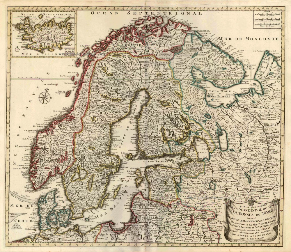
Carte la Plus Nouvelle de la Scandinivie ou les Couronnes du Nord Scavoir La Suede le Dannemarc et La Norvege Ou Lon Trouve La Mer Baltique et une Grande Partie de la Moscovie etc. 1730-45
Scandinavia par R. & I. Ottens.
[Item number: 25858]
Rare and important map.
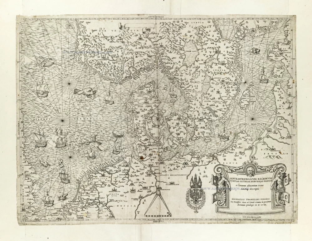
Septemtrionalium Regionum Svetiae Gothiae Norvegiae Daniae et terrarum adiacentium recens exactaq[ue] descriptio. 1558
Scandinavia, by Michele Tramezini.
[Item number: 27045]
Early edition with Durer's woodcut panels on verso.
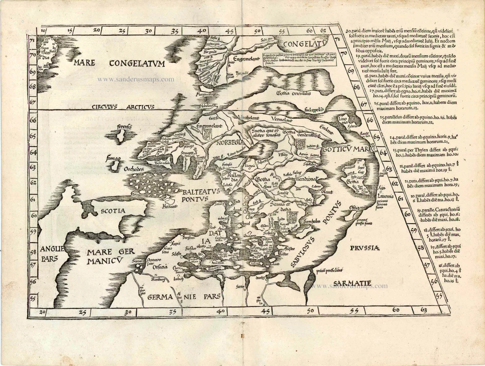
[No title - on verso:] Tab. Nova Norbegiae et Gottiae 1525
Ptolemy map of Scandinavia by Lorenz Fries, after Matin Waldseemüller.
[Item number: 27930]
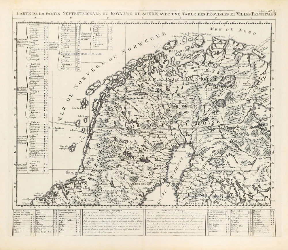
Carte de la Partie Septentrionale du Royaume de Suède avec une Table des Provinces et Villes Principales. 1714
Northern Scandinavia by Zacharias Châtelain.
[Item number: 29412]

Carte de la Partie Meridionale du Royaume de Suède avec une Table des Provinces et Villes Principales. 1714
Southern Scandinavia by Zacharias Châtelain.
[Item number: 29413]

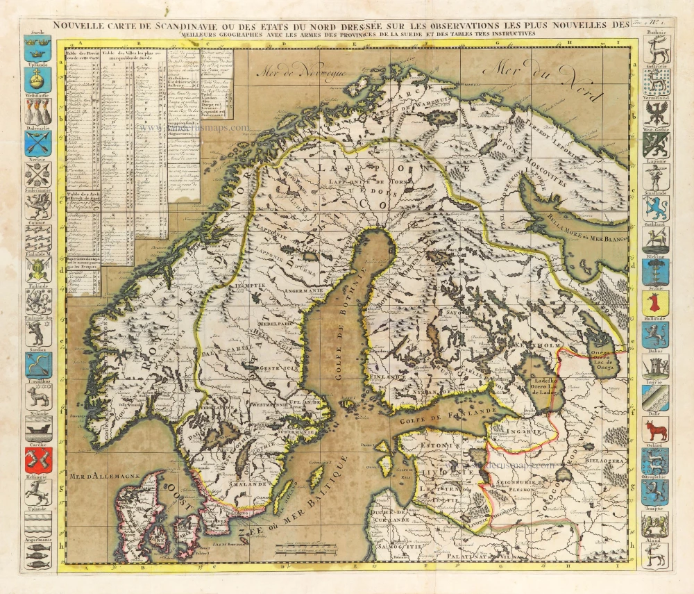
Nouvelle Carte de Scandinavie ou des Etats du Nord Dressée sur les observations les plus nouvelles des meilleurs Géographes avec les Armes des Provinces de la Suède et des Tables tres instructives. 1714
Scandinavia, by Zacharias Châtelain.
[Item number: 29499]
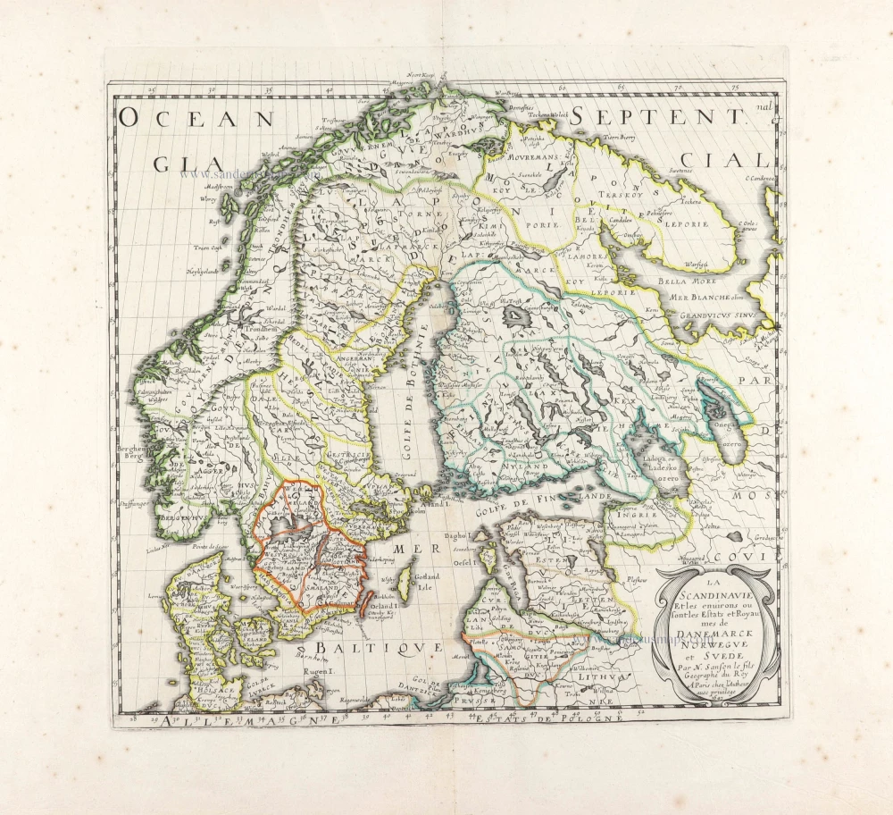
La Scandinavie et les environs ou sont les Estats et Royaumes de Danemarck Norwegue et Suede. 1652
Scandinavia by Nicolas Sanson.
[Item number: 29607]
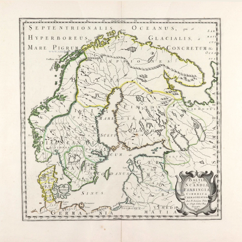
Baltia, quae et Scandia, Cimbrica Chersonesus &c. 1654-58
Scandinavia by Nicolas Sanson.
[Item number: 29608]
First edition.
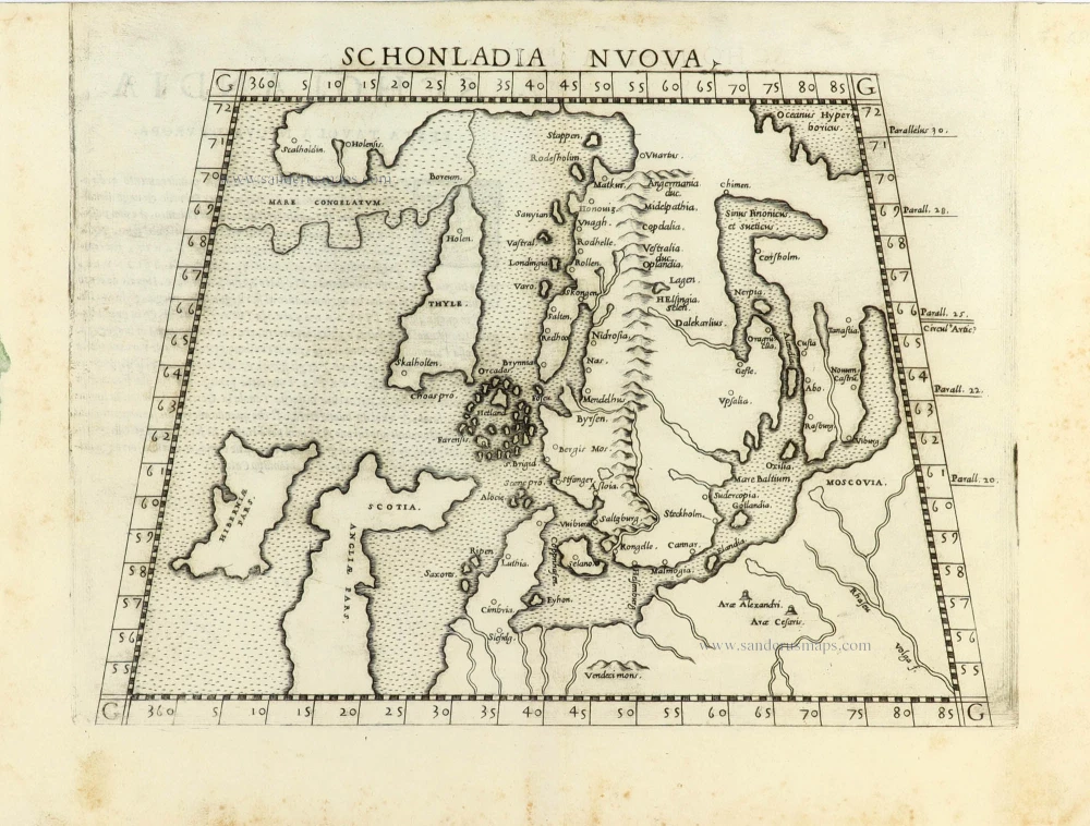
Schonladia Nuova. 1561
Scandinavia by Girolamo Ruscelli.
[Item number: 31087]
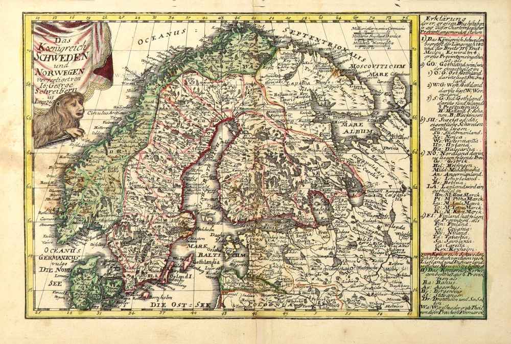
Das Koenigreich Schweden und Norwegen. c. 1745.
Scandinavia by J.G. Schreiber.
[Item number: 31108]
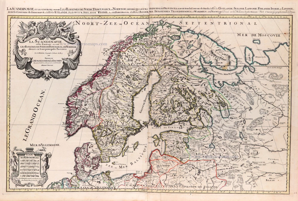
La Scandinavie, et les Environs, ou sont les Royaumes de Suede de Danemarck, et de Norwege. divisés en leurs principales Provinces. 1692
Scandinavia by N. Sanson, so-called published by Hubert Jaillot. (Pirated edition by Pierre Mortier).
[Item number: 31170]
In rare original colour
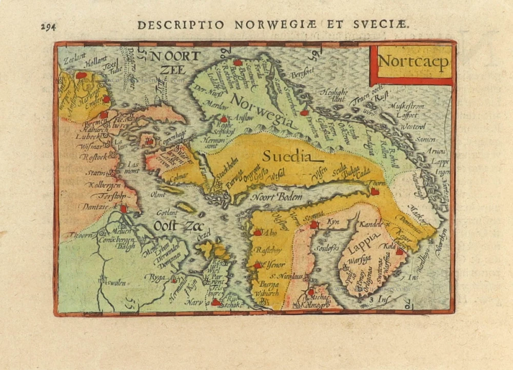
Nortcaep 1602
Scandinavia by Barent Langenes, published by Petrus Bertius.
[Item number: 31204]
In rare original colour
Nouvelle Carte de Scandinavie ou des Etats du Nord Dressée sur les observations les plus nouvelles des meilleurs Géographes avec les Armes des Provinces de la Suède et des Tables tres instructives. 1714
Scandinavia, by Zacharias Châtelain.
[Item number: 31424]

Suecia et Norvegia ect. 1618
Scandinavia by Petrus Bertius, published by Jodocus Hondius II.
[Item number: 31631]
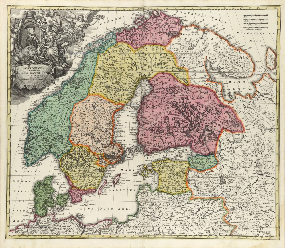
Scandinavia complectens Sueciae, Daniae, & Norvegiae Regna. c. 1720
Scandinavia, by Homann J.B.
[Item number: 32203]
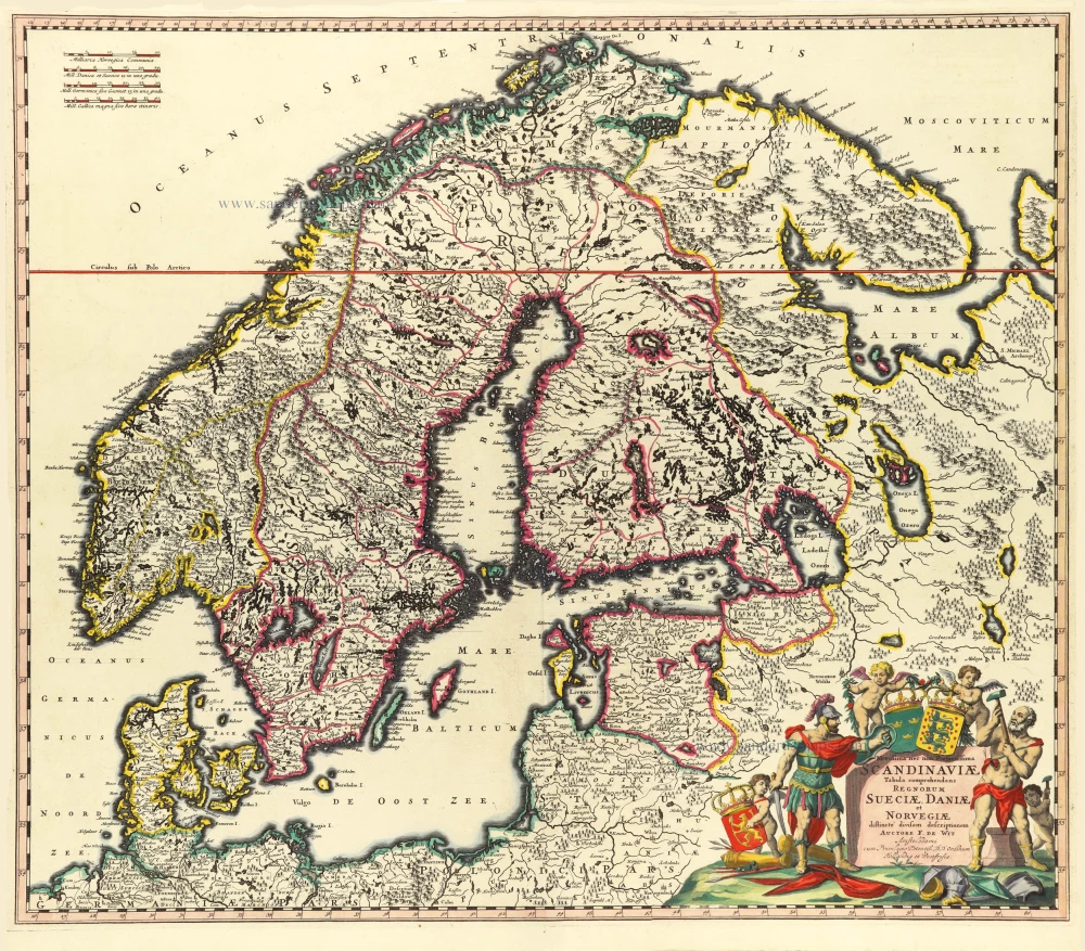
Novissima nec non Perfectissima Scandinaviae Tabula Comprehendens Regnorum Sueciae, Daniae et Novegiae. 1689-1691
Scandinavia by Frederick de Wit.
[Item number: 32208]
Suecia, Dania et Norvegia, Regna Europae Septentrionalia. 1659
Scandinavia by Joan Blaeu.
[Item number: 32423]

Scarce
Accuratissima Regnorum et Norvegiae, Tabula. c. 1680
Scandinavia by Justus Danckerts
[Item number: 32613]

La Scandinavia Divisa nelli suoi Regni di Suezia, Danimarca, Norvegia, e Paese de Lapponi, 1678
Scandinavia by Nicolas Sanson, published by Giovanni de Rossi.
[Item number: 32900]