
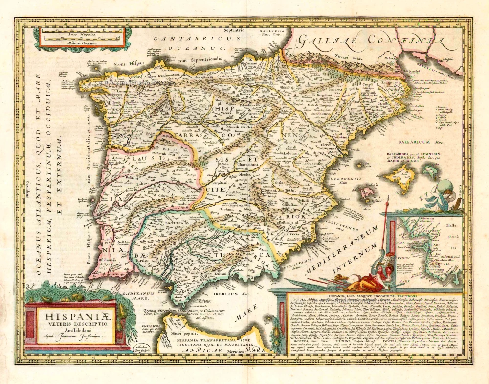
Spain by Willem Blaeu. 1635


The Blaeus: Willem Janszoon, Cornelis & Joan
Willem Jansz. Blaeu and his son Joan Blaeu are the seventeenth century's most widely known cartographic publishers.
Willem Jansz. (also written Guilielmus Janssonius) = Willem Janszoon Blaeu was born in Uitgeest (Netherlands), near Alkmaar, in 1571. He studied mathematics under Tycho Brahe and learned the theory and practice of astronomical observations and the art of instrument- and globe-making.
In 1596, he came to Amsterdam, where he settled down as a globe-, instrument- and mapmaker. He published his first cartographic work (a globe) in 1599 and probably published his first printed map (a map of the Netherlands) in 1604. He specialised in maritime cartography, published the first edition of the pilot guide Het Licht der Zeevaert in 1608, and was appointed Hydrographer of the V.O.C. (United East India Company) in 1633. After publishing books, wall maps, globes, charts and pilot guides for thirty years, he brought out his first atlas, Atlas Appendix (1630). This was the beginning of the great tradition of atlas-making by the Blaeus.
In 1618, another mapmaker, bookseller and publisher, Johannes Janssonius, established himself in Amsterdam next door to Blaeu's shop. No wonder these two neighbours began accusing each other of copying and stealing their information and became fierce competitors who did not have a good word to say about each other. In about 1621 Willem Jansz. decided to end the confusion between his name and his competitor's and assumed his grandfather's nickname, 'blauwe Willem' ('blue Willem'), as the family name; after that, he called himself Willem Jansz. Blaeu.
Willem Janszoon Blaeu died in 1638, leaving his prospering business to his sons, Cornelis and Joan. We only know that Cornelis's name occurs in the prefaces of books and atlases until c. 1645.
Joan Blaeu, born in Amsterdam in 1596, became a partner in his father's book trade and printing business. 1638, he was appointed his father's successor in the Hydrographic Office of the V.O.C. His efforts culminated in the magnificent Atlas Major and the town books of the Netherlands and Italy – works unsurpassed in history and modern times, giving eternal fame to the name of the Blaeu's.
A fire ruined the business on February 23, 1672, and one year later, Dr. Joan Blaeu died. The fire and the director's passing caused the complete sale of the Blaeu House's stock. Five public auctions dispersed the remaining books, atlases, copperplates, globes, etc., among many other map dealers and publishers in Amsterdam. The majority was acquired by several booksellers acting in partnership.
In the succeeding years, the remaining printing department remained in the hands of the Blaeu family until 1695, when the printing house's inventory was sold at a public auction. That meant the end of the Blaeu family as a printing house of world renown.
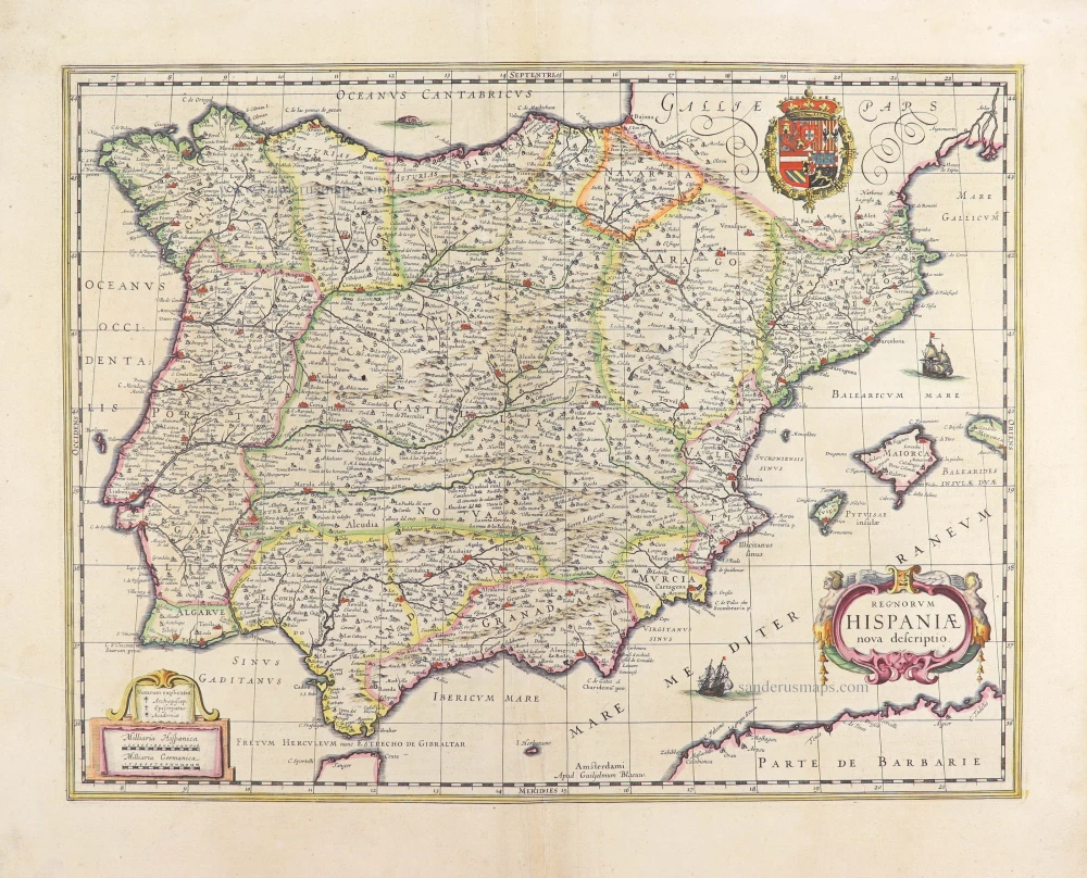
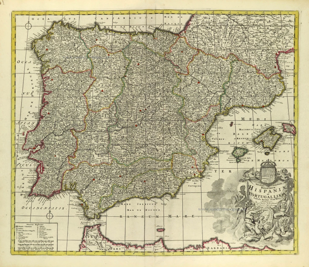
Regnorum Hispaniae nova descriptio.
Item Number: 28729 Authenticity Guarantee
Category: Antique maps > Europe > Spain and Portugal
Old, antique map of the Iberian Peninsula (Spain & Portugal), by Willem Blaeu.
Title: Regnorum Hispaniae nova descriptio.
Amsterdami Apud Guiljelmum Blaeuw.
Date of the first edition: 1630.
Date of this map: 1635.
Copper engraving, printed on paper.
Map size: 380 x 495mm (14.96 x 19.49 inches).
Sheet size: 480 x 570mm (18.9 x 22.44 inches).
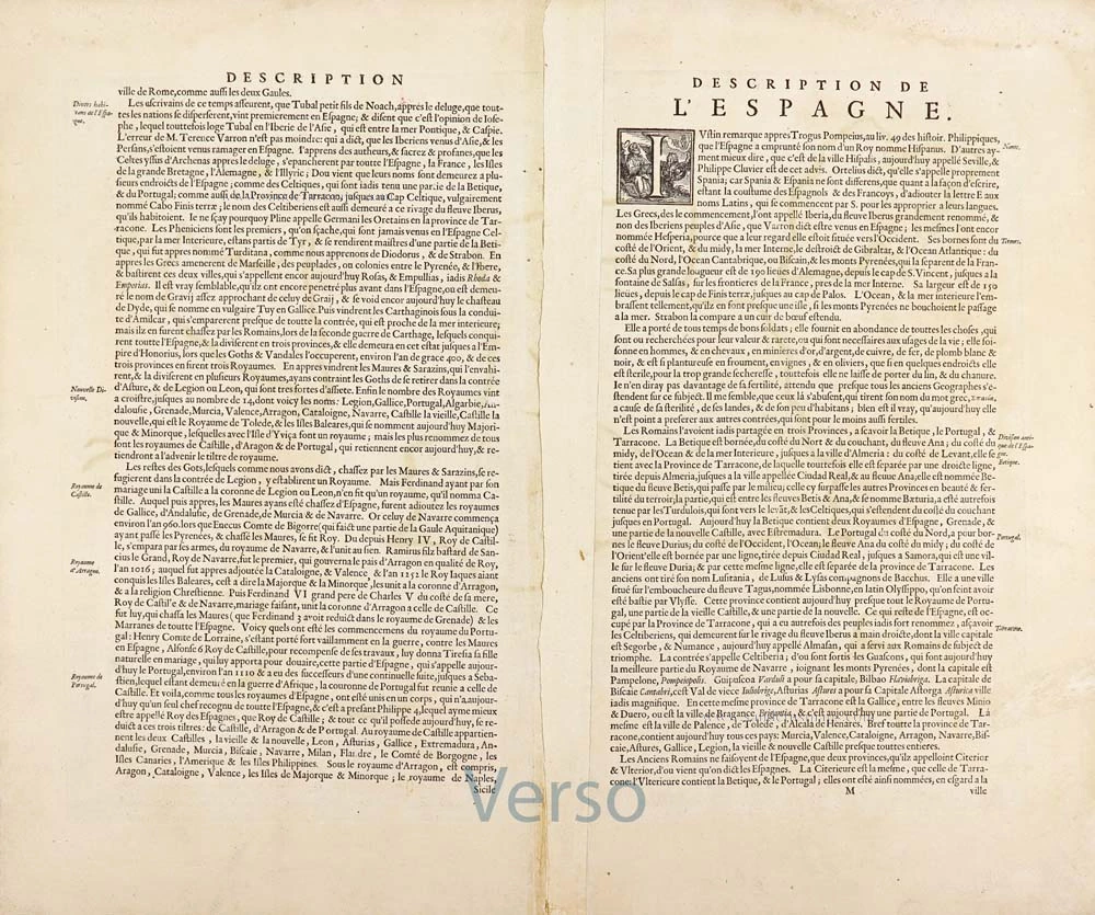
Verso: French text.
Condition: Original coloured, centrefold repaired.
Condition Rating: A.
From: Théâtre du Monde ou Nouvel Atlas. J. Blaeu, 1635. (Van der Krogt 2, 2111)
The Blaeus: Willem Janszoon, Cornelis & Joan
Willem Jansz. Blaeu and his son Joan Blaeu are the seventeenth century's most widely known cartographic publishers.
Willem Jansz. (also written Guilielmus Janssonius) = Willem Janszoon Blaeu was born in Uitgeest (Netherlands), near Alkmaar, in 1571. He studied mathematics under Tycho Brahe and learned the theory and practice of astronomical observations and the art of instrument- and globe-making.
In 1596, he came to Amsterdam, where he settled down as a globe-, instrument- and mapmaker. He published his first cartographic work (a globe) in 1599 and probably published his first printed map (a map of the Netherlands) in 1604. He specialised in maritime cartography, published the first edition of the pilot guide Het Licht der Zeevaert in 1608, and was appointed Hydrographer of the V.O.C. (United East India Company) in 1633. After publishing books, wall maps, globes, charts and pilot guides for thirty years, he brought out his first atlas, Atlas Appendix (1630). This was the beginning of the great tradition of atlas-making by the Blaeus.
In 1618, another mapmaker, bookseller and publisher, Johannes Janssonius, established himself in Amsterdam next door to Blaeu's shop. No wonder these two neighbours began accusing each other of copying and stealing their information and became fierce competitors who did not have a good word to say about each other. In about 1621 Willem Jansz. decided to end the confusion between his name and his competitor's and assumed his grandfather's nickname, 'blauwe Willem' ('blue Willem'), as the family name; after that, he called himself Willem Jansz. Blaeu.
Willem Janszoon Blaeu died in 1638, leaving his prospering business to his sons, Cornelis and Joan. We only know that Cornelis's name occurs in the prefaces of books and atlases until c. 1645.
Joan Blaeu, born in Amsterdam in 1596, became a partner in his father's book trade and printing business. 1638, he was appointed his father's successor in the Hydrographic Office of the V.O.C. His efforts culminated in the magnificent Atlas Major and the town books of the Netherlands and Italy – works unsurpassed in history and modern times, giving eternal fame to the name of the Blaeu's.
A fire ruined the business on February 23, 1672, and one year later, Dr. Joan Blaeu died. The fire and the director's passing caused the complete sale of the Blaeu House's stock. Five public auctions dispersed the remaining books, atlases, copperplates, globes, etc., among many other map dealers and publishers in Amsterdam. The majority was acquired by several booksellers acting in partnership.
In the succeeding years, the remaining printing department remained in the hands of the Blaeu family until 1695, when the printing house's inventory was sold at a public auction. That meant the end of the Blaeu family as a printing house of world renown.
Related items
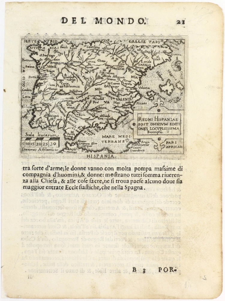
Regni Hispaniae Post Omnium Editiones Locuplessima Descriptio. 1598
Iberian Peninsula (Portugal & Spain), by Abraham Ortelius.
[Item number: 2568]
Regni Hispaniae Post Omnium Editiones Locuplessima Descriptio. 1601
Iberian Peninsula (Spain & Portugal), by A. Ortelius.
[Item number: 5727]

Hispaniae Nova Describtio, de integro multis inlocis, secundum hydrographicas, desc. emendata. 1623
Iberian Peninsula (Spain & Portugal), by J. Hondius.
[Item number: 24904]
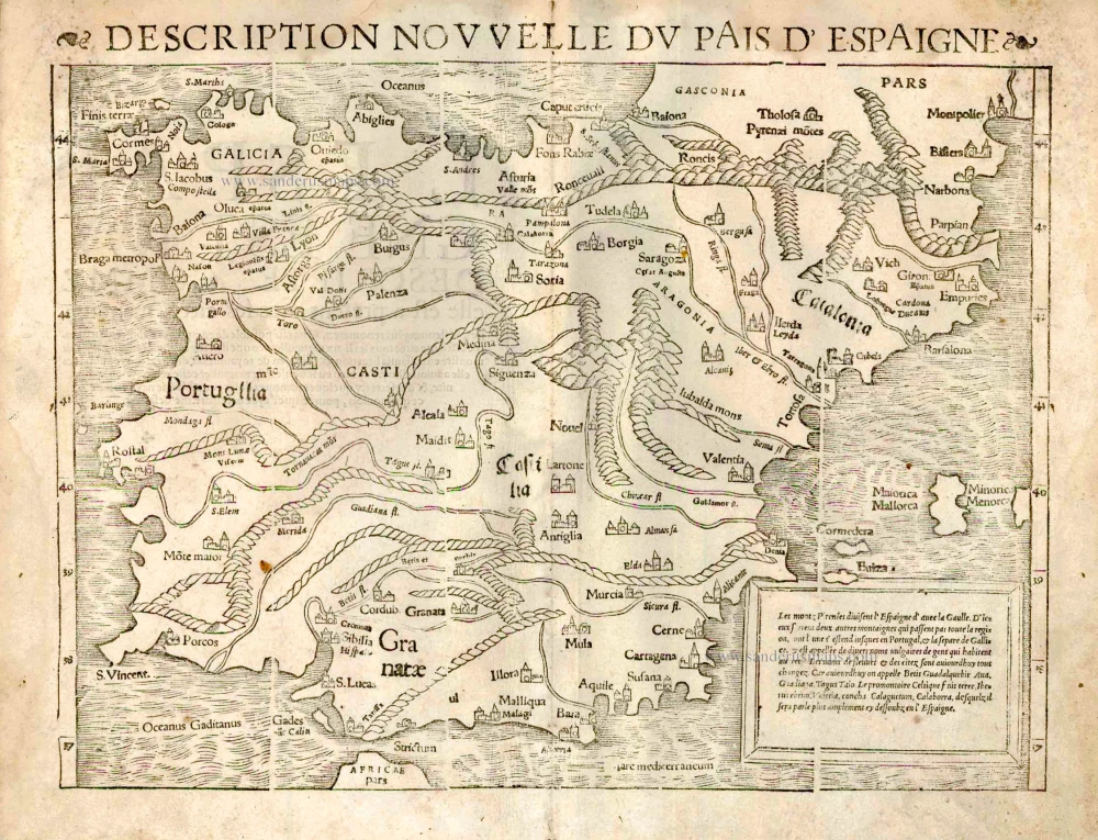
Description Nouvelle du Pais d'Espaigne. 1555
Iberian Peninsula (Spain - Portugal) by S. Munster.
[Item number: 25162]
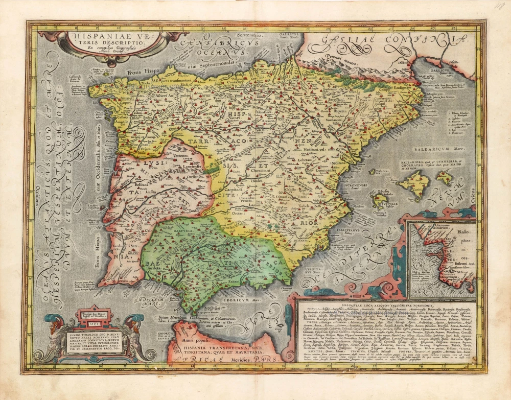
Hispaniae Veteris Descriptio. 1641
Spain (antique), by Johannes Janssonius.
[Item number: 26327]

Typus Hispaniae ab Hesselo Gerardo delineata et juxta annotationes Doctiss. Dni. Don Andreae d'Almada S. Theologiae Publici Professoris apud Coimbricenses emendatus M.DC.XXXI. 1641
The Iberian Peninsula (Spain & Portugal), by Henricus Hondius.
[Item number: 26328]
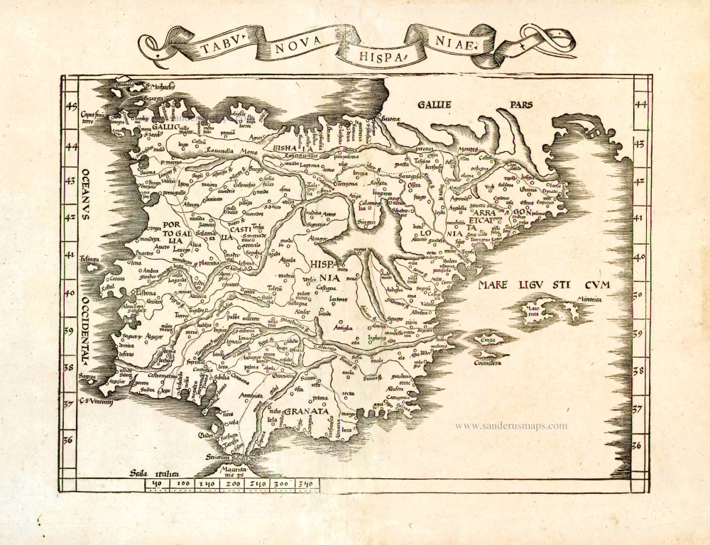
Tabu. Nova Hispaniae. 1535
Iberian Peninsula (Spain and Portugal) by Lorenz Fries.
[Item number: 26762]
[No title] - [On verso:] Tabula .II. Europae. 1525
Spain & Portugal, by Spain & Portugal.
[Item number: 27956]

Hispania Antiqua in tres praecipuas partes scilicet Tarraconensem, Lusitaniam, et Baeticam, 1776-79
Ancient Iberian Peninsula (Spain & Portugal), by Francesco Santini, after Nicolas Sanson & Sr. Robert de Vaugondy.
[Item number: 28106]
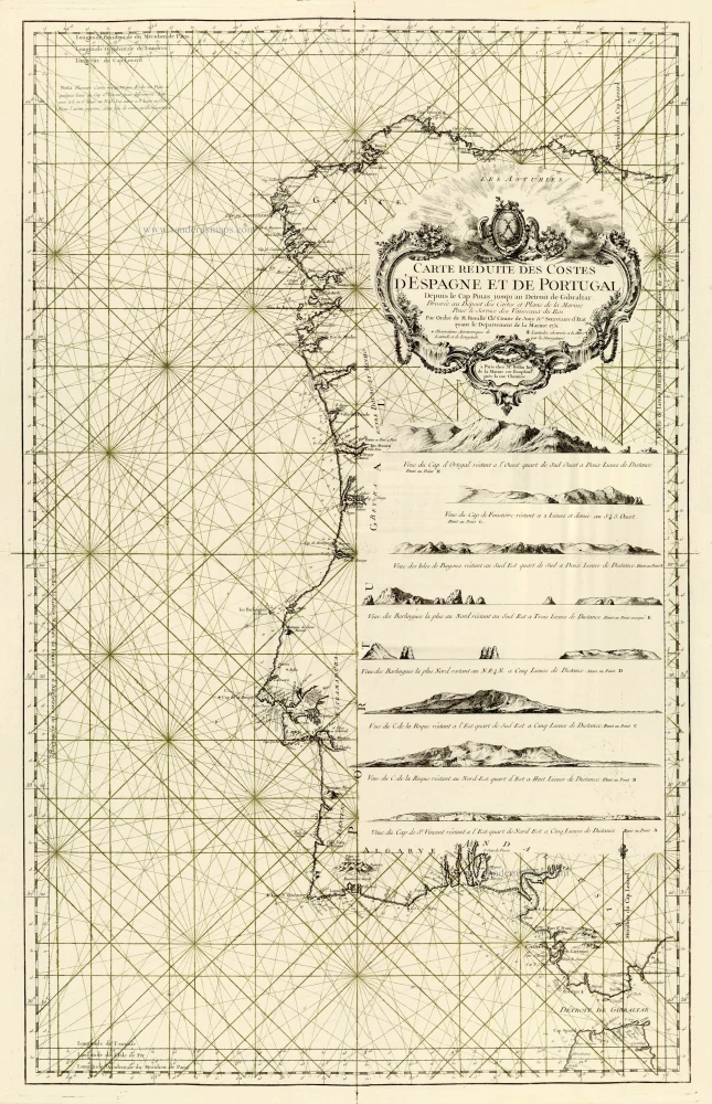
Carte Réduite des Costes d'Espagne et de Portugal. 1756-1770
Spain - Portugal, by J.N. Bellin.
[Item number: 28124]
Very important map.
Hispaniae Descriptio. 1559
Iberian Peninsula (Spain & Portugal) by Vincenzo Luchini.
[Item number: 28151]
Nova Hispaniae Descriptio. 1632
Spain by Joannes Janssonius.
[Item number: 28205]
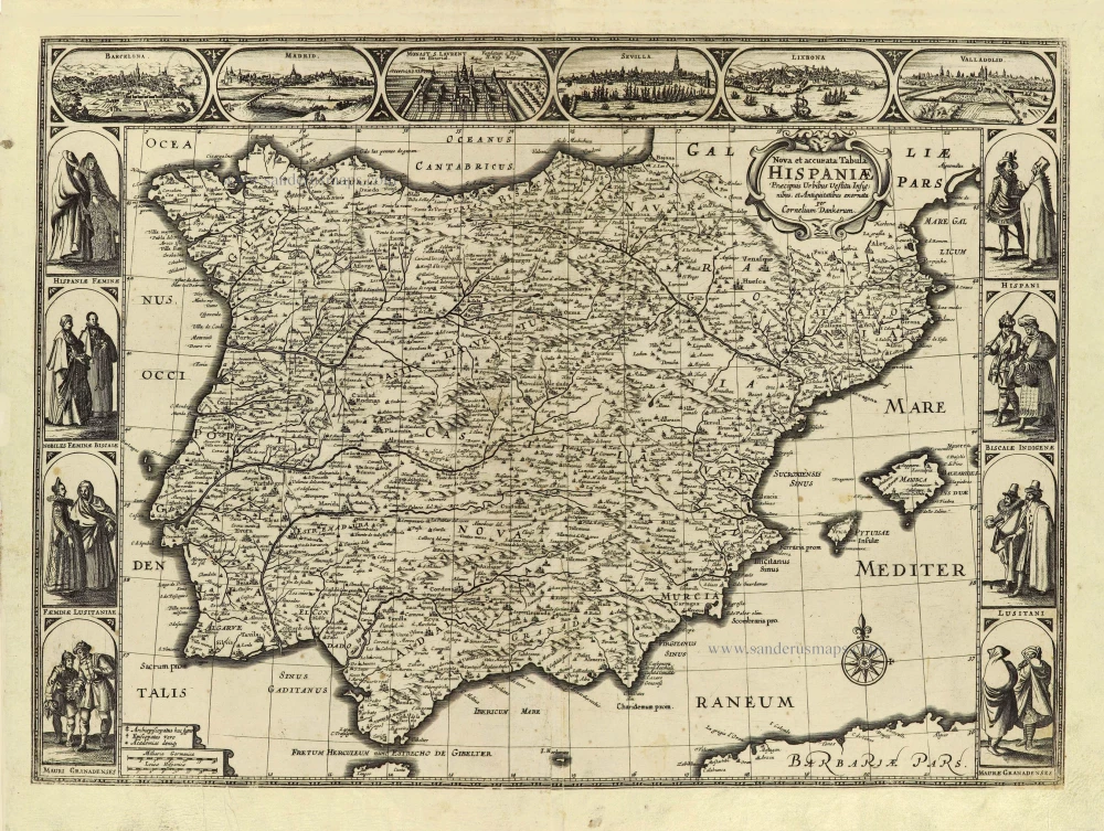
Nova et accurata Tabula Hispaniae Praecipuis Urbibus Vestitu Insignibus et Antiquitatibus exornata. c. 1640
Spain & Portugal (Iberian Peninsula) by Cornelis Danckerts.
[Item number: 28211]
Novissima et Accuratissima Regnorum Hispaniae et Portugalliae. c. 1715
Iberian Peninsula (Spain & Portugal) by Covens & Mortier.
[Item number: 28238]
Rare!
Nova Regni Hispaniae Descriptio, de novo multis in locis aucta et emendata. 1605
Spain by Willem Blaeu
[Item number: 28367]
Totius Regnorum Hispaniae et Portugalliae. 1680
Iberian Peninsula (Spain & Portugal) by
[Item number: 28604]
Hispaniae Antiquae Tabulae. 1652
Spain by Nicolas Sanson.
[Item number: 29694]
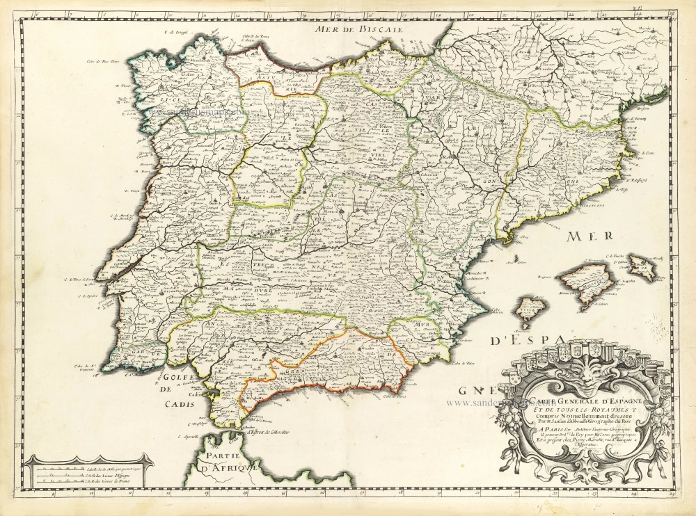
Carte Generale d'Espagne et tous les Royaumes y compris. 1659
Iberian Peninsula (Spain & Portugal) by Nicolas Sanson.
[Item number: 29718]
Regni Hispaniae post omnium editiones locupleissima Descrptio. / Hispania. 1598
Iberian Peninsula (Spain & Portugal) by Abraham Ortelius.
[Item number: 29946]
*** Rare first state. ***
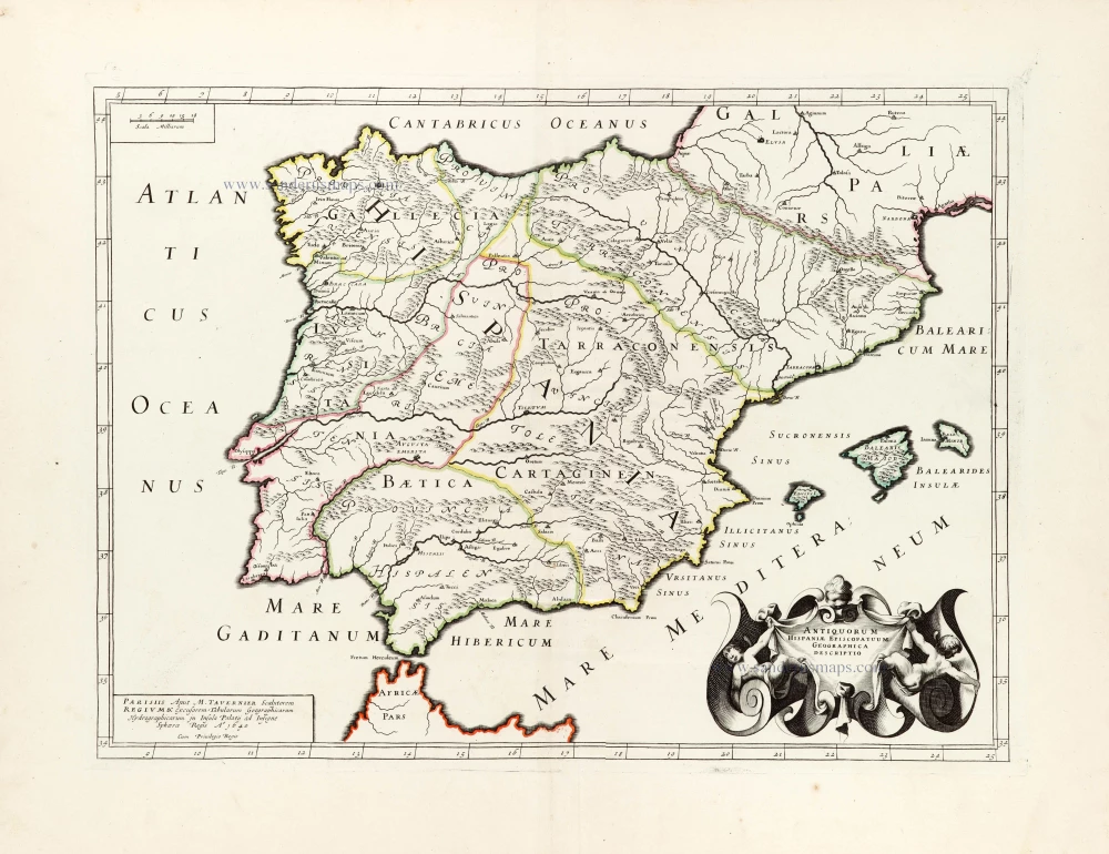
Antiquorum Hispaniae Episcopatuum Geographica Descriptio. 1640
Ancient Iberian Peninsula (Spain & Portugal) by Melchior Tavernier.
[Item number: 30043]
Parergon map
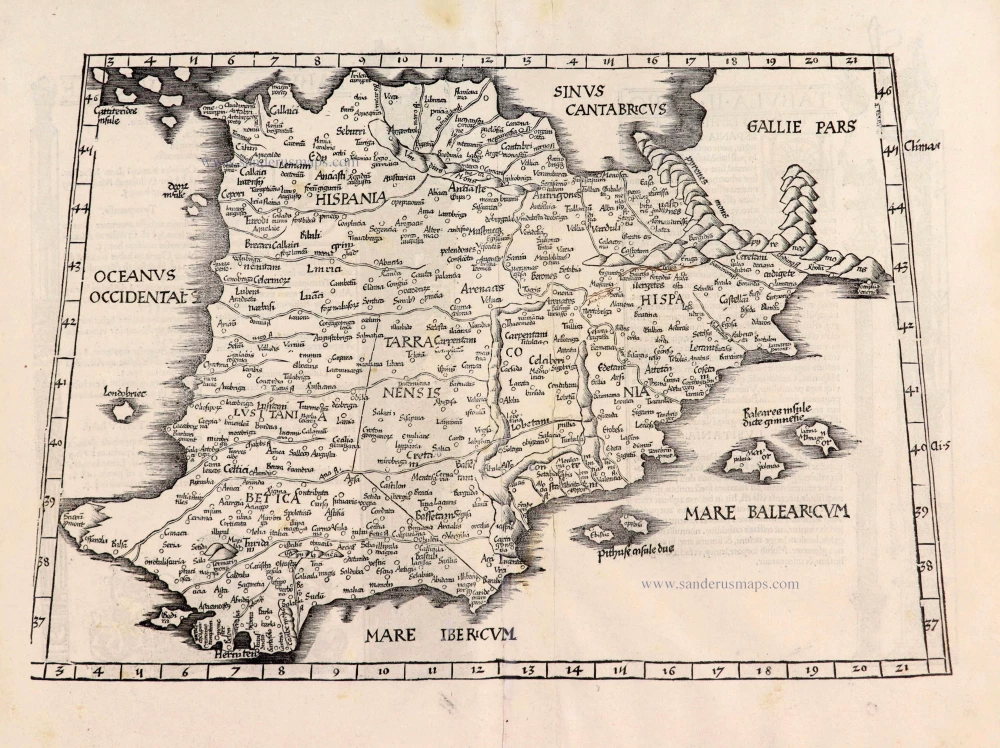
Hispaniae Veteris Descriptio. 1595
Iberian Peninsula by Abraham Ortelius.
[Item number: 30080]