
Important sea chart
Portugal by Waghenaer L.J. 1586

Lucas Janszoon Waghenaer (c. 1533 – 1606)
Lucas Janszoon Waghenaer grew up in Enkhuizen, a fishing port in the Netherlands on the Zuiderzee. It is known that around 1570, Waghenaer was already involved in drawing sea charts. The first indication of his cartographic activity was the plan of the town, engraved by Harmen Hansz. Müller of Amsterdam, dated 2 February. 1577.
In 1579, he gave up his career as a maritime pilot and obtained a post in the town. At the same time, he prepared his chartbook. Cutting the plates cost Waghenaer a large sum. He constantly sought loans and had to accept small jobs to help him earn a living. In the wealthy town of Enkhuizen, he was a poor man, seeking support in every direction and trusting in the success of his significant undertaking: the edition of the Spieghel der Zeevaerdt.
In 1583, the first part of the 'Spieghel' went to press in Plantijn's then-recently established printing house in Leiden. He dedicated the work to Prince William of Orange.
On 25 January 1584, he had a formal certificate drawn up before a notary, which attested to the charts' reliability and originality in the Spieghel der Zeevaerdt.
Waghenaer continued to work on completing the second volume of the Spieghel. In the meantime, the first volume met with considerable success and was reprinted several times during the first two years. The work was reprinted regularly and was also very popular in England. Waghenaer had already become a famous man.
Soon after his Spieghel appeared, he formulated a plan to publish an improved "Rutter of the Sea'. This was to become the Thresoor der Zeevaerdt of 1592.
In addition to revenue from his books, he earned income from the sale of loose portolan charts. In 1580, he was granted a patent for two large charts of the European coasts. One of these portolan charts is the general map from the Spieghel der Zeevaerdt of 1584 and later editions.
In 1592, Jan Huygen van Linschoten settled in the town and wrote the journal of his voyages in Asia, which he published in 1596. In addition, Van Linschoten assisted Waghenaer in compiling another new seaman's guide, the Enchuyser Zeecaertboeck, which contained important information about the coasts of Northern Europe.
In 1598, Waghenaer was appointed as a commission member to develop a method for determining longitude at sea. Unfortunately, he must have been in financial difficulties for the last years of his life. He died in 1606, leaving his widow in dire circumstances.
............................................................................................
The Spieghel der Zeevaerdt or Speculum nauticum super navigatione holds a unique place among the printed rutters of the sea in the 16th century because it is the first printed rutter with charts. Further, it outranks any other rutter of its period with its splendid presentation of charts and text; as such, it stood as a model for the folio-size pilot guides with charts in the 17th century.
However, the format and typography needed to be more balanced to suit the tastes of the practical navigators of that time and those of Lucas Jansz. Waghenaer returned to the traditional, more modest rutter in the oblong format, The Thresoor der Zeevaert, in 1592.
Thanks to the unparalleled skill of the engravers, Baptist and Johannes van Deutecom, the original ms. Waghenaer's charts were transformed into the most beautiful maps of the period.
The composition and adornment have contributed significantly to the splendour of what were initially simple sketch charts; the typography of the Plantijn printing house at Leiden further enhanced the book's quality. In its concept, the text follows the traditional composition of the 16th-century pilot guides, but the charts form a new element. One remarkable feature is the coastal profiles projected onto the land along the coasts, further elucidated by profiles drawn in the charts' open areas. There is no evidence that Waghenaer copied his charts from existing sources. Some of them must have been based on his observations, and for the whole work, he must have relied on his rich experience in practical navigation.
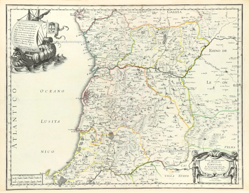
Die Zee Caerte van Portugal, tusschen Camino en Montego, alsoe dat Landt Alt daer in sijn Ghedaente is, met alle sijne Haeven enn Ondiepten ...
Item Number: 33037 new Authenticity Guarantee
Category: Antique maps > Europe > Spain and Portugal
Portugal by Waghenaer L.J.
Title: Die Zee Caerte van Portugal, tusschen Camino en Montego, alsoe dat Landt Alt daer in sijn Ghedaente is, met alle sijne Haeven enn Ondiepten ...
Date of the first edition: 1583.
Date of this map: 1586.
Copper engraving, printed on paper.
Image size: 330 x 515mm (13 x 20¼ inches).
Sheet size: 410 x 555mm (16¼ x 21¾ inches).
Verso: Latin text.
Condition: Excellent.
Condition Rating: A+.
From: Speculum nauticum super navigatione maris Occidentalis confectum, continens omnes oras maritimas Galliae, Hispaniae et praecipuarum partiu Angliae, ... - Spieghel der Zeevaerdt, vande navigatie der Westersche zee Innehoudende alle de Custen van Franckrijck, Spaignen, en t' principaelste deel van Engelandt, ... Lugduni Batavorum (Leiden), Excudebat typis Plantiniannis Franciscus Raphelengius, pro Luca Ioannis Aurigario. MDLXXXVI (1586). (Koeman IV, Wag5A)
Lucas Janszoon Waghenaer (c. 1533 – 1606)
Lucas Janszoon Waghenaer grew up in Enkhuizen, a fishing port in the Netherlands on the Zuiderzee. It is known that around 1570, Waghenaer was already involved in drawing sea charts. The first indication of his cartographic activity was the plan of the town, engraved by Harmen Hansz. Müller of Amsterdam, dated 2 February. 1577.
In 1579, he gave up his career as a maritime pilot and obtained a post in the town. At the same time, he prepared his chartbook. Cutting the plates cost Waghenaer a large sum. He constantly sought loans and had to accept small jobs to help him earn a living. In the wealthy town of Enkhuizen, he was a poor man, seeking support in every direction and trusting in the success of his significant undertaking: the edition of the Spieghel der Zeevaerdt.
In 1583, the first part of the 'Spieghel' went to press in Plantijn's then-recently established printing house in Leiden. He dedicated the work to Prince William of Orange.
On 25 January 1584, he had a formal certificate drawn up before a notary, which attested to the charts' reliability and originality in the Spieghel der Zeevaerdt.
Waghenaer continued to work on completing the second volume of the Spieghel. In the meantime, the first volume met with considerable success and was reprinted several times during the first two years. The work was reprinted regularly and was also very popular in England. Waghenaer had already become a famous man.
Soon after his Spieghel appeared, he formulated a plan to publish an improved "Rutter of the Sea'. This was to become the Thresoor der Zeevaerdt of 1592.
In addition to revenue from his books, he earned income from the sale of loose portolan charts. In 1580, he was granted a patent for two large charts of the European coasts. One of these portolan charts is the general map from the Spieghel der Zeevaerdt of 1584 and later editions.
In 1592, Jan Huygen van Linschoten settled in the town and wrote the journal of his voyages in Asia, which he published in 1596. In addition, Van Linschoten assisted Waghenaer in compiling another new seaman's guide, the Enchuyser Zeecaertboeck, which contained important information about the coasts of Northern Europe.
In 1598, Waghenaer was appointed as a commission member to develop a method for determining longitude at sea. Unfortunately, he must have been in financial difficulties for the last years of his life. He died in 1606, leaving his widow in dire circumstances.
............................................................................................
The Spieghel der Zeevaerdt or Speculum nauticum super navigatione holds a unique place among the printed rutters of the sea in the 16th century because it is the first printed rutter with charts. Further, it outranks any other rutter of its period with its splendid presentation of charts and text; as such, it stood as a model for the folio-size pilot guides with charts in the 17th century.
However, the format and typography needed to be more balanced to suit the tastes of the practical navigators of that time and those of Lucas Jansz. Waghenaer returned to the traditional, more modest rutter in the oblong format, The Thresoor der Zeevaert, in 1592.
Thanks to the unparalleled skill of the engravers, Baptist and Johannes van Deutecom, the original ms. Waghenaer's charts were transformed into the most beautiful maps of the period.
The composition and adornment have contributed significantly to the splendour of what were initially simple sketch charts; the typography of the Plantijn printing house at Leiden further enhanced the book's quality. In its concept, the text follows the traditional composition of the 16th-century pilot guides, but the charts form a new element. One remarkable feature is the coastal profiles projected onto the land along the coasts, further elucidated by profiles drawn in the charts' open areas. There is no evidence that Waghenaer copied his charts from existing sources. Some of them must have been based on his observations, and for the whole work, he must have relied on his rich experience in practical navigation.
Related items
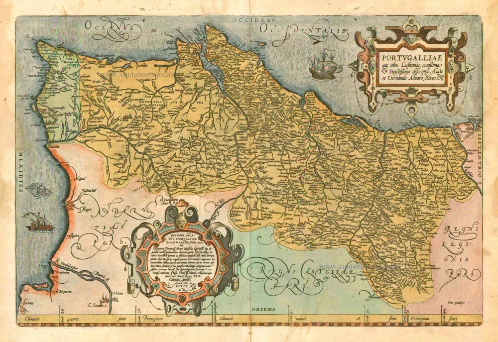
Portugalliae que olim Lusitania, novissima & exactissima descriptio, ... 1601
Portugal by A. Ortelius.
[Item number: 5729]

Very rare!
Nova Regni Portugalliae et Algarbiae Descriptio ... c. 1690
Portugal by J. de Ram, published by F. De Wit.
[Item number: 13745]

Portugalliae que olim Lusitania, novissima & exactissima descriptio, ... 1598
Portugal, by Abraham Ortelius.
[Item number: 22917]

Le Royaume de Portugal et des Algarves ... 1710
Portugal, by Sanson - Covens & Mortier.
[Item number: 23699]

Le Portugal. 1713
Portugal, by Pieter van der Aa.
[Item number: 26086]

Partie Septentrionale du Royaume de Portugal. 1776-79
Northern Portugal, by Francesco Santini.
[Item number: 26951]

Partie Méridional du Royaume de Portugal. 1776-79
Southern Portugal, by Francesco Santini.
[Item number: 26952]

Portugallia et Algarbia quae olim Lusitania. 1638
Portugal by Matthäus Merian
[Item number: 27797]

Rare
Nieuwe Perfecte Caert van 't Coningrijk Poortugael en Algarve. 1656-80
Portugal by Justus Danckerts.
[Item number: 28603]
Parte Septentrional do Reyno de Portugal. 1658
Northern Portugal by Nicolas Sanson.
[Item number: 29663]

Parte Septentrional do Reyno de Portugal. 1658
Southern Portugal by Nicolas Sanson.
[Item number: 29664]

Portugalliae que olim Lusitania, novissima et exactissima descriptio, c. 1610-1650
Portugal, by Jodocus Hondius.
[Item number: 30921]

Portugallia. 1618
Portugal by Petrus Bertius, published by Jodocus Hondius II.
[Item number: 31545]

Portugallia et Algarbia quae olim Lusitania. 1647-50
Portugal, by Willem Blaeu
[Item number: 32435]

Scarce!
Novissima Regnorum Portugalliae et Algarbiae Descriptio. c. 1680
Portugal by Theodore Danckerts.
[Item number: 32461]