
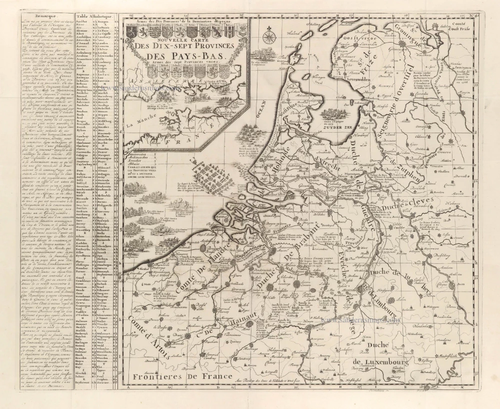
Seventeen Provinces by Zacharias Châtelain. 1713
The Châtelain Family
Zacharias Châtelain (1684-1743) was a bookseller and publisher of Amsterdam. He was succeeded by his sons Zacharias jr and Henry Abraham. The Châtelain family was best known for the historical atlas Atlas Historique, ou nouvelle introduction à l’histoire…, a major work of its time. It was an encyclopaedia in seven volumes, including geography as one of its main subjects. The atlas was published in Amsterdam in seven volumes in various editions with different imprints from 1705 to 1739. An anonym person (Mr. C***) compiled the work with compositions of text, maps, plates and chronological and genealogical tables by Gueudeville, except volume 7, where H.P. Limiers took over this task. The maps were made mainly after the work of Guillaume de l'Isle.
The 1705 edition was published with the imprint “L’Honoré & Châtelain”. Later editions had the imprint: “les Frères Châtelain Libraires” or “L’Honoré & Châtelain Libraires”.
Nouvelle Carte des Dix-Sept Provinces des Pays-Bas
Item Number: 29639 Authenticity Guarantee
Category: Antique maps > Europe > The Low Countries
Old, antique map of the Seventeen Provinces by Zacharias Châtelain.
Title: Nouvelle Carte des Dix-Sept Provinces des Pays-Bas
Avec privilege des Etats de Hollande et West frise.
Date of the first edition: 1705.
Date of this map: 1713.
Copper engraving, printed on paper.
Map size: 460 x 560mm (18.11 x 22.05 inches).
Sheet size: 520 x 635mm (20.47 x 25 inches).
Verso: Blank.
Condition: Folds as issued, excellent.
Condition Rating: A+.
From: Châtelain Z. Atlas Historique, ou Nouvelle Introduction A l'Histoire, à la Chronologie & à la Geographie Ancienne & Moderne; ... Tome Premier. Conténant la Gréce, l'Histoire Romaine, Rome Moderne, Naples, la France, l'Espagne, & les Provinces Unies.A Amsterdam, Chez L'Honoré & Châtelain, M.DCC.XIII. (1713). (Koeman II, p. 35, Cha2)
The Châtelain Family
Zacharias Châtelain (1684-1743) was a bookseller and publisher of Amsterdam. He was succeeded by his sons Zacharias jr and Henry Abraham. The Châtelain family was best known for the historical atlas Atlas Historique, ou nouvelle introduction à l’histoire…, a major work of its time. It was an encyclopaedia in seven volumes, including geography as one of its main subjects. The atlas was published in Amsterdam in seven volumes in various editions with different imprints from 1705 to 1739. An anonym person (Mr. C***) compiled the work with compositions of text, maps, plates and chronological and genealogical tables by Gueudeville, except volume 7, where H.P. Limiers took over this task. The maps were made mainly after the work of Guillaume de l'Isle.
The 1705 edition was published with the imprint “L’Honoré & Châtelain”. Later editions had the imprint: “les Frères Châtelain Libraires” or “L’Honoré & Châtelain Libraires”.
Related items

Belgiae Inferioris descriptio emendata cum circu(m)jacentium regionum confinijs. 1609
The 17 Provinces, by Ludovico Guicciardini.
[Item number: 25913]
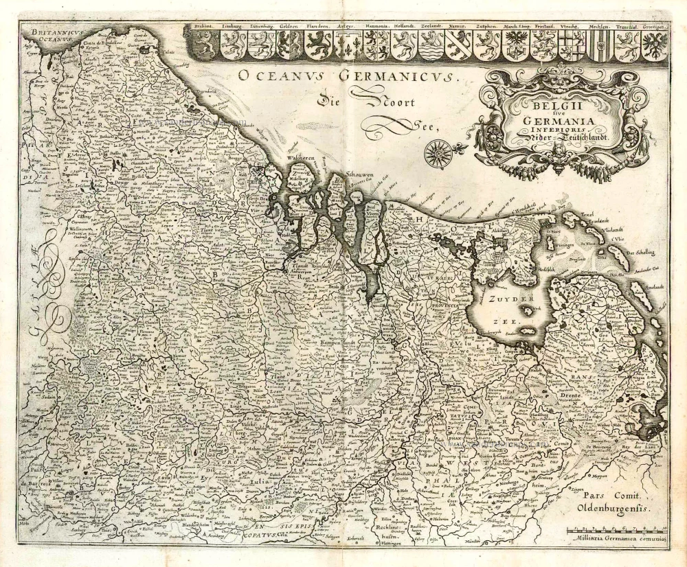
Belgii sive Germania Inferioris - Nider Teutschlandt. 1638
The 17 Provinces, by Matthäus Merian.
[Item number: 26030]
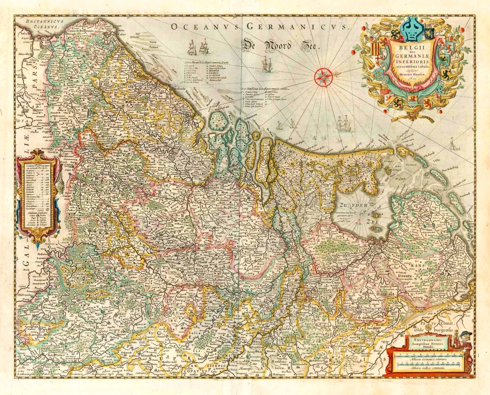
belgii sive germaniae inferioris accuratissima tabula. auctore henrico hondio 1631. amstelodami, sumptibus henrici hondio 1631. 1641
The 17 Provinces, by Henricus Hondius.
[Item number: 26301]
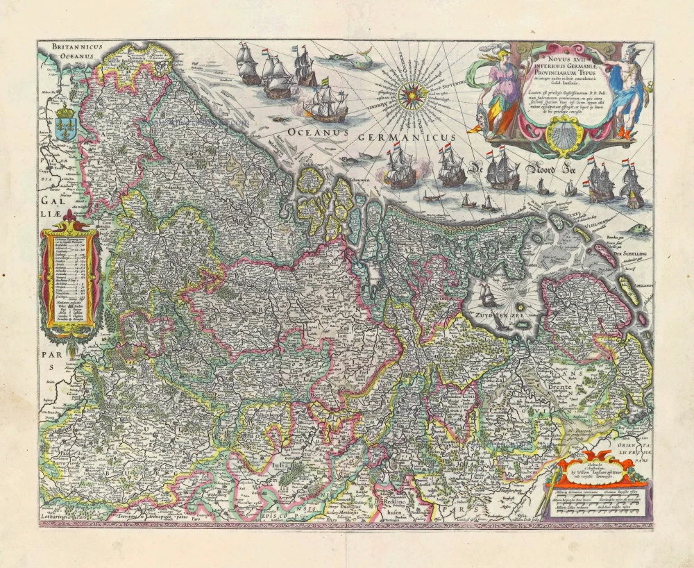
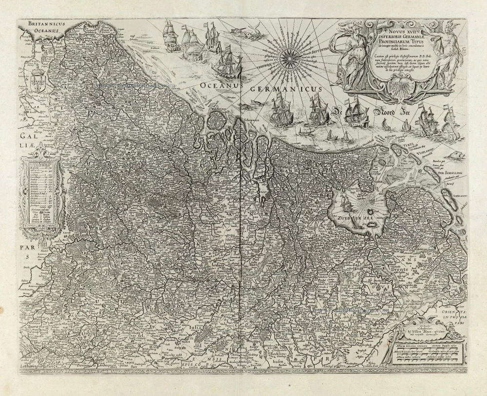
Novus XVII Inferioris Germaniae Provinciarum Typus. 1631
17 Provinces, by Willem Blaeu.
[Item number: 28019]
Novus XVII Inferioris Germaniae Provinciarum Typus. 1664-65
17 Provinces, by Willem Blaeu.
[Item number: 28110]
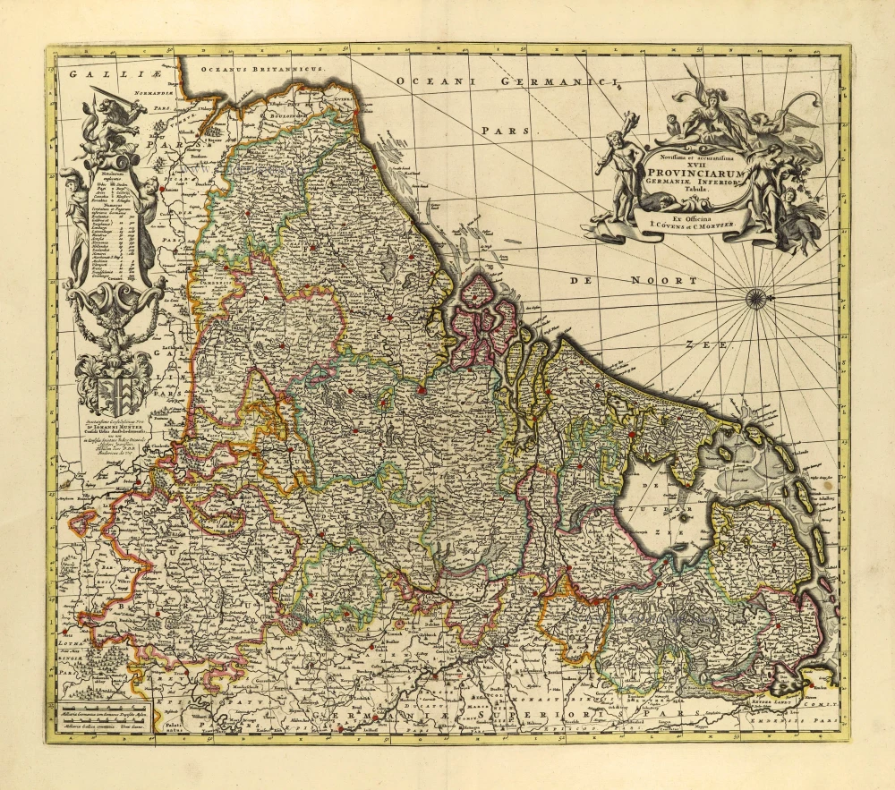
Novissima et accuratissima XVII provinciarum Germaniae Inferioris Tabula. c. 1715
17 Provinces, by Frederik de Wit, published by Covens & Mortier.
[Item number: 28284]
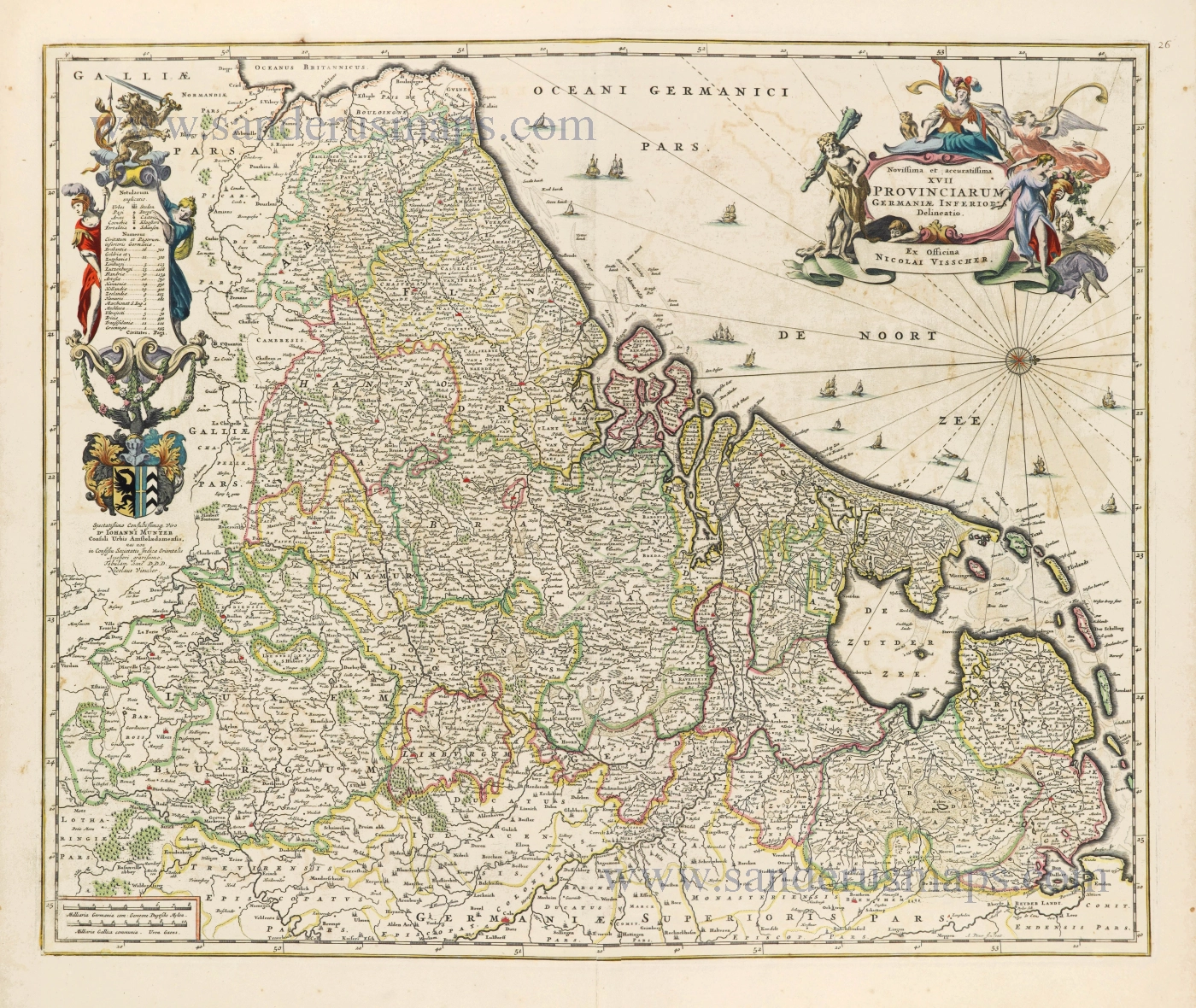
Novissima et accuratissima XVII Provinciarum Germaniae Inferioris Delineatio. c. 1656
Seventeen Provinces by Nicolaes Visscher I.
[Item number: 28539]

Belgium seu Germania Inferior. 1594
The 17 Provinces, by Giovanni Magini.
[Item number: 28914]