
Old antique map of Crete, by Rostagno. 1668
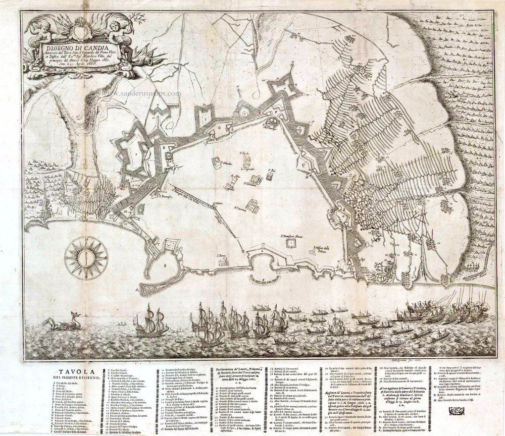
Dissegno di Candia Attaccata dal Turco sotto il Commando del Primo Visir et Diffesa dall' Eccmo. Sigr. Marchese Villa, dal Principio del Attacco li 24 Maggio 1667, sino li 21 Aprile 1668.
Item Number: 26014 Authenticity Guarantee
Category: Antique maps > Mediterranean Sea
Old, antique map of the siege of Crete by the Turks, by Rostagno.
Shows a maritime scene below the plan.
Letterpress key below the engraving.
Oriented to the South
Date of this map: 1668
Date on the map: 1668
Engraved by G.M. Belgramo.
Copper engraving, printed on paper.
Size (not including letterpress key and margins): 44.5 x 50cm (17.4 x 19.5 inches)
Verso: Blank
Condition: Some wear at left fold, else good.
Condition Rating: A
References: Not in Zacharakis.
From: Rostagno, Viaggi in Dalmatia Rostagno, G. B. Viaggi dell'Illustrissimo & Eccellentissimo Sign. Marchese Ghiron Francesco Villa in Dalmatia, e Levante. Con la distincta relatione de'successi di Candia per il tempo. Turin, G. Sinibaldo, 1668.
Related items

Cyprus Insula - Candia, olim Creta. 1572
Cyprus - Crete, by A. Ortelius.
[Item number: 16585]
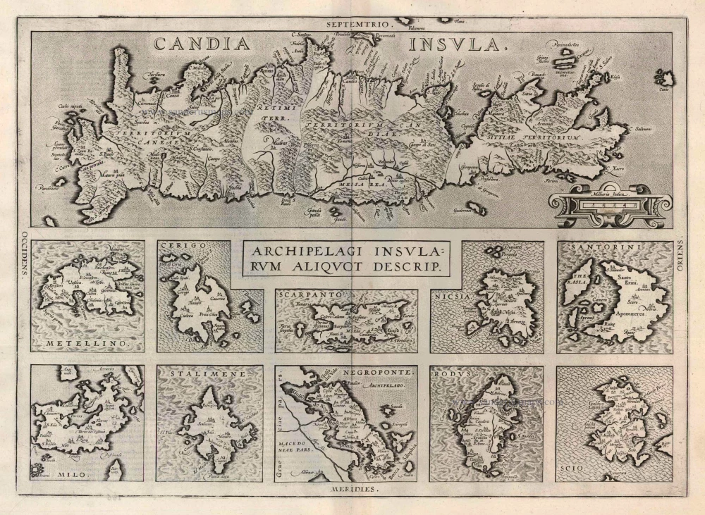
Candia Insula [on sheet with] Archipelagi Insularum aliquot descrip. 1612
Crete and 10 Aegean islands, by Abraham Ortelius.
[Item number: 22976]
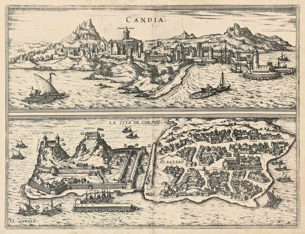
Candia [on sheet with] La Cita de Corphu 1575-1612
Crete - Heraklion (Irákleio) & Corfu (Kérkyra), by Georg Braun and Frans Hogenberg.
[Item number: 24007]