
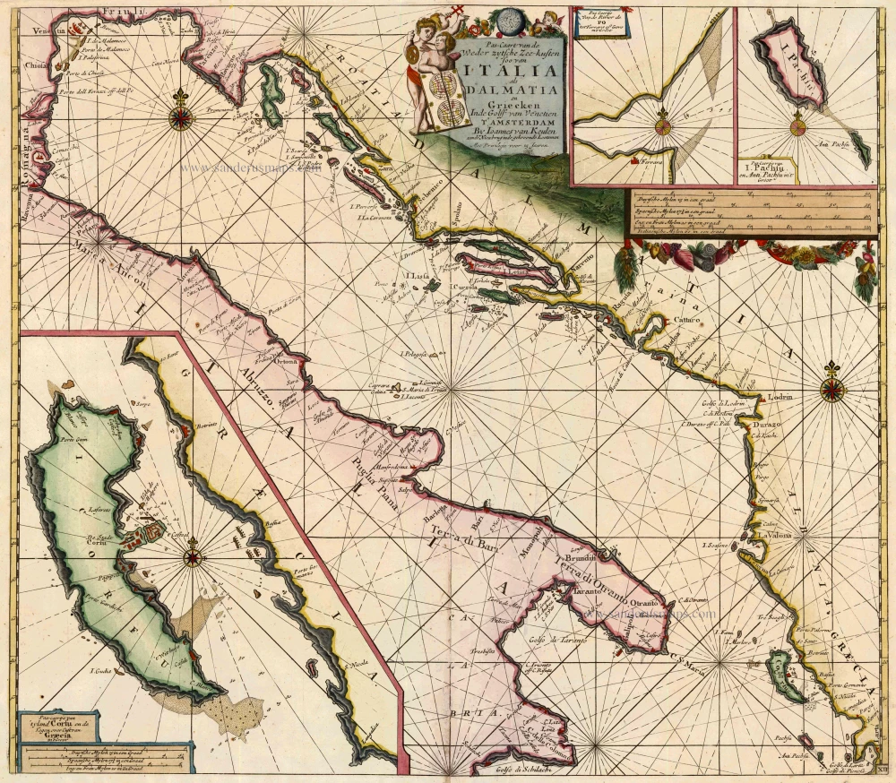
The Adriatic Sea by Van Keulen Johannes. 1697-1709
The House of Van Keulen
For more than two centuries, the chart makers firm of Van Keulen was established in the house with the name of “De Gekroonde Lootsman” (The Crowned Pilot). In 1678, the founder of the firm, Johannes I Van Keulen (1634-1689), registered with the Amsterdam booksellers’ guild. He had enlisted the aid of the well-known Mathematical Practitioner Claas Janz Vooght in the preparation of his nautical publications. In 1680 he published the first edition of the Zee-Atlas with 40 charts, all issued for the first time. In the short period of four years, they produced the five volumes of the Nieuwe Groote Ligtende Zee-Fakkel (1681-85). His acquisition of the stock of the bookseller Hendrik Doncker was an essential factor in the development of the firm.
In 1678 a son, Gerard Van Keulen (1678-1726), was born out of Johannes’s first marriage. This son was endowed with talent. He was a skilful engraver and proficient in mathematics and navigational science. Gerard was responsible for establishing the scientific basis of the firm of Van Keulen. In 1714 he was appointed to the office of hydrographer to the Dutch East India Company. The Van Keulens remained chart makers to the East India Company until the Company’s liquidation.
With the introductions to the Zee-Fakkel and Zee-Atlas, Gerard van Keulen gave a new impetus to the firm. Unfortunately, he did not live long, dying when he was 49. The business was carried on by his widow Ludwina Konst. Shortly before Gerard’s death, his son Johannes II had entered the bookseller’s guild, and in 1726 he assumed the management of the firm, though his mother retained her financial interests in the business.
Johannes II Van Keulen (1704-1755) is known in particular for his publication in 1753 of a sixth volume of the Zee-Fakkel, the volume containing the charts of the route to the East Indies.
Johannes II had two sons; they joined the firm as partners in 1757. A considerable number of books appeared in the period 1778-1801. New issues of the Zee-Fakkel again saw the light. The firm flourished under different names until 1885.
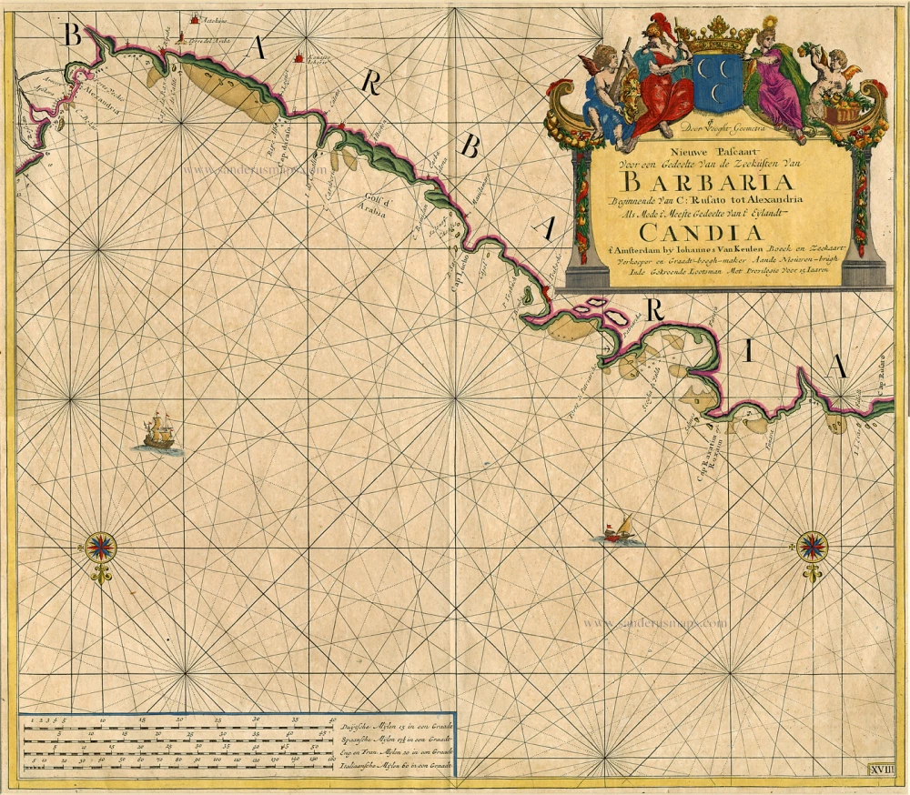
Pas-Caart van de Weder Zytsche Zeekusten soo van Italia als Dalmatia en Griecken inde Golff van Venetien
Item Number: 10068 Authenticity Guarantee
Category: Antique maps > Mediterranean Sea
Old, antique sea chart of the Adriatic Sea by Van Keulen Johannes.
Insets of the Po River, Paxoi & Andipaxoi, and Corfu.
Title: Pas-Caart van de Weder Zytsche Zeekusten soo van Italia als Dalmatia en Griecken inde Golff van Venetien
Date: 1697-1709.
Copper engraving, printed on paper.
Size (not including margins): 515 x 585mm (20.28 x 23.03 inches).
Verso: Blank.
Condition: Old coloured, excellent.
Condition Rating: A.
From: De Nieuwe Groote Lichtende Zee-Fakkel, ... Amsterdam, J. van Keulen, 1697-1709.
The House of Van Keulen
For more than two centuries, the chart makers firm of Van Keulen was established in the house with the name of “De Gekroonde Lootsman” (The Crowned Pilot). In 1678, the founder of the firm, Johannes I Van Keulen (1634-1689), registered with the Amsterdam booksellers’ guild. He had enlisted the aid of the well-known Mathematical Practitioner Claas Janz Vooght in the preparation of his nautical publications. In 1680 he published the first edition of the Zee-Atlas with 40 charts, all issued for the first time. In the short period of four years, they produced the five volumes of the Nieuwe Groote Ligtende Zee-Fakkel (1681-85). His acquisition of the stock of the bookseller Hendrik Doncker was an essential factor in the development of the firm.
In 1678 a son, Gerard Van Keulen (1678-1726), was born out of Johannes’s first marriage. This son was endowed with talent. He was a skilful engraver and proficient in mathematics and navigational science. Gerard was responsible for establishing the scientific basis of the firm of Van Keulen. In 1714 he was appointed to the office of hydrographer to the Dutch East India Company. The Van Keulens remained chart makers to the East India Company until the Company’s liquidation.
With the introductions to the Zee-Fakkel and Zee-Atlas, Gerard van Keulen gave a new impetus to the firm. Unfortunately, he did not live long, dying when he was 49. The business was carried on by his widow Ludwina Konst. Shortly before Gerard’s death, his son Johannes II had entered the bookseller’s guild, and in 1726 he assumed the management of the firm, though his mother retained her financial interests in the business.
Johannes II Van Keulen (1704-1755) is known in particular for his publication in 1753 of a sixth volume of the Zee-Fakkel, the volume containing the charts of the route to the East Indies.
Johannes II had two sons; they joined the firm as partners in 1757. A considerable number of books appeared in the period 1778-1801. New issues of the Zee-Fakkel again saw the light. The firm flourished under different names until 1885.
Related items
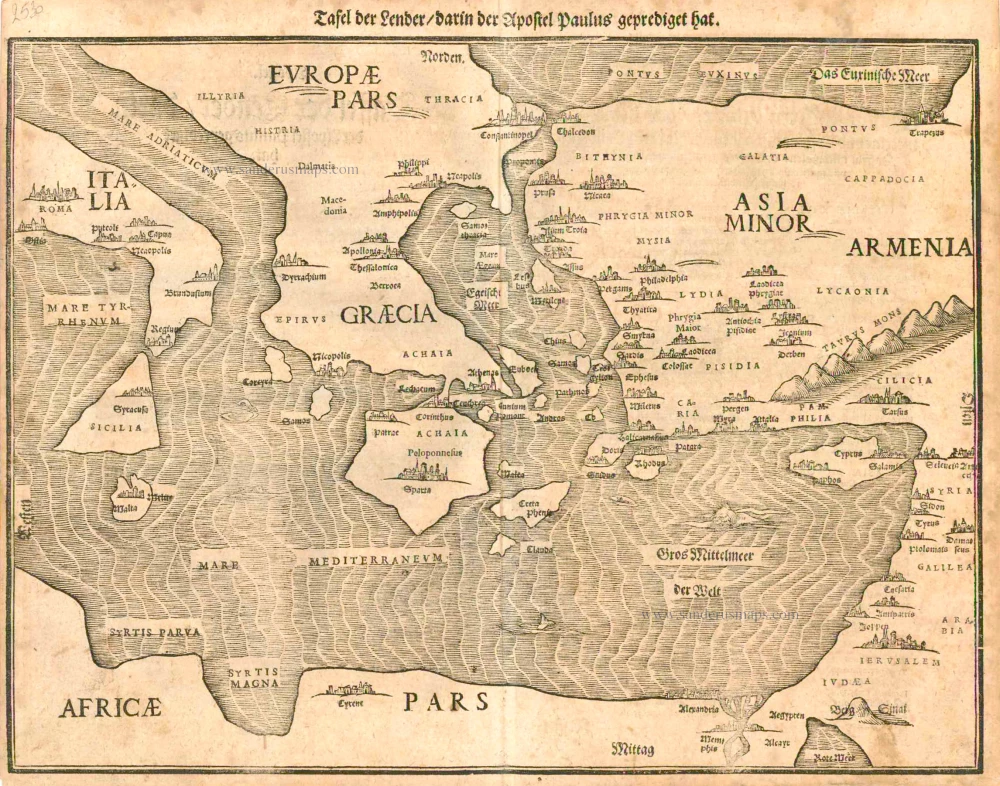
Tafel der Lender darin der Apostel Paulus geprediget hat. 1581
Eastern part of the Mediterranean Sea, by Heinrich Bünting.
[Item number: 2530]
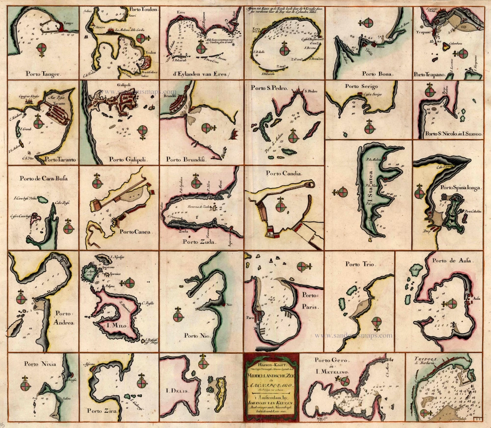
Haaven-Kaart van Eenige Voornaamste Haavens Leggende in de Middel-Landsche Zee en Archipelago 1697-1709
Mediterranean Sea Ports by Johannes Van Keulen.
[Item number: 4125]
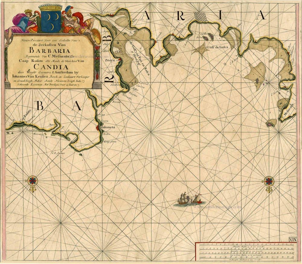
Nieuwe Pascaart voor een Gedeelte van de Zeekusten van Barbaria Beginnende van C. Mesurata tot Caap Rusato Als mede de West-kust van Candia. 1697-1709
Sea chart of the coasts of Morocco, by Johannes Van Keulen.
[Item number: 6506]
Nieuwe Pascaart Voor een Gedeelte van de Zeekusten van Barbaria ... 1697-1709
Sea chart of the coasts of Morocco, by Johannes Van Keulen.
[Item number: 9775]

Sclavonia, Croatia, Bosnia cum Dalmatiae Parte 1619
Balkans (West) by Mercator-Hondius
[Item number: 12223]
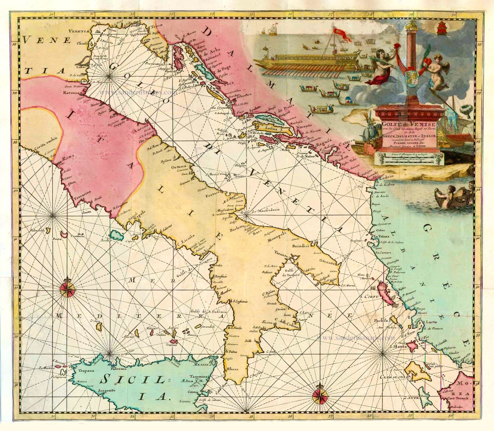
Golfe de Venise avec les Côtes maritimes Bayes et ports, etc. de la Grécee, Dalmatie et Italie. 1713
The Adriatic Sea, by Pieter van der Aa.
[Item number: 26347]
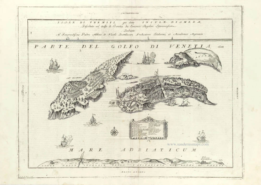
Isole di Tremiti già dette Insulae Diomedae, 1696
The Isole Tremiti in the Adriatic Sea, by Vincenzo Coronelli.
[Item number: 29010]
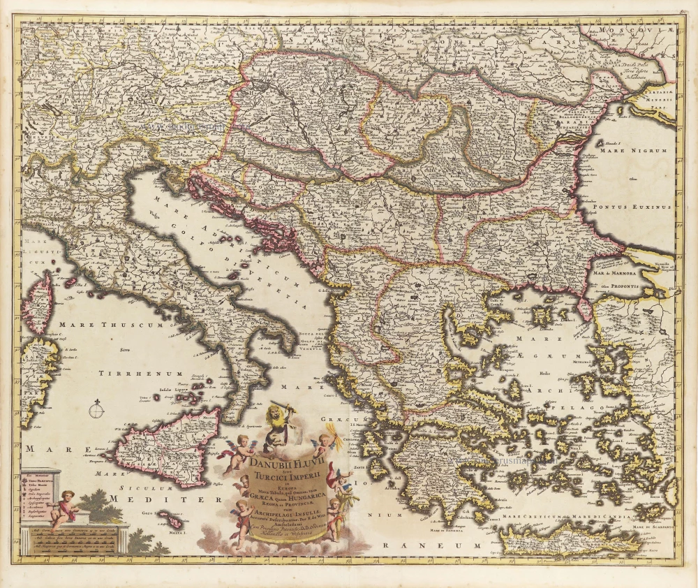
Danubii Fluvii Sive Turcici Imperii in Europa. c. 1705
Danube and European Ottoman Empire, by Frederick de Wit.
[Item number: 29279]
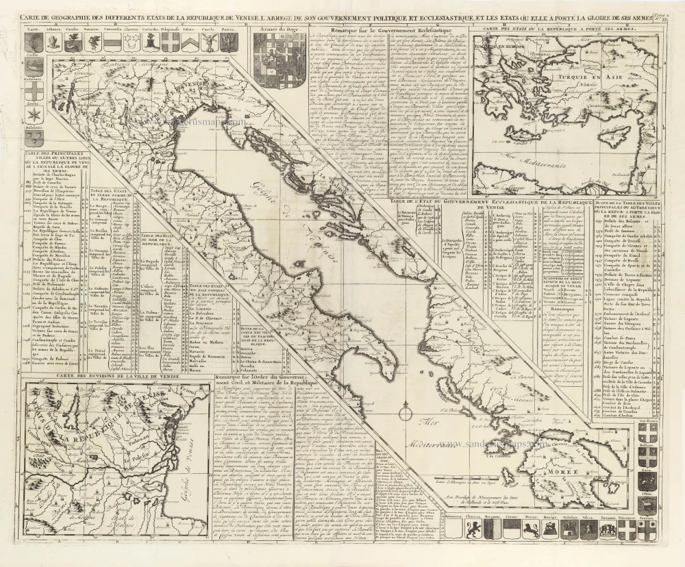
Carte de Géographie des differents Etats de la République de Venise, ... 1708
Gulf of Venice, by Zacharias Châtelain.
[Item number: 29446]