
Old antique map of Australia, the Pacific, America and the Atlantic Ocean, by Andries & Hendrik De Leth c. 1730
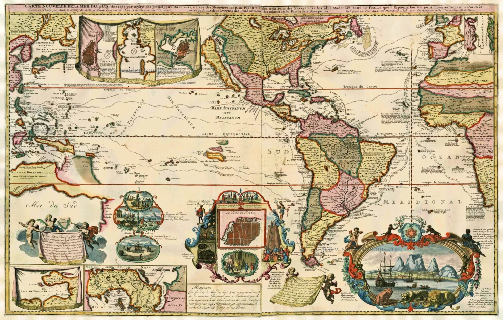
Long folding map covering an area greater than suggested in the title; from Southeast Asia with the north coast of Australia, America occupying a central position with California prominent as an island, to the west coast of Africa. Based in part on de Fer's map of 1713 with decorative vignettes inspired from that map but slightly varied.
Renowned as much for the decoration as for the cartographic extent, the map is finely engraved with large insets and vignettes illustrating, amongst other features, gold mines in Mexico, a sugar mill, turtle catching and Meso-American religious practices. A magnificent vignette in the lower right hand corner, adorned with appropriate animals, shows the settlement of Cape Town with its shipping. Other detailed plans show the Straits of Magellan and Gibraltar, Cape of Good Hope and City of Mexico. Tracks of trade ships and explorers are also shown. This is the third state of the plate, with inset plans of Vera Cruz, Rio De Janeiro and Havana replacing the decorative vignette of Niagara Falls.
Carte Nouvelle de la Mer du Sud.
Item Number: 17145 Authenticity Guarantee
Category: Antique maps > Oceans
Old, antique map showing the Pacific, America and the Atlantic Ocean by Andries & Hendrik De Leth
Copper engraving on two sheets, joined.
Size: 60 x 94cm (23.4 x 36.7 inches)
Verso: Blank
Condition: Contemporary coloured. Some reinforcements to prevent cracking of green colour, margins extended.
Condition Rating: B
References: Tooley (America) #94, p.133; McLaughlin, 220; Baynton-Williams New Worlds, p.136.
Long folding map covering an area greater than suggested in the title; from Southeast Asia with the north coast of Australia, America occupying a central position with California prominent as an island, to the west coast of Africa. Based in part on de Fer's map of 1713 with decorative vignettes inspired from that map but slightly varied.
Renowned as much for the decoration as for the cartographic extent, the map is finely engraved with large insets and vignettes illustrating, amongst other features, gold mines in Mexico, a sugar mill, turtle catching and Meso-American religious practices. A magnificent vignette in the lower right hand corner, adorned with appropriate animals, shows the settlement of Cape Town with its shipping. Other detailed plans show the Straits of Magellan and Gibraltar, Cape of Good Hope and City of Mexico. Tracks of trade ships and explorers are also shown. This is the third state of the plate, with inset plans of Vera Cruz, Rio De Janeiro and Havana replacing the decorative vignette of Niagara Falls.
Related items
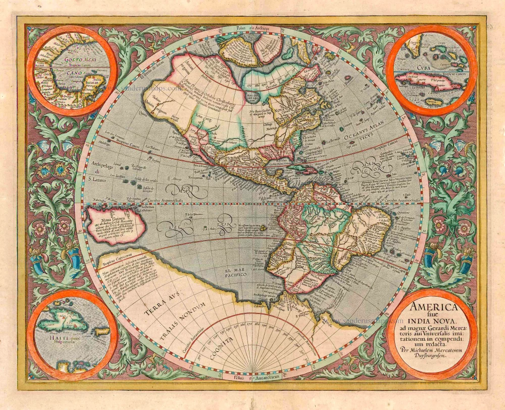
America sive India Nova ad magnae Gerardi Mercatoris avi Universalis imitationem in compendium redacta. 1623
America, by Gerard Mercator
[Item number: 131]
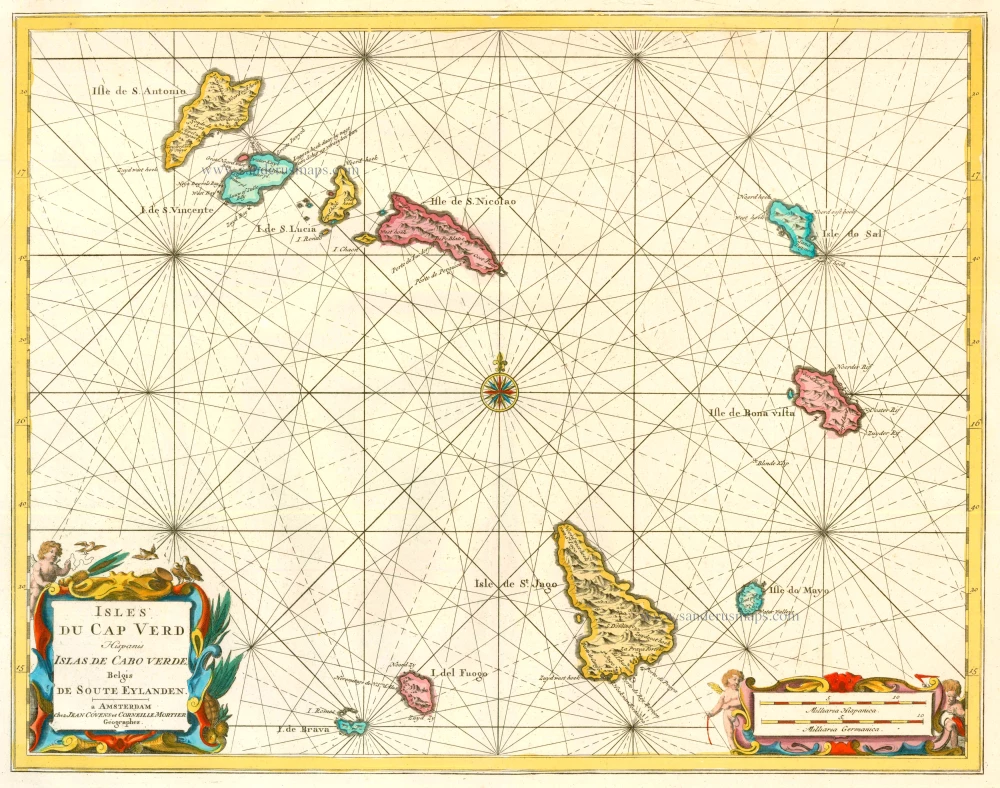
Isles du Cap Verd Hispanis Islas de Cabo Verde Belgis de Soute Eylanden. 1721-41
Cape Verde Islands, by Covens & Mortier.
[Item number: 23621]

Caerte van de zeylage van Jacob le Maire over de Zuydzee, vertonende de Eylanden ende Landen aldaer by hem ghesien ende aenghedaen. / Tabula, ductum navigationis, quem in Mari Australi tenuit Iacobus Le Maire ... 1622
Rare chart showing the route taken by Schouten and le Maire from South America to New Guinea, by Michiel Colijn.
[Item number: 25104]
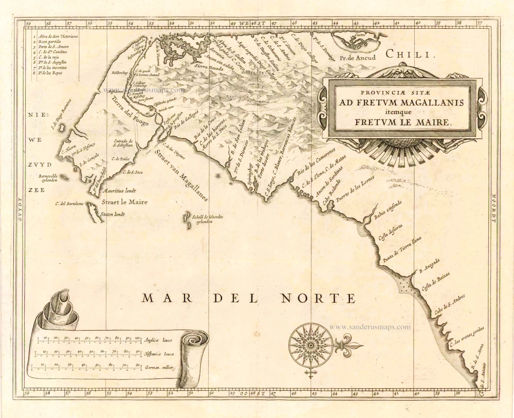
Provinciae Sitae ad Fretum Magallanis itemque Fretum le Maire. 1630
Magellan Straits & Tierra Del Fuego, by Johannes de Laet.
[Item number: 25391]
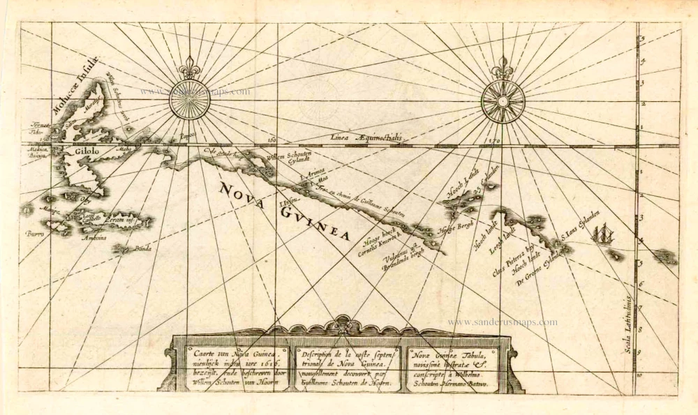
Caarte van Nova Guinea, Nieulijck inden iare 1616 bezeijlt, ende beschreven door Willem Schouten van Hoorn. 1618
New Guinea, by W.C. Schouten
[Item number: 25400]
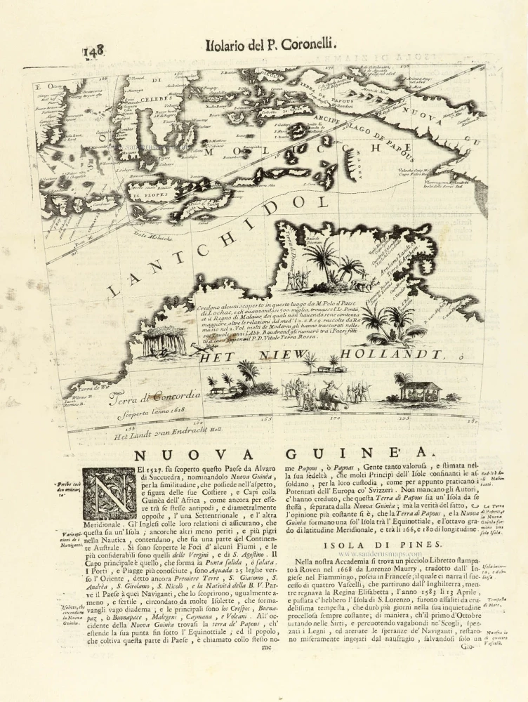
Nuova Guinea. 1696
Globe gore with Northern Australia and the East Indies, by V.M. Coronelli.
[Item number: 30785]