
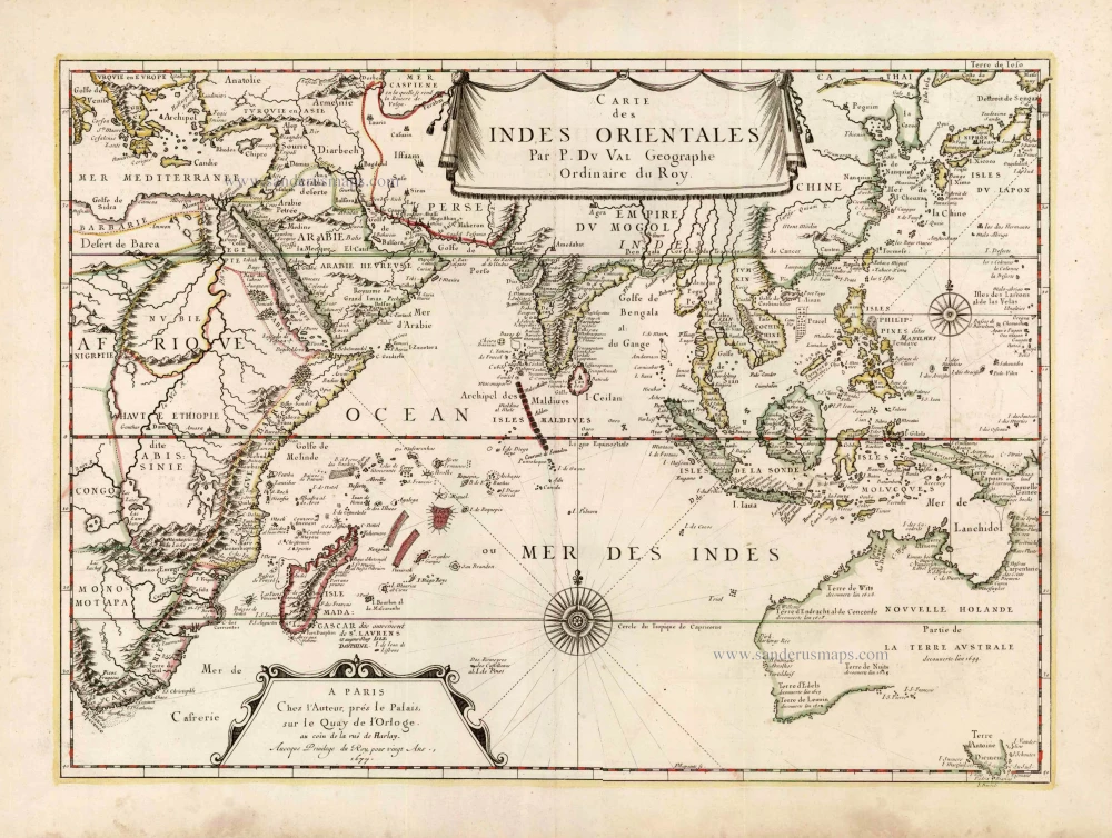
Old antique map of Indian Ocean - Southeast Asia - Australia 1679


Pierre Duval (Abbeville, 1618 - 1683)
French geographer, nephew and pupil of Nicolas Sanson. He was encouraged by Louis XIV to move to Paris. In 1650 he became Géographe Ordinaire du Roy.
Carte des Indes Orientales par P. Du Val Geographe Ordinaire du Roy.
Item Number: 25284 Authenticity Guarantee
Category: Antique maps > Oceans
Old, antique map of the Indian Ocean - Southeast Asia - Australia by P. Du Val.
Second edition, date on map: 1677
Date of the first edition: 1665
Date of this map: 1679
Copper engraving
Size: 39 x 54cm (15.2 x 21.1 inches)
Verso: Blank
Condition: Contemporary coloured, excellent.
Condition Rating: A
References: Pastoureau, Duval II-E #35; Tooley (Australia), p.203 #29: Schilder (Australia), p.414 #86; Clancy, p.86-87 Map 6.19.
From: Cartes de geographie les plus nouvelles et les plus fideles, ... Paris, P. Du Val, 1679. (Pastoureau, Duval II E)
This map shows the entire area between the Cape of Good Hope and Japan and Australia, Tasmania forming the southern limit in the east. The continent of Australia bears the name 'NOUVELLE HOLANDE Partie de LA TERRE AUSTRALE découverte l'an 1644'.
Pierre Duval (Abbeville, 1618 - 1683)
French geographer, nephew and pupil of Nicolas Sanson. He was encouraged by Louis XIV to move to Paris. In 1650 he became Géographe Ordinaire du Roy.
Related items
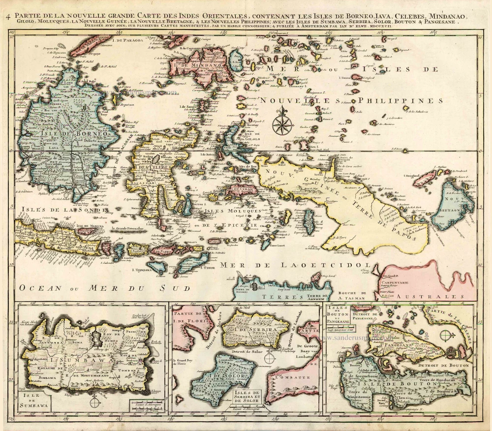
Partie de la Nouvelle Grande Carte des Indes Orientales, Contenant les Isles de Borneo, Iava, Celebes, Mindanao ... 1792
Indonesia - New Guinea - Australia by J.B. Elwe.
[Item number: 2293]
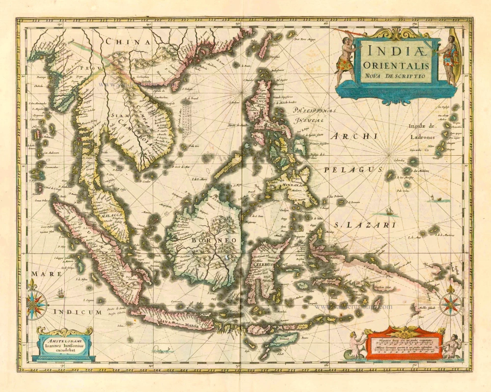
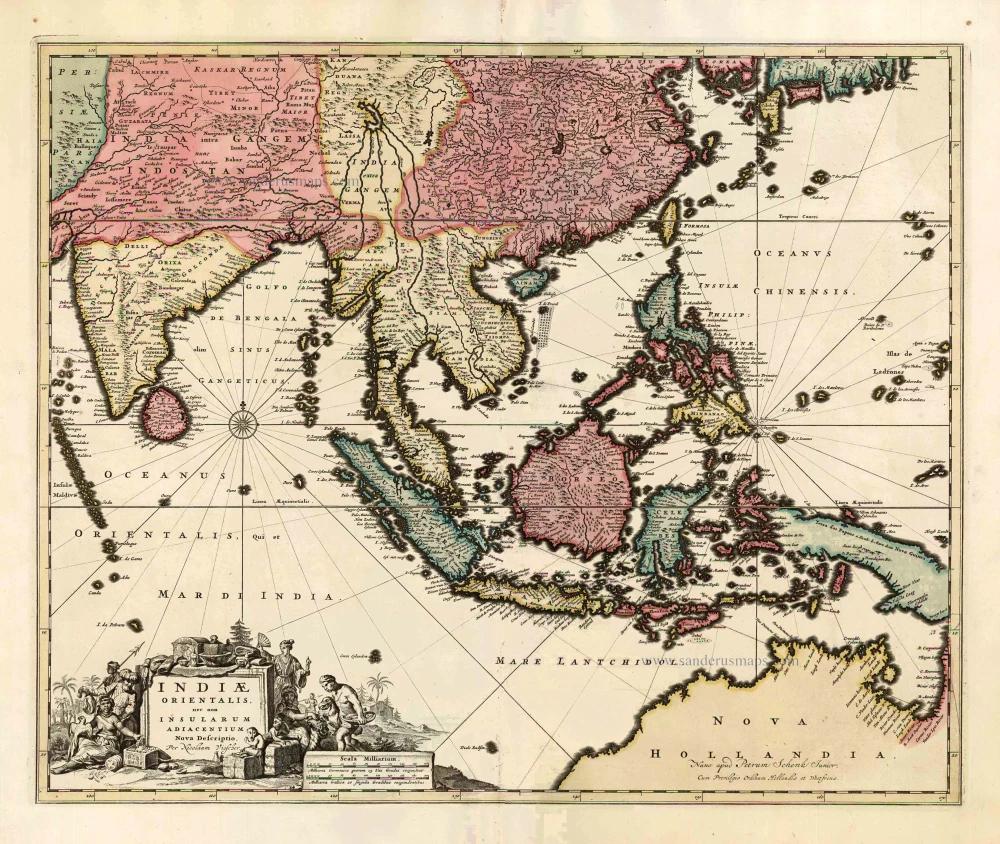
The most accurate and one of the most elegant 17th c. maps of the East Indies
Indiae Orientalis Nova Descriptio. 1644-58
Southeast Asia by Janssonius, Johannes
[Item number: 10013]
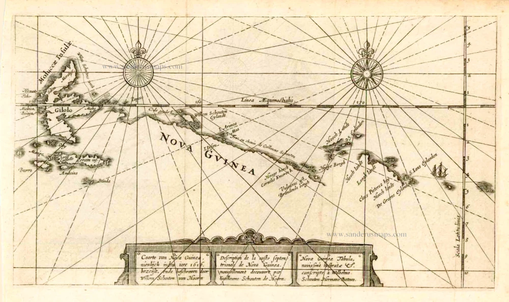
Caarte van Nova Guinea, Nieulijck inden iare 1616 bezeijlt, ende beschreven door Willem Schouten van Hoorn. 1618
New Guinea, by W.C. Schouten
[Item number: 25400]
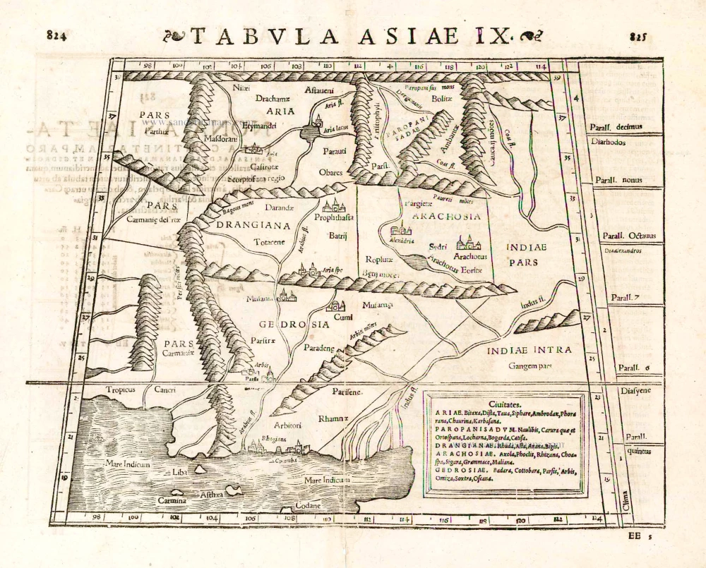
Tabula Asiae IX. 1571
Pakistan, by Sebastian Münster.
[Item number: 25641]

Sumatrae et Insularum Locorumque Nonnullorum Circumiacentium Tabula Nova. c. 1700
Sumatra, by G. Valk & P. Schenk.
[Item number: 25714]
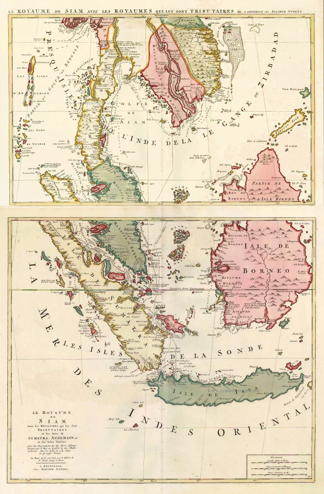
Le Royaume de Siam avec les Royaumes qui luy sont Tributaires, et les Isles de Sumatra, Andemaon, etc. et les Isles Voisine. c. 1700
Southeast Asia, by J. Ottens.
[Item number: 25716]
Indiae Orientalis nec non Insularum Adiacentium Nova Descriptio. c. 1740
Southeast Asia by Nicolaes Visscher, published by Petrus Schenk.
[Item number: 25718]
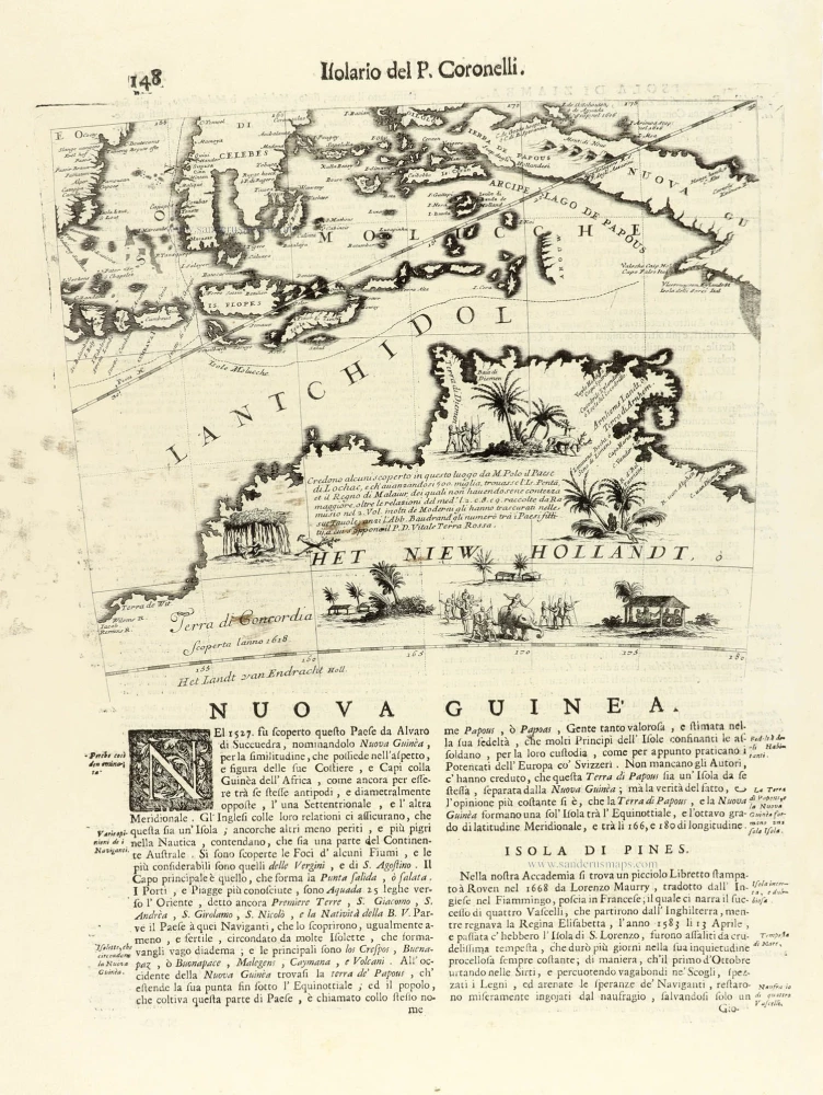
Nuova Guinea. 1696
Globe gore with Northern Australia and the East Indies, by V.M. Coronelli.
[Item number: 30785]