
Tasman's first voyage, by François Valentyn. 1726
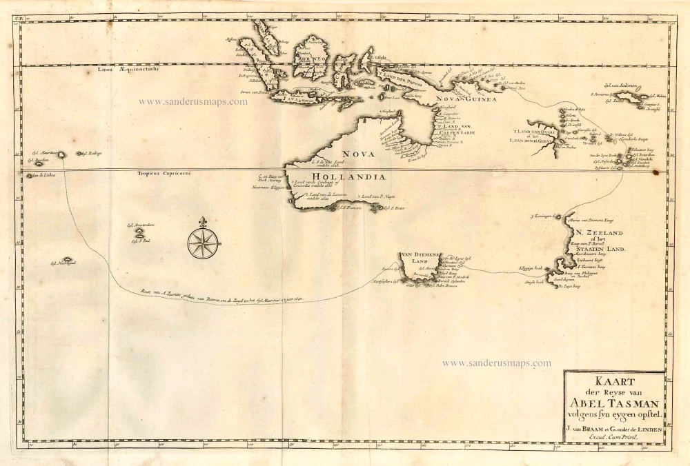
Shows the route of Abel Tasman's voyage in 1642, on which he discovered Tasmania and New Zealand and proved that Australia was not part of the Great Southern Continent. The map also shows the discoveries in northern Australia made on Tasman's second voyage in 1644.
François Valentijn (1666-1727)
François Valentijn was a minister who devoted most of his life to the employ of the V.O.C. In 1685 he was sent by the V.O.C. to Ambon as a Minister to the East Indies, where he remained for a decade. He returned and lived in Holland for about ten years before returning to the Indies in 1705. The following year Valentijn was Army Chaplain on an expedition in eastern Java but suffered health problems and requested permission to return to Holland.
Finally, back home, Valentijn composed his monumental work, Oud en Nieuw Oost-Indien. This massive work of five parts in eight volumes appeared between 1724 and 1726. It was created both from the voluminous journals Valentijn had amassed during his two stays in Southeast Asia, as well as from his own research, correspondence, and previously unpublished material secured from V.O.C. officials. It contained over one thousand engraved illustrations and some of the most accurate maps of the Indies of this time.
Kaart der Reyse van Abel Tasman Volgens syn eygen Opstel.
Item Number: 27889 Authenticity Guarantee
Category: Antique maps > Oceans
Old, antique map of Tasman's first voyage, by François Valentyn (Valentijn).
Title: Kaart der Reyse van Abel Tasman Volgens syn eygen Opstel.
J. van Braam et G. onder de Linden
Excud. Cum Privil.
Date of the first edition: 1726.
Date of this map: 1726.
Copper engraving, printed on paper.
Size (not including margins): 305 x 465mm (12.01 x 18.31 inches).
Verso: Blank.
Condition: Folds as issued, hole repaired (8mm).
Condition Rating: A.
References: Landwehr (VOC), #467.3b(22); Tooley (Australia), #1270; Schilder (Australia), p.152 - Pl.XXXII
From: Valentyn F., Oud en Nieuw Oost-Indien, vervattende Een Naaukeurige en Uitvoerige Verhandelinge van Nederlands Mogendheyd In die Geweesten. Amsterdam, J. van Braam & G. onder de Linden, 1724-26.
Shows the route of Abel Tasman's voyage in 1642, on which he discovered Tasmania and New Zealand and proved that Australia was not part of the Great Southern Continent. The map also shows the discoveries in northern Australia made on Tasman's second voyage in 1644.
François Valentijn (1666-1727)
François Valentijn was a minister who devoted most of his life to the employ of the V.O.C. In 1685 he was sent by the V.O.C. to Ambon as a Minister to the East Indies, where he remained for a decade. He returned and lived in Holland for about ten years before returning to the Indies in 1705. The following year Valentijn was Army Chaplain on an expedition in eastern Java but suffered health problems and requested permission to return to Holland.
Finally, back home, Valentijn composed his monumental work, Oud en Nieuw Oost-Indien. This massive work of five parts in eight volumes appeared between 1724 and 1726. It was created both from the voluminous journals Valentijn had amassed during his two stays in Southeast Asia, as well as from his own research, correspondence, and previously unpublished material secured from V.O.C. officials. It contained over one thousand engraved illustrations and some of the most accurate maps of the Indies of this time.
Related items
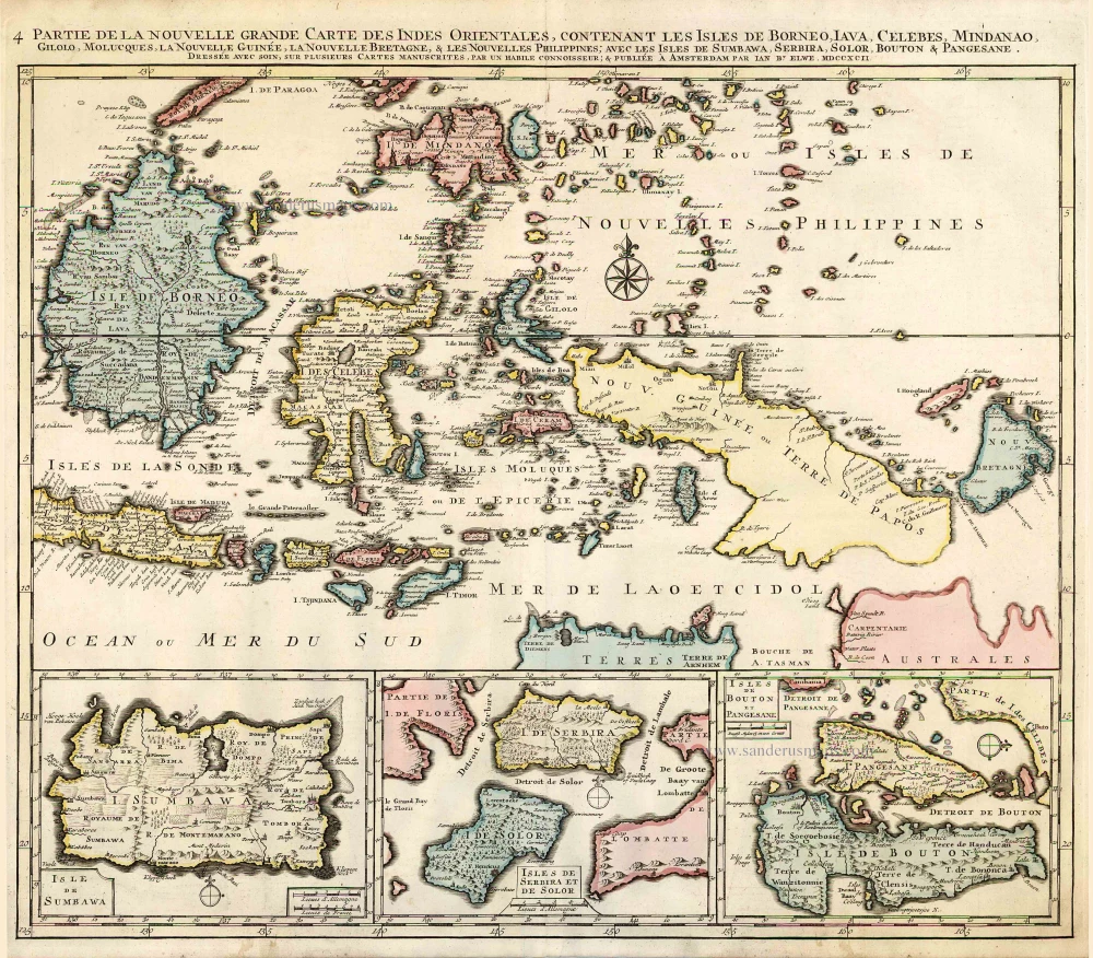
Partie de la Nouvelle Grande Carte des Indes Orientales, Contenant les Isles de Borneo, Iava, Celebes, Mindanao ... 1792
Indonesia - New Guinea - Australia by J.B. Elwe.
[Item number: 2293]
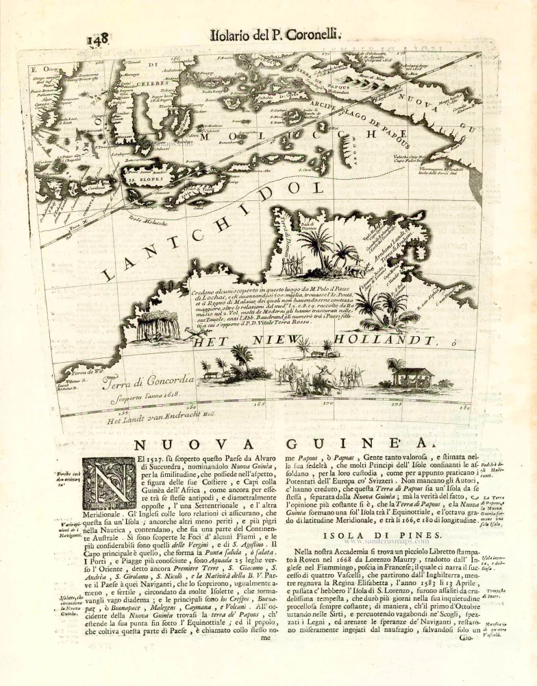
Nuova Guinea. 1696
Globe gore with Northern Australia and the East Indies, by V.M. Coronelli.
[Item number: 26448]
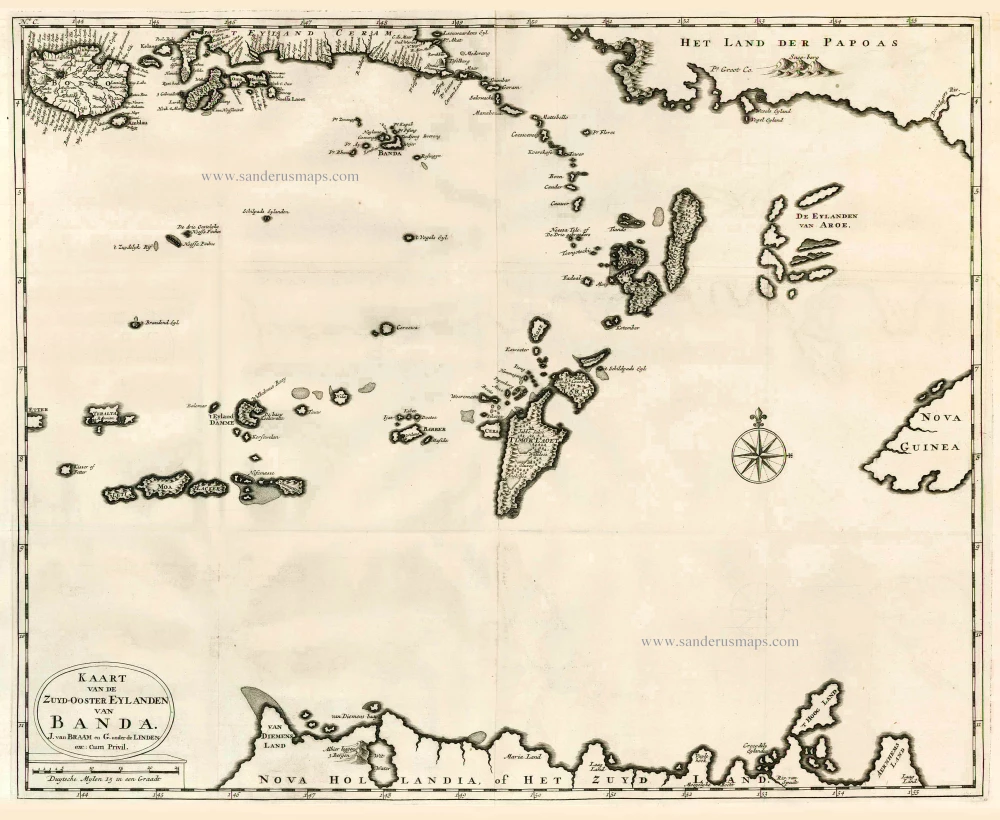
Kaart van de Zuyd-Ooster Eylanden van Banda. 1724-26
The Banda Islands (Southeast) & Northern Australia, by Fr. Valentyn.
[Item number: 26608]
Very rare second state, including the Tasman discoveries (Australia).
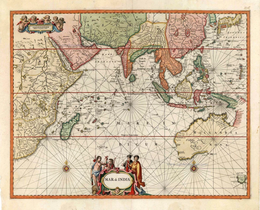
Mar di India. c. 1700
Indian Ocean, by Petrus Schenk
[Item number: 27775]