
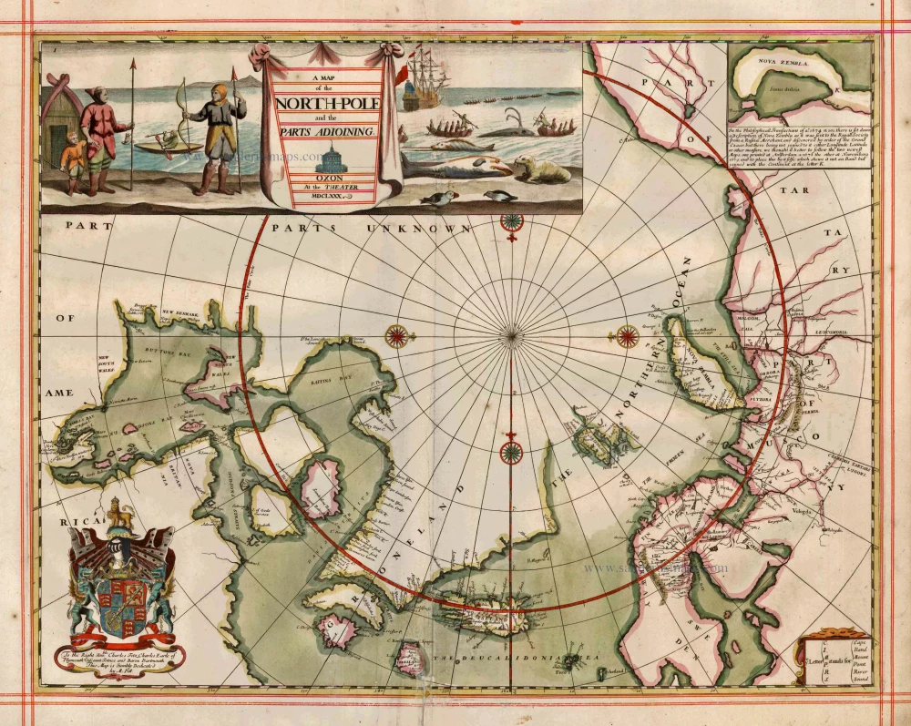
Old, antique map of the North Pole by Moses Pitt 1680
Miami
A Map of the North-Pole and the Parts Adioining. Oxon at the Theatre MDCLXXX
Item Number: 826 Authenticity Guarantee
Category: Antique maps > World and Polar
Old, antique map of the North Pole by Moses Pitt with scenes of Eskimos and whaling.
Inset map of Nova Zembla.
Date of the first edition: 1680
Date of this map: 1680
Copper engraving
Size: 46 x 59cm (17.9 x 23 inches)
Verso: Blank
Condition: Hand coloured, small reinforcement at lower centre. on large, heavy paper, ruled in red,
Condition Rating: A
References: Van der Krogt 1, 0020:Pitt; Ginsberg (Septentrionalium), 45, Kershaw, 120.
From: The English Atlas. Oxford, Moses Pitt, 1680. (Van der Krogt 1, 451)
This is one of the most attractive maps from the English Atlas, and the only one in the atlas made by Moses Pitt himself.
Miami