
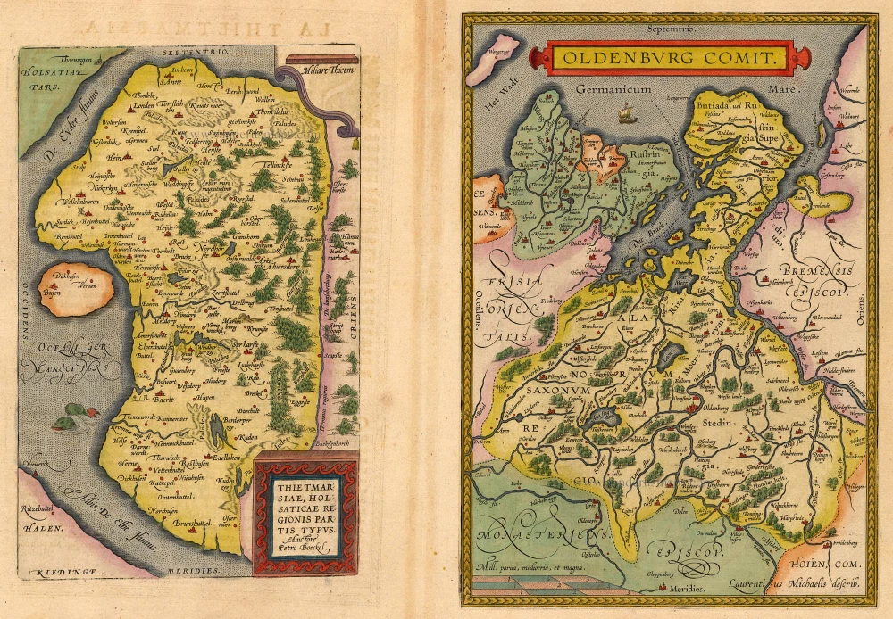
Dithmarschen - Oldenburg, by Abraham Ortelius. 1612
Abraham Ortelius (1527-1598)
The maker of the 'first atlas', the Theatrum Orbis Terrarum (1570), was born on 4 April 1527 into an old Antwerp family. He learned Latin and studied Greek and mathematics.
Abraham and his sisters Anne and Elizabeth took up map colouring. Ortelius was admitted to the Guild of St. Luke as an "illuminator of maps." In addition to colouring maps, Ortelius was a dealer in antiques, coins, maps, and books, and the book and map trade gradually became his primary occupation.
Business went well because his means permitted him to start an extensive collection of medals, coins, antiques, and a library of many volumes. In addition, he travelled a lot, visited Italy and France, made contacts everywhere with scholars and editors, and maintained extensive correspondence with them.
In 1564, he published his first map, a large and ambitious world wall map. The inspiration for this map may well have been Gastaldi's large world map. In 1565, he published a map of Egypt and a map of the Holy Land; a large map of Asia followed.
In 1568, the production of individual maps for his atlas Theatrum Orbis Terrarum was already in full swing. He completed the atlas in 1569, and in May 1570, it was available for sale. It was one of the most expensive books ever published.
This first edition contained seventy maps on fifty-three sheets. Franciscus Hogenberg engraved the maps.
Later editions included Additamenta (additions), resulting in Ortelius' historical atlas, the Parergon, which is mainly bound together with the atlas. The Parergon can be considered a truly original work by Ortelius, who drew the maps based on his research.
The importance of the Theatrum Orbis Terrarum for geographical knowledge in the last quarter of the sixteenth century is difficult to overemphasize. Nothing was like it until Mercator's atlas appeared twenty-five years later. Demand for the Theatrum was remarkable. Some 24 editions appeared during Ortelius's lifetime and another 10 after he died in 1598. Editions were published in Dutch, German, French, Spanish, English, and Italian. The number of map sheets grew from 53 in 1570 to 167 in 1612 in the last edition.
In 1577, engraver Philip Galle and poet-translator Pieter Heyns published the first pocket-sized edition of the Theatrum, the Epitome. The work was trendy. Over thirty editions of this Epitome were published in different languages.
Thietmarsiae, Holsaticae Regionis Partis Typus. - Oldenburg Comit.
Item Number: 18704 Authenticity Guarantee
Category: Antique maps > Europe > Germany
Dithmarschen - Oldenburg, by Abraham Ortelius.
Title: Thietmarsiae, Holsaticae Regionis Partis Typus. - Oldenburg Comit.
Date: 1612.
Copper engraving, printed on paper.
Size (not including margins): 305 x 433mm (12.01 x 17.05 inches).
Verso: Italian text.
Condition: Original coloured, excellent.
Condition Rating: A+.
From: Theatro del Mondo di Abrahamo Ortelio. Antwerpen, Plantin Press (J.&B. Moretus), 1612. (Van der Krogt 3, 1:652)
Abraham Ortelius (1527-1598)
The maker of the 'first atlas', the Theatrum Orbis Terrarum (1570), was born on 4 April 1527 into an old Antwerp family. He learned Latin and studied Greek and mathematics.
Abraham and his sisters Anne and Elizabeth took up map colouring. Ortelius was admitted to the Guild of St. Luke as an "illuminator of maps." In addition to colouring maps, Ortelius was a dealer in antiques, coins, maps, and books, and the book and map trade gradually became his primary occupation.
Business went well because his means permitted him to start an extensive collection of medals, coins, antiques, and a library of many volumes. In addition, he travelled a lot, visited Italy and France, made contacts everywhere with scholars and editors, and maintained extensive correspondence with them.
In 1564, he published his first map, a large and ambitious world wall map. The inspiration for this map may well have been Gastaldi's large world map. In 1565, he published a map of Egypt and a map of the Holy Land; a large map of Asia followed.
In 1568, the production of individual maps for his atlas Theatrum Orbis Terrarum was already in full swing. He completed the atlas in 1569, and in May 1570, it was available for sale. It was one of the most expensive books ever published.
This first edition contained seventy maps on fifty-three sheets. Franciscus Hogenberg engraved the maps.
Later editions included Additamenta (additions), resulting in Ortelius' historical atlas, the Parergon, which is mainly bound together with the atlas. The Parergon can be considered a truly original work by Ortelius, who drew the maps based on his research.
The importance of the Theatrum Orbis Terrarum for geographical knowledge in the last quarter of the sixteenth century is difficult to overemphasize. Nothing was like it until Mercator's atlas appeared twenty-five years later. Demand for the Theatrum was remarkable. Some 24 editions appeared during Ortelius's lifetime and another 10 after he died in 1598. Editions were published in Dutch, German, French, Spanish, English, and Italian. The number of map sheets grew from 53 in 1570 to 167 in 1612 in the last edition.
In 1577, engraver Philip Galle and poet-translator Pieter Heyns published the first pocket-sized edition of the Theatrum, the Epitome. The work was trendy. Over thirty editions of this Epitome were published in different languages.
Related items
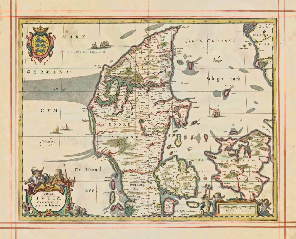
Totius Iutiae Generalis Accurata delineatio. 1680
Denmark - Jylland, by J. Janssonius, published by Moses Pitt and J. Janssonius-Waesberge.
[Item number: 1337]
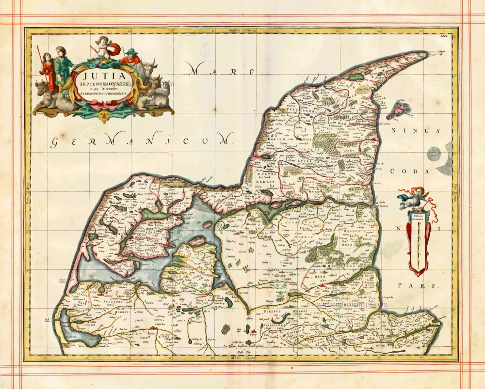
Iutia Septentrionalis, in qua Dioeceses Alburgensis et Viburgensis 1680
Denmark - Jylland (North) by J. Janssonius, published by Moses Pitt and J. Janssonius-Waesberge.
[Item number: 1353]
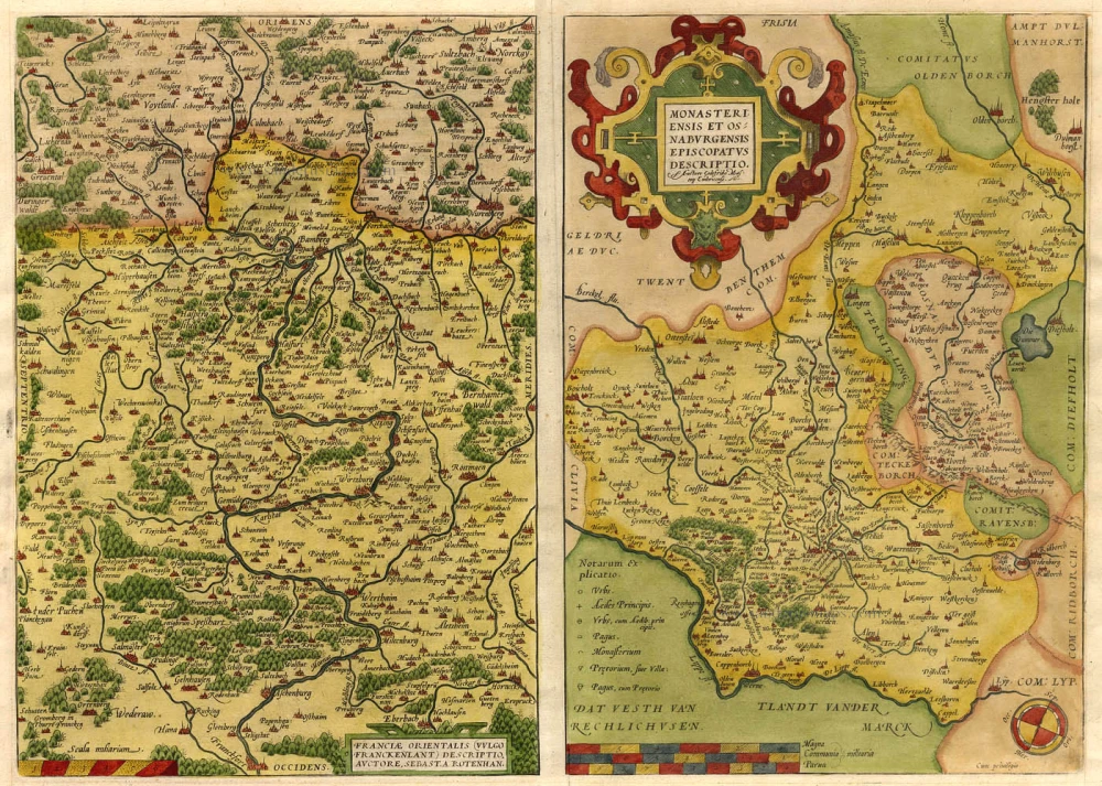
Franciae Orientalis (vulgo Franckenlant) Descriptio, Auctore, Sebast. A Rotenhan. [on sheet with:] Monasteriensis et Osnaburgensis Episcopatus Descriptio. 1571
Franken - Munster, by Abraham Ortelius.
[Item number: 6893]
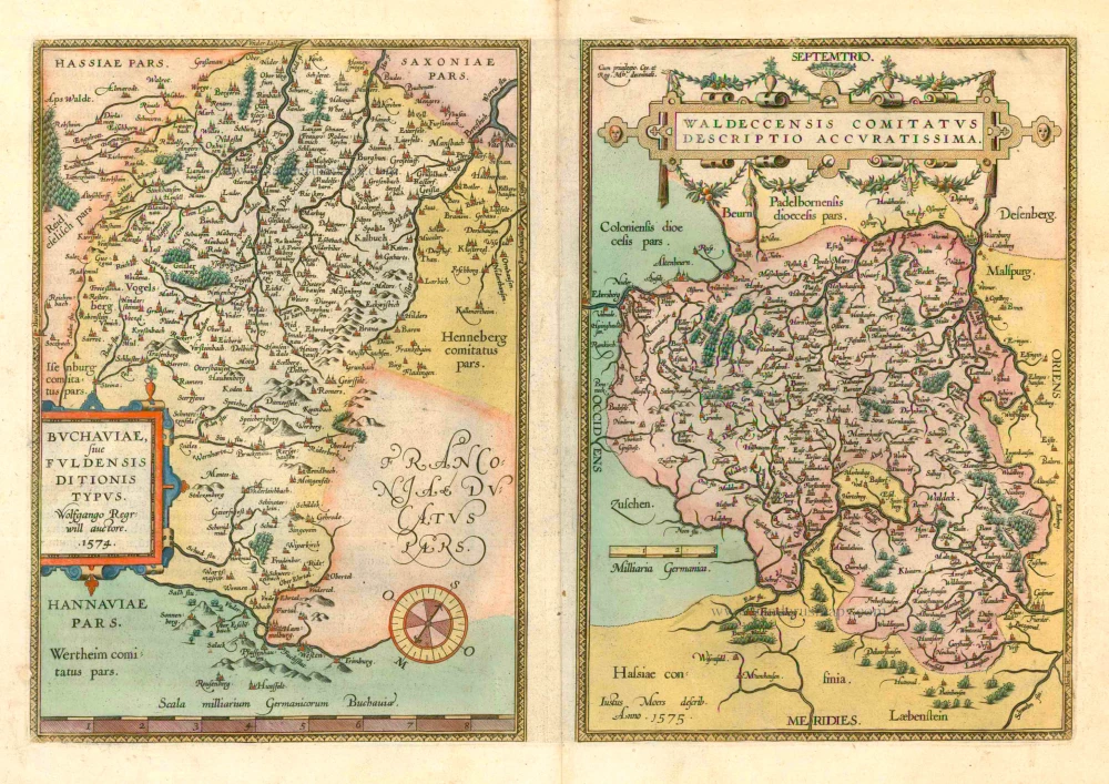
Buchaviae, sive Fuldensis Ditionis Typus - Waldeccensis Comitatus Descriptio Accuratissima. 1601
Fulda and Waldeck by Ortelius A.
[Item number: 8027]
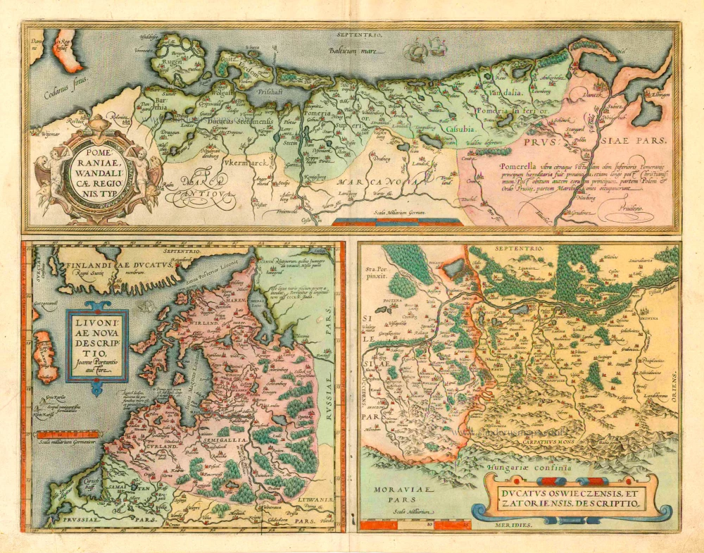
Pomeraniae, Wandaliae Regionis Typ. [on sheet with] Livoniae Nova Descriptio [and] Ducatus Oswieczensis Et Zatoriensis, Descriptio. 1601
Pommern, Livonia, Oswiecim & Zator by Abraham Ortelius.
[Item number: 8090]
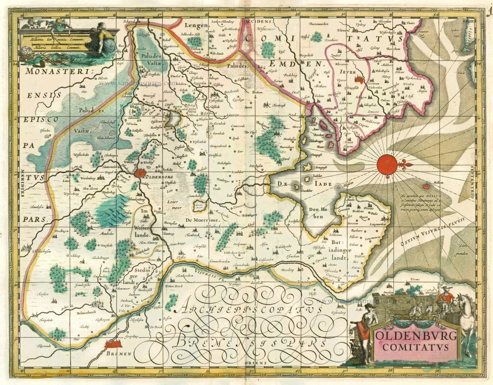
Oldenburg Comitatus c. 1680
Oldenburg, by F. de Wit.
[Item number: 13774]

Hassiae Descriptio, Ioanne Dryandro Auctore. [on sheet with:] Holsatiae Descrip. 1598
Hessen & Holstein, by Ortelius A.
[Item number: 18535]
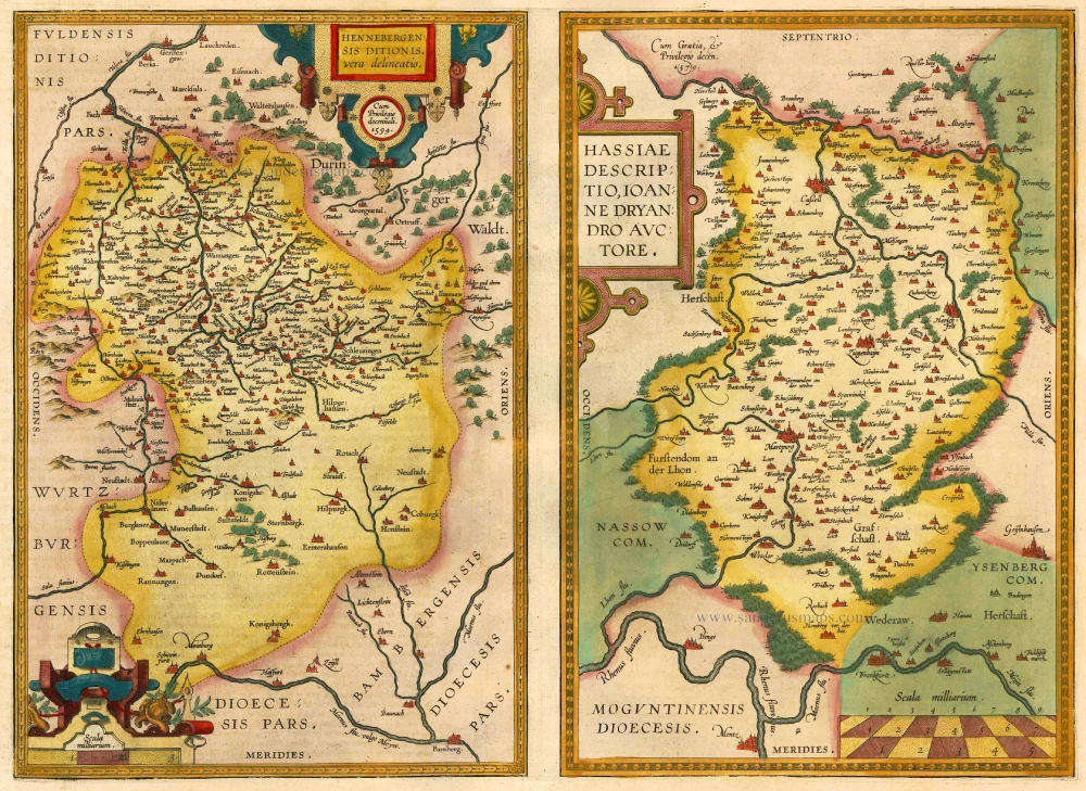
Hennebergensis Ditionis vera delineatio [on sheet with] Hassiae Descriptio 1612
Henneberg & Hessen, by Ortelius A.
[Item number: 22695]
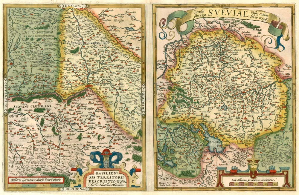
Basiliensis Territorii Descritorii Nova. - Circulus sive Liga Sveviae 1612
Basel and Schwaben by Abraham Ortelius.
[Item number: 22964]
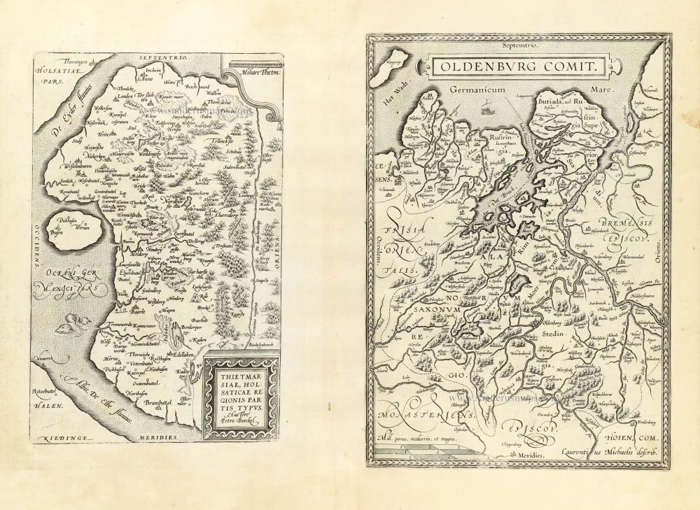
Thietmarsiae, Holsaticae Regionis Partis Typus. - Oldenburg Comit. 1612
Dithmarschen - Oldenburg by Ortelius A.
[Item number: 23001]

Basiliensis Territorii Descritorii Nova. - Circulus sive Liga Sveviae 1612
Basel and Schwaben, by A. Ortelius.
[Item number: 23007]
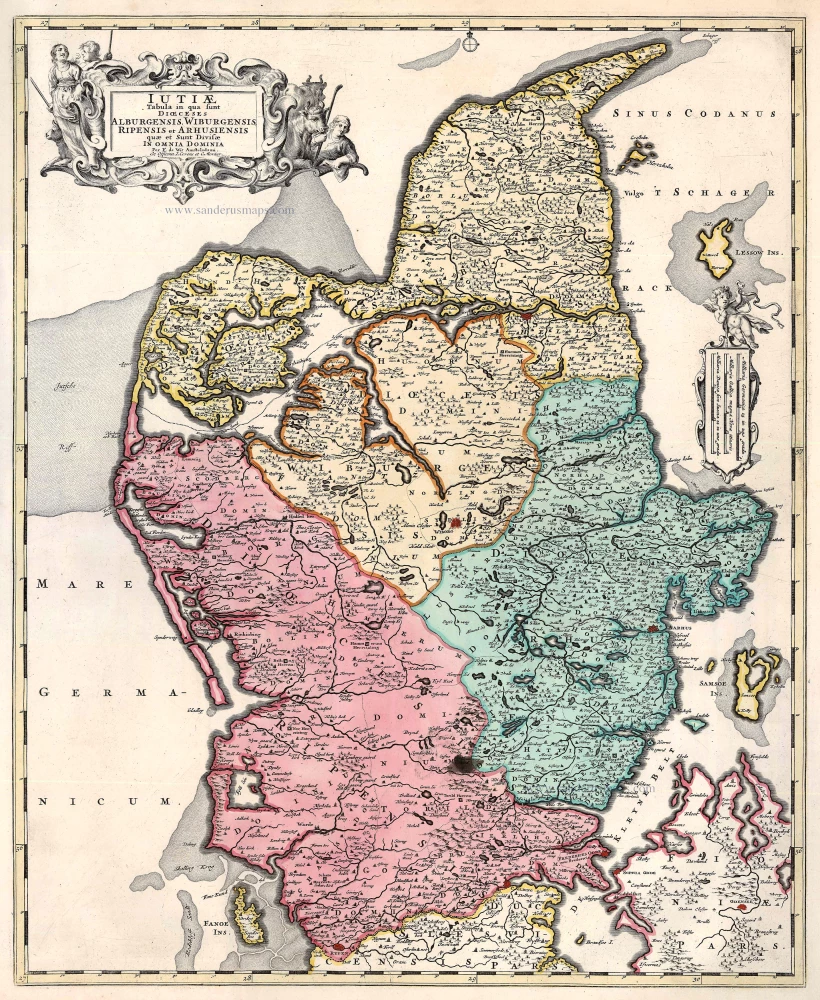
Iutiae Tabula in qua sunt Dioecesis Alburgensis, Wiburgensis, Ripensis et Arhusiensis quae et sunt divisae in Omnia Dominia. 1721-41
Denmark - Jutland, by Covens & Mortier.
[Item number: 23738]
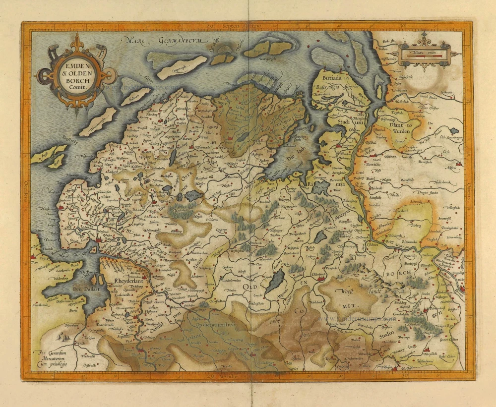
Emden & Oldenborch Comit. 1623
Emden - Oldenburg, by Gerard Mercator.
[Item number: 28134]
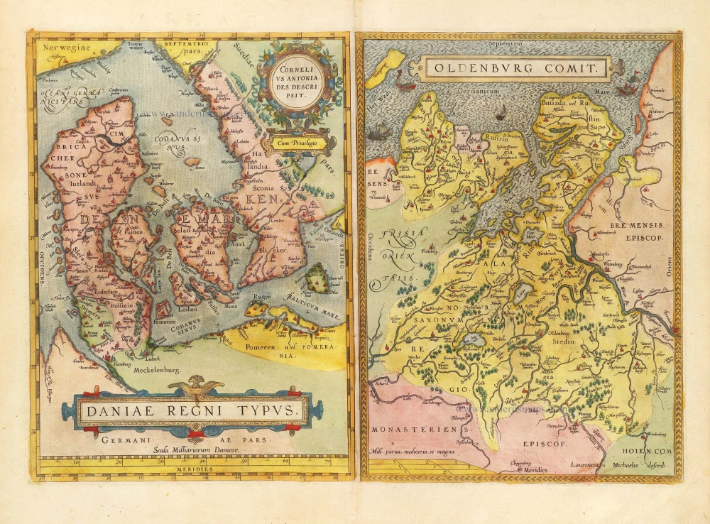
Daniae Regni Typus Cornelius Antoniades Descripsit; [On sheet with:] Oldenburg Comit. 1584
Denmark and Jutland by Abraham Ortelius.
[Item number: 29133]
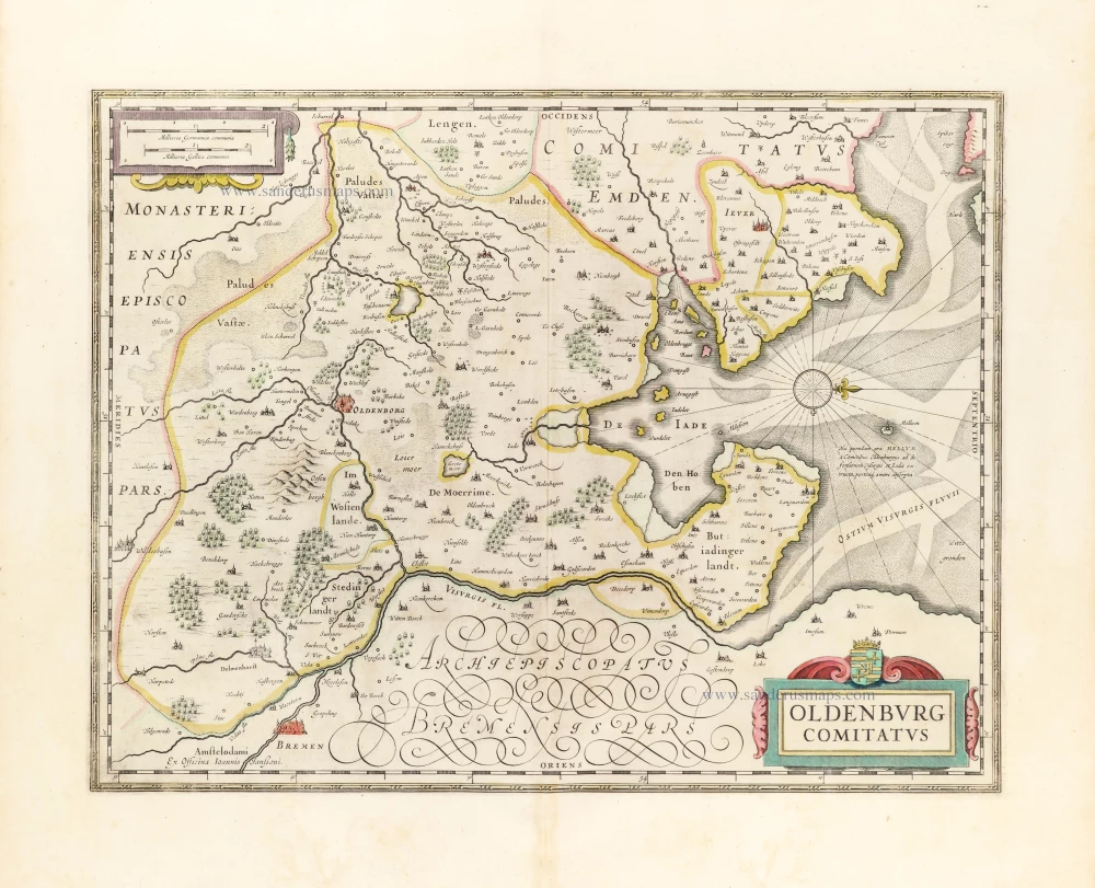
Oldenburg Comitatus. 1653
Oldenburg by Johannes Janssonius.
[Item number: 30373]
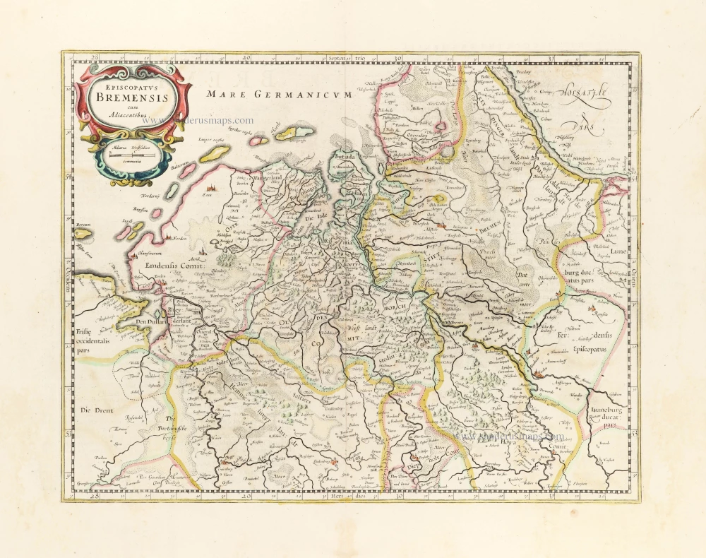
Episcopatus Bremensis cum Adiacentibus. 1653
Ost-Friesland, Oldenburg, and Bremen by Johannes Janssonius after Gerard Mercator.
[Item number: 30374]