
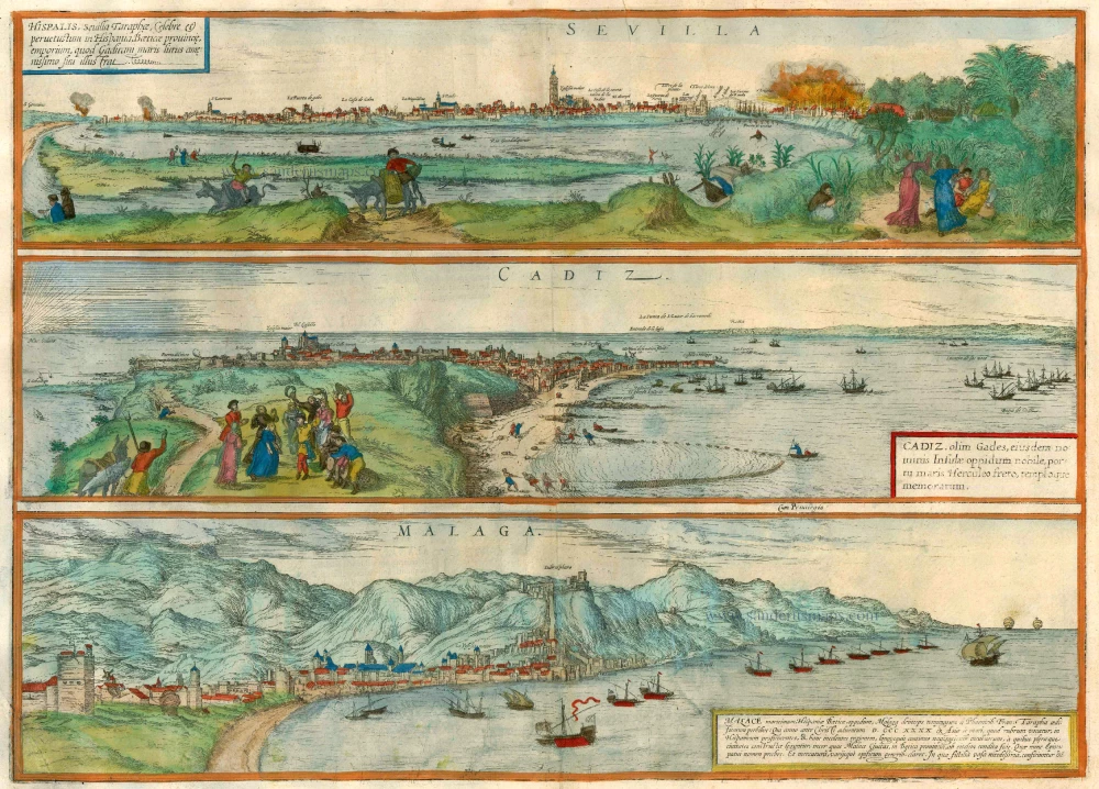
Seville (Sevilla) - Cadiz - Malaga, by Braun & Hogenberg. 1582
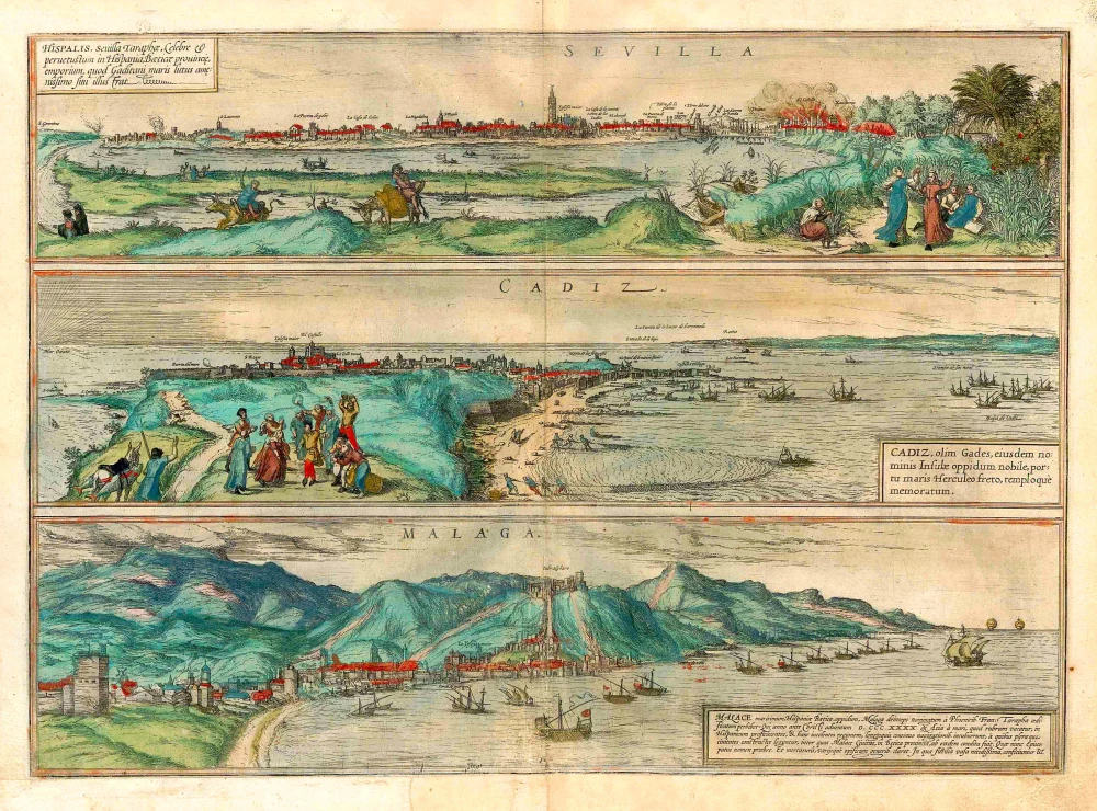

SEVILLA
TRANSLATION OF THE CARTOUCHE TEXT: Hispalis, Tarapha's Seville, famous and ancient trade centre in the province of Baetica in Spain, which embellishes the Gulf of Cadiz through its most delightful position.
COMMENTARY BY BRAUN: "Seville is the most important city of trade in all Spain, able to reap incredible gains from the most diverse places in the world, but primarily from India, which lies towards the west. Furthermore, this city enjoys a more favourable position than the other Spanish cities, since its fertile fields bring forth oils and olives and highly productive trees with palm fruits and lemons, lending truth to the saying: "Those whom God loves, He gives a house and a living in Seville."
This view of Seville presents the city from the southeast, seen at a distance from the far side of the Guadalquivir, from land now occupied by the Barrio de Triana. Visible on the right side of the city is the Castillio, which has caught on fire; the fortress with its many towers was then the seat of the Inquisition. On the left bank of the river, opposite the Castillio, lies the Torre del Oro, further left is the Alcazar, whose originally Almohad architecture was remodelled in the Mudéjar style in the 14th century. Rising above the city centre is the Gothic cathedral (Yglesia maior), which houses the tomb of Columbus. The tall belltower, called the "Giralda", was formerly a minaret and is today one of the city's landmarks. Seville profited greatly from trade with the New World. From 1537 fleets laden with wine, salt, corn, pottery and silk sailed regularly between the continents.
CADIZ
TRANSLATION OF THE CARTOUCHE TEXT: Cadiz, formerly Gades, famous town on the island of the same name, noteworthy for its port, the Strait of Hercules and its church.
COMMENTARY BY BRAUN: "The Island of Cadiz is situated not far from the mainland. The town that one sees today was not built on the old foundations, however, because its location has now shifted eastwards. Strabo, however, writes that the town lay on an island further to the west, evidence for which can still be seen near St Catherine's chapel. For when the sea recede, large broken stones are visible there, which are alleged to be the foundations of ruined houses. The divers also relate that they have seen there huge doorposts, beams and lattice doors (that tear the fishermen's nets) and from this it is possible to estimate the limits of the old town."
Cadiz is shown in cavalier perspective. Vestiges of the Moorish settlement that flourished here from the 8th to the 13th century can be seen in the centre of the fortified town: the large church, whose place is today occupied by the 18th-century cathedral, and the fortress. Particular emphasis is placed upon the fishing industry, from which the town lived before it became a major centre of trade. In the 16th century Cadiz served as the "gateway to America": Columbus embarked upon his second and fourth expeditions from Cadiz harbour. The town later became the home port of the Spanish treasure fleet - and thereby found itself at the centre of Spain's military activities. From 1537 onwards maritime trade with the New World assumed a more organized form, with a treasure fleet sailing annually between Cadiz, Seville and the colonies. Cadiz's most important export was salt.
MALAGA
TRANSLATION OF THE CARTOUCHE TEXT: Malaga is the name of a well-fortified and well-designed town on a very fertile site in the Spanish province of Baetica, lying directly beside the sea, which was founded by the Phoenicians, as recounted by Francisco Tarapha in his chronicle. [...] Malaga is today an important bishopric and is distinguished by its commerce and craft, particularly by its skilfully decorated earthenware, which is exported from here all over the world.
COMMENTARY BY BRAUN: "Malaga is important for its position and its trade and is distinguished by the fact that it possesses all the vital necessities of life in abundance. Large numbers of merchants, chiefly from the Netherlandish and the German towns, come here in order to buy the excellent wines produced by the local vineyards, something that proves itself to be a very good business. On the other hand, Malaga is also a bulwark against various enemies; for this reason the King of Spain has established his arsenal here, from where at no small cost he safeguards his rule in his African cities."
The illustration focuses in particular upon the harbour and thus upon the town's associated importance as a centre of trade. Malaga's occupation by the Moors, which lasted over 700 years and ended only in 1487, in the wake of the Reconquista by King Ferdinand and Queen Isabella, is reflected in the large 11th-century Moorish fortress complex (centre). This is divided into two parts: the lower and the upper fortress (Alcazaca and Gibralfaro). The cathedral (La Yglesia maior) was built after 1528 on top of the former main mosque. It was never completed and is therefore also known as "La Manquita" (the one-armed lady). (Taschen)
Braun G. & Hogenberg F. and the Civitates Orbis Terrarum.
The Civitates Orbis Terrarum, or the "Braun & Hogenberg", is a six-volume town atlas and the most excellent book of town views and plans ever published: 363 engravings, sometimes beautifully coloured. It was one of the best-selling works in the last quarter of the 16th century. Georg Braun wrote the text accompanying the plans and views on the verso. Many plates were engraved after the original drawings of a professional artist, a professional artist, Joris Hoefnagel (1542-1600). The first volume was published in Latin in 1572, and the sixth in 1617. Frans Hogenberg created the tables for volumes I through IV, and Simon van den Neuwel made those for volumes V and VI. Other contributors were cartographers Daniel Freese and Heinrich Rantzau. Works by Jacob van Deventer, Sebastian Münster, and Johannes Stumpf were also used. Translations appeared in German and French.
Following the original publication of Volume 1 of the Civitates in 1572, seven further editions of 1575, 1577, 1582, 1588, 1593, 1599 and 1612 can be identified. Vol.2, first issued in 1575, was followed by further editions in 1597 and 1612. The subsequent volumes appeared in 1581, 1588, 1593, 1599 and 1606. The German translation of the first volume appeared from 1574 on, and the French edition from 1575 on.
Several printers were involved: Theodor Graminaeus, Heinrich von Aich, Gottfried von Kempen, Johannis Sinniger, Bertram Buchholtz and Peter von Brachel, who all worked in Cologne.
Georg Braun (1541-1622)
Georg Braun was born in Cologne in 1541. After his studies in Cologne, he entered the Jesuit Order as a novice. 1561, he obtained his bachelor's degree, and in 1562, he received his Magister Artium. Although he left the Jesuit Order, he studied theology, gaining a licentiate in theology.
Frans Hogenberg (1535-1590)
Frans Hogenberg was a Flemish and German painter, engraver, and mapmaker. He was born in Mechelen as the son of Nicolaas Hogenberg.
By the end of the 1560s, Frans Hogenberg was employed upon Abraham Ortelius's Theatrum Orbis Terrarum, published in 1570; he is named an engraver of numerous maps. In 1568, he was banned from Antwerp by the Duke of Alva and travelled to London, where he stayed a few years before emigrating to Cologne. He immediately embarked on his two most important works, the Civitates, published in 1572 and the Geschichtsblätter, which appeared in several series from 1569 until about 1587.
Thanks to large-scale projects like the Geschichtsblätter and the Civitates, Hogenberg's social circumstances improved with each passing year. He died as a wealthy man in Cologne in 1590.
Sevilla, Hispalis ... [on sheet with] Cadiz [and] Malaga.
Item Number: 25496 Authenticity Guarantee
Category: Antique maps > Europe > Spain and Portugal
Three bird's-eye views one one sheet: Seville, Cadiz, Malaga, by Georg Braun and Frans Hogenberg.
Date of the first edition: 1572
Date of this map: 1582
Copper engraving
Size (not including margins): 33 x 48cm (12.9 x 18.7 inches)
Verso text: Latin
Condition: Original coloured, old reinforcementin lower centrefold.
Condition Rating: A
References: Van der Krogt 4, 3973, State 1 (no privilege); Fauser, 12945, 2182, 8372; Taschen, Braun and Hogenberg, p.50.
From: Civitates Orbis Terrarum, Liber Primus. Köln, Gottfried von Kempen, 1582. (Van der Krogt 4, 41:1.1(1582))
SEVILLA
TRANSLATION OF THE CARTOUCHE TEXT: Hispalis, Tarapha's Seville, famous and ancient trade centre in the province of Baetica in Spain, which embellishes the Gulf of Cadiz through its most delightful position.
COMMENTARY BY BRAUN: "Seville is the most important city of trade in all Spain, able to reap incredible gains from the most diverse places in the world, but primarily from India, which lies towards the west. Furthermore, this city enjoys a more favourable position than the other Spanish cities, since its fertile fields bring forth oils and olives and highly productive trees with palm fruits and lemons, lending truth to the saying: "Those whom God loves, He gives a house and a living in Seville."
This view of Seville presents the city from the southeast, seen at a distance from the far side of the Guadalquivir, from land now occupied by the Barrio de Triana. Visible on the right side of the city is the Castillio, which has caught on fire; the fortress with its many towers was then the seat of the Inquisition. On the left bank of the river, opposite the Castillio, lies the Torre del Oro, further left is the Alcazar, whose originally Almohad architecture was remodelled in the Mudéjar style in the 14th century. Rising above the city centre is the Gothic cathedral (Yglesia maior), which houses the tomb of Columbus. The tall belltower, called the "Giralda", was formerly a minaret and is today one of the city's landmarks. Seville profited greatly from trade with the New World. From 1537 fleets laden with wine, salt, corn, pottery and silk sailed regularly between the continents.
CADIZ
TRANSLATION OF THE CARTOUCHE TEXT: Cadiz, formerly Gades, famous town on the island of the same name, noteworthy for its port, the Strait of Hercules and its church.
COMMENTARY BY BRAUN: "The Island of Cadiz is situated not far from the mainland. The town that one sees today was not built on the old foundations, however, because its location has now shifted eastwards. Strabo, however, writes that the town lay on an island further to the west, evidence for which can still be seen near St Catherine's chapel. For when the sea recede, large broken stones are visible there, which are alleged to be the foundations of ruined houses. The divers also relate that they have seen there huge doorposts, beams and lattice doors (that tear the fishermen's nets) and from this it is possible to estimate the limits of the old town."
Cadiz is shown in cavalier perspective. Vestiges of the Moorish settlement that flourished here from the 8th to the 13th century can be seen in the centre of the fortified town: the large church, whose place is today occupied by the 18th-century cathedral, and the fortress. Particular emphasis is placed upon the fishing industry, from which the town lived before it became a major centre of trade. In the 16th century Cadiz served as the "gateway to America": Columbus embarked upon his second and fourth expeditions from Cadiz harbour. The town later became the home port of the Spanish treasure fleet - and thereby found itself at the centre of Spain's military activities. From 1537 onwards maritime trade with the New World assumed a more organized form, with a treasure fleet sailing annually between Cadiz, Seville and the colonies. Cadiz's most important export was salt.
MALAGA
TRANSLATION OF THE CARTOUCHE TEXT: Malaga is the name of a well-fortified and well-designed town on a very fertile site in the Spanish province of Baetica, lying directly beside the sea, which was founded by the Phoenicians, as recounted by Francisco Tarapha in his chronicle. [...] Malaga is today an important bishopric and is distinguished by its commerce and craft, particularly by its skilfully decorated earthenware, which is exported from here all over the world.
COMMENTARY BY BRAUN: "Malaga is important for its position and its trade and is distinguished by the fact that it possesses all the vital necessities of life in abundance. Large numbers of merchants, chiefly from the Netherlandish and the German towns, come here in order to buy the excellent wines produced by the local vineyards, something that proves itself to be a very good business. On the other hand, Malaga is also a bulwark against various enemies; for this reason the King of Spain has established his arsenal here, from where at no small cost he safeguards his rule in his African cities."
The illustration focuses in particular upon the harbour and thus upon the town's associated importance as a centre of trade. Malaga's occupation by the Moors, which lasted over 700 years and ended only in 1487, in the wake of the Reconquista by King Ferdinand and Queen Isabella, is reflected in the large 11th-century Moorish fortress complex (centre). This is divided into two parts: the lower and the upper fortress (Alcazaca and Gibralfaro). The cathedral (La Yglesia maior) was built after 1528 on top of the former main mosque. It was never completed and is therefore also known as "La Manquita" (the one-armed lady). (Taschen)
Braun G. & Hogenberg F. and the Civitates Orbis Terrarum.
The Civitates Orbis Terrarum, or the "Braun & Hogenberg", is a six-volume town atlas and the most excellent book of town views and plans ever published: 363 engravings, sometimes beautifully coloured. It was one of the best-selling works in the last quarter of the 16th century. Georg Braun wrote the text accompanying the plans and views on the verso. Many plates were engraved after the original drawings of a professional artist, a professional artist, Joris Hoefnagel (1542-1600). The first volume was published in Latin in 1572, and the sixth in 1617. Frans Hogenberg created the tables for volumes I through IV, and Simon van den Neuwel made those for volumes V and VI. Other contributors were cartographers Daniel Freese and Heinrich Rantzau. Works by Jacob van Deventer, Sebastian Münster, and Johannes Stumpf were also used. Translations appeared in German and French.
Following the original publication of Volume 1 of the Civitates in 1572, seven further editions of 1575, 1577, 1582, 1588, 1593, 1599 and 1612 can be identified. Vol.2, first issued in 1575, was followed by further editions in 1597 and 1612. The subsequent volumes appeared in 1581, 1588, 1593, 1599 and 1606. The German translation of the first volume appeared from 1574 on, and the French edition from 1575 on.
Several printers were involved: Theodor Graminaeus, Heinrich von Aich, Gottfried von Kempen, Johannis Sinniger, Bertram Buchholtz and Peter von Brachel, who all worked in Cologne.
Georg Braun (1541-1622)
Georg Braun was born in Cologne in 1541. After his studies in Cologne, he entered the Jesuit Order as a novice. 1561, he obtained his bachelor's degree, and in 1562, he received his Magister Artium. Although he left the Jesuit Order, he studied theology, gaining a licentiate in theology.
Frans Hogenberg (1535-1590)
Frans Hogenberg was a Flemish and German painter, engraver, and mapmaker. He was born in Mechelen as the son of Nicolaas Hogenberg.
By the end of the 1560s, Frans Hogenberg was employed upon Abraham Ortelius's Theatrum Orbis Terrarum, published in 1570; he is named an engraver of numerous maps. In 1568, he was banned from Antwerp by the Duke of Alva and travelled to London, where he stayed a few years before emigrating to Cologne. He immediately embarked on his two most important works, the Civitates, published in 1572 and the Geschichtsblätter, which appeared in several series from 1569 until about 1587.
Thanks to large-scale projects like the Geschichtsblätter and the Civitates, Hogenberg's social circumstances improved with each passing year. He died as a wealthy man in Cologne in 1590.
Related items
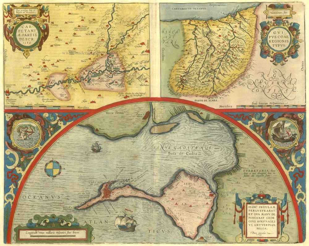
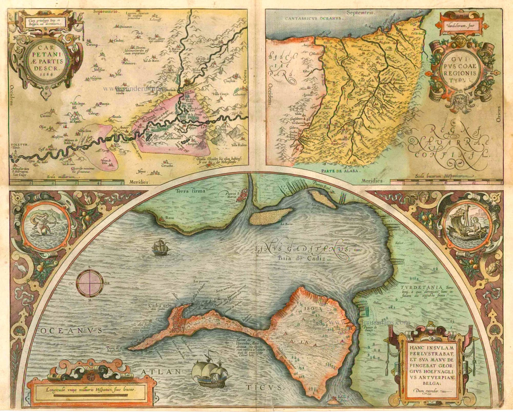
Carpetaniae Partis - Vadulorum sive Guispucoae Regionis Typus - Cadiz Urbs hanc Insulam Perlustrabat ... 1609
Carpetania - Guipuzcoa - Cadiz, by Ortelius A.
[Item number: 1667]
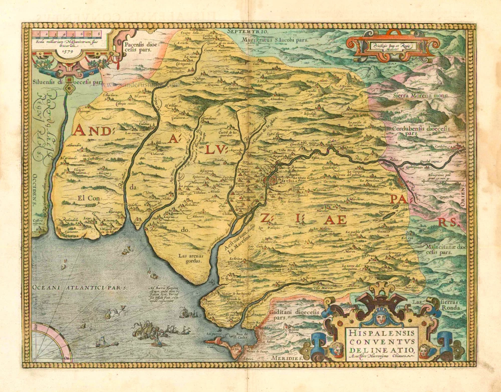
Hispalensis Conventus Delineatio. 1601
Andalucia - Sevilla, by A. Ortelius.
[Item number: 5730]
Carpetaniae Partis - Vadulorum sive Guispucoae Regionis Typus - Cadiz Urbs hanc Insulam Perlustrabat ... 1601
Carpetania - Guipuzcoa - Cadiz, by A. Ortelius.
[Item number: 5749]
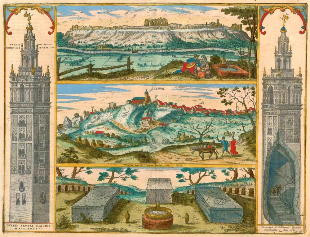
Sant Juan del Foratche [on sheet with] Jerenna ... 1596-1640
Sevilla - Gerena, by Braun & Hogenberg.
[Item number: 16487]
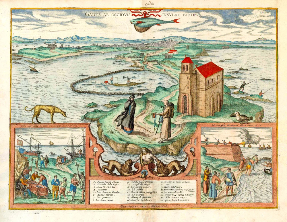
Gades ab Occiduis Insulae Partibus. 1623
Cadiz, by Braun Georg & Hogenberg Frans.
[Item number: 22059]
Sevilla, Hispalis ... [on sheet with] Cadiz [and] Malaga. 1572-1624
Antique map of Seville (Sevilla) - Cadiz - Malaga by Braun & Hogenberg
[Item number: 22685]
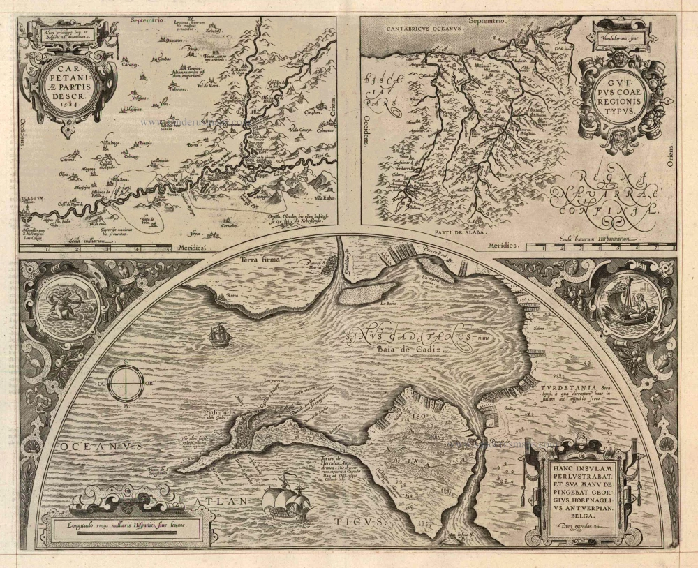
Carpetaniae Partis - Vadulorum sive Guispucoae Regionis Typus - Cadiz Urbs hanc Insulam Perlustrabat ... 1598
Carpetania - Guipuzcoa - Cadiz, by A. Ortelius.
[Item number: 22866]
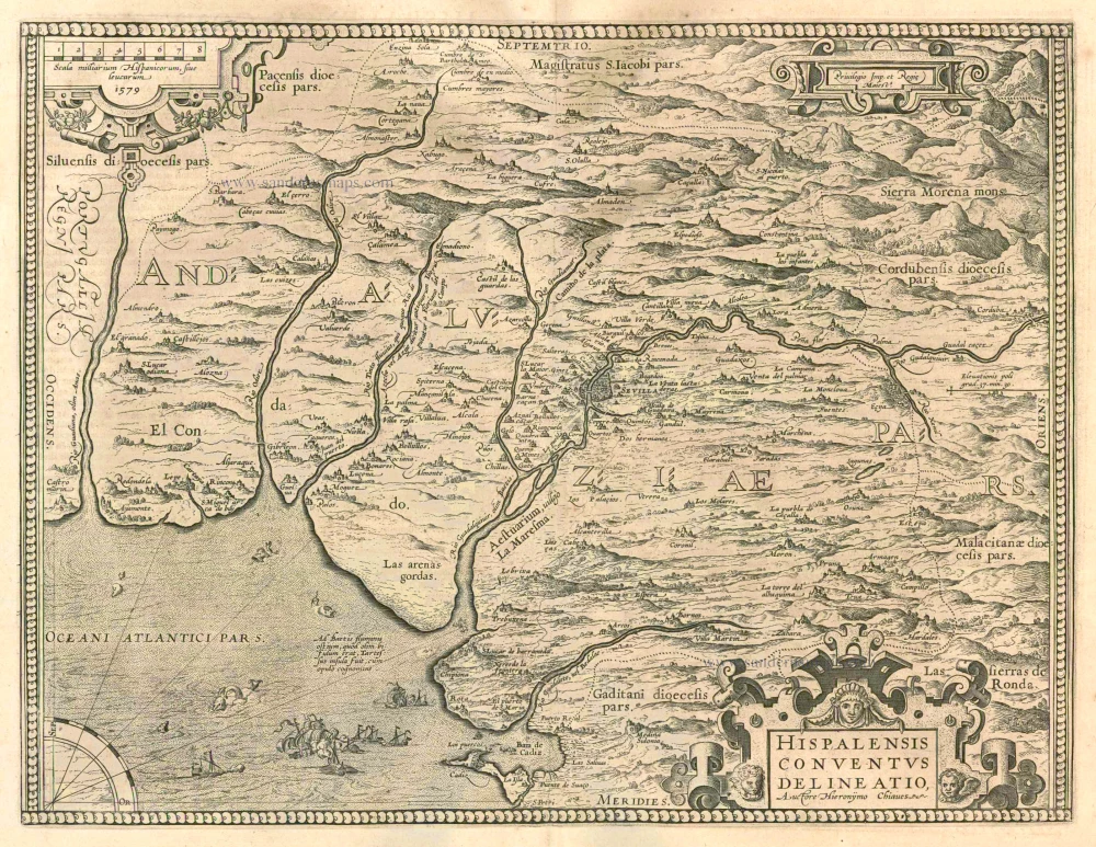
Hispalensis Conventus Delineatio. 1601
Andalucia - Sevilla, by A. Ortelius.
[Item number: 22872]
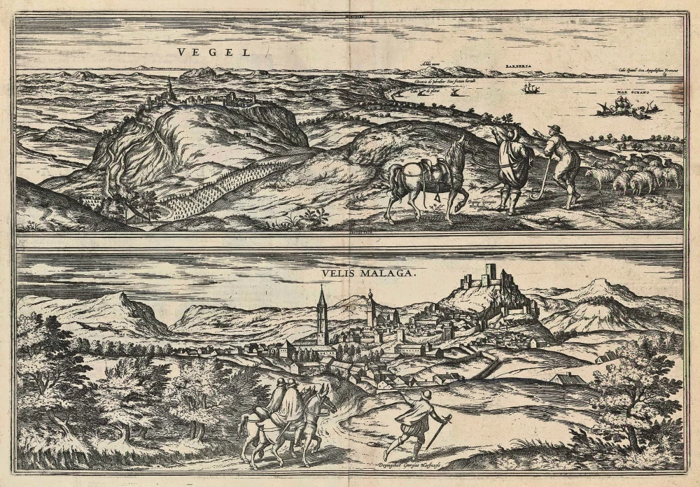
Vegel [on sheet with] Velis Malaga 1597
Vejer de la Frontera and Vélez-Málaga, by Georg Braun and Frans Hogenberg.
[Item number: 23959]
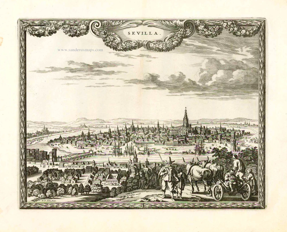
Sevilla. 1658/60
Sevilla, by N. Visscher & P.H. Schut.
[Item number: 26630]
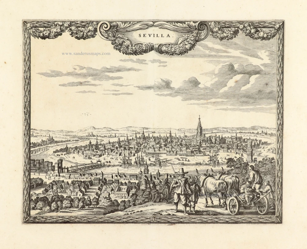
Unrecorded variant of Schut's view of Sevilla, by Carel Allard
Sevilla. 1673
View of Sevilla by Carel Allard.
[Item number: 30556]
new