
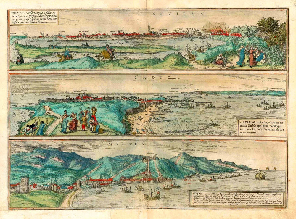
Sevilla - Gerena, by Braun & Hogenberg. 1596-1640


COMMENTARY BY BRAUN (on verso): "Not far from Seville lies San Juan de Aznalfarache with the ancient ruined walls of a huge palace. The site lies on a hill on the River Bétis, called the Guadalquivir from the Arabic, meaning big river. Even today, simple brick-vaulted tombs are often uncovered by the daily ploughing of the fields in front of Seville. When they still ruled Hispania, the Moors built other such towers out of brick with such artistry that anyone who sees them must be astonished."
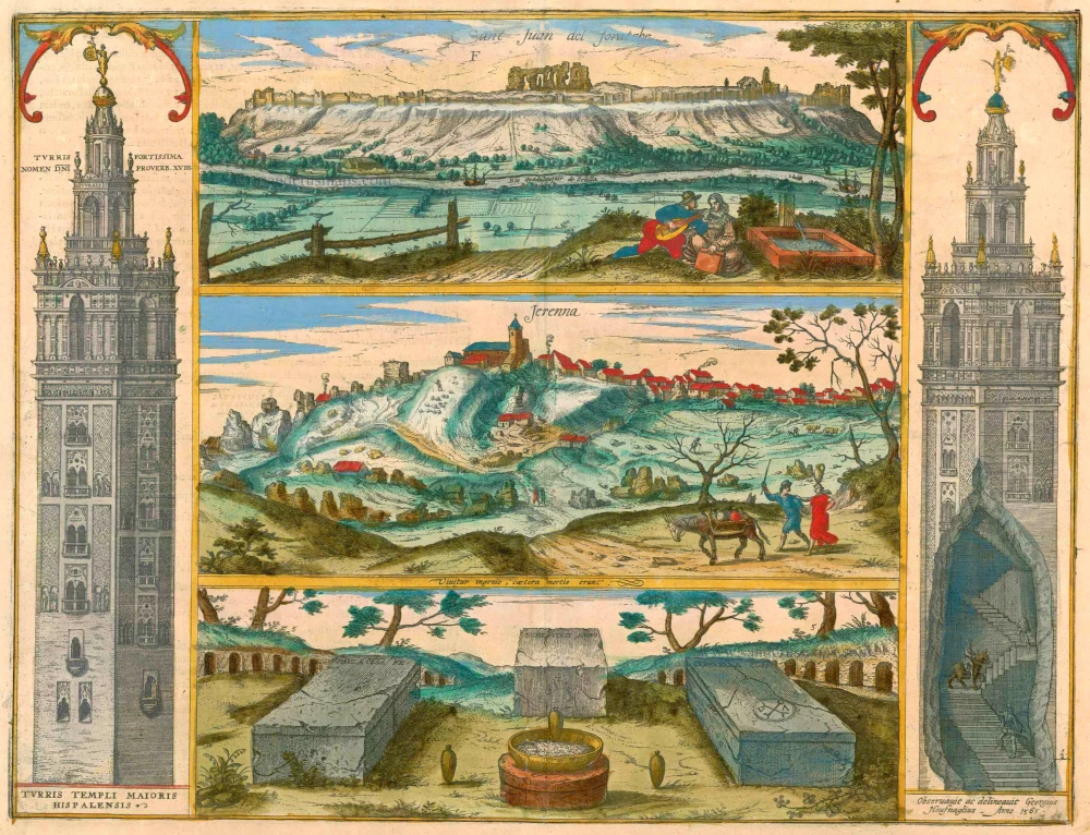
The plate illustrates three sites near Seville, framed on either side by views of the Giralda, the famous bell tower of Seville cathedral. Still, the city's most familiar landmark, the Giralda, is shown on the left in a façade view, while on the right, a cut-away view reveals the tower's internal staircase, a ramp that could be ridden up on horseback. The Giralda was originally the minaret of the Mezquita Major, commenced in 1172. After the Reconquista, however, the Moorish mosque was replaced by the cathedral of Santa Maria de la Juan de Aznalfarache, southwest of Seville. During the Muslim Al-Andalus period (from the 8th cent. onwards), it was called Hisn-al-Faray, which means "castle with a view" and is the origin of today's Aznalfarache. The castle in question was built in 1196/97. In 1248, after being reconquered from the Moors, the site passed to the Order of St John (San Juan) of Jerusalem, hence the first part of the town's name. The middle view shows the hilltop village of Gerena, northwest of Seville. The city goes back to a Roman settlement, and many Roman remains are still to be found there. These include sections of an aqueduct, which carried water to the Roman city of Italica. The aqueduct and the ruins of Italica are probably the subjects of the lower view. Italica was founded in 206 BC by Publius Cornelius Scipio Africanus and was used as a quarry after the arrival of the Moors in 711. As a vanitas motif above the tombs, Hoefnagel has included an antique motto taken from the Appendix Vergiliana and widespread within humanism: Vivitur ingenio caetera mortis erunt - "Genius live on, all else is mortal." (Taschen)
Braun G. & Hogenberg F. and the Civitates Orbis Terrarum.
The Civitates Orbis Terrarum, also known as the 'Braun & Hogenberg', is a six-volume town atlas and the most excellent book of town views and plans ever published: 363 engravings, sometimes beautifully coloured. It was one of the best-selling works in the last quarter of the 16th century. Georg Braun, a skilled writer, wrote the text accompanying the plans and views on the verso. Many plates were engraved after the original drawings of a professional artist, Joris Hoefnagel (1542-1600). The first volume was published in Latin in 1572 and the sixth in 1617. Frans Hogenberg, a talented engraver, created the tables for volumes I through IV, and Simon van den Neuwel made those for volumes V and VI. Other contributors were cartographers Daniel Freese and Heinrich Rantzau, who provided valuable geographical information. Works by Jacob van Deventer, Sebastian Münster, and Johannes Stumpf were also used as references. Translations appeared in German and French, making the atlas accessible to a wider audience.
Since its original publication of volume 1 in 1572, the Civitates Orbis Terrarum has left an indelible mark on the history of cartography. The first volume was followed by seven more editions in 1575, 1577, 1582, 1588, 1593, 1599, and 1612. Vol.2, initially released in 1575, saw subsequent editions in 1597 and 1612. The subsequent volumes, each a treasure trove of historical insights, graced the world in 1581, 1588, 1593, 1599, and 1606. The German translation of the first volume, a testament to its widespread appeal, debuted in 1574, followed by the French edition in 1575.
Several printers were involved: Theodor Graminaeus, Heinrich von Aich, Gottfried von Kempen, Johannis Sinniger, Bertram Buchholtz, and Peter von Brachel, all of whom worked in Cologne.
Georg Braun (1541-1622)
Georg Braun, the author of the text accompanying the plans and views in the Civitates Orbis Terrarum, was born in Cologne in 1541. After his studies in Cologne, he entered the Jesuit Order as a novice, indicating his commitment to learning and intellectual pursuits. In 1561, he obtained his bachelor's degree; in 1562, he received his Magister Artium, further demonstrating his academic achievements. Although he left the Jesuit Order, he continued his studies in theology, gaining a licentiate in theology. His theological background likely influenced the content and tone of the text in the Civitates Orbis Terrarum, adding a unique perspective to the work.
Frans Hogenberg (1535-1590)
Frans Hogenberg was a Flemish and German painter, engraver, and mapmaker. He was born in Mechelen as the son of Nicolaas Hogenberg.
By the end of the 1560s, Frans Hogenberg was employed upon Abraham Ortelius's Theatrum Orbis Terrarum, published in 1570; he is named an engraver of numerous maps. In 1568, he was banned from Antwerp by the Duke of Alva and travelled to London, where he stayed a few years before emigrating to Cologne. He immediately embarked on his two most important works, the Civitates, published in 1572 and the Geschichtsblätter, which appeared in several series from 1569 until about 1587.
Thanks to large-scale projects like the Geschichtsblätter and the Civitates, Hogenberg's social circumstances improved with each passing year. He died as a wealthy man in Cologne in 1590.
Sant Juan del Foratche [on sheet with] Jerenna ...
Item Number: 16487 Authenticity Guarantee
Category: Antique maps > Europe > Spain and Portugal
5 views of San Juan on Guadalquivir, Gerena, 3 Roman tombs, & towers at side, one cutaway showing Hoefnagel ascending on horseback. Engraved after a drawing by Georg Hoefnagel, 1565.
Copper engraving
Size: 38 x 49cm (14.8 x 19.1 inches)
Verso text: Latin
Condition: Lower centrefold split reinforced, superb old colour.
Condition Rating: A
References: Van der Krogt 4, 3849, State 1 (With Hoefnagel's name); Taschen, Braun and Hogenberg, p.350
From: Civitates Orbis Terrarum, ... Part 5. Köln, 1598.
COMMENTARY BY BRAUN (on verso): "Not far from Seville lies San Juan de Aznalfarache with the ancient ruined walls of a huge palace. The site lies on a hill on the River Bétis, called the Guadalquivir from the Arabic, meaning big river. Even today, simple brick-vaulted tombs are often uncovered by the daily ploughing of the fields in front of Seville. When they still ruled Hispania, the Moors built other such towers out of brick with such artistry that anyone who sees them must be astonished."
The plate illustrates three sites near Seville, framed on either side by views of the Giralda, the famous bell tower of Seville cathedral. Still, the city's most familiar landmark, the Giralda, is shown on the left in a façade view, while on the right, a cut-away view reveals the tower's internal staircase, a ramp that could be ridden up on horseback. The Giralda was originally the minaret of the Mezquita Major, commenced in 1172. After the Reconquista, however, the Moorish mosque was replaced by the cathedral of Santa Maria de la Juan de Aznalfarache, southwest of Seville. During the Muslim Al-Andalus period (from the 8th cent. onwards), it was called Hisn-al-Faray, which means "castle with a view" and is the origin of today's Aznalfarache. The castle in question was built in 1196/97. In 1248, after being reconquered from the Moors, the site passed to the Order of St John (San Juan) of Jerusalem, hence the first part of the town's name. The middle view shows the hilltop village of Gerena, northwest of Seville. The city goes back to a Roman settlement, and many Roman remains are still to be found there. These include sections of an aqueduct, which carried water to the Roman city of Italica. The aqueduct and the ruins of Italica are probably the subjects of the lower view. Italica was founded in 206 BC by Publius Cornelius Scipio Africanus and was used as a quarry after the arrival of the Moors in 711. As a vanitas motif above the tombs, Hoefnagel has included an antique motto taken from the Appendix Vergiliana and widespread within humanism: Vivitur ingenio caetera mortis erunt - "Genius live on, all else is mortal." (Taschen)
Braun G. & Hogenberg F. and the Civitates Orbis Terrarum.
The Civitates Orbis Terrarum, also known as the 'Braun & Hogenberg', is a six-volume town atlas and the most excellent book of town views and plans ever published: 363 engravings, sometimes beautifully coloured. It was one of the best-selling works in the last quarter of the 16th century. Georg Braun, a skilled writer, wrote the text accompanying the plans and views on the verso. Many plates were engraved after the original drawings of a professional artist, Joris Hoefnagel (1542-1600). The first volume was published in Latin in 1572 and the sixth in 1617. Frans Hogenberg, a talented engraver, created the tables for volumes I through IV, and Simon van den Neuwel made those for volumes V and VI. Other contributors were cartographers Daniel Freese and Heinrich Rantzau, who provided valuable geographical information. Works by Jacob van Deventer, Sebastian Münster, and Johannes Stumpf were also used as references. Translations appeared in German and French, making the atlas accessible to a wider audience.
Since its original publication of volume 1 in 1572, the Civitates Orbis Terrarum has left an indelible mark on the history of cartography. The first volume was followed by seven more editions in 1575, 1577, 1582, 1588, 1593, 1599, and 1612. Vol.2, initially released in 1575, saw subsequent editions in 1597 and 1612. The subsequent volumes, each a treasure trove of historical insights, graced the world in 1581, 1588, 1593, 1599, and 1606. The German translation of the first volume, a testament to its widespread appeal, debuted in 1574, followed by the French edition in 1575.
Several printers were involved: Theodor Graminaeus, Heinrich von Aich, Gottfried von Kempen, Johannis Sinniger, Bertram Buchholtz, and Peter von Brachel, all of whom worked in Cologne.
Georg Braun (1541-1622)
Georg Braun, the author of the text accompanying the plans and views in the Civitates Orbis Terrarum, was born in Cologne in 1541. After his studies in Cologne, he entered the Jesuit Order as a novice, indicating his commitment to learning and intellectual pursuits. In 1561, he obtained his bachelor's degree; in 1562, he received his Magister Artium, further demonstrating his academic achievements. Although he left the Jesuit Order, he continued his studies in theology, gaining a licentiate in theology. His theological background likely influenced the content and tone of the text in the Civitates Orbis Terrarum, adding a unique perspective to the work.
Frans Hogenberg (1535-1590)
Frans Hogenberg was a Flemish and German painter, engraver, and mapmaker. He was born in Mechelen as the son of Nicolaas Hogenberg.
By the end of the 1560s, Frans Hogenberg was employed upon Abraham Ortelius's Theatrum Orbis Terrarum, published in 1570; he is named an engraver of numerous maps. In 1568, he was banned from Antwerp by the Duke of Alva and travelled to London, where he stayed a few years before emigrating to Cologne. He immediately embarked on his two most important works, the Civitates, published in 1572 and the Geschichtsblätter, which appeared in several series from 1569 until about 1587.
Thanks to large-scale projects like the Geschichtsblätter and the Civitates, Hogenberg's social circumstances improved with each passing year. He died as a wealthy man in Cologne in 1590.
Related items
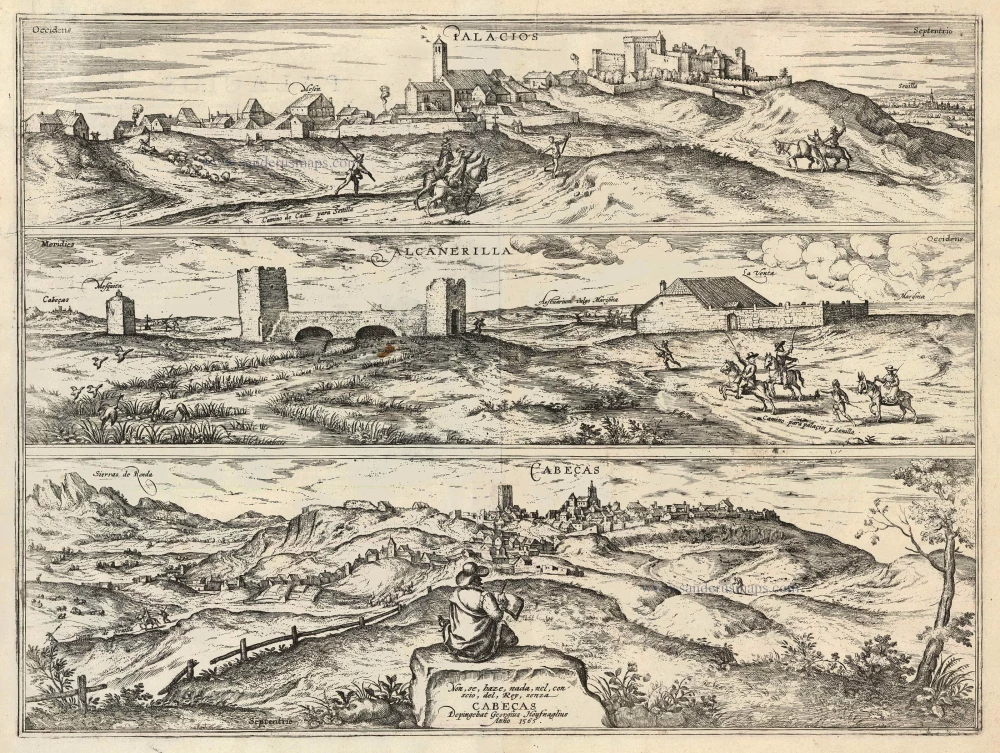
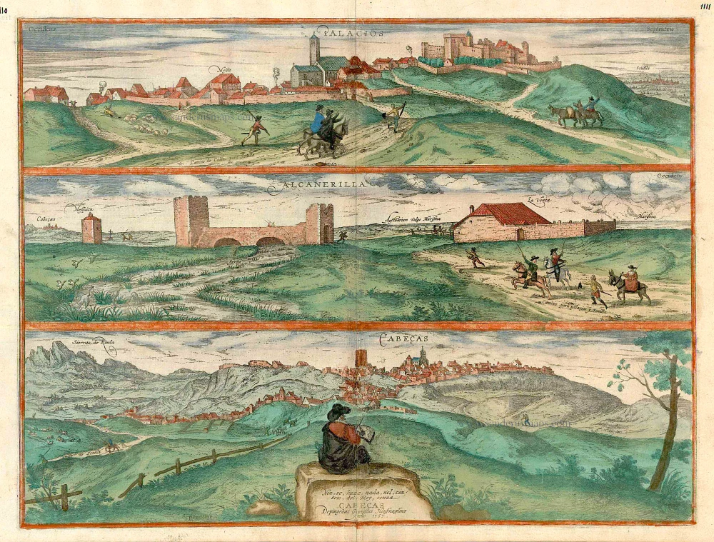
Palacios [on sheet with:] Alcanerilla [and] Cabecas. 1623
Palacios - Alcantarilla - Cabecas by Georg Braun & Frans Hogenberg.
[Item number: 103]
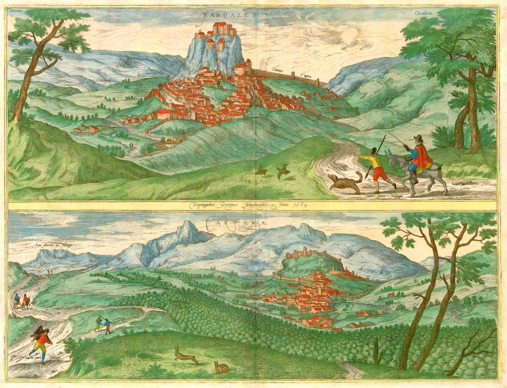
Hardales [on sheet with] Cartama. 1596
Ardales & Cartama by Georg Braun & Frans Hogenberg.
[Item number: 229]
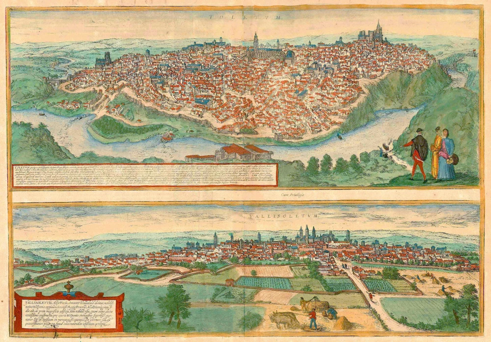
Toletum [on sheet with] Vallisoletum ... Nobilis. Totius Hispania Oppidum 1572-1624
Toledo & Valladolid by Georg Braun & Frans Hogenberg.
[Item number: 2067]
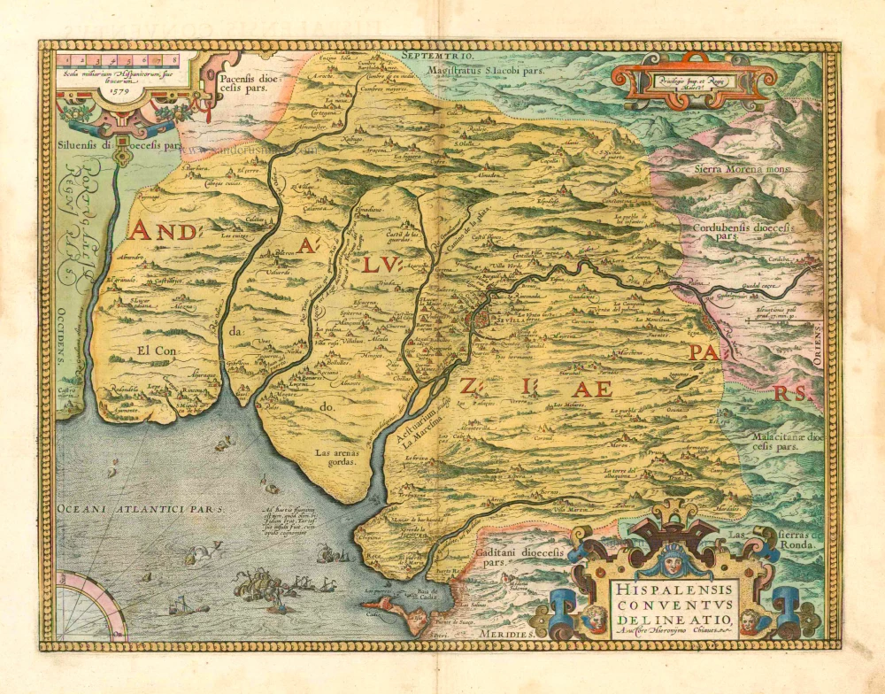
Hispalensis Conventus Delineatio. 1601
Andalucia - Sevilla, by A. Ortelius.
[Item number: 5730]
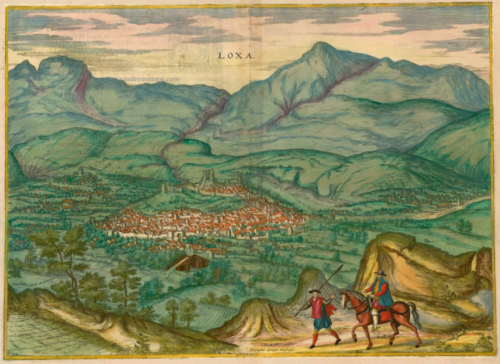
Loxa 1593
Loja, by Georg Braun and Frans Hogenberg.
[Item number: 14706]
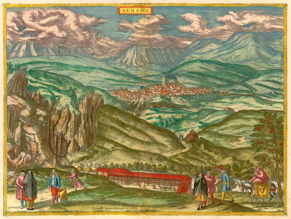
Alhama 1593
Alhama de Granada by Georg Braun & Frans Hogenberg
[Item number: 14714]
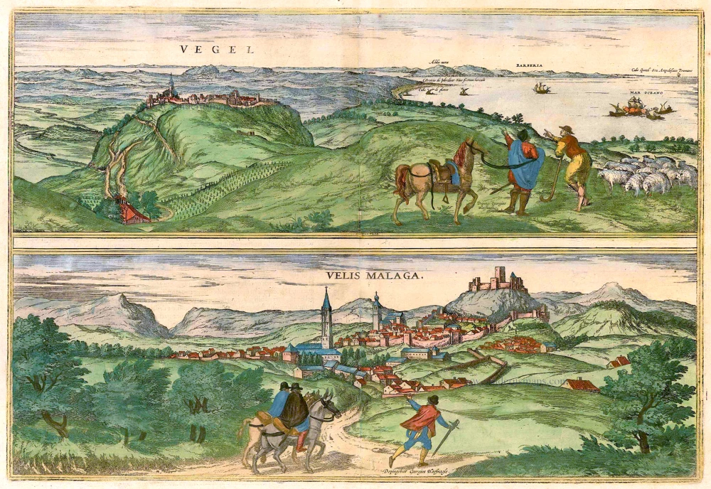
Vegel [on sheet with] Velis Malaga. 1575-1612
Vejer de la Frontera and Vélez-Málaga, by Georg Braun and Frans Hogenberg.
[Item number: 14895]

Corduba. c. 1625
Cordoba, by Georg Braun and Frans Hogenberg.
[Item number: 16385]
Palacios [on sheet with:] Alcanerilla [and] Cabecas. c. 1610
Los Palacios y Villafranca - Las Alcantarillas - Las Cabezas de San Juan, by Georg Braun and Frans Hogenberg.
[Item number: 16715]
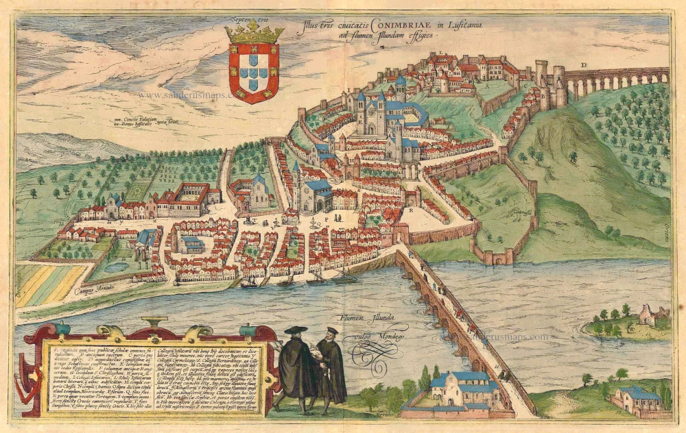
Illustris Civitati Conimbriae In Lusitania ad flumen Illundam effigies. 1596-1640
Coimbra by Braun & Hogenberg.
[Item number: 21345]
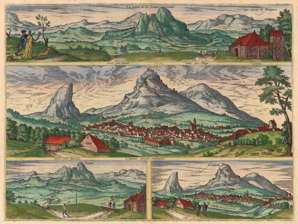
La Penna de los Enamorados - Archidona 1596
Archidona and the mountain "La Peña de los Enamorados" by Georg Braun & Frans Hogenberg.
[Item number: 21364]
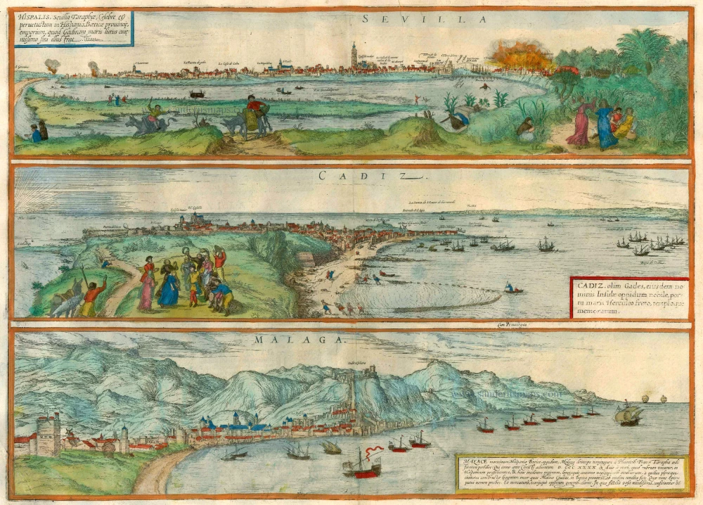
Sevilla, Hispalis ... [on sheet with] Cadiz [and] Malaga. 1572-1624
Antique map of Seville (Sevilla) - Cadiz - Malaga by Braun & Hogenberg
[Item number: 22685]
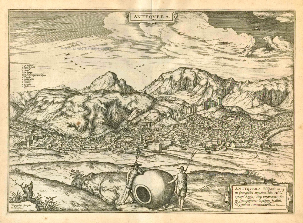
Antequera 1597
Antiquera, by Georg Braun and Frans Hogenberg.
[Item number: 23958]
Sevilla, Hispalis ... [on sheet with] Cadiz [and] Malaga. 1582
Seville (Sevilla) - Cadiz - Malaga, by Braun & Hogenberg.
[Item number: 25496]
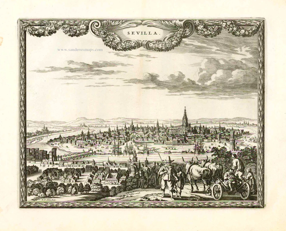
Sevilla. 1658/60
Sevilla, by N. Visscher & P.H. Schut.
[Item number: 26630]
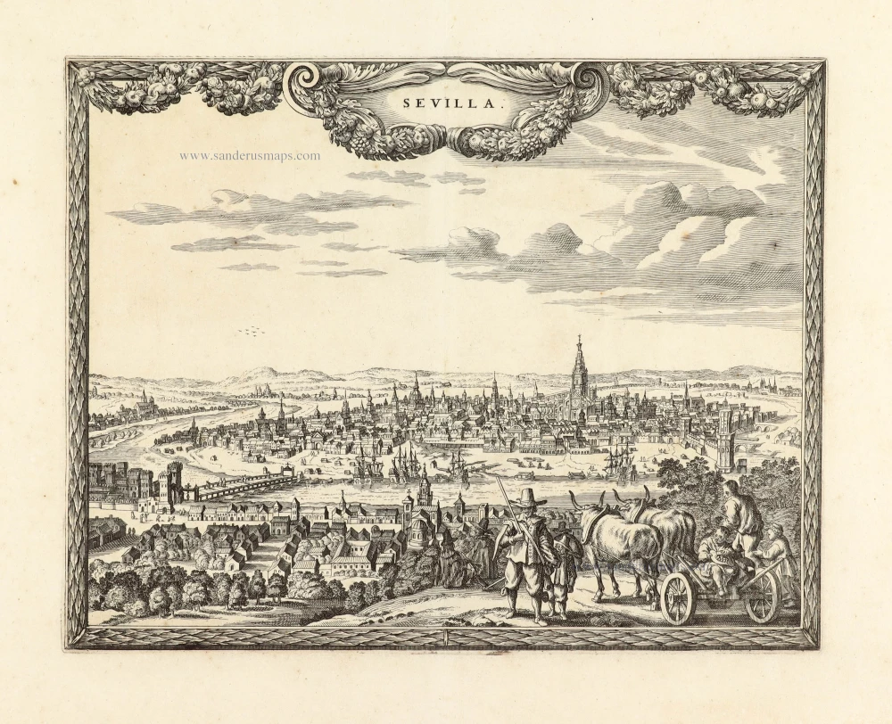
Unrecorded variant of Schut's view of Sevilla, by Carel Allard
Sevilla. 1673
View of Sevilla by Carel Allard.
[Item number: 30556]