
Archidona and the mountain 1596
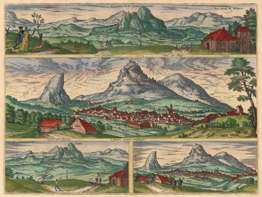
COMMENTARY BY BRAUN: "Archidona is a small town in the Spanish province of Baetica. On the mountain immediately beside the town lies an old ruined castle that the Moors occupied to the distinct disadvantage of the Christians, and from where they plagued the whole of Spain, and Baetica in particular, beyond all measure for many years in order to defend their tyranny. Along the otherwise level road from Seville to Granada can be seen a tall rock that has acquired its name from the eternal example of love and is called by Spaniards La Peña de los Enamorados, which means the boulder or rock of the lovers."
Archidona, which lies north of Malaga between Antequera and Loja, and the Peña de los Enamorados (Lovers' Rock), situated between Archidona and Antequera, are presented in this plate in four views. Rising above the Guadalhorce River in the upper view is the rock formation known as the Peña de los Enamorados, from which - according to legend - a Christian knight and the daughter of a Saracen king are alleged to have flung themselves in despair; included as staffage on the left is a pair of smitten lovers. The view is repeated lower left from a greater distance. The middle illustration shows Archidona, overshadowed by the ruins of the Moorish castle. The fortified complex traces its origins back to the Phoenicians; it was later enlarged by the Carthaginians and finally by the Romans. In the 9th century, the Moors built their castle upon the ruins of the Roman fortress; it was taken by the Christians as late as 1462. This motif, too, is repeated lower right. The two men walking away from the viewer are probably Hoefnagel and Maleparte.
Braun G. & Hogenberg F. and the Civitates Orbis Terrarum.
The Civitates Orbis Terrarum, also known as the 'Braun & Hogenberg', is a six-volume town atlas and the most excellent book of town views and plans ever published: 363 engravings, sometimes beautifully coloured. It was one of the best-selling works in the last quarter of the 16th century. Georg Braun, a skilled writer, wrote the text accompanying the plans and views on the verso. Many plates were engraved after the original drawings of a professional artist, Joris Hoefnagel (1542-1600). The first volume was published in Latin in 1572 and the sixth in 1617. Frans Hogenberg, a talented engraver, created the tables for volumes I through IV, and Simon van den Neuwel made those for volumes V and VI. Other contributors were cartographers Daniel Freese and Heinrich Rantzau, who provided valuable geographical information. Works by Jacob van Deventer, Sebastian Münster, and Johannes Stumpf were also used as references. Translations appeared in German and French, making the atlas accessible to a broader audience.
Since its original publication of volume 1 in 1572, the Civitates Orbis Terrarum has left an indelible mark on the history of cartography. Seven more editions followed the first volume in 1575, 1577, 1582, 1588, 1593, 1599, and 1612. Vol.2, initially released in 1575, saw subsequent editions in 1597 and 1612. The subsequent volumes, each a treasure trove of historical insights, graced the world in 1581, 1588, 1593, 1599, and 1606. The German translation of the first volume, a testament to its widespread appeal, debuted in 1574, followed by the French edition in 1575.
Several printers were involved: Theodor Graminaeus, Heinrich von Aich, Gottfried von Kempen, Johannis Sinniger, Bertram Buchholtz, and Peter von Brachel, all of whom worked in Cologne.
Georg Braun (1541-1622)
Georg Braun, the author of the text accompanying the plans and views in the Civitates Orbis Terrarum, was born in Cologne in 1541. After his studies in Cologne, he entered the Jesuit Order as a novice, indicating his commitment to learning and intellectual pursuits. In 1561, he obtained his bachelor's degree; in 1562, he received his Magister Artium, further demonstrating his academic achievements. Although he left the Jesuit Order, he continued his studies in theology, gaining a licentiate in theology. His theological background likely influenced the content and tone of the text in the Civitates Orbis Terrarum, adding a unique perspective to the work.
Frans Hogenberg (1535-1590)
Frans Hogenberg was a Flemish and German painter, engraver, and mapmaker. He was born in Mechelen as the son of Nicolaas Hogenberg.
By the end of the 1560s, Frans Hogenberg was employed upon Abraham Ortelius's Theatrum Orbis Terrarum, published in 1570; he is named an engraver of numerous maps. In 1568, he was banned from Antwerp by the Duke of Alva and travelled to London, where he stayed a few years before emigrating to Cologne. He immediately embarked on his two most important works, the Civitates, published in 1572 and the Geschichtsblätter, which appeared in several series from 1569 until about 1587.
Thanks to large-scale projects like the Geschichtsblätter and the Civitates, Hogenberg's social circumstances improved with each passing year. He died as a wealthy man in Cologne in 1590.
La Penna de los Enamorados - Archidona
Item Number: 21364 Authenticity Guarantee
Category: Antique maps > Europe > Spain and Portugal
Four views on one sheet: two of the mountain "La Peña de los Enamorados" and two of the village Archidona, by Georg Braun & Frans Hogenberg.
Title: La Penna de los Enamorados - Archidona
Date of the first edition: 1596.
Date of this map: 1596.
Copper engraving, printed on paper.
Size (not including margins): 358 x 477mm (14.09 x 18.78 inches).
Verso: Latin text.
Condition: Original coloured, excellent.
Condition Rating: A+.
References: Van der Krogt 4, 223, State 1 (With Hoefnagel's name); Taschen, Braun and Hogenberg, p.356
From: Urbium Praecipuarum Mundi Theatrum Quintum Auctore Georgio Braunio Agrippinate. Part 5. Köln, 1596. (Van der Krogt 4, 41:1.5)
COMMENTARY BY BRAUN: "Archidona is a small town in the Spanish province of Baetica. On the mountain immediately beside the town lies an old ruined castle that the Moors occupied to the distinct disadvantage of the Christians, and from where they plagued the whole of Spain, and Baetica in particular, beyond all measure for many years in order to defend their tyranny. Along the otherwise level road from Seville to Granada can be seen a tall rock that has acquired its name from the eternal example of love and is called by Spaniards La Peña de los Enamorados, which means the boulder or rock of the lovers."
Archidona, which lies north of Malaga between Antequera and Loja, and the Peña de los Enamorados (Lovers' Rock), situated between Archidona and Antequera, are presented in this plate in four views. Rising above the Guadalhorce River in the upper view is the rock formation known as the Peña de los Enamorados, from which - according to legend - a Christian knight and the daughter of a Saracen king are alleged to have flung themselves in despair; included as staffage on the left is a pair of smitten lovers. The view is repeated lower left from a greater distance. The middle illustration shows Archidona, overshadowed by the ruins of the Moorish castle. The fortified complex traces its origins back to the Phoenicians; it was later enlarged by the Carthaginians and finally by the Romans. In the 9th century, the Moors built their castle upon the ruins of the Roman fortress; it was taken by the Christians as late as 1462. This motif, too, is repeated lower right. The two men walking away from the viewer are probably Hoefnagel and Maleparte.
Braun G. & Hogenberg F. and the Civitates Orbis Terrarum.
The Civitates Orbis Terrarum, also known as the 'Braun & Hogenberg', is a six-volume town atlas and the most excellent book of town views and plans ever published: 363 engravings, sometimes beautifully coloured. It was one of the best-selling works in the last quarter of the 16th century. Georg Braun, a skilled writer, wrote the text accompanying the plans and views on the verso. Many plates were engraved after the original drawings of a professional artist, Joris Hoefnagel (1542-1600). The first volume was published in Latin in 1572 and the sixth in 1617. Frans Hogenberg, a talented engraver, created the tables for volumes I through IV, and Simon van den Neuwel made those for volumes V and VI. Other contributors were cartographers Daniel Freese and Heinrich Rantzau, who provided valuable geographical information. Works by Jacob van Deventer, Sebastian Münster, and Johannes Stumpf were also used as references. Translations appeared in German and French, making the atlas accessible to a broader audience.
Since its original publication of volume 1 in 1572, the Civitates Orbis Terrarum has left an indelible mark on the history of cartography. Seven more editions followed the first volume in 1575, 1577, 1582, 1588, 1593, 1599, and 1612. Vol.2, initially released in 1575, saw subsequent editions in 1597 and 1612. The subsequent volumes, each a treasure trove of historical insights, graced the world in 1581, 1588, 1593, 1599, and 1606. The German translation of the first volume, a testament to its widespread appeal, debuted in 1574, followed by the French edition in 1575.
Several printers were involved: Theodor Graminaeus, Heinrich von Aich, Gottfried von Kempen, Johannis Sinniger, Bertram Buchholtz, and Peter von Brachel, all of whom worked in Cologne.
Georg Braun (1541-1622)
Georg Braun, the author of the text accompanying the plans and views in the Civitates Orbis Terrarum, was born in Cologne in 1541. After his studies in Cologne, he entered the Jesuit Order as a novice, indicating his commitment to learning and intellectual pursuits. In 1561, he obtained his bachelor's degree; in 1562, he received his Magister Artium, further demonstrating his academic achievements. Although he left the Jesuit Order, he continued his studies in theology, gaining a licentiate in theology. His theological background likely influenced the content and tone of the text in the Civitates Orbis Terrarum, adding a unique perspective to the work.
Frans Hogenberg (1535-1590)
Frans Hogenberg was a Flemish and German painter, engraver, and mapmaker. He was born in Mechelen as the son of Nicolaas Hogenberg.
By the end of the 1560s, Frans Hogenberg was employed upon Abraham Ortelius's Theatrum Orbis Terrarum, published in 1570; he is named an engraver of numerous maps. In 1568, he was banned from Antwerp by the Duke of Alva and travelled to London, where he stayed a few years before emigrating to Cologne. He immediately embarked on his two most important works, the Civitates, published in 1572 and the Geschichtsblätter, which appeared in several series from 1569 until about 1587.
Thanks to large-scale projects like the Geschichtsblätter and the Civitates, Hogenberg's social circumstances improved with each passing year. He died as a wealthy man in Cologne in 1590.
Related items
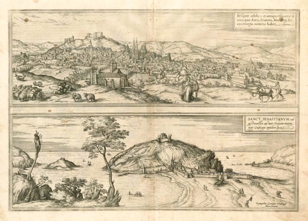
Burgos celebris et antiqua Hispaniae civitas, ... [on sheet with] Sanct. Sebastianum vulgo Donosien ad Occanum ... 1582
Burgos - San Sebastian by Braun & Hogenberg
[Item number: 14159]
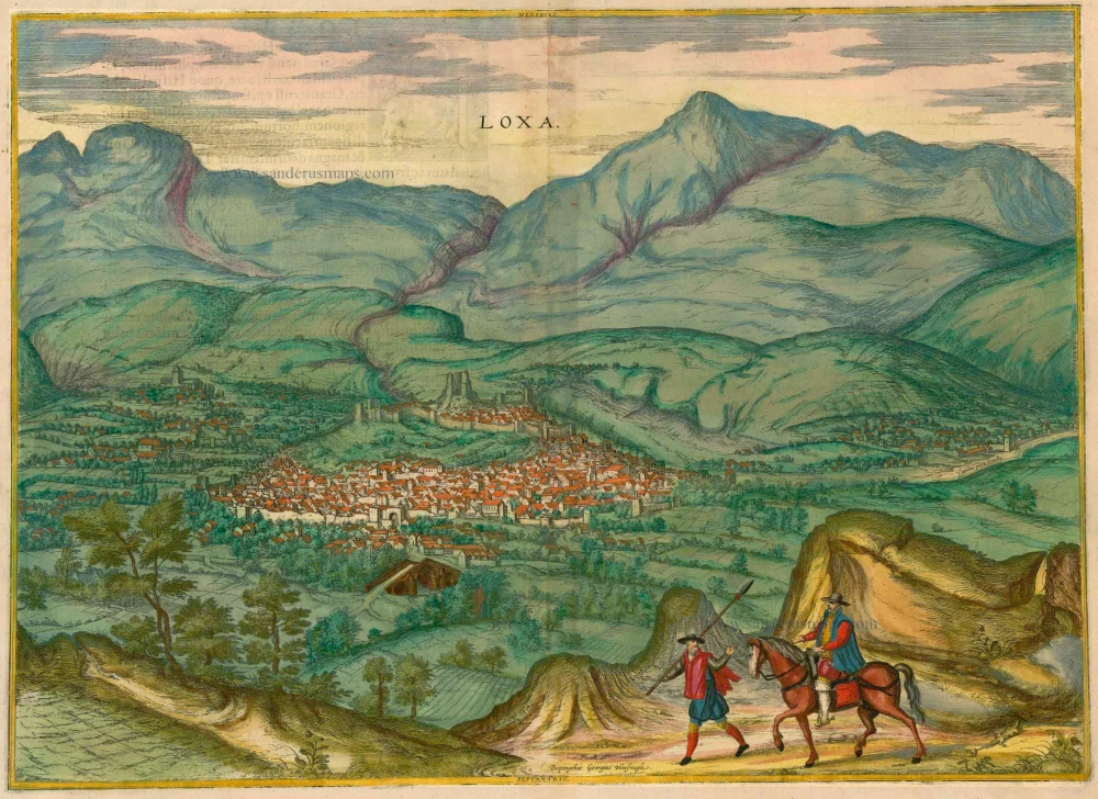
Loxa 1593
Loja, by Georg Braun and Frans Hogenberg.
[Item number: 14706]
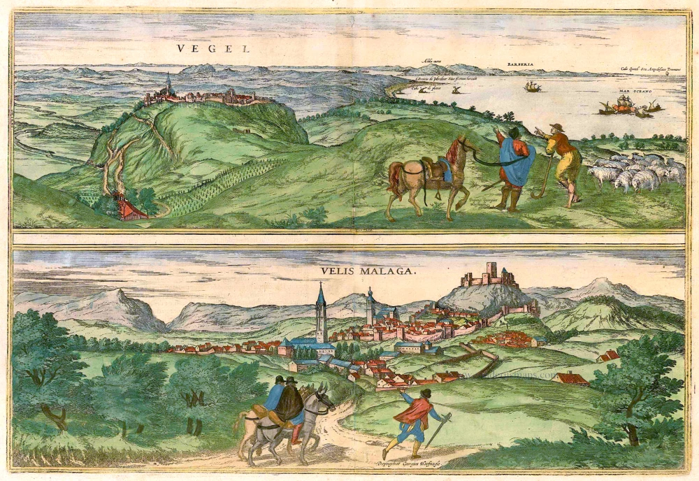
Vegel [on sheet with] Velis Malaga. 1575-1612
Vejer de la Frontera and Vélez-Málaga, by Georg Braun and Frans Hogenberg.
[Item number: 14895]

Corduba. c. 1625
Cordoba, by Georg Braun and Frans Hogenberg.
[Item number: 16385]
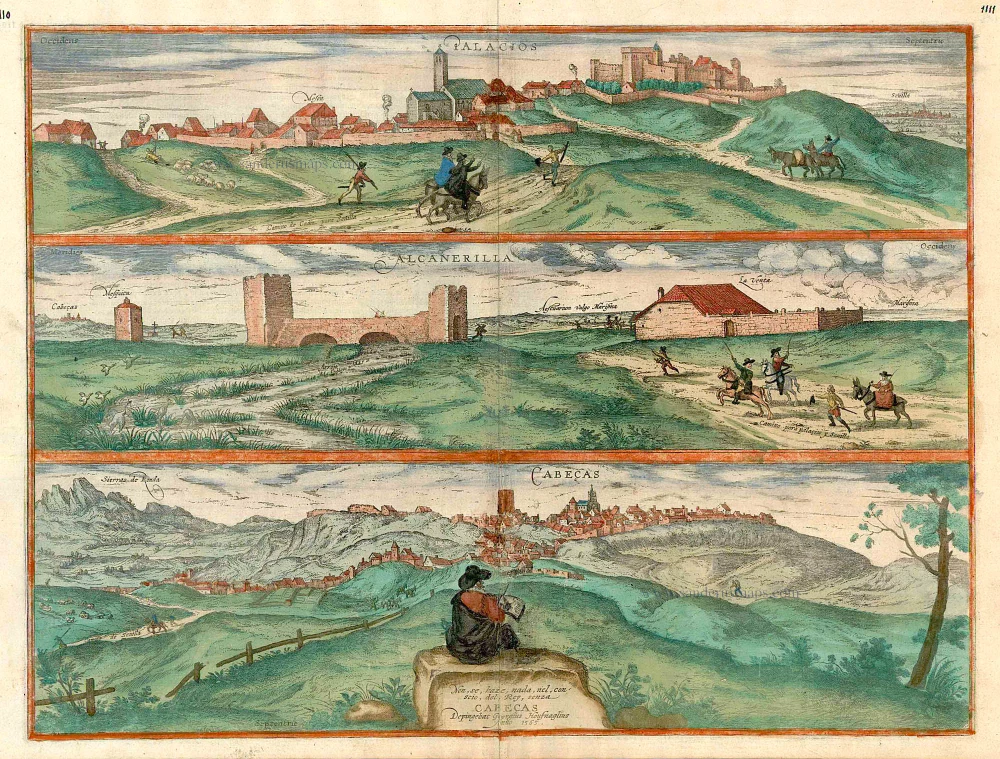
Palacios [on sheet with:] Alcanerilla [and] Cabecas. c. 1610
Los Palacios y Villafranca - Las Alcantarillas - Las Cabezas de San Juan, by Georg Braun and Frans Hogenberg.
[Item number: 16715]
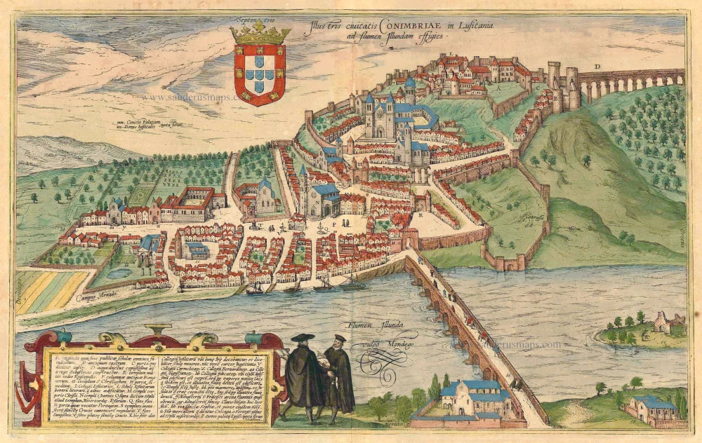
Illustris Civitati Conimbriae In Lusitania ad flumen Illundam effigies. 1596-1640
Coimbra by Braun & Hogenberg.
[Item number: 21345]
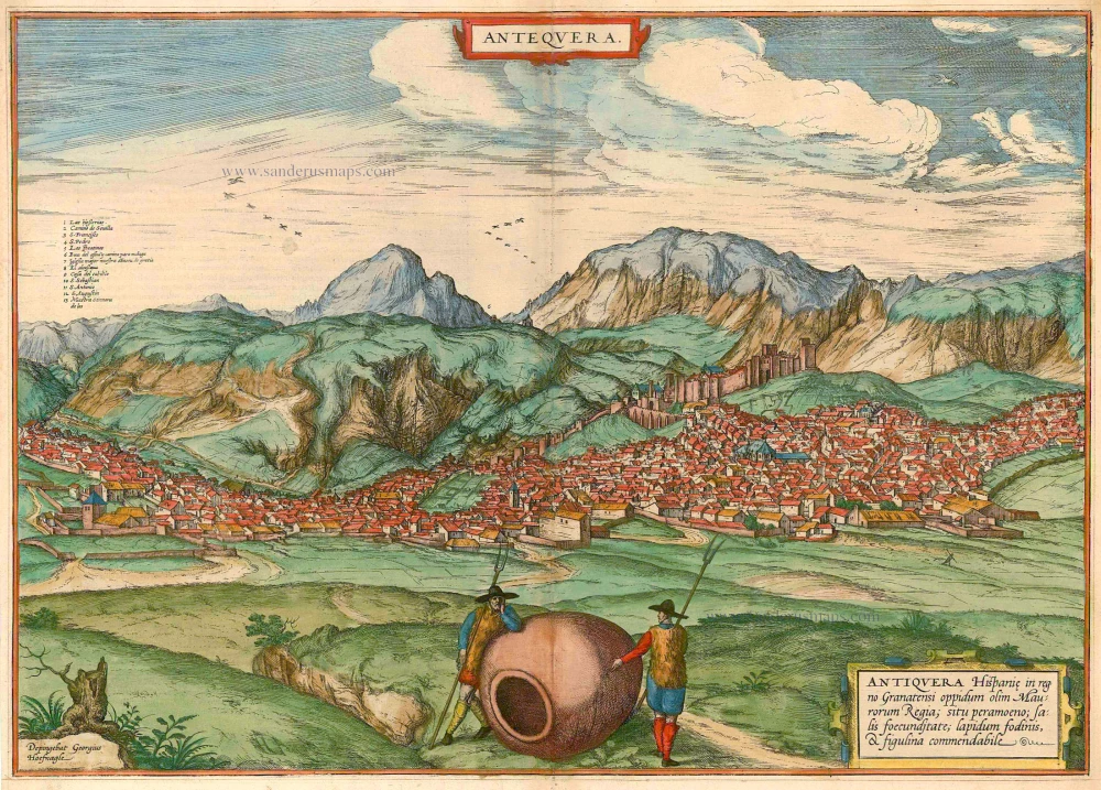
Antequera 1575
Antequera, by Georg Braun & Frans Hogenberg.
[Item number: 21641]
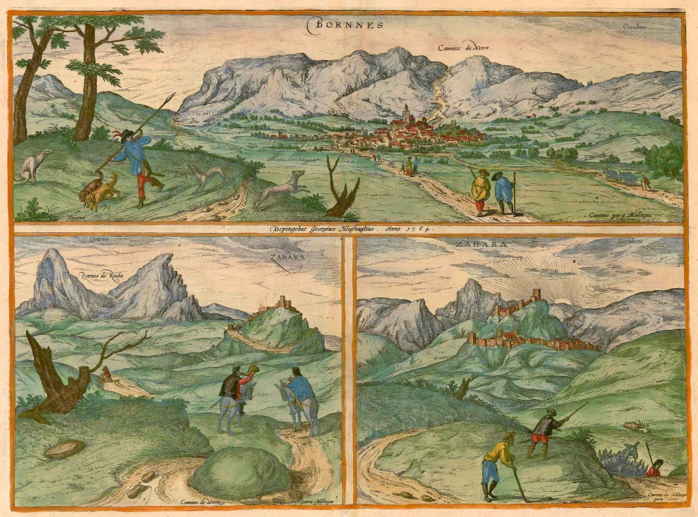
Bornnes [on sheet with] Zahara. 1596-1640
Bornes and Zahara, by Braun & Hogenberg.
[Item number: 21643]
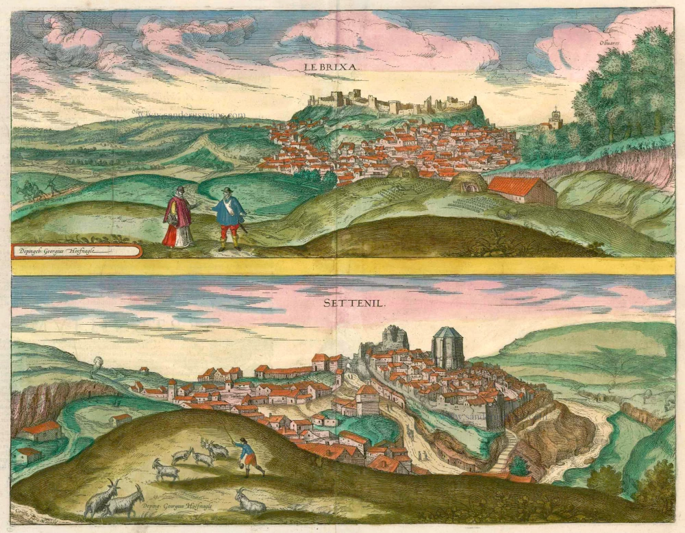
Le Brixa [on sheet with] Settenil. 1599
Lebrija & Settenil de las Bodegas by Braun & Hogenberg.
[Item number: 22188]
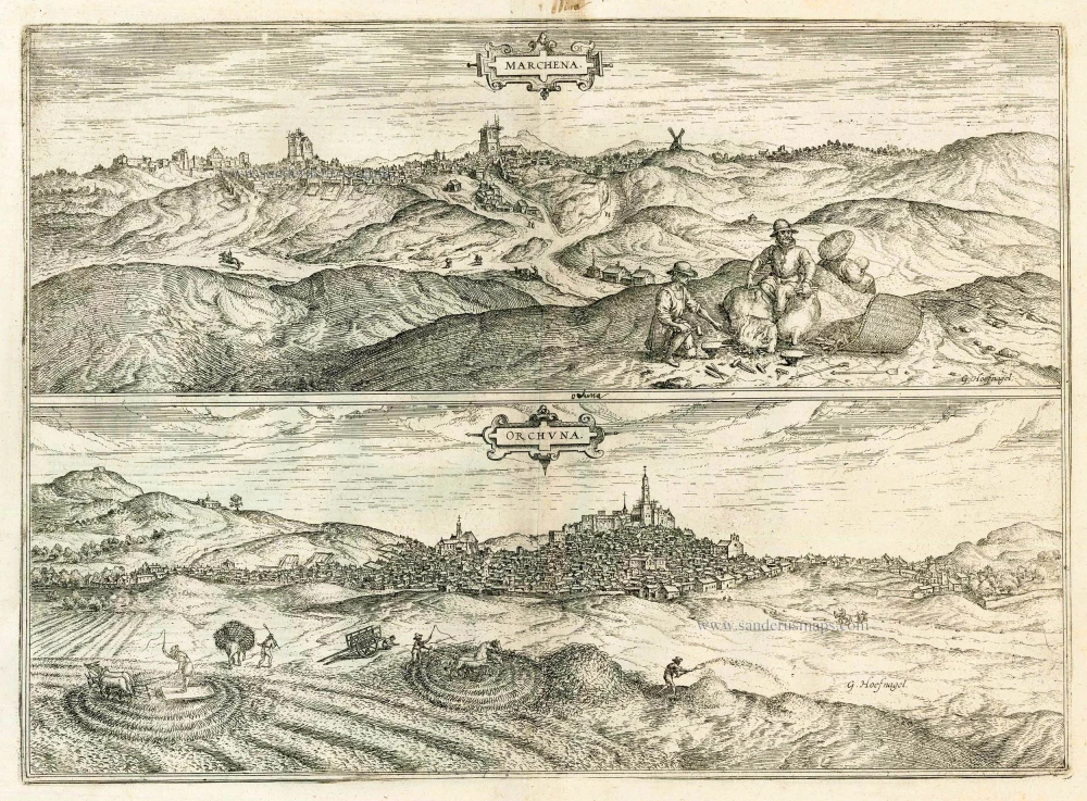
Marchena [on sheet with] Onchuna. 1588-97
Marchena and Osuna, by Georg Braun and Frans Hogenberg.
[Item number: 22247]