
Marchena and Osuna, by Georg Braun and Frans Hogenberg. 1588-97

MARCHENA
COMMENTARY BY BRAUN: "The town is situated on a hill from where the surrounding plain can be seen in all directions. The most distinguished church is in the north of the town, embellished with a fine tower. Next to it lies the magnificent princely palace, at the town gate leading to Eçija, well protected with parapets [...] and various furnishings belonging to the princes who frequently stay there."
This is a view of Marchena from the west. The town lies heavy on the hilltops in a barren landscape traversed by several roads. Marchena has receded into the background, making a forbidding, even gloomy, impression. The houses appear to be crowded around the two churches, which began in the 15th century and whose towers are still under construction: on the left is San Miguel and on the right is Santa Maria. They scarcely hide the fact that the character of the town has remained Moorish. On the horizon can be seen the palace of the Dukes of Arcóbriga. Today this little town, which is one hour's drive from Seville, has a population of 20,000 and is known for its picturesque Moorish Old Town.
OSUNA
COMMENTARY BY BRAUN: "But today it is the capital of a duchy and a distinguished seat of the noble Giron dynasty, which [...] was awarded the title of the Dukes of Osuna in 1562. [...] Not so long ago, in 1549, they also set up a splendid university where almost all disciplines could be studied. They have thus left nothing undone that Catholic and noble rulers can do to increase the fame of the city of Osuna, which was conquered for them by the blood and sweat of their forefathers. The number of burghers in the city, not including the scholars, is over 3,000, and they are all very prosperous due to the annual revenue from their olive and grain harvest."
In this view from the southwest, Osuna occupies a hill crowned by the striking three-nave collegiate church of Santa Maria de la Asunción. On the left, directly next to it, is the hospice founded in 1549. The city spreads out in all directions into the surrounding countryside, whose fecundity is symbolized by the harvest scene in the foreground. With vividness and attention to detail, Georg Hoefnagel has depicted farmers engaged in the simplest form of threshing. Osuna, a notable town even in Roman times, became a university town in 1548 and flourished in the 16th and 17th centuries under the Dukes of Osuna. Some of the mansions built in the city by the nobility still stand today as a testimony to this period of prosperity. (Taschen)
Braun G. & Hogenberg F. and the Civitates Orbis Terrarum.
The Civitates Orbis Terrarum, also known as the 'Braun & Hogenberg', is a six-volume town atlas and the most excellent book of town views and plans ever published: 363 engravings, sometimes beautifully coloured. It was one of the best-selling works in the last quarter of the 16th century. Georg Braun, a skilled writer, wrote the text accompanying the plans and views on the verso. Many plates were engraved after the original drawings of a professional artist, Joris Hoefnagel (1542-1600). The first volume was published in Latin in 1572 and the sixth in 1617. Frans Hogenberg, a talented engraver, created the tables for volumes I through IV, and Simon van den Neuwel made those for volumes V and VI. Other contributors were cartographers Daniel Freese and Heinrich Rantzau, who provided valuable geographical information. Works by Jacob van Deventer, Sebastian Münster, and Johannes Stumpf were also used as references. Translations appeared in German and French, making the atlas accessible to a broader audience.
Since its original publication of volume 1 in 1572, the Civitates Orbis Terrarum has left an indelible mark on the history of cartography. Seven more editions followed the first volume in 1575, 1577, 1582, 1588, 1593, 1599, and 1612. Vol.2, initially released in 1575, saw subsequent editions in 1597 and 1612. The subsequent volumes, each a treasure trove of historical insights, graced the world in 1581, 1588, 1593, 1599, and 1606. The German translation of the first volume, a testament to its widespread appeal, debuted in 1574, followed by the French edition in 1575.
Several printers were involved: Theodor Graminaeus, Heinrich von Aich, Gottfried von Kempen, Johannis Sinniger, Bertram Buchholtz, and Peter von Brachel, all of whom worked in Cologne.
Georg Braun (1541-1622)
Georg Braun, the author of the text accompanying the plans and views in the Civitates Orbis Terrarum, was born in Cologne in 1541. After his studies in Cologne, he entered the Jesuit Order as a novice, indicating his commitment to learning and intellectual pursuits. In 1561, he obtained his bachelor's degree; in 1562, he received his Magister Artium, further demonstrating his academic achievements. Although he left the Jesuit Order, he continued his studies in theology, gaining a licentiate in theology. His theological background likely influenced the content and tone of the text in the Civitates Orbis Terrarum, adding a unique perspective to the work.
Frans Hogenberg (1535-1590)
Frans Hogenberg was a Flemish and German painter, engraver, and mapmaker. He was born in Mechelen as the son of Nicolaas Hogenberg.
By the end of the 1560s, Frans Hogenberg was employed upon Abraham Ortelius's Theatrum Orbis Terrarum, published in 1570; he is named an engraver of numerous maps. In 1568, he was banned from Antwerp by the Duke of Alva and travelled to London, where he stayed a few years before emigrating to Cologne. He immediately embarked on his two most important works, the Civitates, published in 1572 and the Geschichtsblätter, which appeared in several series from 1569 until about 1587.
Thanks to large-scale projects like the Geschichtsblätter and the Civitates, Hogenberg's social circumstances improved with each passing year. He died as a wealthy man in Cologne in 1590.
Marchena [on sheet with] Onchuna.
Item Number: 22247 Authenticity Guarantee
Category: Antique maps > Europe > Spain and Portugal
Antique map with two bird's-eye views by Braun and Hogenberg after G. Hoefnagel: Marchena and Osuna.
Old, antique bird’s-eye view plan of Marchena and Osuna, by Georg Braun and Frans Hogenberg.
Title: Marchena [on sheet with] Onchuna.
Date: 1588-97.
Copper engraving, printed on paper.
Size (not including margins): 330 x 480mm (12.99 x 18.9 inches).
Verso: Latin text.
Condition: Uncoloured, excellent.
Condition Rating: A+.
From: Liber quartus Urbium Praecipuarum totius Mundi. Cologne, 1588-97. (Koeman, B&H4, Van der Krogt 4, 41:1.4)
MARCHENA
COMMENTARY BY BRAUN: "The town is situated on a hill from where the surrounding plain can be seen in all directions. The most distinguished church is in the north of the town, embellished with a fine tower. Next to it lies the magnificent princely palace, at the town gate leading to Eçija, well protected with parapets [...] and various furnishings belonging to the princes who frequently stay there."
This is a view of Marchena from the west. The town lies heavy on the hilltops in a barren landscape traversed by several roads. Marchena has receded into the background, making a forbidding, even gloomy, impression. The houses appear to be crowded around the two churches, which began in the 15th century and whose towers are still under construction: on the left is San Miguel and on the right is Santa Maria. They scarcely hide the fact that the character of the town has remained Moorish. On the horizon can be seen the palace of the Dukes of Arcóbriga. Today this little town, which is one hour's drive from Seville, has a population of 20,000 and is known for its picturesque Moorish Old Town.
OSUNA
COMMENTARY BY BRAUN: "But today it is the capital of a duchy and a distinguished seat of the noble Giron dynasty, which [...] was awarded the title of the Dukes of Osuna in 1562. [...] Not so long ago, in 1549, they also set up a splendid university where almost all disciplines could be studied. They have thus left nothing undone that Catholic and noble rulers can do to increase the fame of the city of Osuna, which was conquered for them by the blood and sweat of their forefathers. The number of burghers in the city, not including the scholars, is over 3,000, and they are all very prosperous due to the annual revenue from their olive and grain harvest."
In this view from the southwest, Osuna occupies a hill crowned by the striking three-nave collegiate church of Santa Maria de la Asunción. On the left, directly next to it, is the hospice founded in 1549. The city spreads out in all directions into the surrounding countryside, whose fecundity is symbolized by the harvest scene in the foreground. With vividness and attention to detail, Georg Hoefnagel has depicted farmers engaged in the simplest form of threshing. Osuna, a notable town even in Roman times, became a university town in 1548 and flourished in the 16th and 17th centuries under the Dukes of Osuna. Some of the mansions built in the city by the nobility still stand today as a testimony to this period of prosperity. (Taschen)
Braun G. & Hogenberg F. and the Civitates Orbis Terrarum.
The Civitates Orbis Terrarum, also known as the 'Braun & Hogenberg', is a six-volume town atlas and the most excellent book of town views and plans ever published: 363 engravings, sometimes beautifully coloured. It was one of the best-selling works in the last quarter of the 16th century. Georg Braun, a skilled writer, wrote the text accompanying the plans and views on the verso. Many plates were engraved after the original drawings of a professional artist, Joris Hoefnagel (1542-1600). The first volume was published in Latin in 1572 and the sixth in 1617. Frans Hogenberg, a talented engraver, created the tables for volumes I through IV, and Simon van den Neuwel made those for volumes V and VI. Other contributors were cartographers Daniel Freese and Heinrich Rantzau, who provided valuable geographical information. Works by Jacob van Deventer, Sebastian Münster, and Johannes Stumpf were also used as references. Translations appeared in German and French, making the atlas accessible to a broader audience.
Since its original publication of volume 1 in 1572, the Civitates Orbis Terrarum has left an indelible mark on the history of cartography. Seven more editions followed the first volume in 1575, 1577, 1582, 1588, 1593, 1599, and 1612. Vol.2, initially released in 1575, saw subsequent editions in 1597 and 1612. The subsequent volumes, each a treasure trove of historical insights, graced the world in 1581, 1588, 1593, 1599, and 1606. The German translation of the first volume, a testament to its widespread appeal, debuted in 1574, followed by the French edition in 1575.
Several printers were involved: Theodor Graminaeus, Heinrich von Aich, Gottfried von Kempen, Johannis Sinniger, Bertram Buchholtz, and Peter von Brachel, all of whom worked in Cologne.
Georg Braun (1541-1622)
Georg Braun, the author of the text accompanying the plans and views in the Civitates Orbis Terrarum, was born in Cologne in 1541. After his studies in Cologne, he entered the Jesuit Order as a novice, indicating his commitment to learning and intellectual pursuits. In 1561, he obtained his bachelor's degree; in 1562, he received his Magister Artium, further demonstrating his academic achievements. Although he left the Jesuit Order, he continued his studies in theology, gaining a licentiate in theology. His theological background likely influenced the content and tone of the text in the Civitates Orbis Terrarum, adding a unique perspective to the work.
Frans Hogenberg (1535-1590)
Frans Hogenberg was a Flemish and German painter, engraver, and mapmaker. He was born in Mechelen as the son of Nicolaas Hogenberg.
By the end of the 1560s, Frans Hogenberg was employed upon Abraham Ortelius's Theatrum Orbis Terrarum, published in 1570; he is named an engraver of numerous maps. In 1568, he was banned from Antwerp by the Duke of Alva and travelled to London, where he stayed a few years before emigrating to Cologne. He immediately embarked on his two most important works, the Civitates, published in 1572 and the Geschichtsblätter, which appeared in several series from 1569 until about 1587.
Thanks to large-scale projects like the Geschichtsblätter and the Civitates, Hogenberg's social circumstances improved with each passing year. He died as a wealthy man in Cologne in 1590.
Related items

Conil [on sheet with] Xeres de la Frontera 1576
Conil de la Frontera and Jerez de la Frontera, by Georg Braun and Frans Hogenberg, after Georg Hoefnagel.
[Item number: 4133]

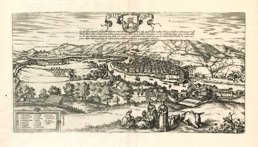
Bilvao. En, Spectator Benevole, Magnifica Hispaniae Civitas Bilbao ... 1576
Bilbao, by Georg Braun & Frans Hogenberg.
[Item number: 26703]
Bilvao. En, Spectator Benevole, Magnifica Hispaniae Civitas Bilbao ... 1593
Bilbao, by Georg Braun & Frans Hogenberg.
[Item number: 26930]