
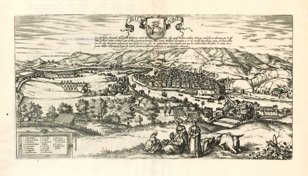
Bilbao, by Georg Braun & Frans Hogenberg. 1576


Braun G. & Hogenberg F. and the Civitates Orbis Terrarum.
The Civitates Orbis Terrarum, also known as the 'Braun & Hogenberg', is a six-volume town atlas and the most excellent book of town views and plans ever published: 363 engravings, sometimes beautifully coloured. It was one of the best-selling works in the last quarter of the 16th century. Georg Braun, a skilled writer, wrote the text accompanying the plans and views on the verso. Many plates were engraved after the original drawings of a professional artist, Joris Hoefnagel (1542-1600). The first volume was published in Latin in 1572 and the sixth in 1617. Frans Hogenberg, a talented engraver, created the tables for volumes I through IV, and Simon van den Neuwel made those for volumes V and VI. Other contributors were cartographers Daniel Freese and Heinrich Rantzau, who provided valuable geographical information. Works by Jacob van Deventer, Sebastian Münster, and Johannes Stumpf were also used as references. Translations appeared in German and French, making the atlas accessible to a broader audience.
Since its original publication of volume 1 in 1572, the Civitates Orbis Terrarum has left an indelible mark on the history of cartography. Seven more editions followed the first volume in 1575, 1577, 1582, 1588, 1593, 1599, and 1612. Vol.2, initially released in 1575, saw subsequent editions in 1597 and 1612. The subsequent volumes, each a treasure trove of historical insights, graced the world in 1581, 1588, 1593, 1599, and 1606. The German translation of the first volume, a testament to its widespread appeal, debuted in 1574, followed by the French edition in 1575.
Several printers were involved: Theodor Graminaeus, Heinrich von Aich, Gottfried von Kempen, Johannis Sinniger, Bertram Buchholtz, and Peter von Brachel, all of whom worked in Cologne.
Georg Braun (1541-1622)
Georg Braun, the author of the text accompanying the plans and views in the Civitates Orbis Terrarum, was born in Cologne in 1541. After his studies in Cologne, he entered the Jesuit Order as a novice, indicating his commitment to learning and intellectual pursuits. In 1561, he obtained his bachelor's degree; in 1562, he received his Magister Artium, further demonstrating his academic achievements. Although he left the Jesuit Order, he continued his studies in theology, gaining a licentiate in theology. His theological background likely influenced the content and tone of the text in the Civitates Orbis Terrarum, adding a unique perspective to the work.
Frans Hogenberg (1535-1590)
Frans Hogenberg was a Flemish and German painter, engraver, and mapmaker. He was born in Mechelen as the son of Nicolaas Hogenberg.
By the end of the 1560s, Frans Hogenberg was employed upon Abraham Ortelius's Theatrum Orbis Terrarum, published in 1570; he is named an engraver of numerous maps. In 1568, he was banned from Antwerp by the Duke of Alva and travelled to London, where he stayed a few years before emigrating to Cologne. He immediately embarked on his two most important works, the Civitates, published in 1572 and the Geschichtsblätter, which appeared in several series from 1569 until about 1587.
Thanks to large-scale projects like the Geschichtsblätter and the Civitates, Hogenberg's social circumstances improved with each passing year. He died as a wealthy man in Cologne in 1590.
Bilvao. En, Spectator Benevole, Magnifica Hispaniae Civitas Bilbao ...
Item Number: 26703 Authenticity Guarantee
Category: Antique maps > Europe > Spain and Portugal
Old, antique map - bird's-eye view of Bilbao, by Georg Braun & Frans Hogenberg.
Date of the first edition: 1575
Date of this map: 1576
Copper engraving, printed on paper.
Size (not including margins): 25.5 x 48.5cm (9.9 x 18.9 inches)
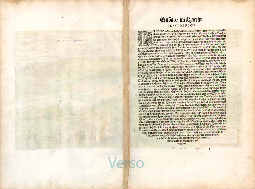
Verso text: German
Condition: Original coloured, some browning along centrefold.
Condition Rating: A
References: Van der Krogt 4, #501, State 1; Fauser, #1492, Taschen, Br. Hog., p.148.
From: Beschreibung und Contrafactur von den vornembsten Stetten der Welt. Dass ander Buch. Köln, 1576. (Van der Krogt 4, 41:2.2)
TRANSLATION OF CAPTION: See, benevolent spectator, the magnificent Spanish city of Bilbao, called by others as it were Bellum Vadum ("beautiful ford") Bilvao; this is why they write the second syllable with v. Founded by Didacus Lopez de Hazo, prince of the Cantabrans, around 1300. Drawn charmingly and true to nature by Hogenberg's hand, it is put before your eyes as it looked in 1544.
COMMENTARY BY BRAUN: "Bilbao lies on a plain, two miles from the sea, and its air is salubrious and of pleasant temperature. On the land side are the mountains [...], on the other the little town of Portugalete, where a great river links Bilbao with the sea. [...] Among other things precious wool is exported from here, from which fine cloth is made in the Netherlands. It is known that fifty great ships are loaded with this wool each year and fifty thousand sacks of wool are exported."
The view shows Bilbao from the southeast; in the distance the town of Portugalete can be seen on the estuary of the Nervion in the Bay of Biscay. Diego López V de Haro founded Bilbao on 15 June 1300. The bay known as Ria cuts deep into the land and links Bilbao with the Gulf of Biscay via Portugalete. It is navigable due to its depth, which made it possible to build a harbour in Bilbao that offered far better protection than coastal harbours, and led to the town becoming one of Castile's trade centres; in particular, Merino wool was exported to northern Europe from here. The church of San Anton adjoins the San Anton bridge (on the right). The Gothic cathedral of Santiago is visible in the middle of the city. (Taschen)
Braun G. & Hogenberg F. and the Civitates Orbis Terrarum.
The Civitates Orbis Terrarum, also known as the 'Braun & Hogenberg', is a six-volume town atlas and the most excellent book of town views and plans ever published: 363 engravings, sometimes beautifully coloured. It was one of the best-selling works in the last quarter of the 16th century. Georg Braun, a skilled writer, wrote the text accompanying the plans and views on the verso. Many plates were engraved after the original drawings of a professional artist, Joris Hoefnagel (1542-1600). The first volume was published in Latin in 1572 and the sixth in 1617. Frans Hogenberg, a talented engraver, created the tables for volumes I through IV, and Simon van den Neuwel made those for volumes V and VI. Other contributors were cartographers Daniel Freese and Heinrich Rantzau, who provided valuable geographical information. Works by Jacob van Deventer, Sebastian Münster, and Johannes Stumpf were also used as references. Translations appeared in German and French, making the atlas accessible to a broader audience.
Since its original publication of volume 1 in 1572, the Civitates Orbis Terrarum has left an indelible mark on the history of cartography. Seven more editions followed the first volume in 1575, 1577, 1582, 1588, 1593, 1599, and 1612. Vol.2, initially released in 1575, saw subsequent editions in 1597 and 1612. The subsequent volumes, each a treasure trove of historical insights, graced the world in 1581, 1588, 1593, 1599, and 1606. The German translation of the first volume, a testament to its widespread appeal, debuted in 1574, followed by the French edition in 1575.
Several printers were involved: Theodor Graminaeus, Heinrich von Aich, Gottfried von Kempen, Johannis Sinniger, Bertram Buchholtz, and Peter von Brachel, all of whom worked in Cologne.
Georg Braun (1541-1622)
Georg Braun, the author of the text accompanying the plans and views in the Civitates Orbis Terrarum, was born in Cologne in 1541. After his studies in Cologne, he entered the Jesuit Order as a novice, indicating his commitment to learning and intellectual pursuits. In 1561, he obtained his bachelor's degree; in 1562, he received his Magister Artium, further demonstrating his academic achievements. Although he left the Jesuit Order, he continued his studies in theology, gaining a licentiate in theology. His theological background likely influenced the content and tone of the text in the Civitates Orbis Terrarum, adding a unique perspective to the work.
Frans Hogenberg (1535-1590)
Frans Hogenberg was a Flemish and German painter, engraver, and mapmaker. He was born in Mechelen as the son of Nicolaas Hogenberg.
By the end of the 1560s, Frans Hogenberg was employed upon Abraham Ortelius's Theatrum Orbis Terrarum, published in 1570; he is named an engraver of numerous maps. In 1568, he was banned from Antwerp by the Duke of Alva and travelled to London, where he stayed a few years before emigrating to Cologne. He immediately embarked on his two most important works, the Civitates, published in 1572 and the Geschichtsblätter, which appeared in several series from 1569 until about 1587.
Thanks to large-scale projects like the Geschichtsblätter and the Civitates, Hogenberg's social circumstances improved with each passing year. He died as a wealthy man in Cologne in 1590.
Related items

Palacios [on sheet with:] Alcanerilla [and] Cabecas. c. 1610
Los Palacios y Villafranca - Las Alcantarillas - Las Cabezas de San Juan, by Georg Braun and Frans Hogenberg.
[Item number: 16715]

Illustris Civitati Conimbriae In Lusitania ad flumen Illundam effigies. 1596-1640
Coimbra by Braun & Hogenberg.
[Item number: 21345]

Marchena [on sheet with] Onchuna. 1588-97
Marchena and Osuna, by Georg Braun and Frans Hogenberg.
[Item number: 22247]
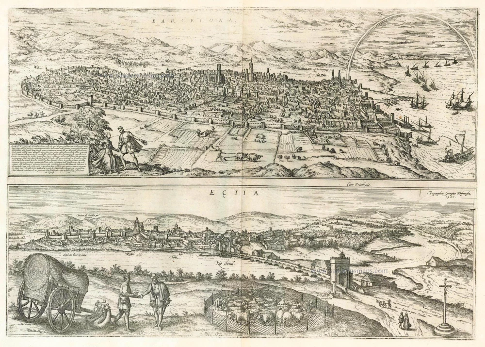
Barcelona, Barcino, que vulgo Barcelona Dicitur [on sheet with] Ecija 1599
Barcelona and Ecija, by Georg Braun and Frans Hogenberg.
[Item number: 23901]

Le Brixa [on sheet with] Settenil. 1599
Lebrija & Settenil de las Bodegas, by Georg Braun and Frans Hogenberg.
[Item number: 24018]

La Penna de los Enamorados - Archidona 1596
The mountain La Peña de los Enamorados and the village Archidona, by Georg Braun and Frans Hogenberg.
[Item number: 24140]

Bornnes [on sheet with] Zahara 1596
Bornes and Zahara, by Georg Braun and Frans Hogenberg.
[Item number: 24143]
Bilvao. En, Spectator Benevole, Magnifica Hispaniae Civitas Bilbao ... 1593
Bilbao, by Georg Braun & Frans Hogenberg.
[Item number: 26930]