
Barcelona and Ecija, by Georg Braun and Frans Hogenberg. 1599
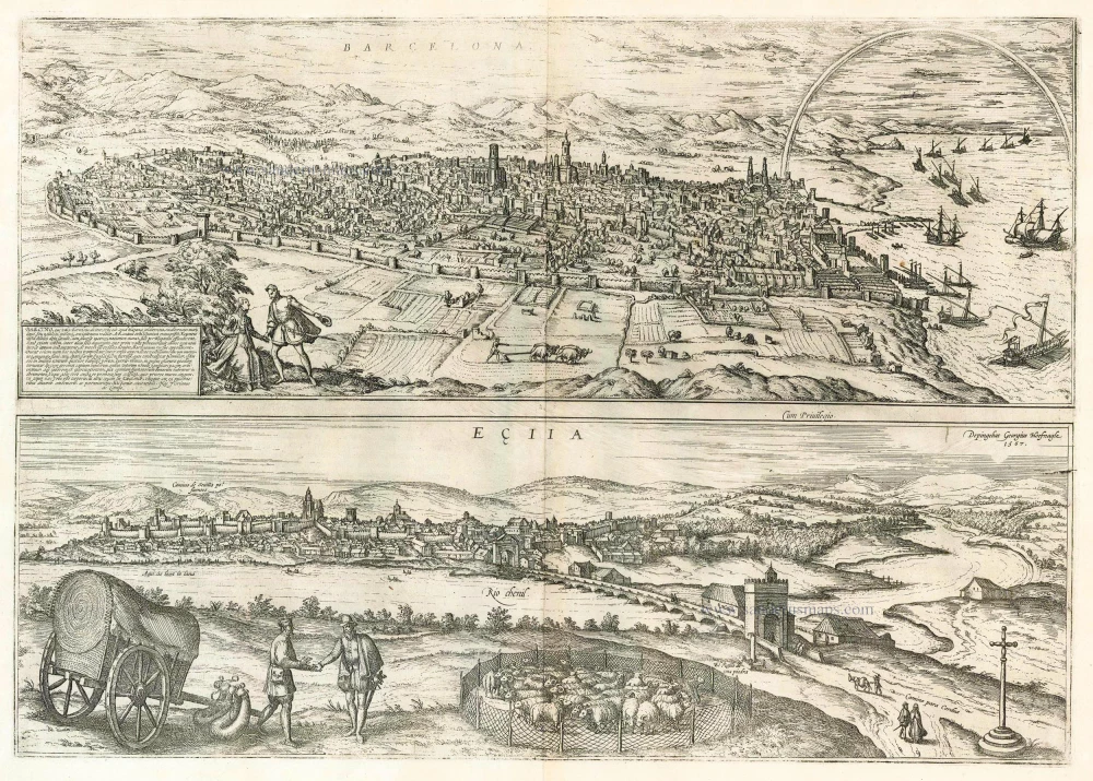
BARCELONA
TRANSLATION OF CARTOUCHE TEXT: Barcino, commonly known as Barcelona, called Faventia by the Romans, is a city famed by the Spaniards on the shores of the Mediterranean, known for its location and full of the scent of the wonderful past. [...] Although one can still see today from the old city walls that it was formerly very small and had only four city gates, it has now grown so much that it is the capital of Catalonia and one of the most beautiful and powerful cities in Spain.
COMMENTARY BY BRAUN: "Nothing can be said with certainty about the founders of this city, since the chroniclers are all fairly unspecific. It is certain, however, that it was formerly only a small town, one day's ride from the shores of the sea [...], albeit with sizeable houses and with a high city wall with four gates that opened in all four directions, as can still be seen in the middle of the city. Since the number of inhabitants continued to increase, however, the city was twice expanded with handsome houses and splendid churches, and was also ringed with solid walls and magnificent towers on two further occasions."
The view shows Barcelona from the northeastern slopes of Montjuich. An unusual feature of this engraving is undoubtedly the rainbow on the right. The two sets of city walls mentioned by Braun are also clearly visible. In the centre of the picture are the cathedral (1298-1448) and the arsenal, which stood immediately beside the palace of the Kings of Aragon, not visible here. The royal shipyards, or Reales Atarazanas, dating from the 13th-14th centuries, are prominently depicted on the shoreline. By his own admission, Braun possessed no reliable information about the founders of the city, but it is widely assumed that the town was established in the 3rd century BC by the Carthaginian Hamilcar Barca.
EÇIJA
COMMENTARY BY BRAUN: "The town's wealth is based on wool production, since the numerous fields provide good grazing for sheep. For this reason sheepfold are to be seen all around the city. The inhabitants thereby make a good living, partly from raising the animals and partly by selling the wool, which the farmers take to market, as can be clearly seen in this picture. The Rio Chenil, which rises in the snowy mountains not far from the city of Granada, is a great asset. Its waters allow the wool to be cleaned and washed and also allow the diseases of the animals to be cured, better than any other."
Ecija is seen at a distance from the far bank of the River Genil, from a point overlooking the road to Cordoba. The town lies South of Seville and was famed from the Middle Ages onwards for its skilled shoemakers and for its cloth industry, in particular wool and flannel. In tribute to this fact, Hoefnagel has included a flock of sheep and a market scene in the foreground and in the river has written "This is where the wool is washed" (Aqui si lava la lana).
Braun G. & Hogenberg F. and the Civitates Orbis Terrarum.
The Civitates Orbis Terrarum, also known as the 'Braun & Hogenberg', is a six-volume town atlas and the most excellent book of town views and plans ever published: 363 engravings, sometimes beautifully coloured. It was one of the best-selling works in the last quarter of the 16th century. Georg Braun, a skilled writer, wrote the text accompanying the plans and views on the verso. Many plates were engraved after the original drawings of a professional artist, Joris Hoefnagel (1542-1600). The first volume was published in Latin in 1572 and the sixth in 1617. Frans Hogenberg, a talented engraver, created the tables for volumes I through IV, and Simon van den Neuwel made those for volumes V and VI. Other contributors were cartographers Daniel Freese and Heinrich Rantzau, who provided valuable geographical information. Works by Jacob van Deventer, Sebastian Münster, and Johannes Stumpf were also used as references. Translations appeared in German and French, making the atlas accessible to a broader audience.
Since its original publication of volume 1 in 1572, the Civitates Orbis Terrarum has left an indelible mark on the history of cartography. Seven more editions followed the first volume in 1575, 1577, 1582, 1588, 1593, 1599, and 1612. Vol.2, initially released in 1575, saw subsequent editions in 1597 and 1612. The subsequent volumes, each a treasure trove of historical insights, graced the world in 1581, 1588, 1593, 1599, and 1606. The German translation of the first volume, a testament to its widespread appeal, debuted in 1574, followed by the French edition in 1575.
Several printers were involved: Theodor Graminaeus, Heinrich von Aich, Gottfried von Kempen, Johannis Sinniger, Bertram Buchholtz, and Peter von Brachel, all of whom worked in Cologne.
Georg Braun (1541-1622)
Georg Braun, the author of the text accompanying the plans and views in the Civitates Orbis Terrarum, was born in Cologne in 1541. After his studies in Cologne, he entered the Jesuit Order as a novice, indicating his commitment to learning and intellectual pursuits. In 1561, he obtained his bachelor's degree; in 1562, he received his Magister Artium, further demonstrating his academic achievements. Although he left the Jesuit Order, he continued his studies in theology, gaining a licentiate in theology. His theological background likely influenced the content and tone of the text in the Civitates Orbis Terrarum, adding a unique perspective to the work.
Frans Hogenberg (1535-1590)
Frans Hogenberg was a Flemish and German painter, engraver, and mapmaker. He was born in Mechelen as the son of Nicolaas Hogenberg.
By the end of the 1560s, Frans Hogenberg was employed upon Abraham Ortelius's Theatrum Orbis Terrarum, published in 1570; he is named an engraver of numerous maps. In 1568, he was banned from Antwerp by the Duke of Alva and travelled to London, where he stayed a few years before emigrating to Cologne. He immediately embarked on his two most important works, the Civitates, published in 1572 and the Geschichtsblätter, which appeared in several series from 1569 until about 1587.
Thanks to large-scale projects like the Geschichtsblätter and the Civitates, Hogenberg's social circumstances improved with each passing year. He died as a wealthy man in Cologne in 1590.
Barcelona, Barcino, que vulgo Barcelona Dicitur [on sheet with] Ecija
Item Number: 23901 Authenticity Guarantee
Category: Antique maps > Europe > Spain and Portugal
Antique map with two bird's-eye views on one sheet: Barcelona and Ecija by Braun and Hogenberg.
Date of the first edition: 1572
Date of this map: 1599
Copper engraving
Size: 32 x 47cm (12.5 x 18.3 inches)
Verso text: Latin
Condition: Uncoloured, excellent.
Condition Rating: A
References: Van der Krogt 4, 380, state 3; Taschen, Braun and Hogenberg, p.56.
From: Civitates Orbis Terrarum, Liber Primus. Köln, Bertram Buchholtz, 1599. (Van der Krogt 4, 41:1.1)
BARCELONA
TRANSLATION OF CARTOUCHE TEXT: Barcino, commonly known as Barcelona, called Faventia by the Romans, is a city famed by the Spaniards on the shores of the Mediterranean, known for its location and full of the scent of the wonderful past. [...] Although one can still see today from the old city walls that it was formerly very small and had only four city gates, it has now grown so much that it is the capital of Catalonia and one of the most beautiful and powerful cities in Spain.
COMMENTARY BY BRAUN: "Nothing can be said with certainty about the founders of this city, since the chroniclers are all fairly unspecific. It is certain, however, that it was formerly only a small town, one day's ride from the shores of the sea [...], albeit with sizeable houses and with a high city wall with four gates that opened in all four directions, as can still be seen in the middle of the city. Since the number of inhabitants continued to increase, however, the city was twice expanded with handsome houses and splendid churches, and was also ringed with solid walls and magnificent towers on two further occasions."
The view shows Barcelona from the northeastern slopes of Montjuich. An unusual feature of this engraving is undoubtedly the rainbow on the right. The two sets of city walls mentioned by Braun are also clearly visible. In the centre of the picture are the cathedral (1298-1448) and the arsenal, which stood immediately beside the palace of the Kings of Aragon, not visible here. The royal shipyards, or Reales Atarazanas, dating from the 13th-14th centuries, are prominently depicted on the shoreline. By his own admission, Braun possessed no reliable information about the founders of the city, but it is widely assumed that the town was established in the 3rd century BC by the Carthaginian Hamilcar Barca.
EÇIJA
COMMENTARY BY BRAUN: "The town's wealth is based on wool production, since the numerous fields provide good grazing for sheep. For this reason sheepfold are to be seen all around the city. The inhabitants thereby make a good living, partly from raising the animals and partly by selling the wool, which the farmers take to market, as can be clearly seen in this picture. The Rio Chenil, which rises in the snowy mountains not far from the city of Granada, is a great asset. Its waters allow the wool to be cleaned and washed and also allow the diseases of the animals to be cured, better than any other."
Ecija is seen at a distance from the far bank of the River Genil, from a point overlooking the road to Cordoba. The town lies South of Seville and was famed from the Middle Ages onwards for its skilled shoemakers and for its cloth industry, in particular wool and flannel. In tribute to this fact, Hoefnagel has included a flock of sheep and a market scene in the foreground and in the river has written "This is where the wool is washed" (Aqui si lava la lana).
Braun G. & Hogenberg F. and the Civitates Orbis Terrarum.
The Civitates Orbis Terrarum, also known as the 'Braun & Hogenberg', is a six-volume town atlas and the most excellent book of town views and plans ever published: 363 engravings, sometimes beautifully coloured. It was one of the best-selling works in the last quarter of the 16th century. Georg Braun, a skilled writer, wrote the text accompanying the plans and views on the verso. Many plates were engraved after the original drawings of a professional artist, Joris Hoefnagel (1542-1600). The first volume was published in Latin in 1572 and the sixth in 1617. Frans Hogenberg, a talented engraver, created the tables for volumes I through IV, and Simon van den Neuwel made those for volumes V and VI. Other contributors were cartographers Daniel Freese and Heinrich Rantzau, who provided valuable geographical information. Works by Jacob van Deventer, Sebastian Münster, and Johannes Stumpf were also used as references. Translations appeared in German and French, making the atlas accessible to a broader audience.
Since its original publication of volume 1 in 1572, the Civitates Orbis Terrarum has left an indelible mark on the history of cartography. Seven more editions followed the first volume in 1575, 1577, 1582, 1588, 1593, 1599, and 1612. Vol.2, initially released in 1575, saw subsequent editions in 1597 and 1612. The subsequent volumes, each a treasure trove of historical insights, graced the world in 1581, 1588, 1593, 1599, and 1606. The German translation of the first volume, a testament to its widespread appeal, debuted in 1574, followed by the French edition in 1575.
Several printers were involved: Theodor Graminaeus, Heinrich von Aich, Gottfried von Kempen, Johannis Sinniger, Bertram Buchholtz, and Peter von Brachel, all of whom worked in Cologne.
Georg Braun (1541-1622)
Georg Braun, the author of the text accompanying the plans and views in the Civitates Orbis Terrarum, was born in Cologne in 1541. After his studies in Cologne, he entered the Jesuit Order as a novice, indicating his commitment to learning and intellectual pursuits. In 1561, he obtained his bachelor's degree; in 1562, he received his Magister Artium, further demonstrating his academic achievements. Although he left the Jesuit Order, he continued his studies in theology, gaining a licentiate in theology. His theological background likely influenced the content and tone of the text in the Civitates Orbis Terrarum, adding a unique perspective to the work.
Frans Hogenberg (1535-1590)
Frans Hogenberg was a Flemish and German painter, engraver, and mapmaker. He was born in Mechelen as the son of Nicolaas Hogenberg.
By the end of the 1560s, Frans Hogenberg was employed upon Abraham Ortelius's Theatrum Orbis Terrarum, published in 1570; he is named an engraver of numerous maps. In 1568, he was banned from Antwerp by the Duke of Alva and travelled to London, where he stayed a few years before emigrating to Cologne. He immediately embarked on his two most important works, the Civitates, published in 1572 and the Geschichtsblätter, which appeared in several series from 1569 until about 1587.
Thanks to large-scale projects like the Geschichtsblätter and the Civitates, Hogenberg's social circumstances improved with each passing year. He died as a wealthy man in Cologne in 1590.
Related items

Conil [on sheet with] Xeres de la Frontera 1576
Conil de la Frontera and Jerez de la Frontera, by Georg Braun and Frans Hogenberg, after Georg Hoefnagel.
[Item number: 4133]
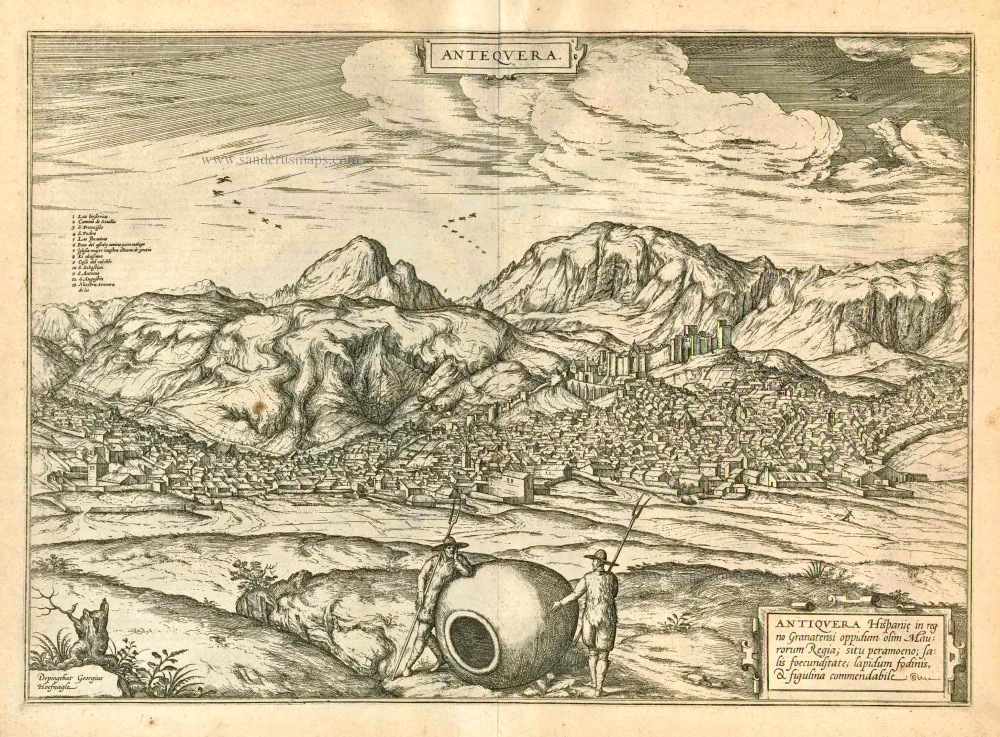
Antequera 1597
Antiquera, by Georg Braun and Frans Hogenberg.
[Item number: 23958]

Bilvao. En, Spectator Benevole, Magnifica Hispaniae Civitas Bilbao ... 1576
Bilbao, by Georg Braun & Frans Hogenberg.
[Item number: 26703]
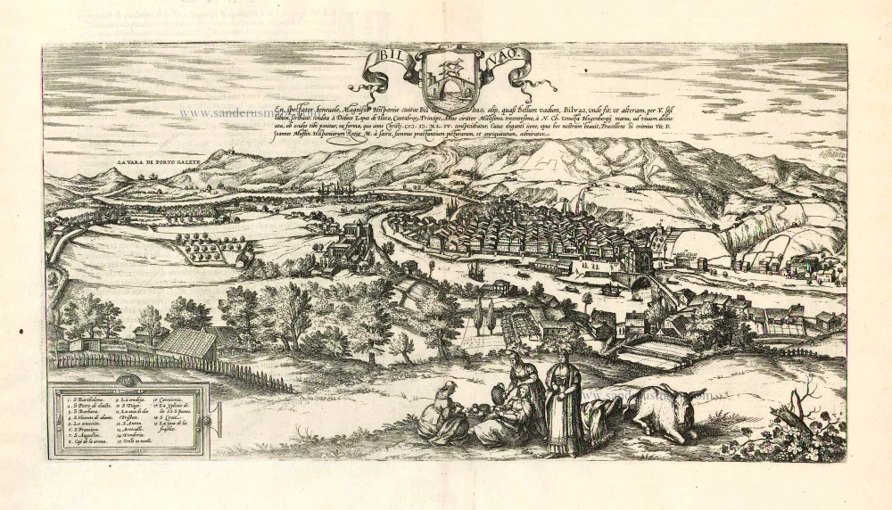
Bilvao. En, Spectator Benevole, Magnifica Hispaniae Civitas Bilbao ... 1593
Bilbao, by Georg Braun & Frans Hogenberg.
[Item number: 26930]

Barcelona, Barcino, que vulgo Barcelona Dicitur [on sheet with] Ecija. 1582
Barcelona - Ecija, by Georg Braun & Frans Hogenberg, after Georg Hoefnagel.
[Item number: 31259]